Hurricane Mountain Wilderness
One of the smaller protected wilderness areas in the Adirondacks sits atop one of the region’s higher mountains.
Hurricane Mountain Wilderness
at a Glance
Size: 14,222 acres
First Designated: 2010
Unit Management Plan Status: Completed in 2010
Special Regulations: None; standard Forest Preserve regulations are in effect
Hemmed in by roads and residential areas, the Hurricane Mountain Wilderness represents 14,222 acres of high-elevation forest and ridgeline, with little of the mid-elevation forest that forms the bulk of many other areas. This is a wilderness that gets right to the point. The area is notable for protecting part of the rugged backdrop to the hamlets of Elizabethtown and Keene. Its highest point is 3694 feet in elevation, but nearly all of Hurricane Mountain below 1750 feet is residential or commercial property — one of the few places in the Adirondacks where civilization has successfully held back the wilderness. One slender corridor in the northwestern part of the wilderness does dip below 1000 feet, almost to the banks of the East Branch Ausable River, but the rest consists exclusively of upper-elevation forest, rock, and wetland.
No one doubts the wildness of Hurricane Mountain and its associates, although the area’s status as a protected wilderness — on equal footing with such massive tracts as the High Peaks Wilderness to the southwest, or even the Giant Mountain Wilderness due south — has produced mixed opinions over the years.
Early lists of proposed wilderness areas in the Adirondack Park did not mention Hurricane Mountain, or even offer reasons for its exclusion, although it is not hard to guess what those reasons might have been. Mid-century biases favored places that were vast, remote, and undeveloped, whereas Hurricane Mountain and its patch of forest were none of those things. Residential development had extended well up the mountain’s slopes, and there was of course a non-wilderness fire tower perched atop the highest summit.
Its potential as a wilderness area was not considered until 1972, when the Adirondack Park Agency first established the Hurricane Mountain Primitive Area. The “primitive” classification was an administrative step short of wilderness, illustrating how the agency was stumbling over the list of man-made features found here at the time: jeep trails, snowmobile trails, telephone lines, an observer cabin, and of course the Hurricane Mountain fire tower itself. According to the 1972 plan, these were all things the state would someday need to address before upgrading the area to full wilderness status.
This line of thought prevailed for 38 years, during which time only a few of the so-called “non-conforming uses” were resolved. But in 2010 the question of how to manage the Hurricane Mountain Primitive Area resurfaced when DEC issued a draft management plan that considered alternate futures for the major non-conforming use: the Hurricane Mountain Fire Tower. These options included removing the structure or maintaining the status quo.
By then the tower had become a derelict structure, no longer the vital communication link it had once been. However, wilderness attitudes aside, removing the tower was not a popular option. Therefore the state chose to adopt a rather “political” solution: promoting the area to wilderness status, blemishes and all. Those non-conforming features the state couldn’t (or wouldn’t) remove became spot-zoned enclaves, while the rest of the former primitive area was renamed the Hurricane Mountain Wilderness.
This origin story aside, there is no denying that exploring this area is fun. Some of the finest Adirondack climbing is conducted within its meager boundaries, and views of the High Peaks are nothing short of extraordinary. This really is a beautiful place, and one that comes highly recommended.
But… the manner in which the wilderness classification occurred swept so much under the rug, and no attempts to praise what was protected should ignore the process of how that protection happened.
Please click through the tabs below to learn more about the Hurricane Mountain Wilderness.

-
Hurricane Mountain is part of a continuum of ranges that include Giant Mountain to the south and Jay Mountain to the north. Each of these areas has its unique attributes, but the common element for all three is that they represent the last major mountain grouping between the High Peaks and Lake Champlain. Their position to the east of center places them in a somewhat drier zone, with less mud and more opportunities to find stands of oak, red pine, and poplar — trees that are mostly absent from the central Adirondack plateau, but which find creative expression here.
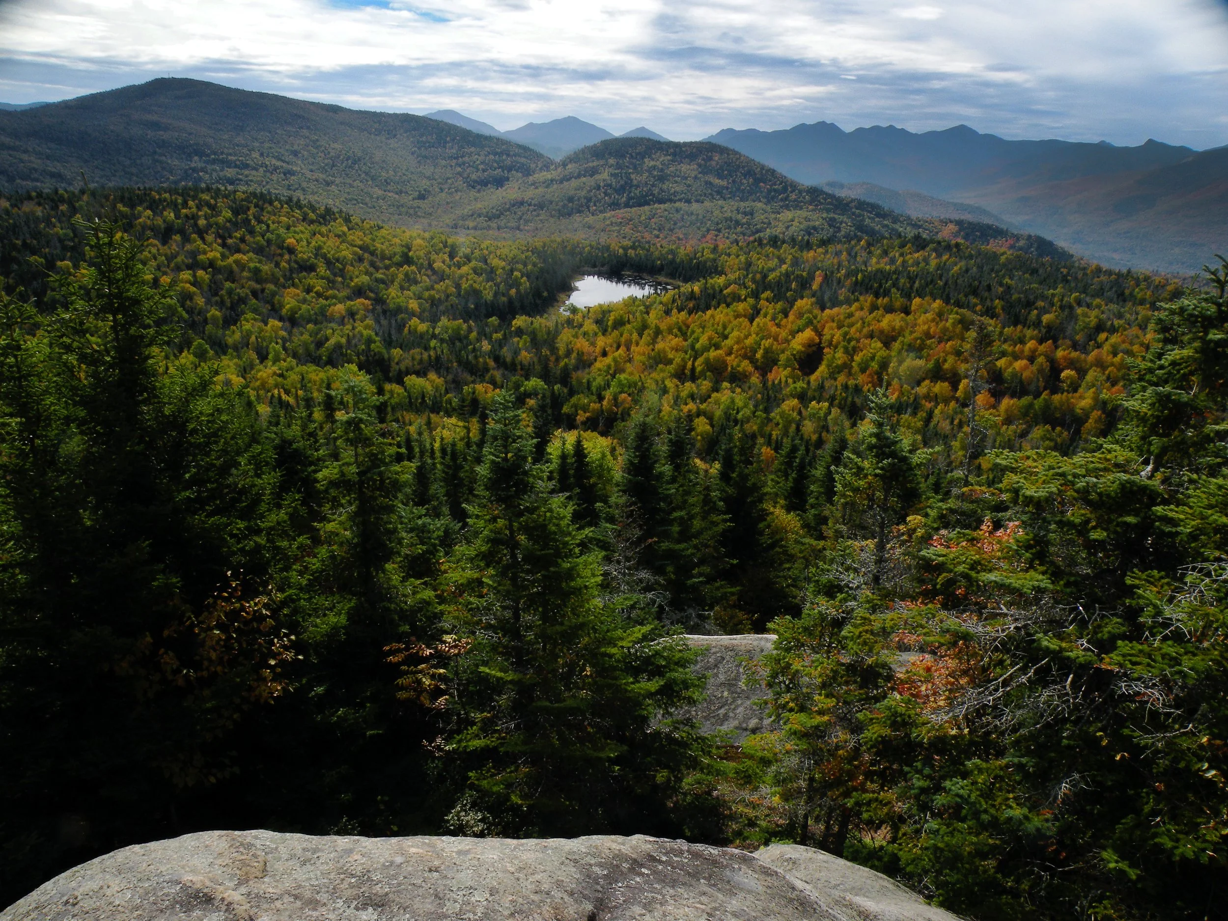
This is a mountainous landscape more than anything, with only a single permanent body of water a mere four acres in size (not counting whatever ephemeral beaver ponds grace a few of the outlying drainages). Lost Pond, as it is called, is not so much “lost” as it is hidden, cradled by the summits that surround it; this might be regarded as an unremarkable beaver flow were it not for its scenic setting.
The presence of bare summits is traditionally ascribed to the effects of past forest fires, although some of the thrusts of rock that dominate this wilderness are so dramatic it is easy to imagine they have always been treeless. But the poplar stands between the ridges, which turn a uniform pale yellow in the fall, outline the extent of the century-old fires. Poplars (also known as aspen) play an opportunistic role in the Adirondacks, avoiding the shady old-growth forests but dominating the sites that had once been bared by disaster. And no disasters were more devastating than the fires of the early twentieth century, which put the viability of the Forest Preserve in doubt and ultimately led to the erection of fire towers like the one on Hurricane Mountain.
Otherwise there is little else to say about this wilderness, given its limited range. Although it appears to be a healthy habitat for the proliferation of trees, one wonders how it is perceived by its faunal population. Hurricane Mountain fits the stereotype for wilderness in the Eastern U.S., in that what we currently celebrate as “wilderness” is just a fragment compared to its former self. Do the roads that carve the western slopes isolate the protected summits? Is there enough connectivity to allow wildlife to pass from other parts of the Ausable watershed to this rugged, high-elevation outpost?
-
Maps of the Hurricane Mountain Wilderness tell an unfortunate story: that these mountains were once not viewed in terms of their wildness, but in terms of the resources that people hoped might be extracted from them. Thus we have inherited today a region full of features named Potash Mountain, Soda Range, Coal Dirt Hill, Spruce Mill Brook, Big Slash Mountain, and Limekiln Mountain. These were not places for adventure or Romantic contemplation of the sublime, but places where commodities were to be exploited. This historical ambivalence perhaps explains the current scenario, in which only a patch of wilderness remains preserved — almost all of it in the highest reaches of the range.
The best historical survey of the Hurricane Mountain Wilderness was included in DEC’s 2010 management plan for the area. You can read it by clicking on the link below.
-
The Hurricane Mountain Wilderness is graced with an extensive and enjoyable trail system that, when viewed on a map, somewhat resembles a high-stepping stick figure. It extends to a point just shy of the northern boundary all the way to its southernmost frontier, and includes small peaks, big peaks, and an enchanting range of half-bald summits.
And yet the sum total of this trail network is just a tad shy of 14 miles.
Only three established trailheads service the area, and only one is prominently located on a major highway. The other two are buried in the hinterlands of Keene and Elizabethtown, discoverable only by braving a sometimes confusing network of local byways.
Nevertheless, this place is no secret. The charm of Hurricane Mountain is that it resembles the alluring High Peaks, without any of the long approaches that characterize that much larger region. Rather than following a long trunk trail to the point where a particular mountain begins, that part of your adventure is already accomplished by the time you park your car. All three trailheads are relatively high in elevation, and so by the time your boots first come in contact with a trail you are already well up the mountain.
And what mountains! Even without its fire tower, Hurricane would be stunning with its 360° views — although most people are captivated by the western horizon, which is rendered jagged by the violent topography of the High Peaks. Three trails converge on its summit, each offering its own experience, from the deep woods of the southern trail, to the gentleness of the northern trail, to the early views found on the eastern approach.
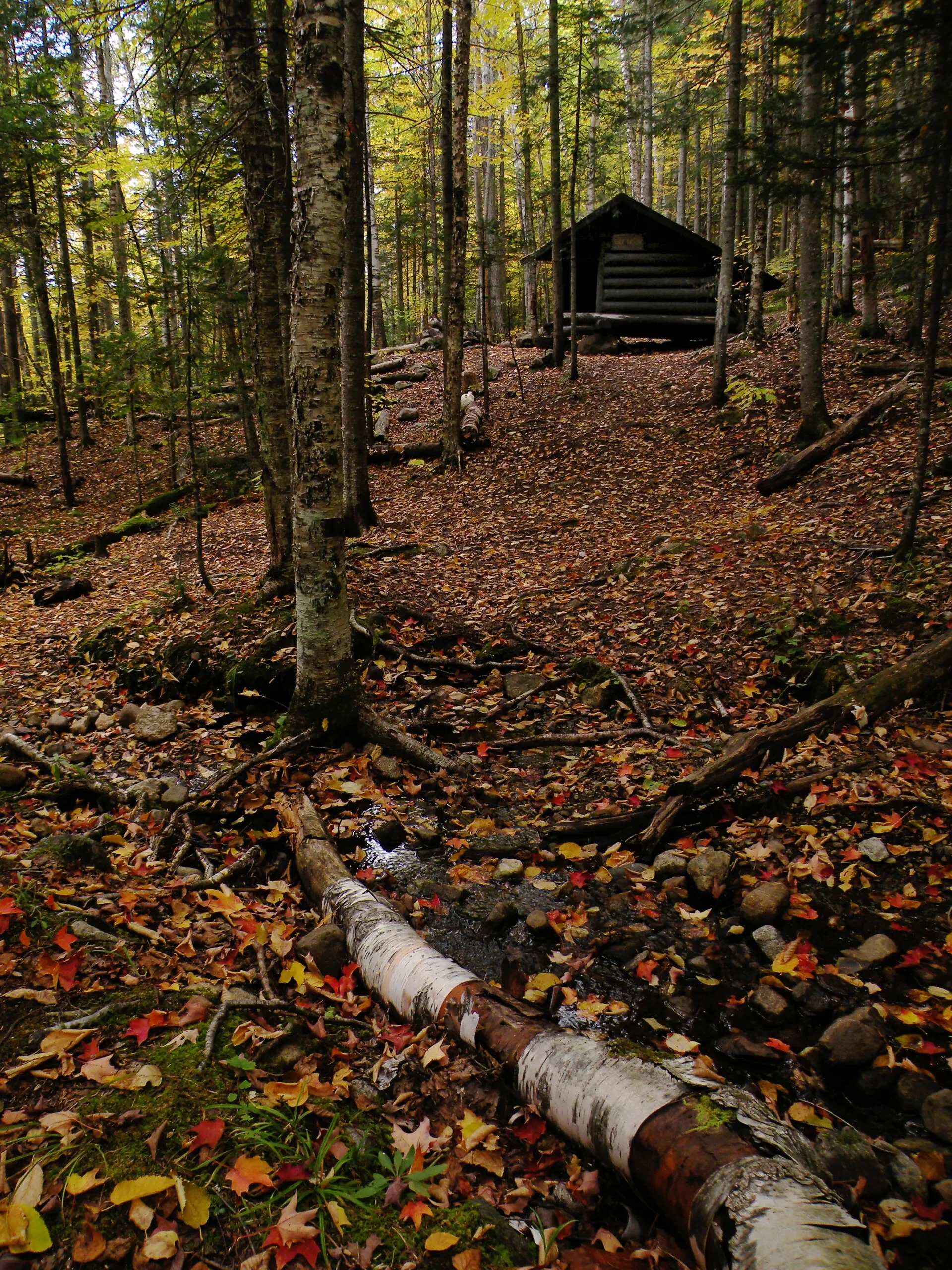
The northern trailhead is called Crow Clearing, and this is nearly a recreation area unto itself. From this access site — a somewhat informal donut-shaped parking area with an old cellar hole in the middle — one can climb the twin summits known as “the Crows,” venture to secluded Lost Pond, or begin the northern approach to Hurricane Mountain. Both lean-tos are accessed from Crow Clearing, which has the distinction of being one of the highest trailheads in the Adirondack Park.
Perhaps the most distinctive hike is the loop to the north, spanning the ridgeline between Big Crow Mountain and Lost Pond. Maps give the official name of this mountain as the Soda Range, but to connoisseurs this will always be Nun-da-ga-o Ridge. The way is narrow, its ledges sometimes quite steep, and all but a handful of key turns are unmarked. But views come by the dozen, all of them gazing across the high country to the slopes of Hurricane Mountain and its High Peak neighbors.
If there is any fault, though, it’s that Crow Clearing is not maintained in winter, and legal parking is nonexistent at that time of year.
An impressive amount of acreage is effectively “trailless,” largely to the east of Weston Mountain. Access to this region is best from Jay Mountain Road, the barely-passable town road that divides the Hurricane Mountain Wilderness from the Jay Mountain Wilderness to the north. Anyone seeking to explore this road is advised to approach from the western end, in the town of Jay; the eastern side in Lewis requires high-clearance four-wheel drive.
-
According to the State Land Master Plan (SLMP), the document that officially designates all twenty wilderness areas in the Adirondack Park, the Hurricane Mountain Wilderness is a perfect entity with no non-conforming uses that need to be addressed.
The reality, though, is that prior to its wilderness classification in 2010, the area was burdened by several features that had troubled earlier state land planners, preventing them from considering a full wilderness classification. Some of these “non-conforming uses,” such as an observer’s cabin, a telephone line, and a snowmobile trail, wereremoved since the original SLMP created old Hurricane Mountain Primitive Area in 1972. But the fire tower, two roads, and a powerline corridor remained — meaning that the wilderness we have today was designated through a rather dubious process.
The solution preferred by the APA and DEC in 2010 was to administratively remove all of the non-wilderness features in a process that uncomfortably resembled “spot-zoning”: applying site-specific land classifications to each non-conforming use, thus exempting them from the full barrage of wilderness guidelines. By this means, state land planners designated the Hurricane Mountain Wilderness without accomplishing several of the administrative steps required by its own management plan since the Watergate era.
The term “spot-zoning” is more commonly associated with residential neighborhoods, where specific lots are granted more leeway than any of their neighbors, usually in an unfair way. Such practices in private land zoning can often be challenged and overturned. But things are murkier when it comes to the zoning of the Forest Preserve, where the state is both the regulator and regulated. Short of an outright violation of procedure, there would be little guarantee of success for anyone seeking to file a legal challenge against the policy of “spot-zoning” in the Forest Preserve, therefore no one has ever tried.
In the specific case of Hurricane Mountain, the state achieved its wilderness classification by punching out several of the area’s non-wilderness features. Whereas the 1972 SLMP contemplated the removal of the Hurricane Mountain Fire Tower as a precondition, for example, the APA voted in 2010 to designate a half-acre “historic area” on the mountain’s summit that exempted the tower’s footprint from wilderness guidelines. Thus, in the agency’s wisdom, the mountain could be two things simultaneously.
Likewise, the status of Crow Clearing was punted when that trailhead — which extends deeper into the wilderness boundaries than guidelines would otherwise permit — retained its primitive classification, thus delaying the time when DEC might be required to relocate it without actually suggesting a resolution.
These are arcane, technical objections to be sure, and it is not our intention to argue here that the fire tower should be removed or a popular trailhead barricaded in order to conform to some puritanical wilderness vision. Indeed, many people would argue the presence of the fire tower does no harm to the surrounding landscape, and that it serves as a cherished cultural resource. Likewise, the effort to relocate the Crow Clearing trailhead to a more peripheral location would probably come at a higher cost than is justified. These are practical arguments with which it is hard to argue.
The issue is that good outcomes do not forgive poor processes. The original SLMP had set a goal for this area — achieving an eventual wilderness classification for Hurricane Mountain — and outlined the required steps: removing each of the “non-conforming uses.” Indeed, some of the 1972 uses had been removed, while things like deeded access roads to private inholdings were obviously beyond the state’s control. But in 2010, state planners were clearly eager to achieve the wilderness classification without addressing the remaining issues within their control. So instead they decreed these problems to not be part of the new wilderness, and then congratulated themselves for their creative thinking.
Of course, success in one part of the Adirondacks inspires these same state land planners to apply their flawed processes elsewhere. Hurricane Mountain was not the first place where APA applied a spot-zoning solution to get around its own wilderness guidelines, and it most certainly wasn’t the last. A few years after the Hurricane Mountain decision, the agency applied the same logic (but on a much larger scale) to the Essex Chain of Lakes, invoking a blend of SLMP management classifications over localized areas to achieve an overall recreational scheme not otherwise permitted by its own guidelines.
Ironically, the issue of spot-zoning returned to the Hurricane Mountain Wilderness in 2018 when it came time to consider the management future of a 246-acre parcel of new state land near the East Branch Ausable River. This land abutted the wilderness but was traversed by a powerline right of way — a key utility link between the hamlets of Keene and Jay, which one could reasonably expect to be a permanent and necessary fixture. Rather than ending the wilderness boundary at this right of way, as would’ve been proper, the APA voted to spot-zone it out of the larger wilderness classification. Thus the SLMP now includes a provision to eventually extinguish a 1.3-mile section of this utility corridor, despite the fact that doing so would do more public harm than good.
Such actions do nothing to advance the goals of wilderness preservation, but go a long way in fostering the notion among some people that the goal of expanding our wilderness areas is to eliminate park residents from the landscape. It is difficult to counter that argument when it is enshrined in writing — inferred or otherwise — in a state planning document.
The state’s goal with managing the Hurricane Mountain Wilderness should therefore not be to maximize its acreage with sub-standard additions, or to actively demonstrate a regulatory agency’s distaste for abiding by its own guidelines by enacting clever end-runs. If there was a unique situation that made this 14,000-acre tract a non-traditional candidate for wilderness, then the best approach would’ve been to address those concerns head-on. Maybe wilderness wasn’t the best fit for Hurricane, or maybe support for the tower was so strong that a variance could’ve been justified for this one site.
Instead, what we got was a rushed decision intended to please the maximum number of people without addressing any of the underlying issues — and perhaps creating new issues in the process. And unfortunately, hindsight proves this decision was a steppingstone in a string of similarly misguided actions, which future park planners will someday have to unravel.
-
The following links leave the AWA website and take you to various pages on the Department of Environmental Conservation (DEC) website with more information on the Hurricane Mountain Wilderness.
Hurricane Mountain Wilderness Information Page. Learn important contact information and peruse a list of facilities.
Backcountry Information for the Adirondack High Peaks Region. Trail conditions updated weekly for the Hurricane Mountain Wilderness and neighboring areas.
Hurricane Mountain Wilderness Unit Management Plan (2010). Download DEC’s official management plan, as well as the related Hurricane Mountain Fire Tower Historic Area UMP (2014).
State Land Regulations. Review the complete list of DEC regulations.
Maps of the Hurricane Mountain Wilderness and the Surrounding Area
Below is the current DEC map of the wilderness and its facilities. The remaining maps show the evolution of the area. Click maps to enlarge.
Hurricane Mountain Wilderness Map
1955 Elizabethtown USGS Quad
1901 Elizabethtown USGS Quad
1953 Ausable Forks USGS Quad
1903 Ausable USGS Quad
Hurricane Mountain Wilderness Image Gallery