Round Lake Wilderness
There are many lakes and ponds throughout the Adirondacks bearing the name “Round,” but a quick glance at a map will show few of them are round in the geometric sense.
Round Lake Wilderness
at a Glance
Size: 10,310 acres
First Designated: 2006
Unit Management Plan Status: No management plan has been completed for this area
Special Regulations: None; standard Forest Preserve regulations are in effect
This observation holds true for the Round Lake located along Hamilton County’s northern edge, in the Bog River watershed. Here you will find one of the largest lakes entirely within the Forest Preserve, and the largest of all the so-called “round” lakes.
And as it just so happens, this one is the star feature of its own namesake wilderness.
State agencies pieced the Round Lake Wilderness together in 2006 from two sources: the landmark acquisition that added the lake to the Forest Preserve, and a piece of the existing Horseshoe Lake Wild Forest to its north. The result was a pocket-sized area with big features, including not just Round Lake, but also the last free-flowing section of the Bog River.
This area is very compact, with its potential growth (in terms of acreage) severely limited by the belt-like encirclement of three pubic highways and a railroad corridor. Even so, the Round Lake Wilderness is not as large as it could be; the current size of 10,310 acres is close to the bare minimum required by the State Land Master Plan to justify a wilderness designation. But left on the table in 2006 were several thousand acres north of the Bog River, without which the wilderness seems distinctly incomplete. There are also non-public lands in the vicinity that would add greatly to the area, if they could be acquired.
Nevertheless, despite its small size this “pocket wilderness” is not without its exceptional qualities. The most prominent, of course, is the vaguely triangular Round Lake itself, which may have been named long ago for the round whitefish, Prosopium cylindraceum. At least, this is a theory that is consistent with the way many other Adirondack lakes were named by early settlers for the fish they contained. Before the lake was acquired by the state, several small camps stood along its shores; now those sites are choice real estate for primitive camping.
The Bog River currently defines the northern extent of the wilderness, although there seems to be no reason why the boundary shouldn’t be moved north, all the way to NY 421. Between the lake and the river lies the wild and wonderful Round Lake Stream, and to the west lurks a trio of intriguing ponds. So while there may be some obvious opportunities for modest enlargements, the Round Lake Wilderness already exists as an example of how wild landscapes sometimes come in compact packages.
Please click through the tabs below to learn more about the Round Lake Wilderness.

-
As mentioned in the overview, this is a compact “pocket-sized” wilderness with a height and breadth of just a few miles each. Even though there is an opportunity to expand the area in a few places, the current 10,310 acres do contain quite a few noteworthy features, including its namesake lake, two wild streams, and several ponds.
The area that now comprises the Round Lake Wilderness was pieced together over several land purchases, with the most recent being the 2006 acquisition of Round Lake itself from International Paper. Prior to that, state land managers had not considered this area for wilderness classification, and indeed it seemed like an unlikely candidate; only the northern half of the area was in public ownership, and for many years the Forest Preserve lands shared a checkerboard pattern with several private inholdings. The incomplete ownership pattern made the area difficult to access and explore, and so it was known primarily for the photogenic waterfall on the Bog River near NY 421.
The Round Lake purchase, which occurred in the middle of a decade of stunning, blockbuster-style wildland acquisition in the Adirondacks, filled in some of the holes and created a consolidated block of state land that permitted a wilderness classification for the first time. In fact, the Adirondack Park Agency designated the Round Lake Wilderness before the area was fully open to the public or before all the leasehold camps had been removed; for a short interim period it was a wilderness with active roads and dozens of structures, all of which were soon removed.
Several key features fell within the new boundaries, including the entirety of 740-acre Round Lake. Once part of the original Whitney Park, it was later sold to International Paper in the mid-twentieth century, along with thousands of other acres. Most of those sale lands remain working forests today, but when I.P. chose to divest itself of all its Adirondack lands, Round Lake was singled out as one of its choicest pieces of real estate. The lake (and a sufficient land buffer on each side) was sold to the state, with the goal of protecting its wild shorelines and creating a corridor of public land continuous with the William C. Whitney Wilderness to the south and the Horseshoe Lake Wild Forest to the north.
The lake also shares a native brook trout fishery with Little Tupper Lake – but unfortunately, that was jeopardized years ago by the illegal introduction of bass. Presumably an act of ecological sabotage committed by unknown individuals sometime around 1998 to 2000, land trusts have cited this event as a reason not to sell any other rare fisheries to the state on several occasions since then.
Because of the checkerboard land acquisition pattern, forest quality also follows an alternating pattern, from young to mature and often back again. The Round Lake parcel and a few other lots exhibit the younger forests of a recently-acquired forestry tract, punctuated by a few clearings that have yet to reforest. Between these areas are the older plots of land with maturing forests; these provide pleasing backdrops to Winding Falls and Trout Pond.
Although named for the large lake at its southern end, the Round Lake Wilderness is just as noteworthy for the section of the Bog River that constitutes its northern boundary. The New York City businessman A. A. Low dammed the upper half of the Bog in two places, and the state now maintains both dams for the purposes of retaining the Bog River Flow, a popular canoe route; it seems unlikely that we’ll ever see a return to native conditions there.
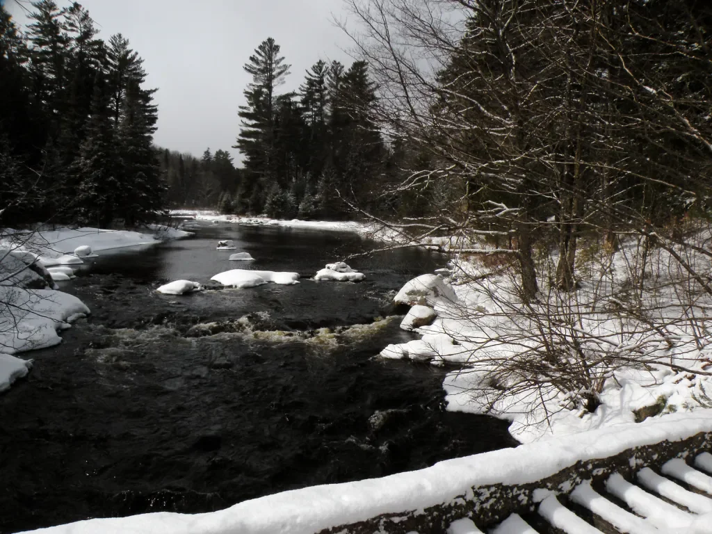
But from Lows Lower Dam to Tupper Lake, the Bog River still goes about its own business, tracing a route through a secluded valley. The highlight of this section is Winding Falls, a powerful cascade with a distinctive S-turn to its course.
The wilderness boundaries also extend west to include three noteworthy ponds and a portion of the large bogs surrounding Hitchins Pond. Because of the small size of the Round Lake Wilderness none of these places are truly remote, at least not on the same scale of the region’s larger wilderness areas, but the area does seem adequately secluded to offer an immersive wilderness experience.
-
When William C. Whitney, the Gilded Age businessman and politician, purchased 68,000 acres of forest in northern Hamilton County in 1897, the tract (which later became known as Whitney Park) included Round Lake along its northern boundary. From 1898 to 1909 Whitney and his partners conducted lumbering operations across the property, harvesting the largest spruce and pine trees – nothing smaller than ten inches in diameter – and then floating the logs down Round Lake Stream to the mills at Tupper Lake.
Although this was just a brief period in the land’s history, a few obvious landmarks remain. One is the low concrete dam at the north end of Round Lake, which was created not so much to enlarge the lake but to increase the flow into its outlet stream to sustain the log drives; the hand-operated devices which opened the sluice can still be seen, as are the long piles of rock in the riverbed below the dam, which helped keep logs within the main channel.
Whitney Industries sold Round Lake and its environs to International Paper in the 1970s, and this is presumably when the era of recreational leases began. Sportsmen’s clubs organized dozens of individual camps across the property – some of them isolated, some of them clustered in small “villages,” but all of them quite modest in size. A handful even stood along the shore of the lake, marking what might have been its most “developed” epoch.
When the state acquired 5,730 acres of land surrounding the lake in 2006, these camps still existed but the lease agreements were all about to expire. As the public began to explore the Round Lake Wilderness that year, the camps and the roads leading to them were all in active usage. However, the lessees were beginning the clean-up process at the time, and whatever they left behind was then removed by crews contracted to restore natural conditions. By the end of a three-year window, all of the buildings were completely removed. It is to the credit of everyone involved that many of these spots may now be hard to recognize; only those that stood on the lakeshore remain in current usage as primitive campsites.
One site located on a separate, previously-acquired parcel along the Bog River is worthy of note because of the collection of small memorial stones that now mark the spot. Here, a group of men once maintained a small camp just above Winding Falls; sometime later, some of their children placed tributes to their fathers on the nearby riverbank. This collection of little monuments has inspired the alternate name of “Pa’s Falls,” which appears on some commercial maps of the region. However, although it doesn’t appear on official USGS maps, the name Winding Falls is an established toponym that has the weight of history behind it.
There is one other prominent site that is worthy of mention; it stands not within the wilderness, but at one of its key entry points. The ever-industrious A. A. Low acquired some 40,000 acres of the Bog River watershed around the turn of the twentieth century, putting the land to many productive uses. Among the long list of indelible marks he left behind was a dam on the Bog River first built in 1903, seven miles upstream from Tupper Lake. The original purpose of Lows Lower Dam was to generate electricity, although not so any longer; the current structure exists for no other reason than to maintain the waterway above it for canoe access to Lows Lake. Hikers can cross the top of the dam to access the foot trail to Trout Pond.
-
The Round Lake Wilderness is a landscape that, due to its small size, often offers up its best features within a mile or so – never more than two.
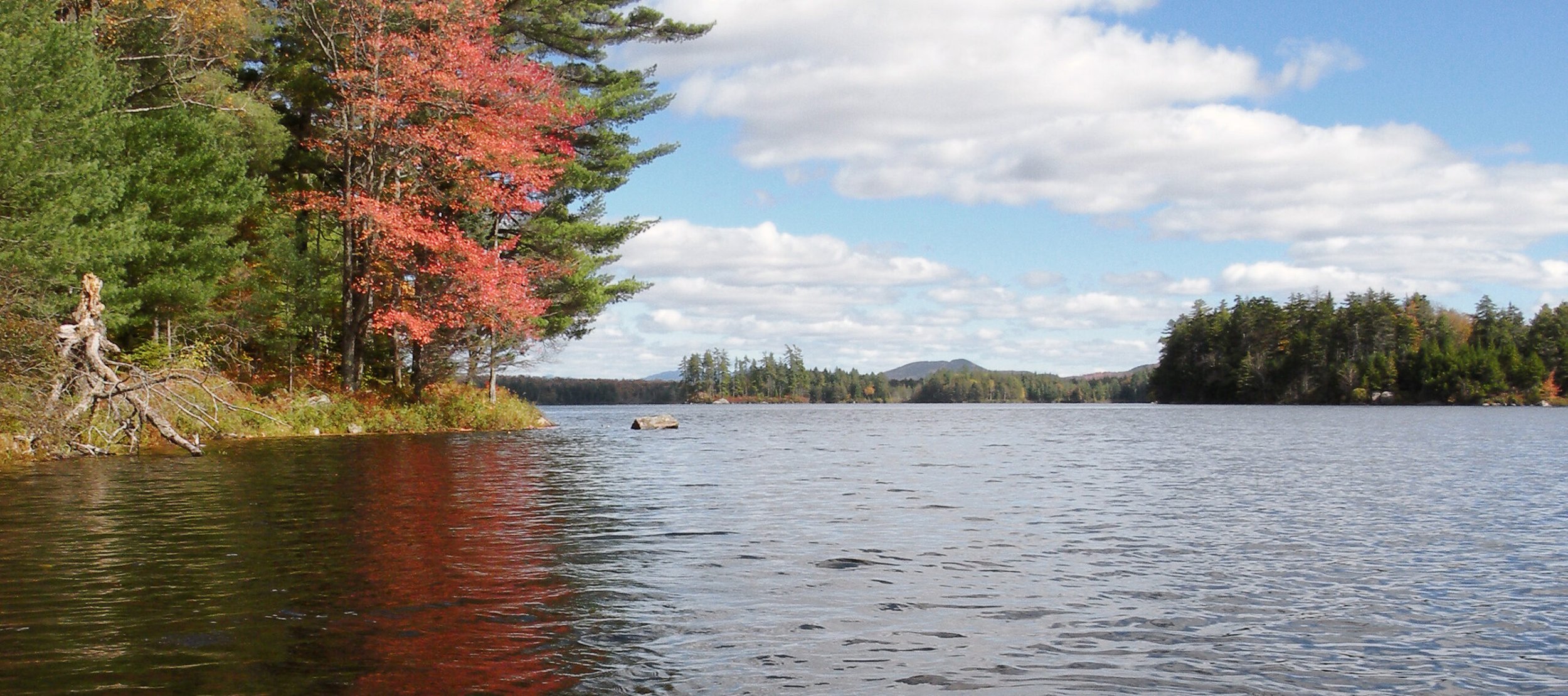
This is true of 740-acre Round Lake, the centerpiece of the area. After just a short paddle from the put-in on Sabattis Road, canoe-campers will find 11 designated shoreline campsites to choose from. Many of these occupy the sites of former hunting camps that had leased small parcels from the prior owner, International Paper. These were removed shortly after the state acquired the lake in 2006, resulting in primitive tent sites that tend to be a little more spacious than their counterparts on nearby Little Tupper Lake to the south.
It is worth seeking out the lake’s outlet – not to see the dam that gives the lake’s water line a modest boost, but to seek out the outstanding footpath that follows the east bank of Round Lake Stream downstream. Although no signs or markers point out this route, the path is well worn and worth every effort to find, since it reveals an awesome display of cascading water.
Compared to the other large paddle-only lakes in the region, Round Lake is relatively easy to digest; though large, it is still compact enough to see in a single day if needed, without the strong sense of remoteness found at the far ends of Lila, Little Tupper, and Lows.
But this is not a one-dimensional area, and the newly-minted trail system along the Bog River adds greatly to its exploration potential. Technically, most of this trail network falls outside the official wilderness boundaries, within the Horseshoe Lake Wild Forest, but then both sides of the Bog are equally wild; by rights, the majority of this area should be added to the wilderness.
The Bog was not a long river in its original, untrammeled state; so when A. A. Low built his two dams at Hitchins Pond and Lows Lake, these two impoundments transformed the upper half of the river into massive flows. From Lows Lower Dam downstream to Tupper Lake, however, the river still runs wild and free. The highlight of this area is Winding Falls, the attractive cascade with a corkscrew shape. Once difficult to find, it is now within sight of a junction where three newly-marked DEC trails meet.
At the western end of the wilderness you will find a trio of ponds: Trout, Little Trout, and High Pond. A marked hiking trail leads from Lows Lower Dam to the north end of Trout Pond, the setting for an outstanding snowshoe adventure (or somewhat challenging ski trek). Summer hikers will have to contend for parking spaces with paddlers bound for Hitchins and Lows, but winter explorers can range out across Trout Pond to seek out its secluded neighbors.
-
The state designated the Round Lake Wilderness just a few years after a larger land acquisition led to the creation of the William C. Whitney Wilderness in 2000. The large lakes in each of these areas are connected by a mile-long channel of uninterrupted water, making them one continuous waterway. Combined, Little Tupper and Round are the home of a unique strain of brook trout, and protecting this fishery was one of the primary goals of preserving the lakes through state acquisition and then banning motorized access.
Unfortunately this effort was sabotaged not long after the Little Tupper purchase, when an unknown party dumped bass into the waterway. This predatory fish species now occupies the heritage trout waters, with no easy way to oust the transplants. Although it hasn’t resulted in the complete collapse of the trout fishery, the bass introduction has since caused various land trusts to think twice about selling other lakes with heritage fisheries to the state – including Follensby Pond near Tupper Lake and Little Charley Pond near Lake Lila.
One of the state’s motivations for creating the Round Lake Wilderness in 2006 was to preserve the lake for motorless recreation, complementing the management plan already in place at neighboring Little Tupper Lake. However, because the acquisition was only 5,730 acres in size, additional Forest Preserve land to the north had to be added to reach the 10,000-acre minimum for a wilderness classification. Here the state acted conservatively, extending the boundary as far as Winding Falls and the Bog River, but omitting several thousand acres north of the river.
A proposed snowmobile trail was partly to blame. In an earlier management plan for the Horseshoe Lake Wild Forest, DEC had reserved the option to cut a snowmobile trail parallel to NY 421, should a need arise. The Round Lake acquisition, despite its wilderness designation, offered a new possibility for routing that snowmobile trail diagonally across the area. This possibility was recognized by the Adirondack Park Agency at the time of the area’s designation, and they included an exception that granted DEC the option to route a shortcut snowmobile trail through the new Round Lake Wilderness.
Fortunately that option has never been exercised, partly because the identified route has since been deemed impractical; currently, snowmobile traffic is routed along the shoulder of Sabattis Road, the county highway that defines the boundary between the Round Lake and William C. Whitney areas. This leaves the wilderness interior free of motors, just as a wilderness interior should be.
However, the State Land Master Plan still includes a provision to route the snowmobile trail through a corner of the Round Lake Wilderness, along an excepted route called the “Winding Falls Primitive Corridor.” Normally a “Primitive Corridor” represents a non-conforming use that can’t be helped, such as a private right of way. Here, though, the corridor is little more than a compromise struck years ago for something that, as it turned out, was never needed.
Not only should the Winding Falls Primitive Corridor be eliminated and fully added to the wilderness, but the wilderness boundaries should be pushed northward to include as much as the lower Bog River as possible. The current wilderness leaves much acreage on the table, even though the 2006 acquisition created a solid block of state land from Sabattis Road to NY 421.
Wilderness boundaries routed through the middle of a forest, such as the current line along the Bog River, are problematic for several reasons: they can be difficult to monitor, and when different activities are permitted on one side of a survey line but not the other, this can lead to confusion. Therefore the best way to manage this area is to consolidate it under a single management plan.
Save for the unbuilt snowmobile trail, as well as an aborted proposal to open the ski trails north of the Bog to bicycles, there are no non-conforming structures or uses other than Goodman Bridge, a concrete span over the river near NY 421 that was built by a prior landowner, and Lows Lower Dam and its access road. With boundary adjustments to accommodate these peripheral features, the majority of the lower Bog River can and should be added to an enlarged Round Lake Wilderness.
At Lows Lower Dam, DEC has long planned to relocate the public parking area for paddlers seeking access to Hitchins Pond and Lows Lake. Indeed, the current parking is inadequate compared to the sheer amount of acreage available from this location, including not just foot access to the western end of the Round Lake Wilderness but the entirety of Lows Lake as well.
However, physical barriers to snowmobiles have traditionally been poor here, making it possible for riders to cross the dam and “poach” the foot trail to Trout Pond. Prime snowmobile trails already exist elsewhere in the Horseshoe Lake Wild Forest, and so it will be no loss to the riding community – and a tremendous gain to wilderness visitors – if the state includes in its project plans more effective barriers at Lows Lower Dam to prevent this trespass in the wilderness.
-
The following links leave the AWA website and take you to various pages on the Department of Environmental Conservation (DEC) website with more information on the Round Lake Wilderness.
Round Lake Wilderness Information Page. Learn important contact information and peruse a list of facilities.
Backcountry Information for the Western Adirondacks. Trail conditions updated weekly for the Round Lake Wilderness and neighboring areas.
State Land Regulations. Review the complete list of DEC regulations.
All photos © Bill Ingersoll. Site visitors are permitted to download an unlimited number of images from our website for personal, educational, scientific, or professional use only, with attribution. Commercial use and further distribution of images is prohibited without express written permission.
Maps of the Round Lake Wilderness and the Surrounding Area
Below is the current DEC map of the wilderness and its facilities. The remaining maps show the evolution of the area. Click maps to enlarge.
Map of the William C. Whitney and Round Lake wildernesses
1907 Tupper Lake USGS Quad
1954 Tupper Lake USGS Quad
Round Lake Wilderness Image Gallery