Silver Lake Wilderness
The Silver Lake Wilderness is named for its largest interior lake, but perhaps the feature that best defines this large and rugged area is the West Branch Sacandaga River, sometimes called the “West River” for short.
Silver Lake Wilderness
at a Glance
Size: 107,995 acres
First Designated: 1972
Unit Management Plan Status: Completed in 2006
Special Regulations: None; standard Forest Preserve regulations are in effect
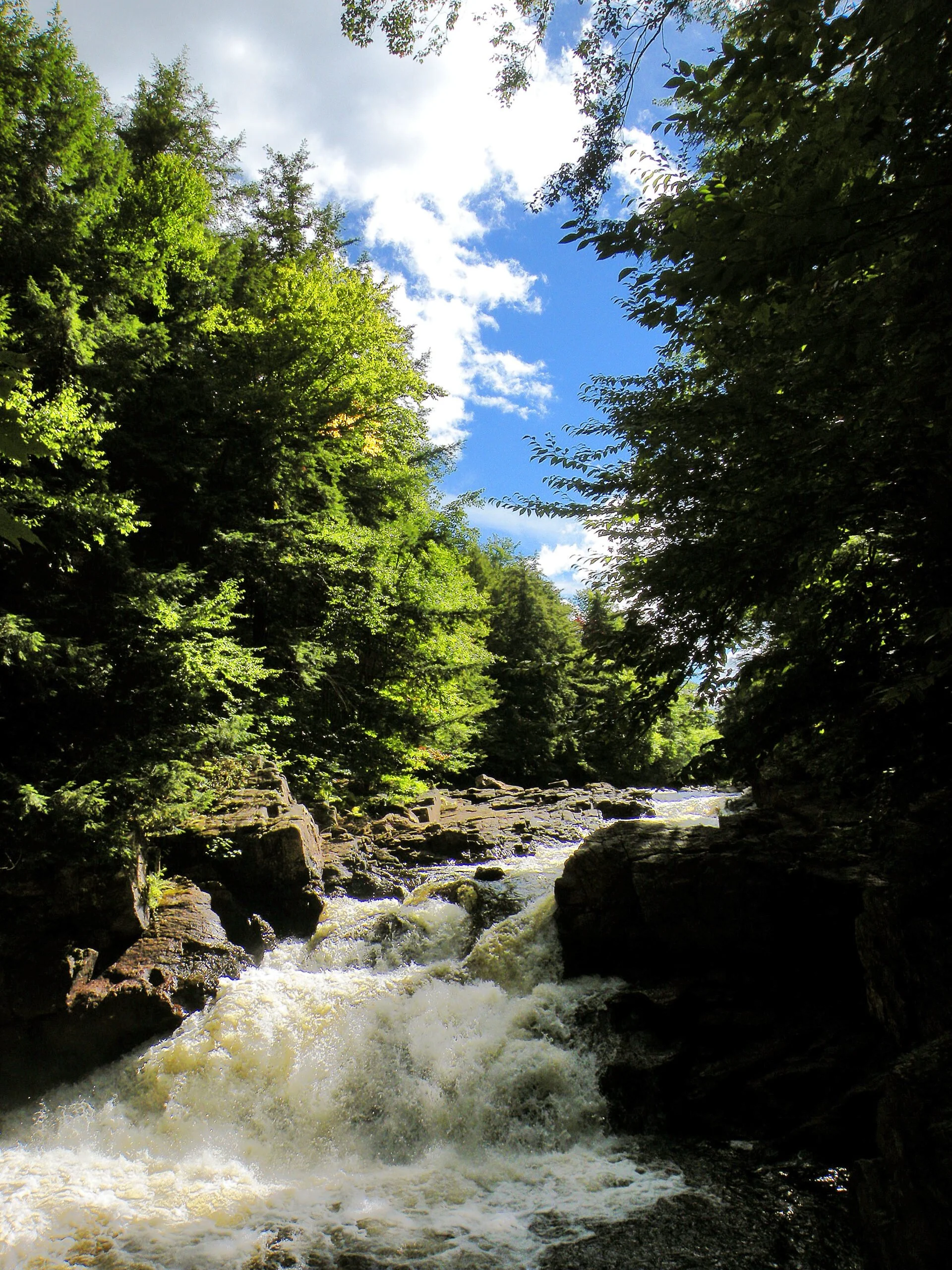
From the mountains southeast of Silver Lake, the West Branch coils for about 36.5 miles in and around the wilderness core to join the main branch of the Sacandaga at Wells. Throughout this entire length there are only three road bridges and one footbridge. This is a wild and free-flowing river.
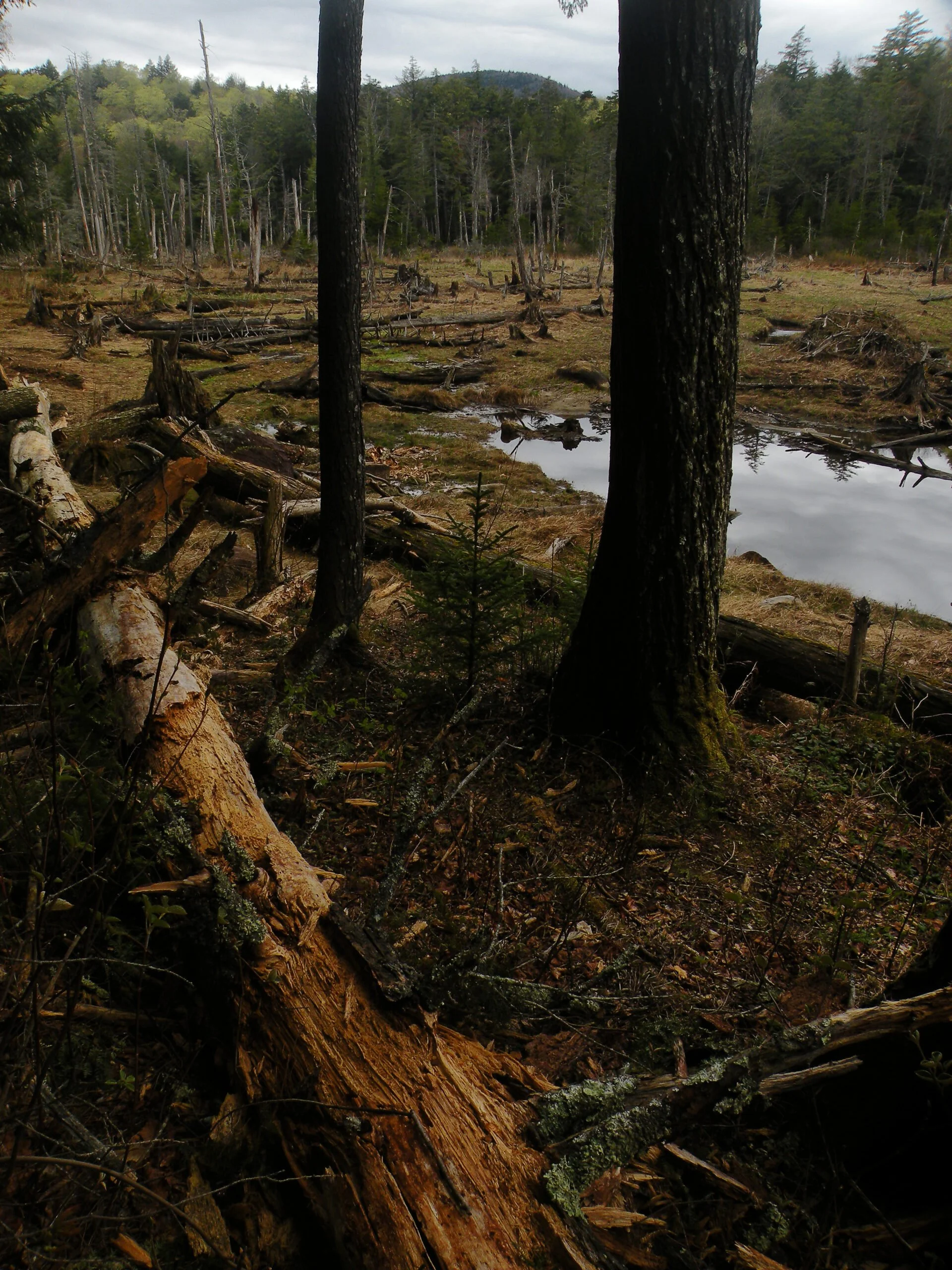
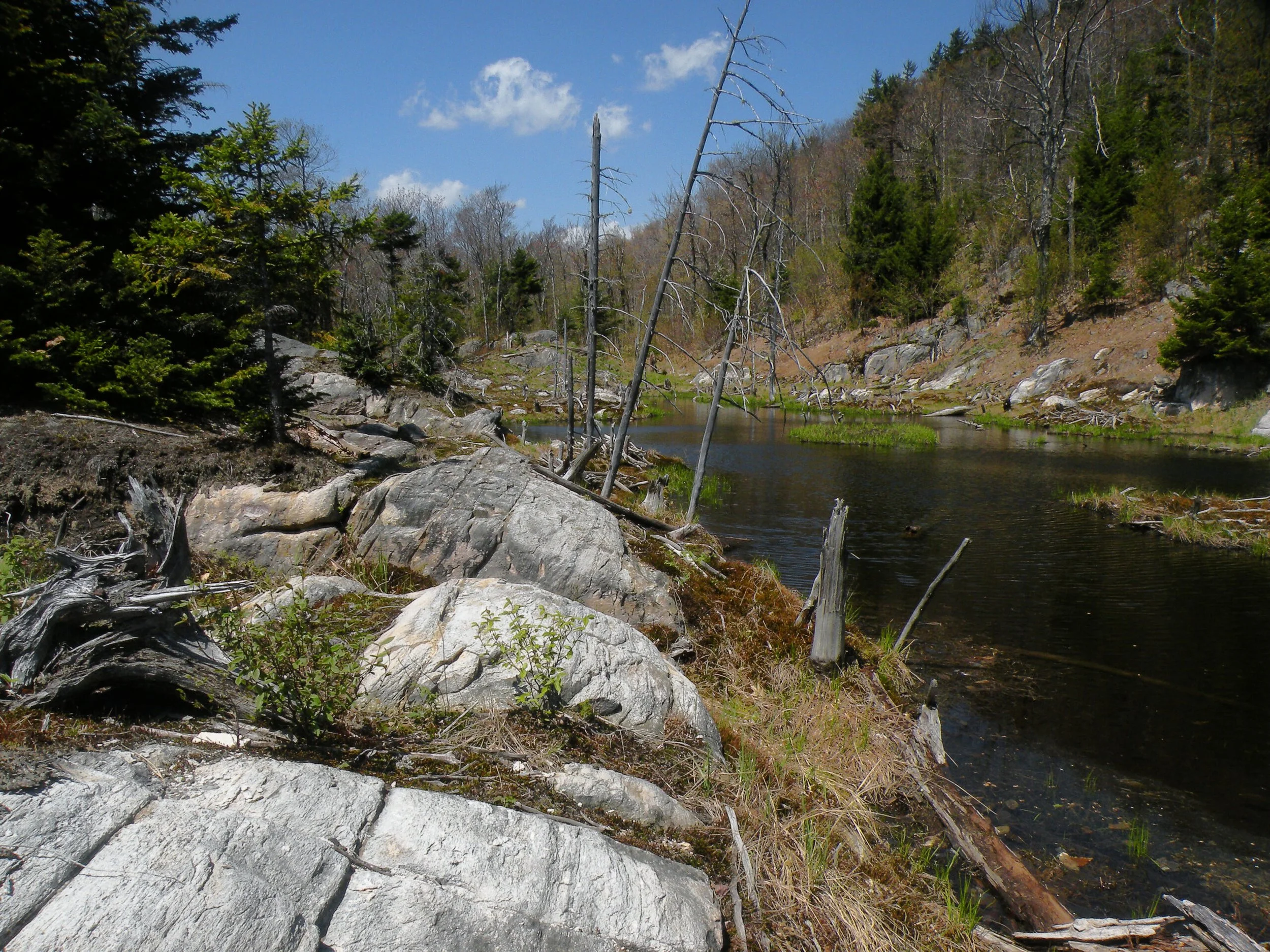
The state acquired most of the land that now comprises the Silver Lake Wilderness at a very early date in the history of the Adirondack Park. Therefore even though nearly all of the forest was logged in the nineteenth century, enough time has passed that most of the area has been able to return to near old growth conditions. The traces of dams and old tote roads are the most obvious signs of past human activity; naturally speaking, this wilderness has probably changed very little over the last few centuries.
There are no alpine summits to entice throngs of sightseers, nor are the lakes plentiful enough to lure a navy of paddlers. The charms of the Silver Lake Wilderness lie in its vast open spaces, its many miles of wild streams, its spruce and hemlock groves, the traces of its traditional trail system, and the relative lack of crowds. The open forests that grace much of the area are highly favorable to off-trail wandering. Some locations may go years without hosting any human visitors at all.
If there are any crowded places here, they will be found along the Northville-Placid Trail corridor and at some of the outlying areas close to roads. A 27.7-mile section of the NPT traverses the Silver Lake Wilderness from Woods Lake near Benson to Route 8 in Piseco, with three lean-tos along the way. This route and one connector trail near Upper Benson are currently the only marked state trails in the entire 107,731-acre area. Easy access to Woods Lake and Whitehouse makes these two locations popular summer camping sites.
The rest of the wilderness is only lightly traveled and little known outside of a small number of repeat visitors. Therefore in terms of its generous size, grand forests, and low recreational use, this area is among the best examples of true wilderness in the entire Adirondack Park.
Please click through the tabs below to learn more about the Silver Lake Wilderness.

-
The Silver Lake Wilderness is hardly a land of superlatives. Its mountains are middling, its ponds are scattered and small. In terms of size, it ranks fifth among the wilderness areas of the Adirondack Park. Visitation levels fall far short of many of the more popular areas.
But as anyone familiar with the area will tell you, the most impressive feature is the forest itself. Despite the human history, much of the backcountry seems to be untouched. The logging that did occur was often selective; because of the area’s isolation, the lumbermen were economically driven to harvest only the largest trees of certain species. And these activities ended so long ago that the forest has had plenty of time to recover.
The tanneries were less selective in the hemlocks they felled, but even in the Arietta region these trees still grow large and plentiful.
Hemlocks are perhaps the most notable trees in the Silver Lake Wilderness, occurring in groves throughout the area. Although accounting for a comparatively small percentage of the forest cover, red spruce nevertheless grows to enormous heights throughout the southern Adirondacks. Among the hardwoods, white ash grows in numbers and proportions that are uncommon elsewhere in the Adirondacks. Northern red oak is more common along the river valleys, but it also extends up to several of the summits as well.
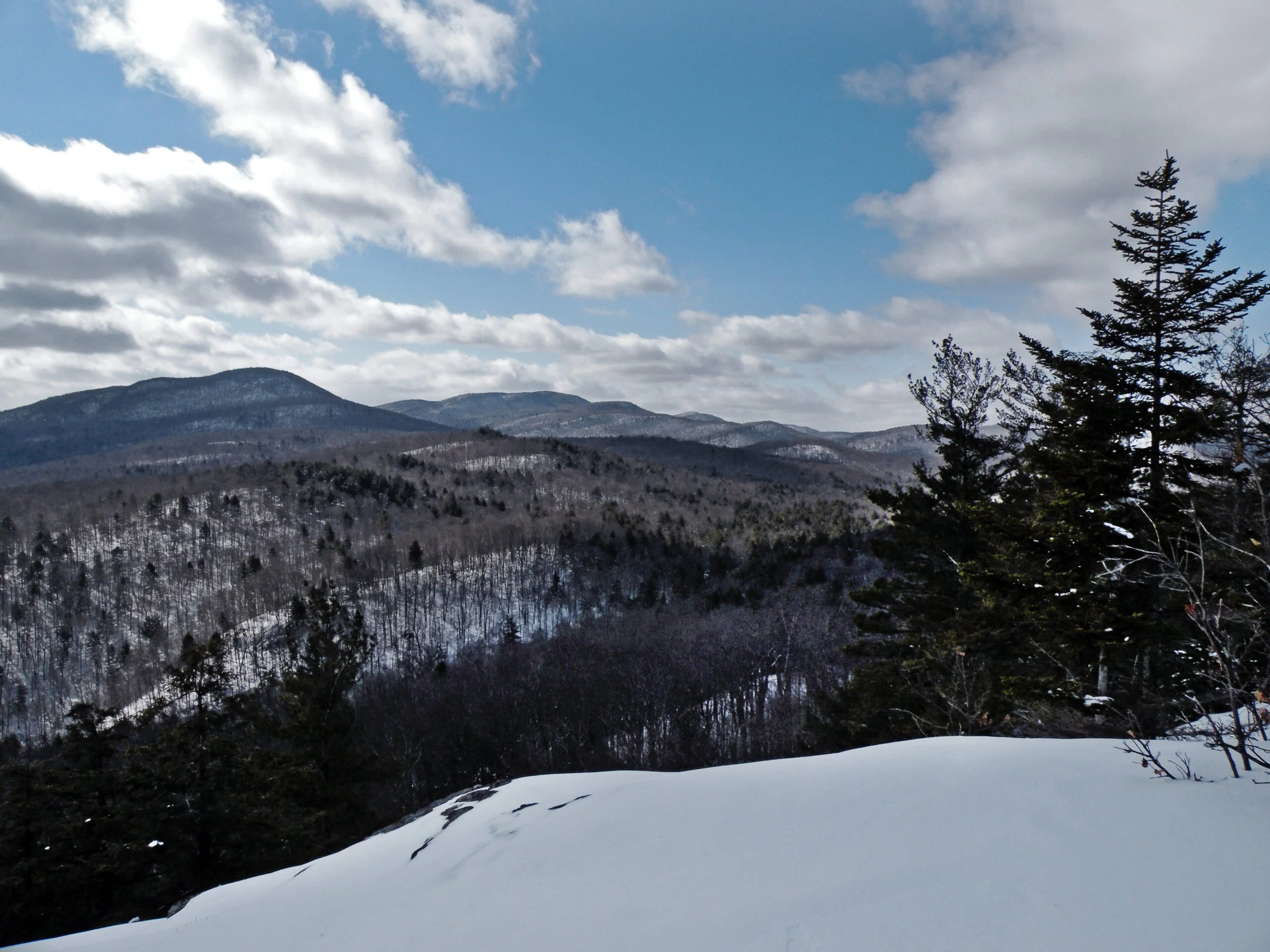
This is a region that is not known for its mountain heights. Nevertheless, there is an elevation differential of over 2400 feet from the banks of the Sacandaga River near Hope (approximately 820 feet in elevation) to the summit of Hamilton Mountain, a former fire tower summit (3250 feet). But most of the highest mountains in the Silver Lake Wilderness have thickly forested summits, and thus are essentially unknown to climbers. In this wilderness, it’s the peripheral foothills that steal the show, because that’s where the best ledges and cliffs are found: Francisco, Southerland, Finch, Southerland, Sherman, and Trout Lake are all outstanding little mountains, none of them very remote at all.
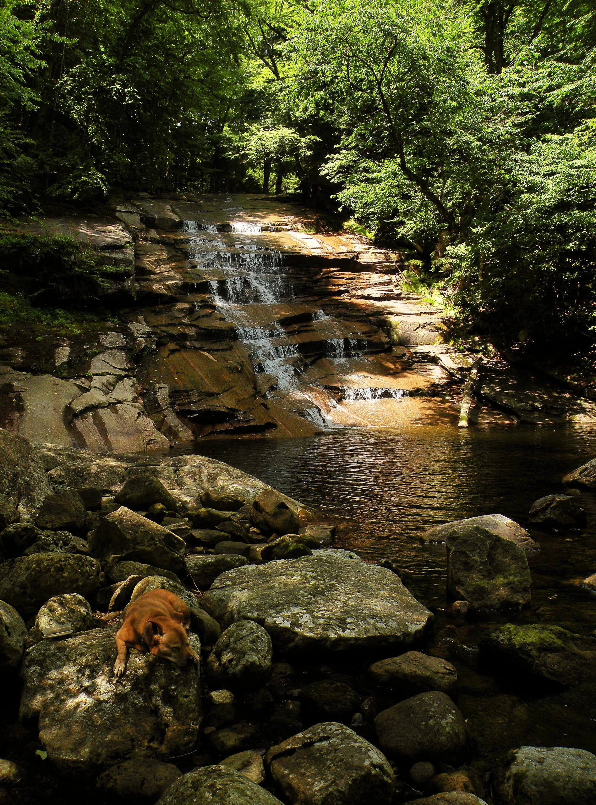
There are 29 named ponds and lakes, ranging in size from an acre to Silver Lake’s 75.1 acres. Once a vibrant trout fishery, Silver Lake was rendered fishless in the 1960s due to the effects of acid rain, which lowered the pH levels until the water became chemically unsuitable to sustain fish. This continued until 2002, when reductions in acid precipitation permitted DEC to resume stocking the lake again.
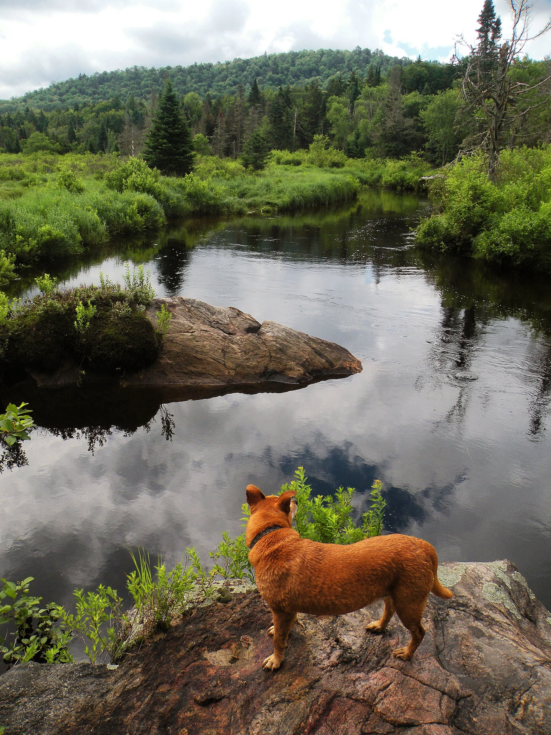
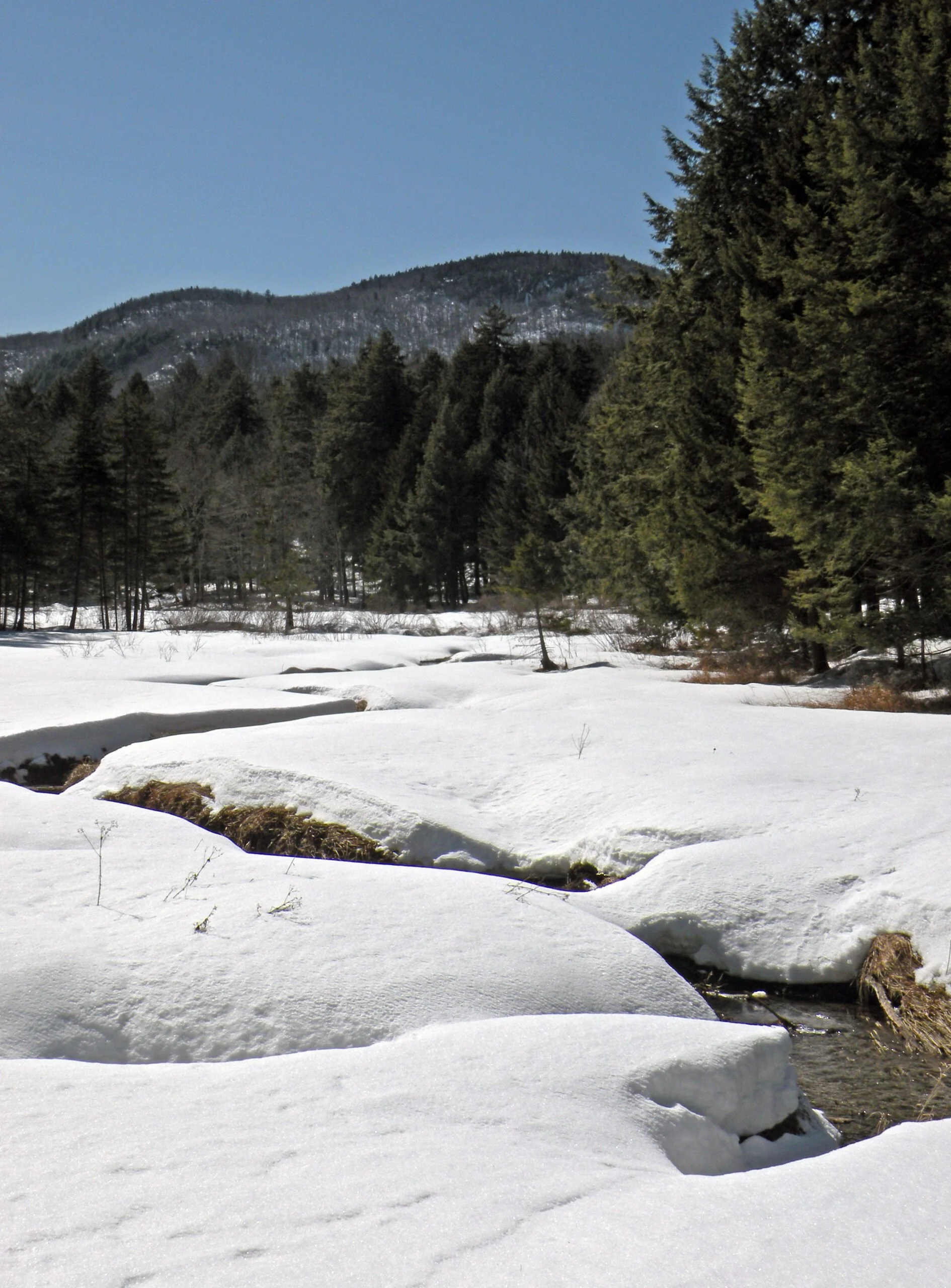
Topographic maps show many more small bodies of water than just the 29 named ponds. However, most of these are ephemeral flows subject to the whims of the beavers; instead of ponds filled with water, they are just as likely to be grassy, stump-filled meadows. These ubiquitous landmarks sometime bear the name vly, pronounced as either “vly” or “fly,” a word imported by New York’s early Dutch settlers to connote a marshy area. Vlies are found along nearly every stream, and some are regarded as prominent local landmarks, such as Priests Vly near Piseco and King Vly near Blackbridge.
The most dominant feature of this wilderness, though, is not a mountain or a lake or even a vly, but the West Branch Sacandaga River, which begins as a small stream high in the hills and exits as a raging river near Blackbridge. Since all but the southwestern corner of the Silver Lake Wilderness falls within the Sacandaga watershed, this area would be more appropriately named the “West River Wilderness.”
The upper half of the river is characterized by long, gentle flows through open wetlands, including one highly scenic area alongside NY 10 in Arietta—an area that state officials once deemed so “worthless” they planned to flood it in an enormous reservoir. The lower half is a much different river. Below Piseco Outlet, it spills over a series of small cascades and disappears briefly in a deep, forested gorge. It pauses for only a few hundred yards at Big Eddy; otherwise, from Whitehouse to Wells the West Branch is mostly rocky and raucous. It even has the attention of some whitewater enthusiasts.
In 1916, the New York State Museum published a bulletin entitled “Geology of the Lake Pleasant Quadrangle, Hamilton County, New York.” Although this publication is more than a century old, it remains the most comprehensive natural history study of the Silver Lake Wilderness and its immediate environs, covering topics from the composition of the area’s bedrock to the location of extinct glacial lakes.
-
The Silver Lake Wilderness has survived into the modern era intact despite the fact that American settlement penetrated the southern Adirondacks beginning in the 1790s. For the better part of the next century, the area remained wild if not always pristine and uninhabited. Although it is the natural environment that impresses most visitors today, the area has a rich human history.
The hamlet of Wells, located near the forks in the Sacandaga River, was settled in 1792. From there, roads penetrated westward into the wilderness, reaching as far as the site now known as Whitehouse. Richard Van Voorhis built one of the first known sawmills on the West River in 1835, and it was supplied by lumber drawn from the Benson Tract, a trapezoidal land grant that comprises the heart of the Silver Lake Wilderness.
Henry Devereaux of Stratford built a sawmill much further upstream on the West Branch in the hamlet of Arietta, and began logging the western side of the wilderness in the 1840s. Later, William Claflin of Massachusetts built a tannery at this same site. Beginning in the years after the Civil War, the surrounding hemlock forests provided the tannery with an abundant source of tannins, a key ingredient in the manufacture of leather. But when the tannery burned in December 1892 it was never rebuilt, since by that time synthetic chemicals had eliminated the industry’s dependence on hemlock bark. The foundations still remain, though, and the unmarked trail to the North Branch cuts straight through the site of the tannery complex.
The most unusual economic activity to occur within the Silver Lake Wilderness was a short-lived gold rush in the town of Benson. When reports of gold discoveries in West Stony Creek and its tributaries reached Albany and the Mohawk Valley in 1880, newly-minted mining corporations seemed to appear overnight. Capitalists displayed bars of gold bullion—supposedly from Benson—in front of eager investors. But all of the gold and silver prospecting yielded very few results, for there never was any gold. The rush lasted for only a few years, after which it was largely forgotten; only one site on Goldmine Creek, not far from the Northville-Placid Trail, bears obvious evidence that a search for gold ever occurred. A state geological survey in 1916 confirmed that Benson was an unlikely place to find valuable minerals.
Of course the forest also saw its fair share of logging activity in the nineteenth century. The most valuable tree was red spruce, which in the southern Adirondacks grows in large sizes, but not in large numbers. Unlike hardwoods and hemlocks, spruce logs could be floated down streams and rivers all the way to the great mills of Glens Falls. Cut-and-run practices flourished here, because the low quantities of spruce combined with the long distances from the Hudson River made the Benson Tract a low priority. Lumbermen acquired land by the lot, cut the largest trees, and then moved on. The abandoned lots often reverted to the state when no one paid the taxes on them.
However, when the state began planning for the proposed Adirondack Park, the Benson Tract lots were among the first additions to the Forest Preserve, established by law in 1885. By 1900 the state had acquired nearly all of what is now the Silver Lake Wilderness.
But was this area really a wilderness at that time? Almost. The area was crisscrossed by a network of roads, and its numerous streams were punctuated by the remains of small log dams. The farm clearings at Whitehouse and Devorse Creek were still inhabited. Not all of the roads were primitive logging tracks; some had been created or adopted as public highways at one point, including one route between Benson and Wells that was constructed under state commission in 1858.
Nor had all of the woodsmen left, either. Daniel Wadsworth had retreated to the woods of Benson after the death of his wife in 1880, finding employment in the lumber camps—and there he remained long after the state acquired the land. He was joined by his son Seth in 1901, who was also apparently reeling from personal tragedy. The two men occupied the sites where they had once worked, enjoying reclusive lifestyles in separate camps a few miles apart from each other. Daniel preferred a remote cabin near Silver Lake, and Seth spent much of his time at a camp on Devorse Creek, which was surrounded by a small field.
The Wadsworths were squatters on state land at a time when management of the Forest Preserve was very much unsettled; for years, state officials seemed to tolerate their presence. John Apperson, a General Electric engineer who later became famous as an advocate for the Adirondacks, befriended the men and even tried to convince state officials to let them remain. In the end, though, the Devorse Creek camp was removed by the state in 1915, and Seth Wadsworth traded his former hermitage for a position as a watchman on the Cathead Mountain fire tower. His elderly father was apparently allowed to remain at Silver Lake until his death in 1924.
Whitehouse, located at the heart of the wilderness, was so remote that its inhabitants avoided the reach of census takers for many years; only a few brief mentions in History of Hamilton County tell us that the Northrup family once dwelled here. We can only assume that a residence so far from town had to be a farm, perhaps to supply meat and produce to the surrounding lumber camps.
The site later became a popular sportsmen’s retreat established by Abe Lawrence, a member of a well-known guiding family from the Lake Pleasant area. When Abe died in 1925, his sister Olive took over the management of Whitehouse along with her husband Lee Fountain. The chief attractions of the area were its deer herd and trout fishery; in the off-season, when there were no hunting or fishing parties to host, the Fountains kept busy by making rustic furniture.
Today, casual visitors to the Silver Lake Wilderness will be most impressed by its natural qualities, not the evidence of its human history, because only a few artifacts of these bygone days are easily found. The two chimneys at Whitehouse are the features that probably stand out to most people; the ruins of the Arietta tannery are not hard to find either. Remnants of the old farms, dams, and goldmines are also present, but finding these may require a more deliberate search.
-
Despite the vast size of the Silver Lake Wilderness, the scarcity of developed facilities means that most people tend to congregate in the same popular areas: Woods Lake, Whitehouse, and a few other accessible spots here and there. The Northville-Placid Trail sees the highest volume of hikers—which makes sense, as this and the Godfrey Road Spur are the only marked trails in the entire area.
West River Road extends 8 miles into the wilderness, ending at the site of Whitehouse. There is no doubt that the interior would be wilder and remoter without this road, but it services a number of residential lots near the foot of Dugway Mountain and will therefore probably never be closed in its entirety. The westernmost part of the road lies almost entirely on state land, and DEC did advance a proposal to close about 0.7 mile in its 2006 management plan for the Silver Lake Wilderness. This adjustment was perhaps too little to rouse the support of wilderness advocates, but more than enough to stimulate local ire, so even this modest amount of road closure has never been realized.
Thus Whitehouse remains a key trailhead and roadside camping area near the heart of the wilderness, easily accessible from late spring through the fall hunting season. It is the primary access point for the West Branch Gorge, a rugged section of river just upstream from Big Eddy.
Woods Lake near Benson is an attractive body of water just a fraction of a mile from the nearest parking area. The combination of scenic beauty and accessibility has made this one spot a rare management problem for the area, with more people seeking campsites on summer weekends than there are legal campsites.
In 2014 the NPT was rerouted to include 7 additional miles through the southern portion of the wilderness, for a total length of 27.7 miles between Benson and Piseco. Even for many experienced hikers, this corridor is the only portion of the Silver Lake Wilderness most people ever see. The trail route was first selected by the Adirondack Mountain Club in 1924, utilizing the existing old logging road network for the most part. Before the state built a 320-foot-long suspension bridge over the West Branch in 1962, through-hikers were sometimes ferried across the river by guides at Whitehouse.
Traditionally, this region was of more interest to sportsmen than to hikers; the culture of hiking clubs that gathered around the High Peaks simply never happened here. The result is a system of informal trails that lead into the woods from obscure trailheads and disappear quietly at remote locations. Describing Silver Lake as “trailless” is incorrect, because in reality there is a rich network of traditional footpaths, in addition to the NPT. Several have been inventoried by DEC as “Class I” unmarked trails and thus enjoy a vague official status.
Of these Class I trails, two stand out. The Groff Creek Trail follows what was formerly a prominent road through a deep valley filled with shady hemlocks; the namesake creek tumbles over a series of attractive waterfalls, some easier to find than others. The road once traveled all the way to Seth Wadsworth’s camp at Devorse Creek, but today it can only be traced as far as a beaver meadow with views of Wallace Mountain.
The other notable trail leads to Big Eddy from Whitehouse. This particular Big Eddy is perhaps not as striking as the one on the Cold River, but it is a well-used route linking several attractive campsites—but beware the rampant poison ivy, which you will find in sunny areas all along the river’s banks. Upstream, the path narrows as it winds alongside the river to the foot of the West Branch Gorge, where the rugged terrain makes it impossible for a trail to continue.
The path from Arietta to the stream known only as North Branch follows a road once used for hauling hemlock bark. It is now a highly satisfying wilderness trail, although it is not maintained as well as it was in decades past; the northern half has become quite overgrown, and amateurish attempts to clear it in recent years have caused the trail to wander from the original course of the road.
In Benson, one obvious old road leads north from the NPT past old stone fences toward the Notch at the foot of Wallace Mountain. Another trail leads south from Blackbridge toward Remington and Devorse creeks. Both of these routes are all that remain of a state highway commissioned in 1858; the middle section is extremely indistinct.
The scattered nature of the ponds and lakes makes paddling a more marginal activity than other wilderness areas further north. The most attractive canoe routes are the West Branch Sacandaga between Arietta and Averys, and Spy Lake near Piseco. Both of these waterways are located on the edge of the wilderness and lack a sense of remoteness. There are other, more secluded portions of the West Branch that can be paddled, but these require difficult carries.
In recent years, rock climbers have also discovered the Silver Lake Wilderness—in particular a set of small mountains in the area’s southwestern corner near Arietta. For better or worse, the climbers have cut new trails to a top-roping wall on Chub Lake Mountain, as well as to two more technical walls on nearby Sherman Mountain, in an area that was trailless not too long ago. Non-climbers will be disappointed to learn that these access trails lead to the bottoms of the cliffs, not to the open views found at the tops.
-
In the nineteenth century, the land that would become the Silver Lake Wilderness was encroached upon by the surrounding agricultural settlements, as well as by the lumbermen and bark peelers who harvested its forest bounty. The twentieth century saw the wilderness regaining some of its lost territory, even as several of its once-productive fisheries succumbed to acid rain. What will be the story of the twenty-first century? Although the region is strongly protected, several potential threats and management concerns either loom on the horizon or remain unresolved.
Insect Invaders: Perhaps the biggest threats to this wilderness will be a pair of small insect species: the hemlock woolly adelgid and the emerald ash borer. The former has been devastating hemlock forests throughout the Appalachian Mountains and has been slowly working its way north. The ash borer has killed millions of trees in the Midwest and has already been found in northern New York.
The intersection of these two invaders in the Adirondacks could cause profound changes in the Silver Lake Wilderness, where the forest is composed of large numbers of both hemlocks and white ash trees. In the worst case scenario, the nonnative insects would kill nearly all of the mature trees of each species, greatly changing the appearance of the area as well as the composition of the forest. On the other hand, it is possible that the sheer size of the wilderness, with its lack of deep road access, may buffer it from these threats.
Cathead Mountain Access: This region has several long-standing management concerns in addition to insect infestation. One is the status of the Cathead Mountain fire tower, which stands on an inholding of private land. Public access was curtailed due to a dispute between the landowner and state officials. There is strong public interest in restoring access, but DEC lacks the legal authority to grant the landowners motorized access across state land to their inholding, and the landowners are not required to grant public access to the mountain they own. AWA has been involved with a project that could restore public access in the near future, however.
Non-Conforming Facilities: Another key issue is the status of West River Road, which dead-ends within the wilderness boundaries at the site of Whitehouse. The State Land Master Plan identifies this road as one that should be closed to motor vehicles if the private land is ever acquired. In 2006, the Silver Lake Wilderness management plan did propose the closure of the final 0.7 mile of the road, including the parking area at Whitehouse.
Currently, Whitehouse is the site of a trailhead parking area and several popular drive-in campsites. There are no established clearings at the proposed point of closure, and thus DEC would need to perform significant work to establish a new parking area here. There was strong opposition to the proposal among users of the road, and only lukewarm support among wilderness advocates for its closure. DEC does have the legal authority to close this town highway, but to date it has taken no action.
There are also two steel suspension bridges near Whitehouse that do not meet State Land Master Plan guidelines for wilderness footbridges, which require the use of natural materials. One spans the West Branch Sacandaga River, and the other is located on Hamilton Lake Stream. Both were constructed prior to the wilderness designation, and both will remain as long as they are structurally safe to use. When these bridges deteriorate, it will likely trigger a discussion on what constitutes appropriate bridge construction in the wilderness.
Trail Development: The lack of recreational development has always been one of the defining characteristics of the Silver Lake Wilderness since its establishment in 1972. The Northville-Placid Trail is the only marked hiking route, and the rest of the area is sometimes described as being “trailless,” despite the presence of numerous unmarked Class I footpaths.
However, the communities of southern Hamilton County have expressed an interest in linking their town centers with points of interest in the surrounding state lands, in the way that many Essex County hamlets are encircled by rich trail networks. Practically speaking, this cannot happen unless some amount of new trail development is considered for the Silver Lake Wilderness. The Great South Woods project in 2016 identified several new trail options around the periphery of the area that would create new links and loop opportunities, but any plan for recreational development in this area will likely stir controversy.
Potential for Expansion: There are no large forestry tracts adjacent to the Silver Lake Wilderness, and thus the potential to expand the protected area through land acquisition is very low. Several thousand acres of the Shaker Mountain Wild Forest to the south therefore represent the most qualified potential addition to the wilderness. This area features several small ponds, including Eastman Lake and County Line Lake. When the Adirondack Park Agency established the wilderness boundaries in 1972 it used the Fulton-Hamilton county line as an arbitrary southern border, although this line follows no natural landmarks as it traverses the woods from Stoner Lake to Upper Benson, and in fact it cuts corners through two remote ponds. Both sides of the county line are equally wild.
-
The following links leave the AWA website and take you to various pages on the Department of Environmental Conservation (DEC) website with more information on the Silver Lake Wilderness.
Silver Lake Wilderness Information Page. Learn important contact information and peruse a list of facilities.
Backcountry Information for the Southern Adirondacks. Trail conditions updated weekly for the Silver Lake Wilderness and neighboring areas.
Silver Lake Wilderness Unit Management Plan (2006). Download DEC’s official management plan, approved in 2006.
State Land Regulations. Review the complete list of DEC regulations.
All photos © Bill Ingersoll. Site visitors are permitted to download an unlimited number of images from our website for personal, educational, scientific, or professional use only, with attribution. Commercial use and further distribution of images is prohibited without express written permission.
Maps of the Silver Lake Wilderness and the Surrounding Area
Below is the current DEC map of the wilderness and its facilities. The remaining maps show the evolution of the area. Click maps to enlarge.
Silver Lake Wilderness Map
1890 Forest Quality
1903 Forest Fires
1907 Lake Pleasant USGS Quad
1954 Lake Pleasant USGS Quad
Silver Lake Wilderness Image Gallery