
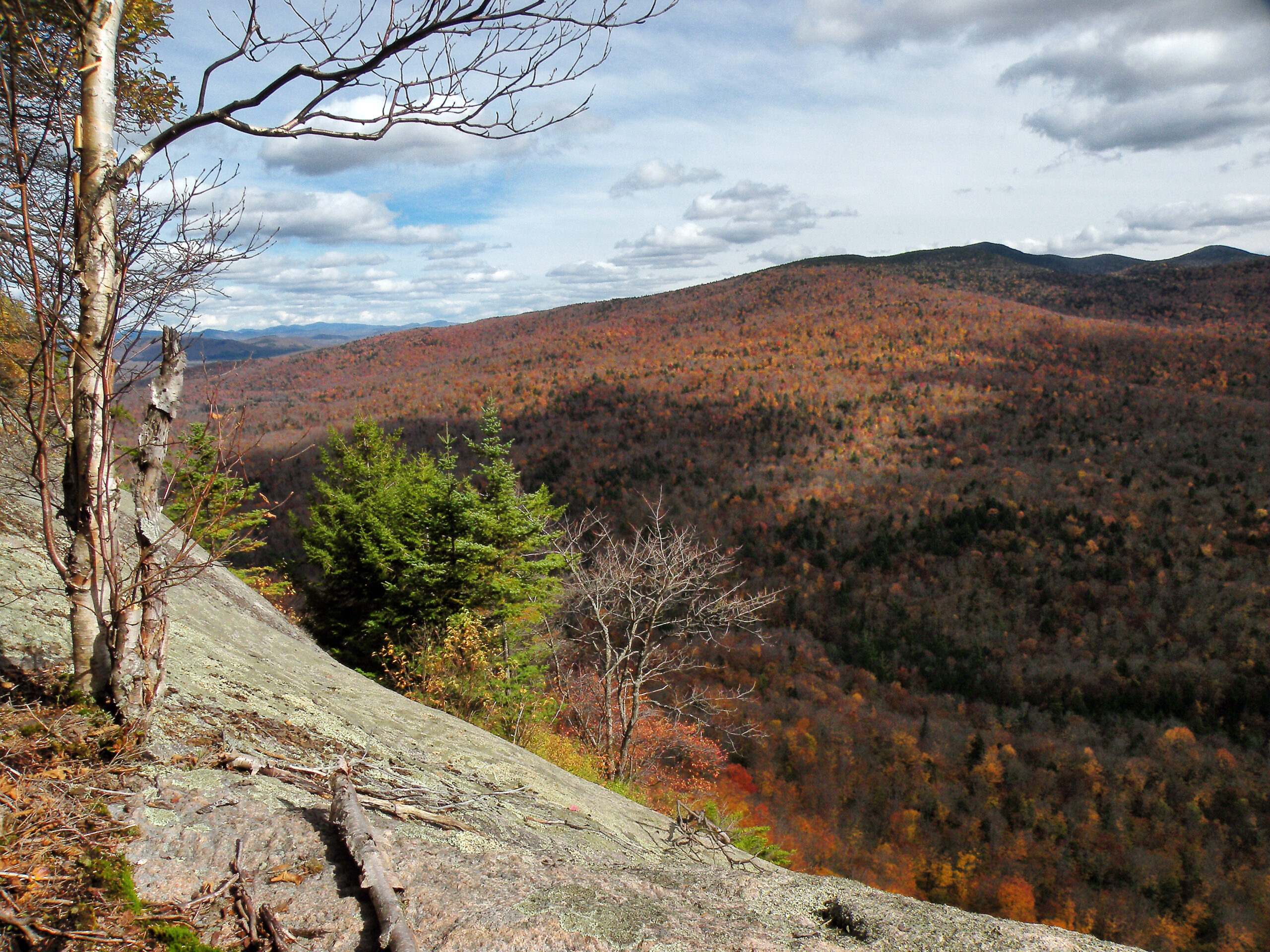
View from Sugarloaf Mountain

If the Adirondack Park has a wild heart, it must beat somewhere deep in the Blue Ridge Wilderness. This area, which is nearly 48,000 acres in size, barely misses the park’s geographic center, skewing just a short distance to the southwest of that mark. But in many ways it is the region’s quintessential wilderness: vast, serene, and much of it seemingly untouched.
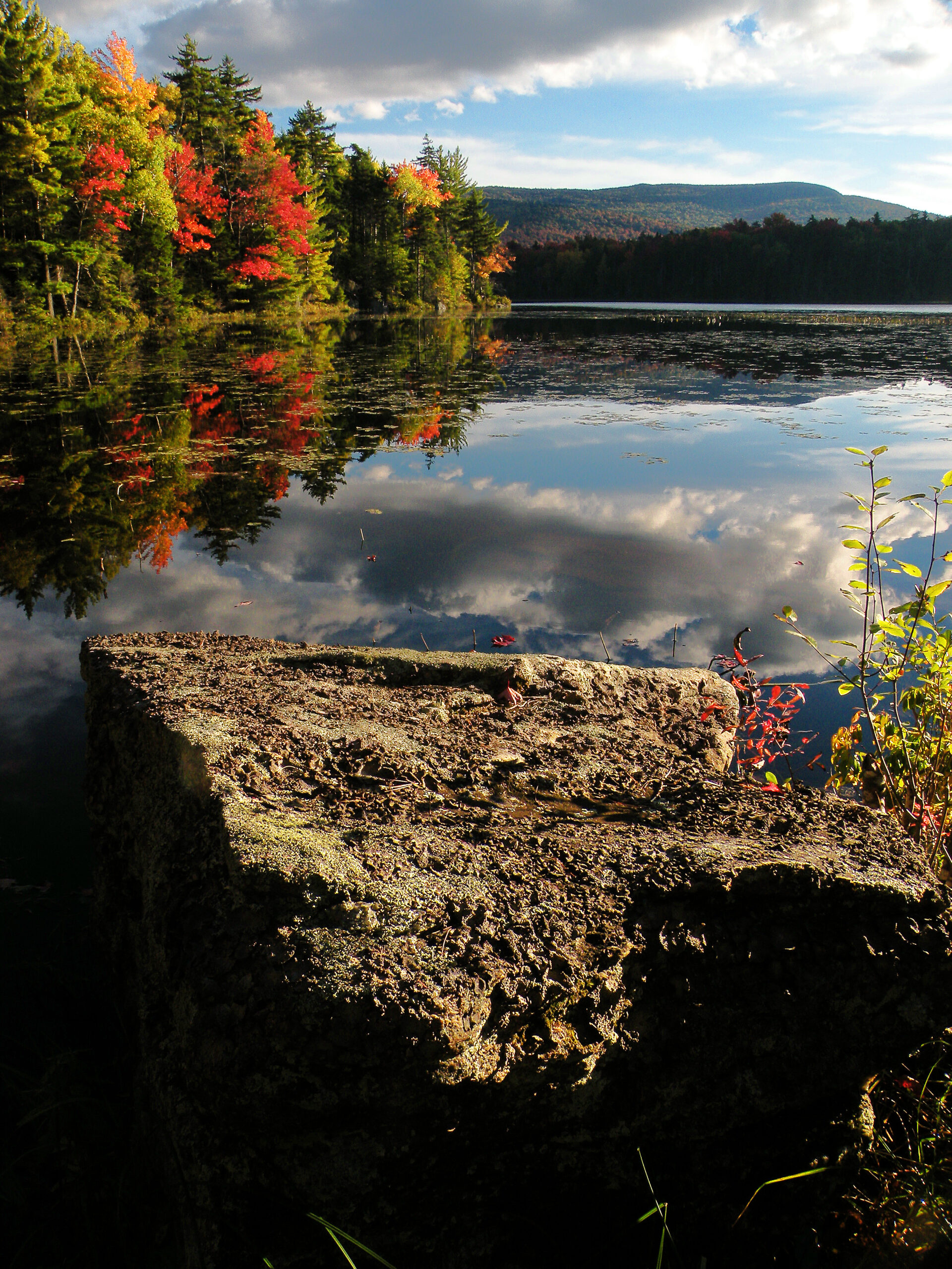
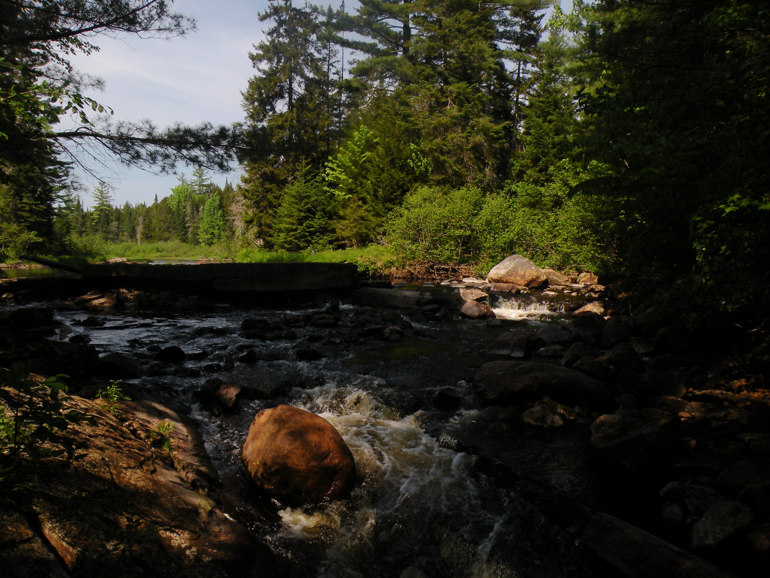
There is no doubt this area is aptly named; Blue Ridge, the mountain, spans at least half the width of its namesake wilderness. This multi-summited massif is seldom visited, both because of its remoteness and its lack of views. For most visitors, the mountain is merely the backdrop to several of the scenic ponds in its northern foothills, lurking far beyond the reach of any trail.
The shape of the Blue Ridge Wilderness is somewhat peculiar, with a vast western half that tapers to near nothingness as it extends eastward, almost to the hamlet of Indian Lake. On a map it looks vaguely like a giant whale, its maw prepared to snap on poor Lake Kora. In more practical terms, this size differential means that the eastern and western ends of the wilderness also provide different experiences, as well as somewhat different forested environments.
Despite its central location within the Adirondack Park, the Blue Ridge Wilderness is often overlooked by hikers, backpackers, and people of the sporting variety. Even the team of park planners who proposed the first wilderness areas in 1962 overlooked it at first; its potential was not recognized until a few years later. But this low-key nature is perhaps one of the Blue Ridge Wilderness Area’s best assets, for except at a few key locations solitude is a very good possibility.
Please click through the tabs below to learn more about the Blue Ridge Wilderness.
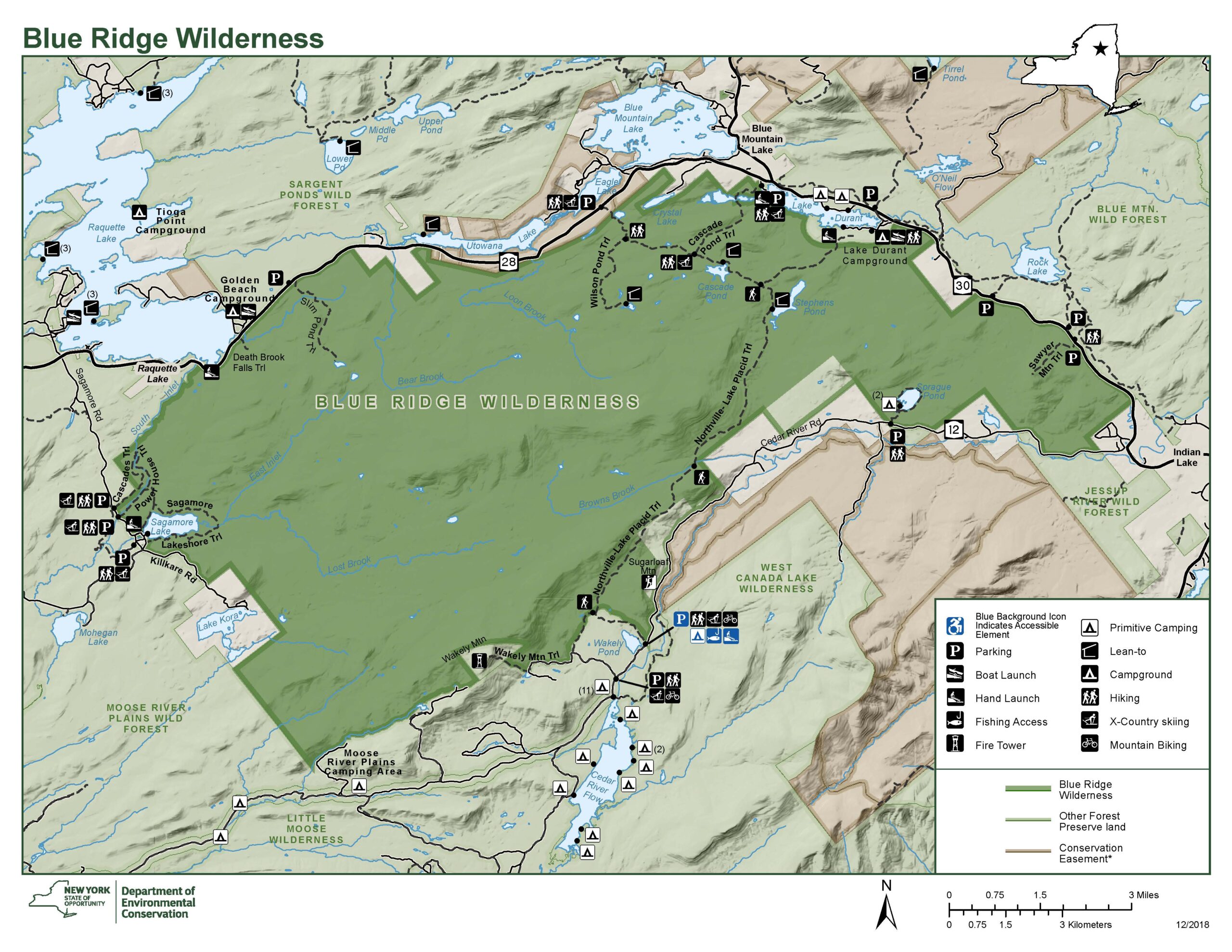
Size: 47,848 acres
First Designated: 1972
Unit Management Plan Status: Completed in 2006; draft amendment proposed in 2018
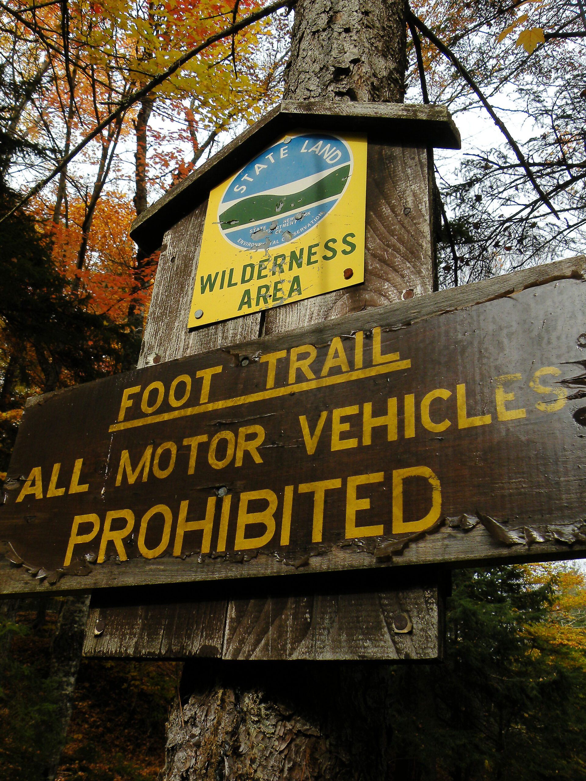
Special Regulations: None; standard Forest Preserve regulations are in effect


The western half of the wilderness falls predominantly in Township 6 of the Totten and Crossfield Purchase. William West Durant acquired this township in 1888 and sold most of it to the state a few years later, its forests still in their native, virgin condition. The tract contained many thousands of acres of broad valleys forested with dark, boreal stands of balsam fir and red spruce, with enormous white pines that were often double the size of their neighbors.
This remained one of the largest stands of virgin timber in the Adirondacks until 1950, when a November hurricane devastated the North Country and leveled many of these noble stands. In a controversial decision, the state attorney general authorized the old Conservation Department – precursor to the modern DEC – to conduct salvage operations on the Forest Preserve to remove the fallen timber. In doing so, the AG cited the fire hazard posed by the destroyed trees to the remaining forests and surrounding communities. Fortunately, plenty of tall pines and old-growth acreage still remain in this region, but the keen observer might otherwise be puzzled by the presence of tote road traces in an otherwise mature forest.
The eastern half of the wilderness falls within Township 34, which has a decidedly different provenance. The tract was logged several times, including operations conducted by James Ordway beginning in 1863. Durant purchased the tract in 1888 and also harvested trees to provide building materials for his elaborate Great Camps. The state acquired this land in 1906.
Both halves of the Blue Ridge region have notable wilderness values, but those of the western region can be through the roof, so to speak. This area has a few well-worn trails around its periphery, enough to tease the visitor into thinking they have actually seen all there is to see – while beyond lies a valley nearly two miles wide and so difficult to access that few people venture into it.
Most of the more familiar destinations are found in the eastern half, and most of them are reached with modest effort. The ponds here are small but quite attractive, each with its own character. By the time you work your way eastward to Sprague Pond and Sawyer Mountain, in the tail of the Blue Ridge Wilderness, the forest is not much more than a mile wide.
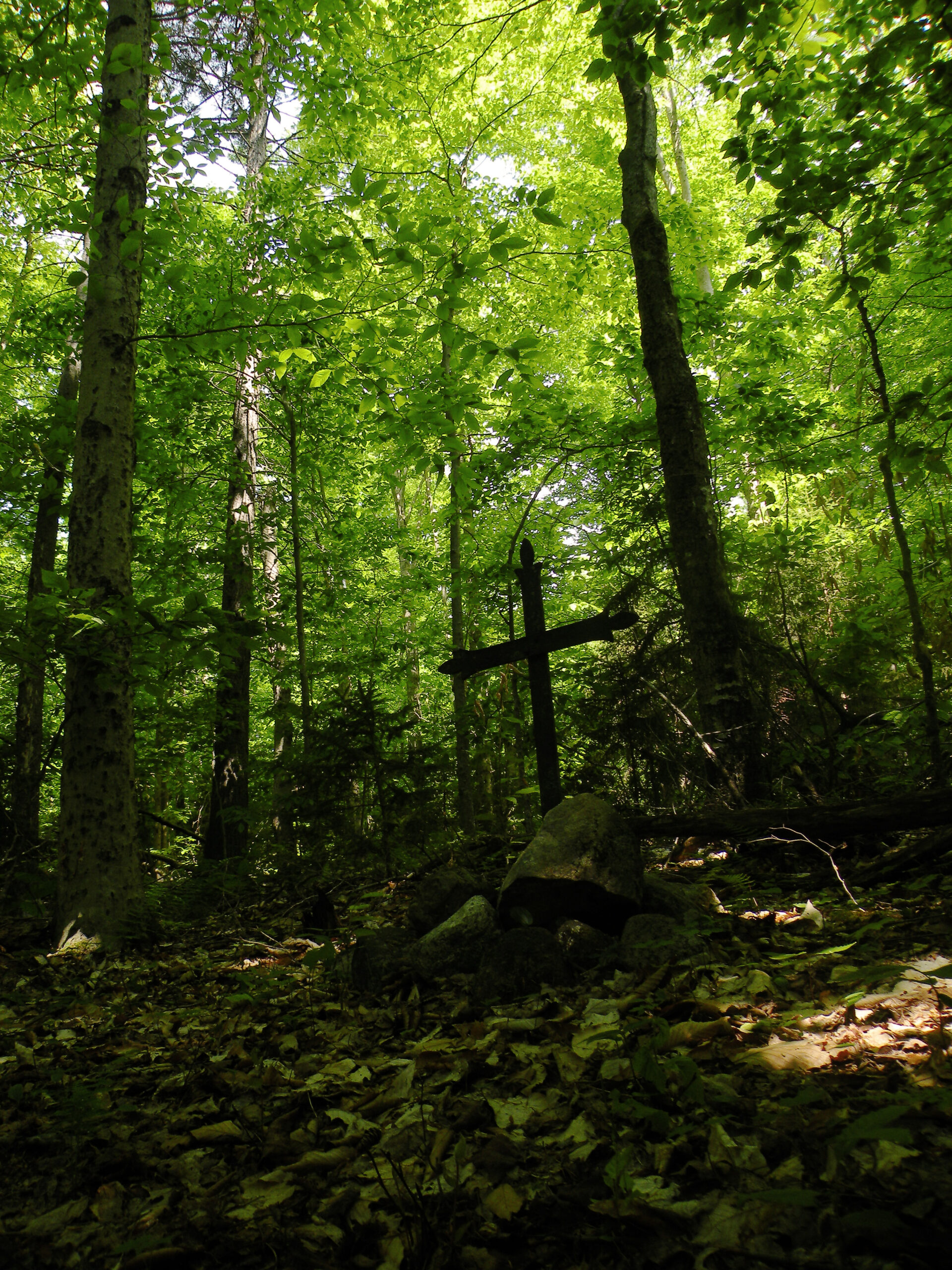
Like any other Adirondack wilderness, there is a human story hidden in the Blue Ridge Wilderness. But in one small corner, “History” should be spelled with a capital letter H, because it is impossible to explore this area without stumbling into some of the obvious artifacts of America’s so-called Gilded Age.
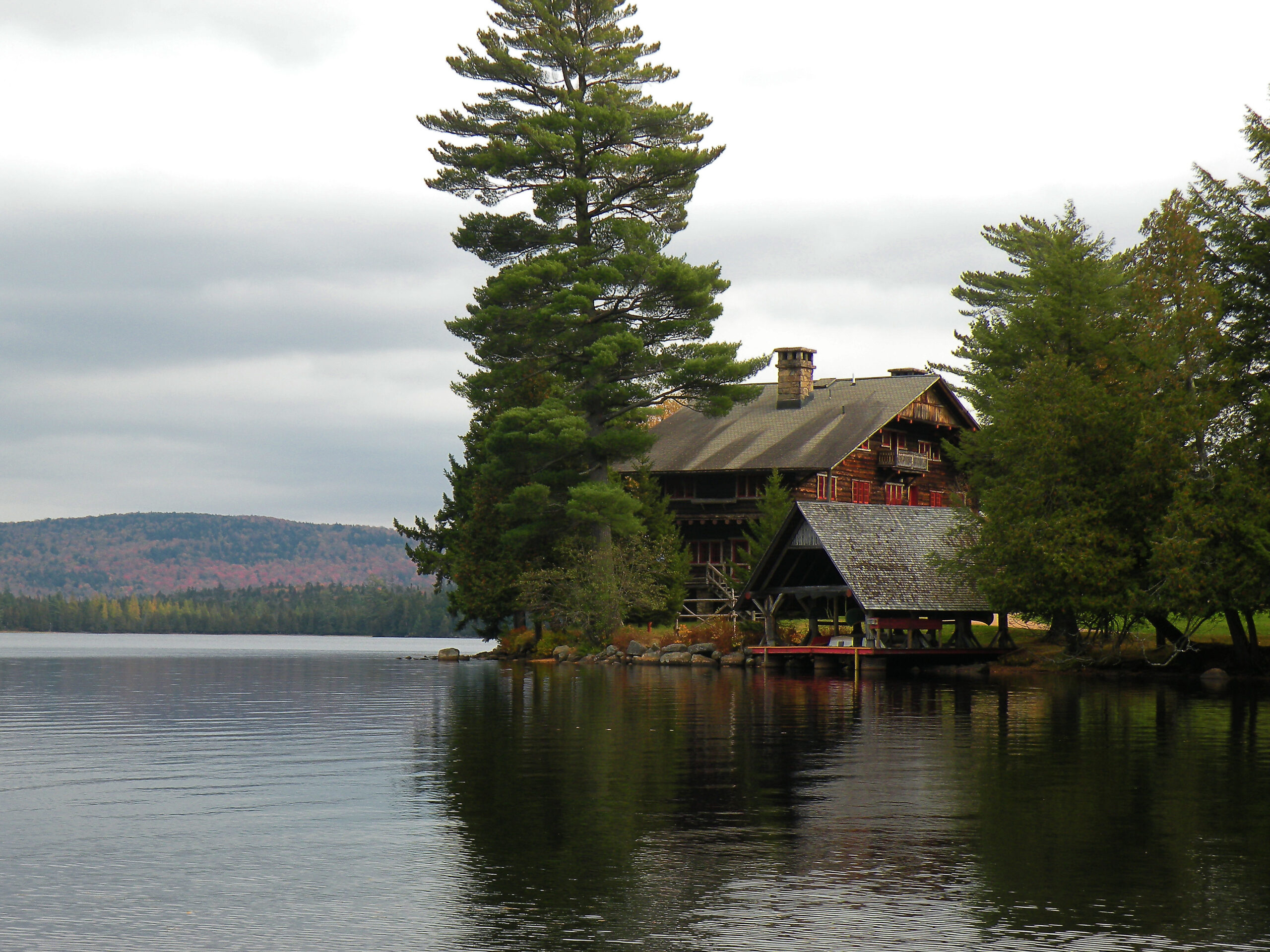
William West Durant, son of the Union Pacific Railway vice president Thomas Clark Durant, attempted to establish his own fortune by developing the Raquette Lake region into a vacation retreat for the nation’s wealthiest families. He designed and constructed elaborate camp complexes with an architectural style renowned for its use of local materials. After first building Camp Pine Knot on the shore of Raquette Lake, Durant looked south at Sagamore and Mohegan lakes for his next two projects.
Sagamore Lake was known as Shedd Lake when Durant purchased Township 6 of the Totten and Crossfield Purchase from Marshall Shedd in 1888. He built Camp Sagamore there in 1895 and sold it and the 1526 acres surrounding the lake to Alfred G. Vanderbilt in 1901. Durant also built Camp Uncas on nearby Mohegan Lake and sold it to J. P. Morgan.
The expenses of building both camps almost simultaneously forced Durant to sell the surrounding undeveloped acreage to the state in 1897. One of the negotiators for the state was Timothy L. Woodruff, who was both the lieutenant governor and chairman of the Forest Preserve Board, and as such he was one of several state representatives who personally inspected the tract. He must have been very impressed with what he saw, for he arranged to acquire a thousand acres of the land being offered to the state — the part surrounding Sumner Lake — for his own use. He built Kamp Kill Kare a year later on the lake, which he renamed Lake Kora.
Camp Sagamore remained in the Vanderbilt family until they donated it to Syracuse University in 1954. The university then logged the area before offering to sell the entire tract, including the camp complex, to the state in 1972.
While state acquisition of the Sagamore lands would have preserved the forests from development, it would’ve also called into question the future of the camp itself. Article XIV of the state constitution requires that all state-owned lands in the Adirondack Park be managed as part of the Forest Preserve, and the “forever wild” provisions precluded the possibility of maintaining the historic structures. In order to avoid the destruction of the camp, historic preservationists were allowed to intervene in the sale to purchase the eight acres surrounding the main camp complex while the state purchased all of the surrounding land. Voters then passed a constitutional amendment in 1983 that also allowed the transfer of the ten acres containing the servants’ complex.
All three camps remain in private ownership, although all are completely surrounded by state land. The carriage trails and service roads around Sagamore and Mohegan lakes form the basis for today’s hiking, biking, and ski trails. In the summer, it is possible to take a tour of Camp Sagamore. Visiting that Great Camp and then exploring the trails is a great way to relive the days of the Gilded Age in the Adirondacks.
If you choose to explore the portion of the Blue Ridge Wilderness surrounding South Inlet and Sagamore Lake, you’ll agree this is the best example of how historic preservation and wilderness preservation have intersected each other here. Although most of the Sagamore complex has been preserved, a few outliers remain in the Forest Preserve, resulting in a very unique situation.
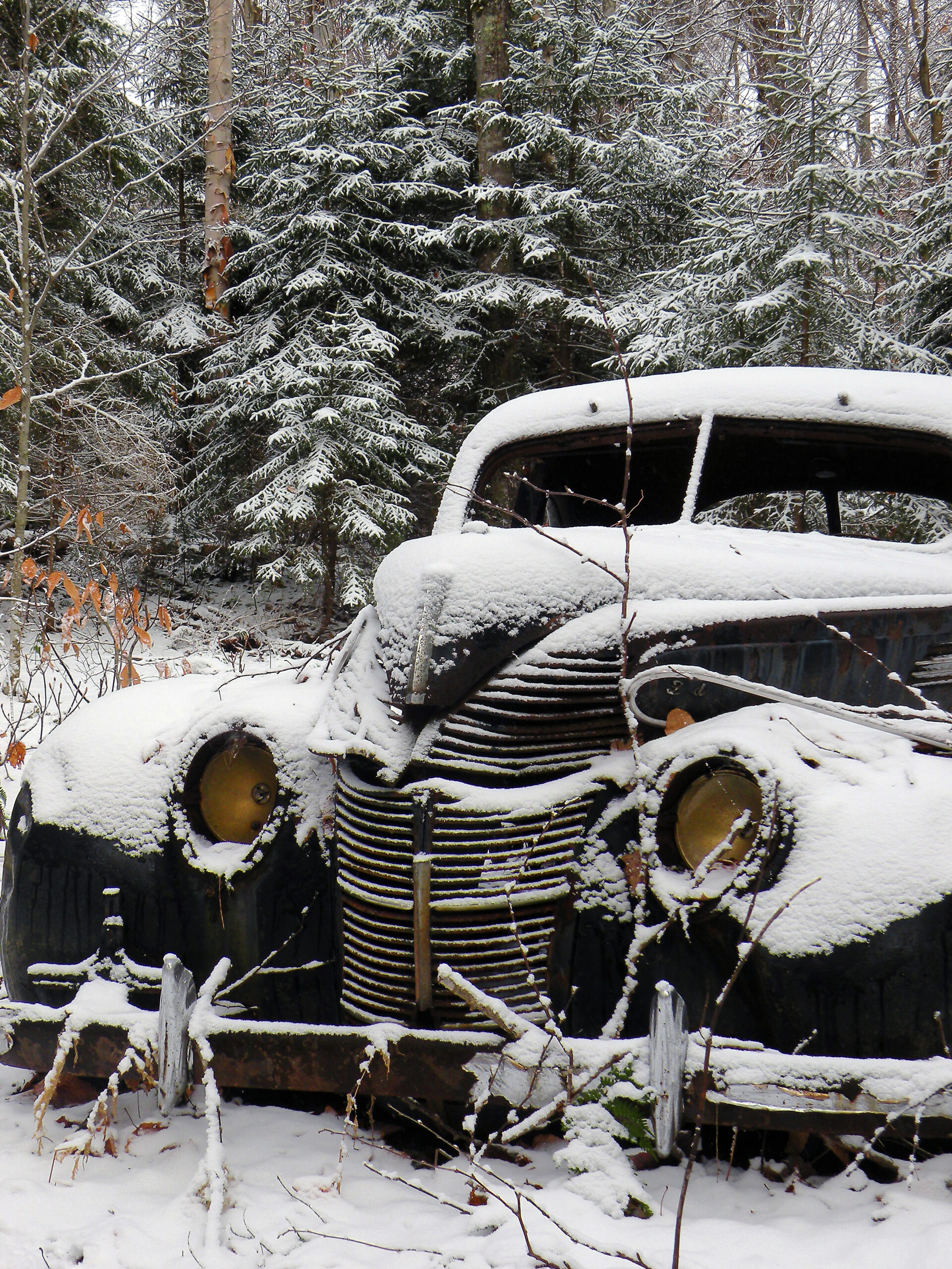
The most prominent of these structures is a small hydroelectric facility located on South Inlet, which provided power to Camp Sagamore; the two brick buildings that comprise the plant now stand within the Blue Ridge Wilderness. Structures such as these are generally banned from wilderness areas, which are intended to be natural landscapes free of human development. However, DEC has chosen to retain them on the grounds that demolishing the buildings would do more harm than good to the surroundings. Instead they will be left as they are, as a demonstration of how natural forces affect the works of man over time.
As mentioned in the previous tabs, the Blue Ridge Wilderness has distinctive eastern and western halves, with nearly all of the trails limited to the peripheries of each. You could explore every trail and see every sight they offer, and yet only cover a small fragment of the total acreage.
Being less remote and in close proximity to the hamlets of Blue Mountain Lake and Indian Lake, the eastern zone is the most hiker-friendly, with a pleasing trail network that connects with several choice destinations. All three lean-tos are found here, as is Blue Ridge’s portion of the Northville-Placid Trail. The routes to Stephens, Cascade, and Wilson ponds are all connected with each other, making point-to-point trips possible.
If you feel the need to climb a mountain, Sawyer is the only option with a trail completely within the wilderness. Located in Blue Ridge’s eastern “tail,” don’t apologize if you find this modest mountain with its narrow wedge of a view to be a disappointment.
Instead, most people prefer the thrilling steepness of Wakely Mountain, a noteworthy enclave within the Blue Ridge Wilderness. Normally old-school fire towers are prohibited in wilderness areas, and many unused towers across the Adirondacks were removed in the 1970s to bring some areas into compliance. Wakely survived that purge, and its tower still stands. Technically its summit stands in a management unit of its own called the Wakely Mountain Primitive Area, just beyond the official bounds of the Blue Ridge Wilderness. But when you’re standing on Wakely’s lofty summit these invisible map lines are meaningless. In every way that matters, Wakely Mountain is an integral part of the Blue Ridge landscape.
The most distinctive mountain of all, though, is Sugarloaf, which lies on the southern edge of the wilderness just above Cedar River Road; people driving to and from Wakely Dam might glimpse it through the trees. The road-facing half of this mountain is a vertical cliff, and the handful of people who bushwhack to its top are faced with a sheer drop-off.
A quirk of topography makes the large western half of this wilderness seem even more vast than it really is. Although readily accessible from NY 28, which defines the northern boundary, the massive, sprawling mountain known as Blue Ridge effectively discourages most people from venturing too far south. Likewise, explorers entering from the Cedar River valley along the southern edge of the wilderness have to contend with the wall-like trio of Wakely, Cellar, and Metcalf mountains. Between these two ranges lies a secluded valley that is nearly two miles wide and unseen by all but a hardy few. A wilderness doesn’t get much wilder than that!
Trails become commonplace again in one small corner of the westernmost reaches of the Blue Ridge Wilderness, all of them associated with Great Camp Sagamore. These hiking and ski trails all follow the former carriage and service roads of the former Sagamore estate, which DEC acquired for the Forest Preserve in the 1980s. Except for the main camp complex itself, the lake and its environs are now constituent parts of the wilderness. Even so, artifacts abound; exploring this corner of Blue Ridge is as much a historical exploration as it is a natural experience.
One final trail of note is a relative newcomer: Death Falls. Despite its lethal name, nothing about this hike is scary; being just 0.3 mile long, anybody so inclined can manage the distance. And being short and accessible, Death Falls does enjoy a modest measure of popularity. But there is a hidden irony for people familiar with the site’s prior condition: the falls appear to be the remains of an abandoned rock quarry, the trail passes over the decommissioned septic field for the nearby Golden Beach Campground, and the woods were so strewn with mid-century trash that an archaeology team was once brought in to analyze the “artifacts.”
Thankfully, though, Death Falls is the exception, not the rule, and on the whole the Blue Ridge area is a high-caliber wilderness.
The Blue Ridge Wilderness is an area for which AWA has taken action. In 2018 DEC proposed building a new snowmobile trail southeast of Raquette Lake that would pass along the boundary of this wilderness. In our analysis, such a trail would diminish the natural soundscape of the area, and we did not think DEC had considered all viable alternatives.
So we spoke up.
You can read our concerns and ideas by following the link below. Currently, DEC’s proposal is pending further review and certain legal challenges. However, you can be sure that if other proposals arise, we will analyze them and do our best to offer alternate solutions that will do no harm to the wilderness.
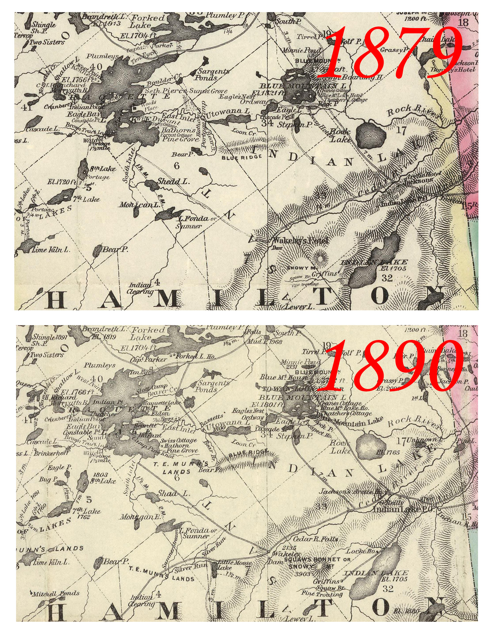
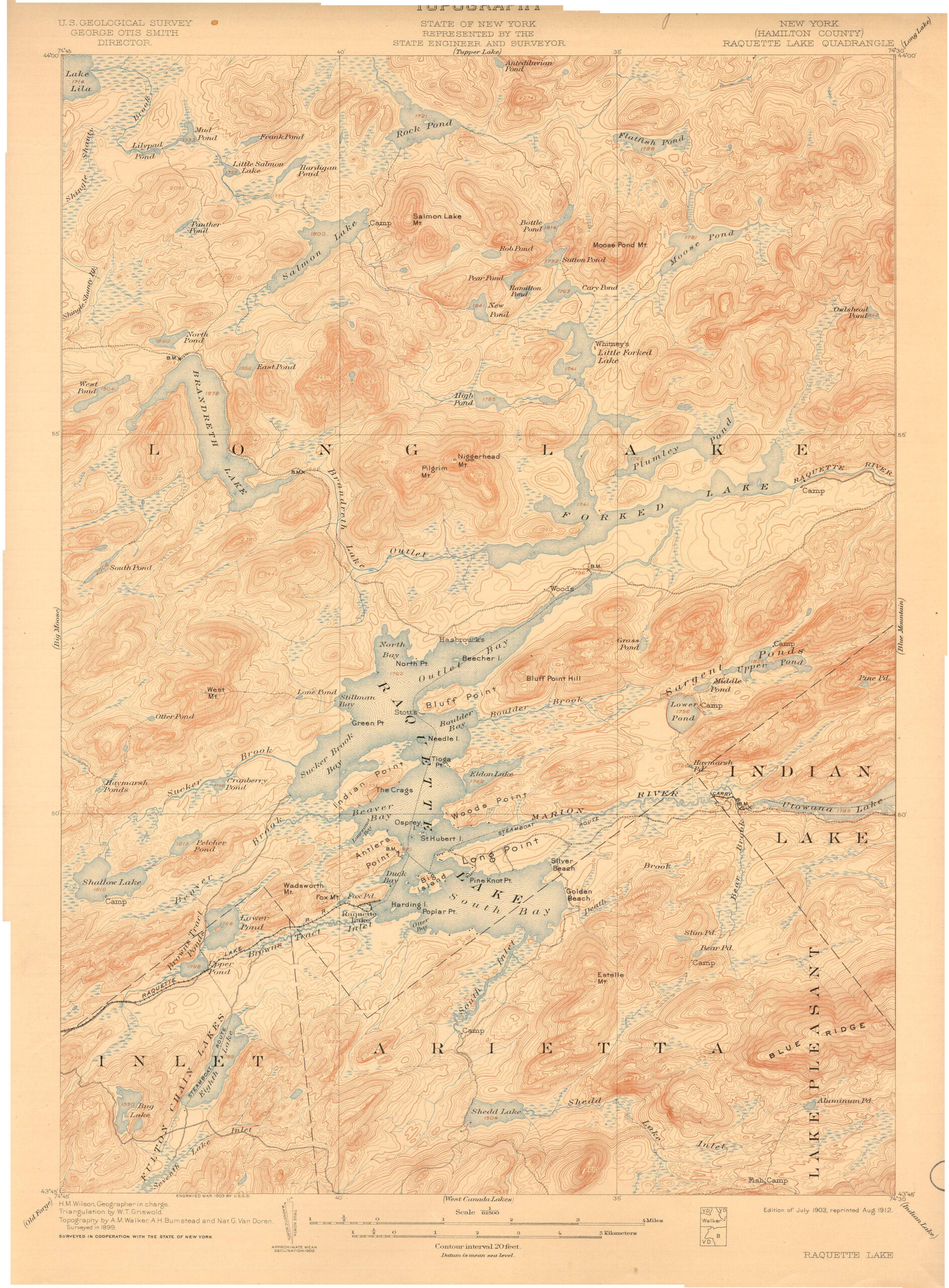
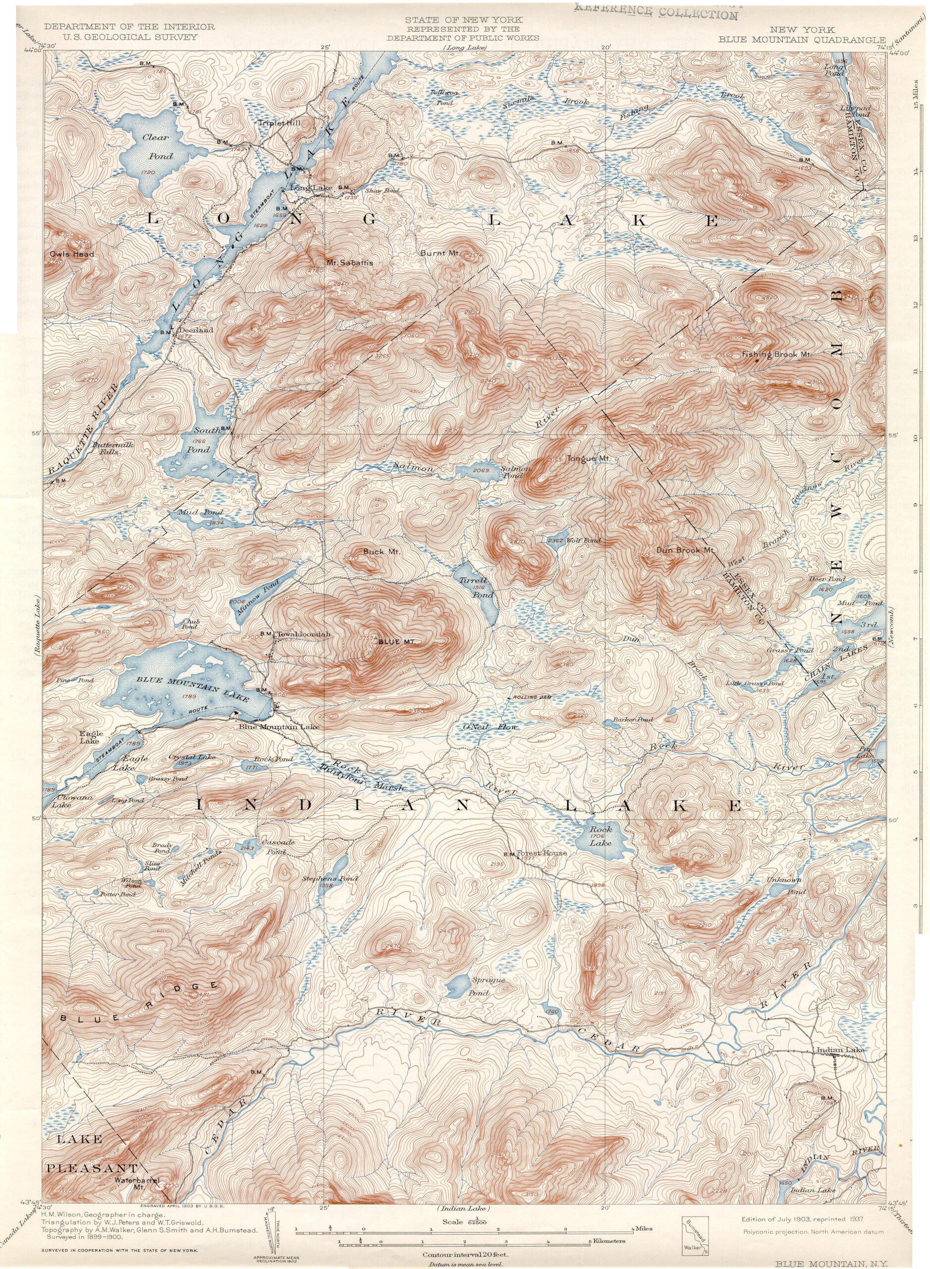
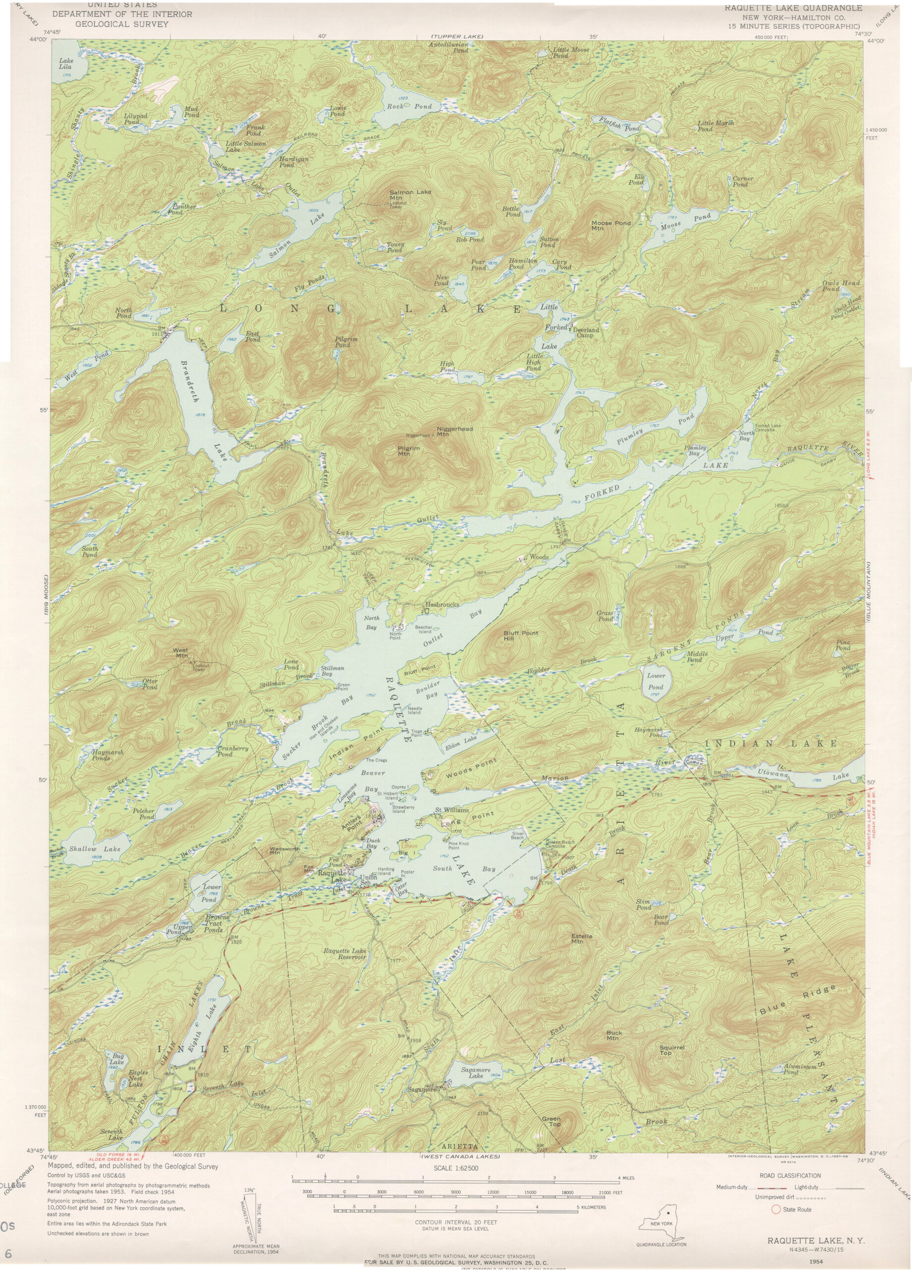
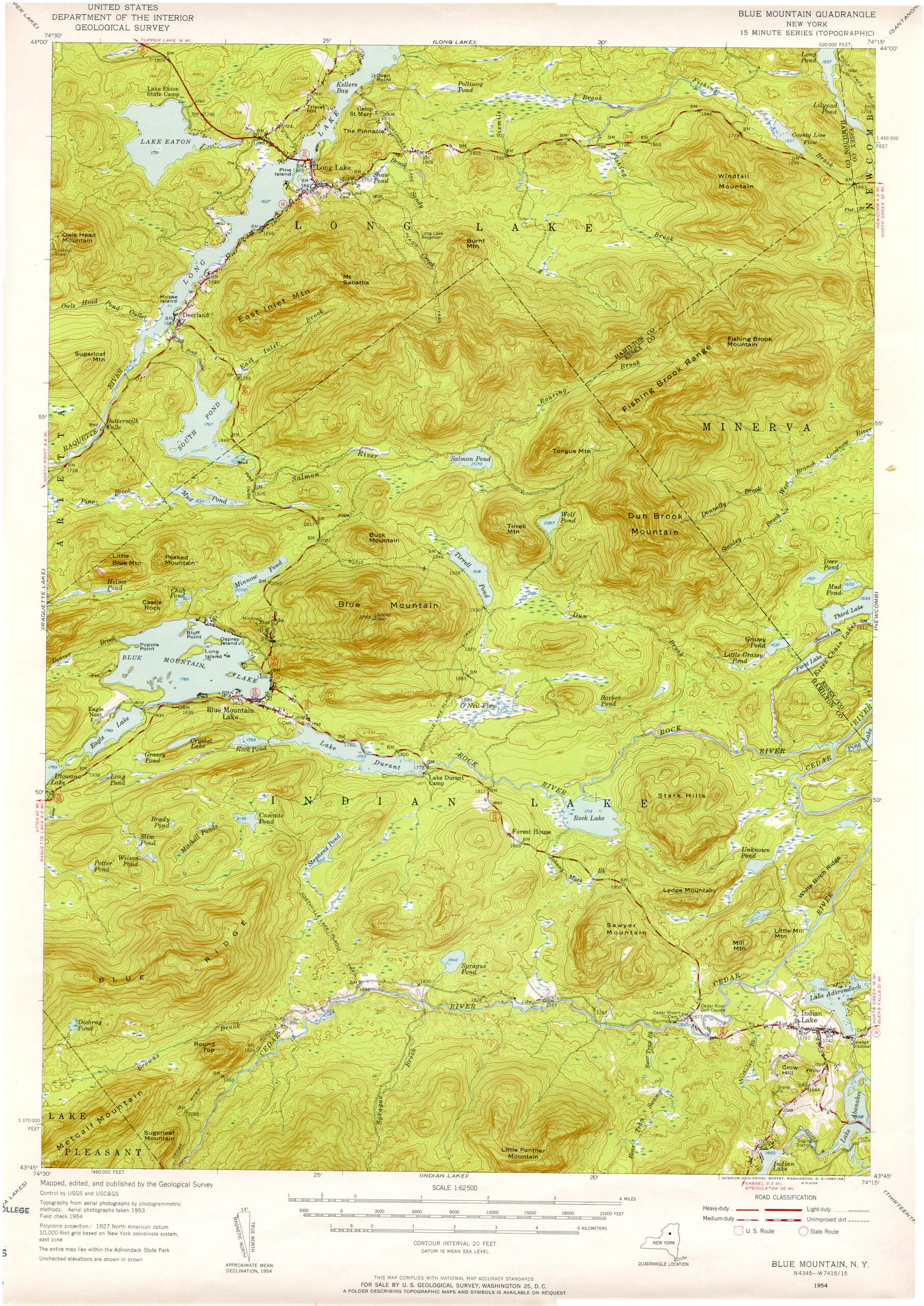
Maps of the Blue Ridge Wilderness and the surrounding area. At left is the current DEC map of the wilderness and its facilities. The remaining maps show the evolution of the area from 1879 through 1954: lakeside hotels coming and going, and the roads that faded into faint trails. You may need to download these high-resolution files to see all the details.
The following links leave the AWA website and take you to various pages on the Department of Environmental Conservation (DEC) website with more information on the Blue Ridge Wilderness.
Blue Ridge Wilderness Information Page. Learn important contact information and peruse a list of facilities.
Backcountry Information for the West Central Adirondacks. Trail conditions updated weekly for the Blue Ridge Wilderness and neighboring areas.
Blue Ridge Wilderness Unit Management Plan (2006). Download DEC’s official management plan, approved in 2006.
Draft Amendment to the Blue Ridge Unit Management Plan (2018). Download DEC’s proposed controversial amendment to the Blue Ridge UMP.
State Land Regulations. Review the complete list of DEC regulations.
All photos © Bill Ingersoll. Site visitors are permitted to download an unlimited number of images from our website for personal, educational, scientific, or professional use only, with attribution. Commercial use and further distribution of images is prohibited without express written permission.


