The evening of Halloween 2019 brought strong winds and torrential rains to much of northern New York. The storm caused widespread damage over a vast region: significant flooding in communities along the Mohawk River and West Canada Creek, homes and businesses destroyed, roads washed away. The destruction to the region’s infrastructure – and the hardships inflicted on many of our neighbors – was nothing short of severe.
In the Adirondack Park, so many major highways were shut down by floods and washouts that in the immediate aftermath of the storm, traveling across Hamilton County was a difficult proposition. The village of Speculator was practically isolated, with Route 8 completely shut down to the east and west, Route 30 closed to the north, and severe damage along the Sacandaga River to the south. This left Route 10 as the sole remaining highway, but even this road was partially underwater.
In the weeks since the storm, there has been a heroic rush to reopen all of these roads, all of which are vital connections between communities. At a time of year when road construction usually grinds to a halt, and asphalt production ceases for the winter, crews have been working through the early snowfalls of November to rebuild the sections of highway destroyed in the floods.
I can only imagine the stress this has placed on the emergency service providers in these mostly rural communities, particularly Hamilton County. When you combine the washouts with the widespread power outages, you have an entire county that has been on emergency footing for too long a time.
How fitting, then, that I have recently been involved in discussions with county officials, local landowners, and other Forest Preserve advocacy groups regarding a project that might someday improve the ability of emergency responders to communicate with each other – while also opening the door on meaningful discussions to enhance the adjacent Silver Lake Wilderness.
This project would involve allowing Hamilton County access to the summit of Cathead Mountain in the town of Benson for the purposes of erecting a microwave emitter tower – one in a series of such towers that would connect communities like Wells with the rest of the county, as well as link Hamilton County with its neighbor to the south, Fulton County.

Access to Cathead Mountain
Many people may know Cathead as the fire tower summit near Northville that has been closed to public access for over twenty years. The mountain’s summit is owned by a private hunting club, which curtailed hiking access to the DEC tower in 1998 after an access dispute with the state. The problem is that this privately-owned mountain is completely encircled by Forest Preserve lands, and no legal right of way exists into the inholding; the landowners are free to cross state land on foot, but motor vehicles are not permitted.
If Hamilton County gained access to the summit, they wouldn’t be the first government agency to put communication equipment on Cathead. The State Police have had a presence there for some time; in fact, they have taken over the top half of the old fire tower and turned it into a repeater station of their own.
The problem? The same lack of a right of way across state land also hinders any public agencies they would lease access to Cathead. And not only is there no road access into the inholding, there is no electrical connection either. Power for the State Police emitters is generated on site with a combination of solar panels, a wind turbine, and a propane generator. This equipment is serviced by helicopter, since there is no other way to get there.
For the State Police, the significance of Cathead Mountain is that it provides a link from the Adirondacks almost to the Catskills. For Hamilton County, a tower on the mountain would beam signals into the hamlet of Wells, which is isolated by the curving nature of the valley in which it sits.
However, Hamilton County doesn’t own a helicopter, and there are limitations to what can be powered by solar, wind, and propane generators. Therefore to make this a viable site, the county would need a direct connection to the power grid, as well as a land-based service access of some kind.
Of course, this would require an amendment to Article XIV of the state’s constitution, because if no right of way currently exists across the Forest Preserve, then no other legal mechanism is capable of creating one. Such an amendment would require an exchange of land and access rights, involving a minimum of three stakeholders:
- The State of New York, which owns the wilderness lot that stands between the mountain and the nearest road;
- Hamilton County, which would be the custodian and primary beneficiary of whatever service corridor is created on the mountain; and
- The Hatch Brook Sportsmen’s Club, which owns the summit of the mountain and which would also stand to benefit from the opening of a new right of way.
Presumably, the state would cede all or a portion of the rights to a strip of Forest Preserve leading into the Hatch Brook property, and in exchange gain new lands for the Forest Preserve elsewhere. Although the summit of Cathead would remain in private ownership, public access to the fire tower would likely be restored – and perhaps the State Police’s intrusive equipment would be relocated elsewhere on the summit.
The earliest such an amendment could be put to the voters in a public referendum – assuming the state’s legislature started taking action now – would be 2021.
Wilderness Protection
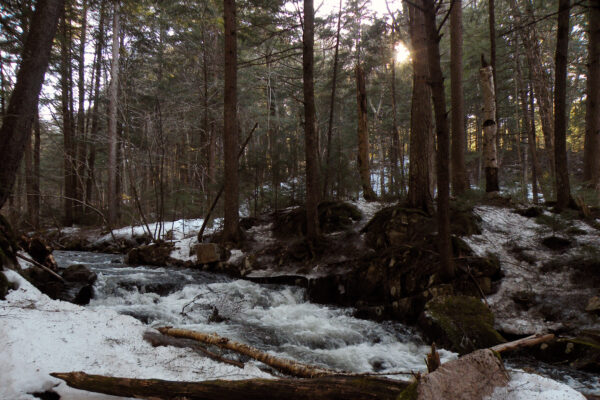
My interest in this project has been as the board chairman of Adirondack Wilderness Advocates. Cathead Mountain is surrounded by lands designated as part of the Silver Lake Wilderness, a region I have been exploring extensively for the last twenty years. In 2018 I spent Columbus Day weekend avoiding the crowds by exploring the Whitehouse area on the West Branch Sacandaga; this year I spent the same holiday weekend bushwhacking past such gems as Jack Green Creek and Helldevil Dam. As wilderness areas go, Silver Lake’s charms are reclusive, like the hermits who once made their homes in its backcountry. If you want to see the best the area has to offer, you must actively seek out those features – just as I have been doing since my first bushwhack to the Loomis Ponds in March 1999.
Although my interest is wilderness, my desire to see the backcountry protected does not preclude me from appreciating the need for reasonable accommodations along the periphery – especially when the proposal is being made by a rural county that is seeking to provide better services to its residents. If a new communication tower is required to ensure an entire hamlet is covered by the proposed new network, then it makes perfect sense to place that tower on Cathead, which is already compromised for similar purposes. If that tower requires a service road and a powerline – and it’s hard to imagine how it wouldn’t – then hopefully those features will be constructed in an unobtrusive manner.
And if that service road has the secondary effect of giving the landowner motorized access to their inholding, then so be it.
The flipside is that this development would result in a minor intrusion in the Silver Lake Wilderness, resulting in new road construction on the mountain and almost eliminating the possibility that the summit might someday be added to the protected area. But these are impacts that could be easily mitigated with an expansion of the wilderness boundary to the south, and possibly the closure of a portion of West River Road.
Admittedly, the road closure may be difficult to achieve, even if Mother Nature tried to do the job herself on Halloween. There has been a rough public road to the remote site known as Whitehouse on the West Branch Sacandaga since 1848, and there are still numerous camps and residences along the middle portion of what is now called West River Road. The final two miles are almost entirely on lands classified as wilderness, but the town of Wells has been resistant to past suggestions that even this portion should be closed. If there was ever a time to broach that topic again, that time is now.
West River Road is of particular interest to me because of the way it extends deep into the Silver Lake Wilderness before dead-ending at the site of Whitehouse. As a cultural site, there is little to see there now other than a pair of aging chimneys and a small cemetery; most of the other structures were apparently bulldozed away when the state acquired Whitehouse in 1962 and converted it into a free camping area. Today, the steel suspension bridge that carries the Northville-Placid Trail across the West Branch is one of its most well-known features.
Closing the final portion of this road to motor vehicles would have the effect of making the wilderness interior more remote than it already is. But there is another way that the Silver Lake Wilderness could be enlarged: expanding the boundary to include a large section of existing state land to the immediate south.
Currently, the southern edge of the Silver Lake Wilderness follows an “imaginary” line through the woods – by which I mean that it is pegged to a jurisdictional boundary, and not a physical or ecological feature. You can wander these woods and have no clue where that line is drawn, as it all appears to be one continuous wild expanse when you see it firsthand. Nevertheless, the land on the north side of the county line is the Silver Lake Wilderness, where mechanical access has been curtailed; the land to the south is classified as the Shaker Mountain Wild Forest, where snowmobiles are permitted.
A healthy chunk of the Shaker Mountain area still exists in a de facto wilderness state. Here you will find a cluster of ponds – the highest in Fulton County – that are difficult to reach and just as wild as anyone could hope for. In the past, acid rain was unkind to these small lakes, but other than one marked hiking trail to County Line Lake the entire plateau is undeveloped and practically untouched.

A Trail of Positive Outcomes
What does all this have to do with microwave emitters on Cathead Mountain? In my view, the status of West River Road and the County Line Lakes should play into the larger discussion on the status of the mountain. If what we’re proposing in the name of the public good is building a service road up a roadless mountain – and sacrificing a small portion of the Silver Lake Wilderness to make this possible – then there is more that we could do to ensure a net victory for wilderness preservation.
Yes, if the land exchange goes forward, there will be some new acreage added to the Forest Preserve to offset the little bit that has been taken, but these acres will probably within a stone’s throw of the tower. Closing the westernmost end of West River Road, and reclassifying the County Line Lakes region as wilderness, would be significant victories – if one or both of these outcomes can be achieved.
The point is, there are interest-based items on both sides that should be pursued – and in so doing, both sides might discover common ground. My discussions with Bill Farber, the chair of Hamilton County’s Board of Supervisors, have been very encouraging. I presented my ideas for how his need for access to the mountain could be married with a conservation plan for the surrounding wilderness, and thus we were able to conduct a congenial conversation and identify a potential path forward.
The saying goes that in the Adirondacks, people would rather fight than win. Unfortunately, experience bears this out far too often. But to me, advocacy means taking positive steps to achieve your goals, and not necessarily obstructing others in achieving theirs. For instance, if people understand that my interest is in maintaining the wild qualities of the Forest Preserve, and working toward a net enhancement of those qualities whenever possible, it is easier to understand the outcomes I want to achieve – and boy, do I want to achieve outcomes. It is not my intent to just be an armchair critic of the processes that have frustrated (and sometimes disgusted) me for so long, but someone who takes specific actions to make the wild places I love even wilder for the people who will come after me.
As the chair of AWA’s board of directors, I hope our new organization will grow into an effective one, leaving a trail of positive outcomes wherever we go. This will never happen by taking the adversarial approach, but by acting as an interest-based organization that finds ways to work with others to achieve mutually-desirable outcomes.
A tower on Cathead would not have prevented the flooding in Wells and Hope, but it’s hard to imagine a situation in which its services would have been more in demand. Yes, the Adirondack Park is a wild place, and those pockets of deep wilderness are what fire my imagination the most. But I’m well aware that this is an inhabited park, and that the people who live here deserve the same public services that I enjoy in my home in Oneida County, just fourteen miles outside the Blue Line.
So for those of us who consider ourselves leaders – whether of the political kind, or the kind who stands for ideas – let’s get to work. I have no problems with the idea of a county-run communications tower on Cathead, and I see this as a real opportunity to achieve measurable benefits for the adjacent Silver Lake Wilderness.


