
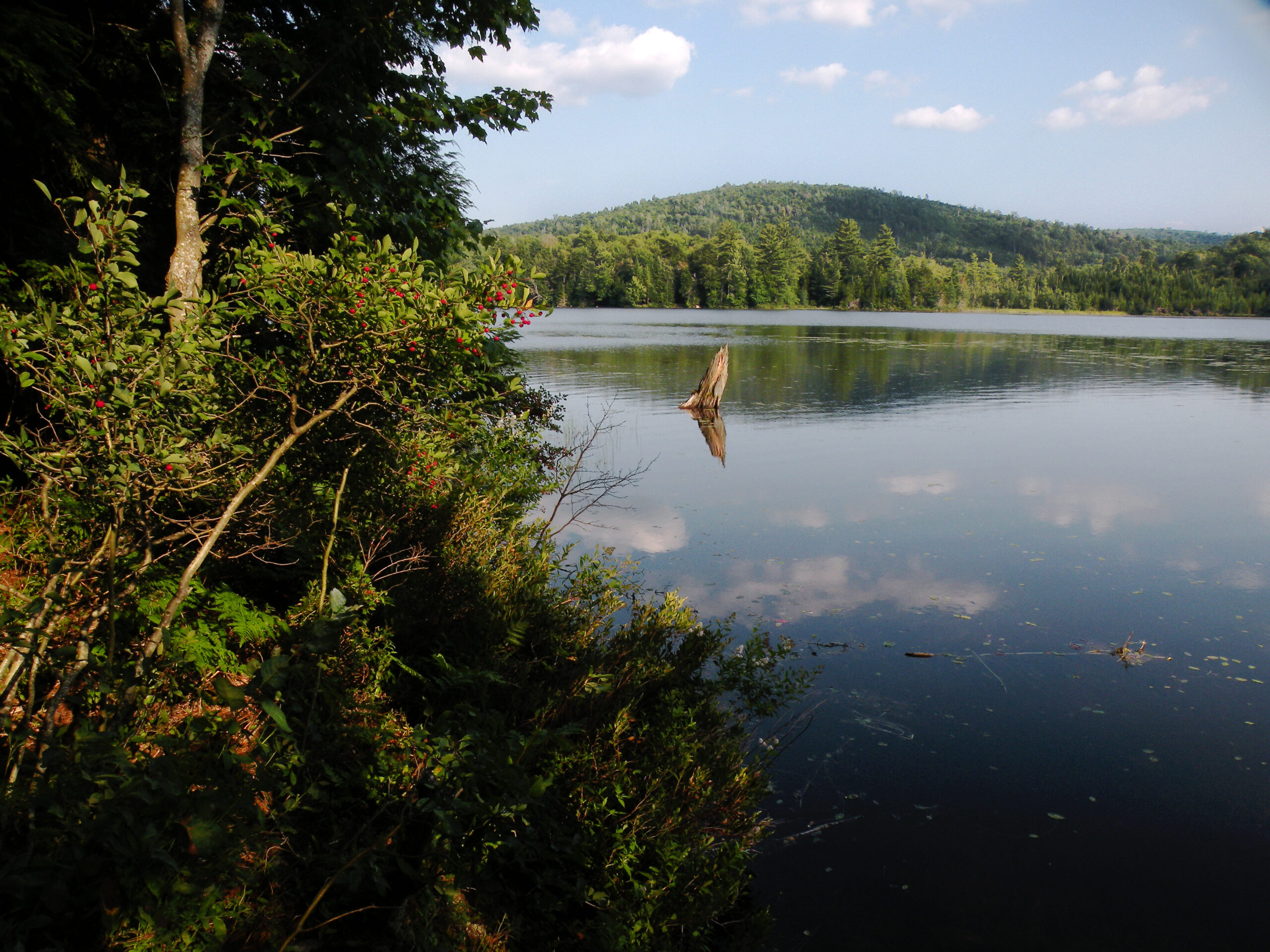
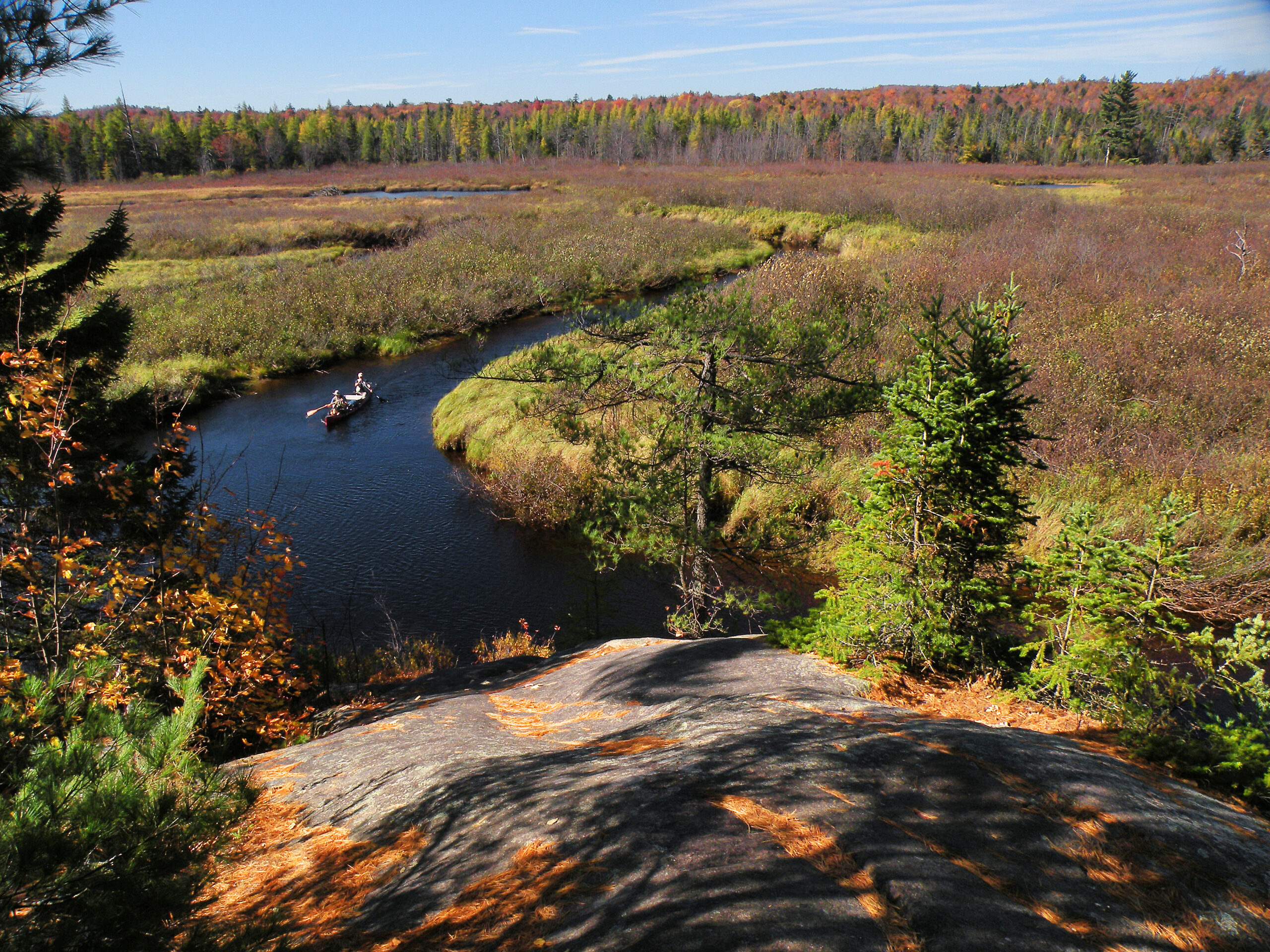
Dead Creek Flow

The Five Ponds Wilderness stands apart from the other protected areas of its size – both literally and figuratively. It lies in a region of the Adirondack Park with no mountains of any notable elevation, and well away from many of the most heavily-traveled highways. Hemmed in by three large man-made lakes, the landscape is dotted with more ponds, lakes, and wetlands than anyone might care to count. There are rivers of water, as well as ancient rivers of sand and gravel. Wherever people can think to put a trail, a beaver can find a choice spot to build a dam.
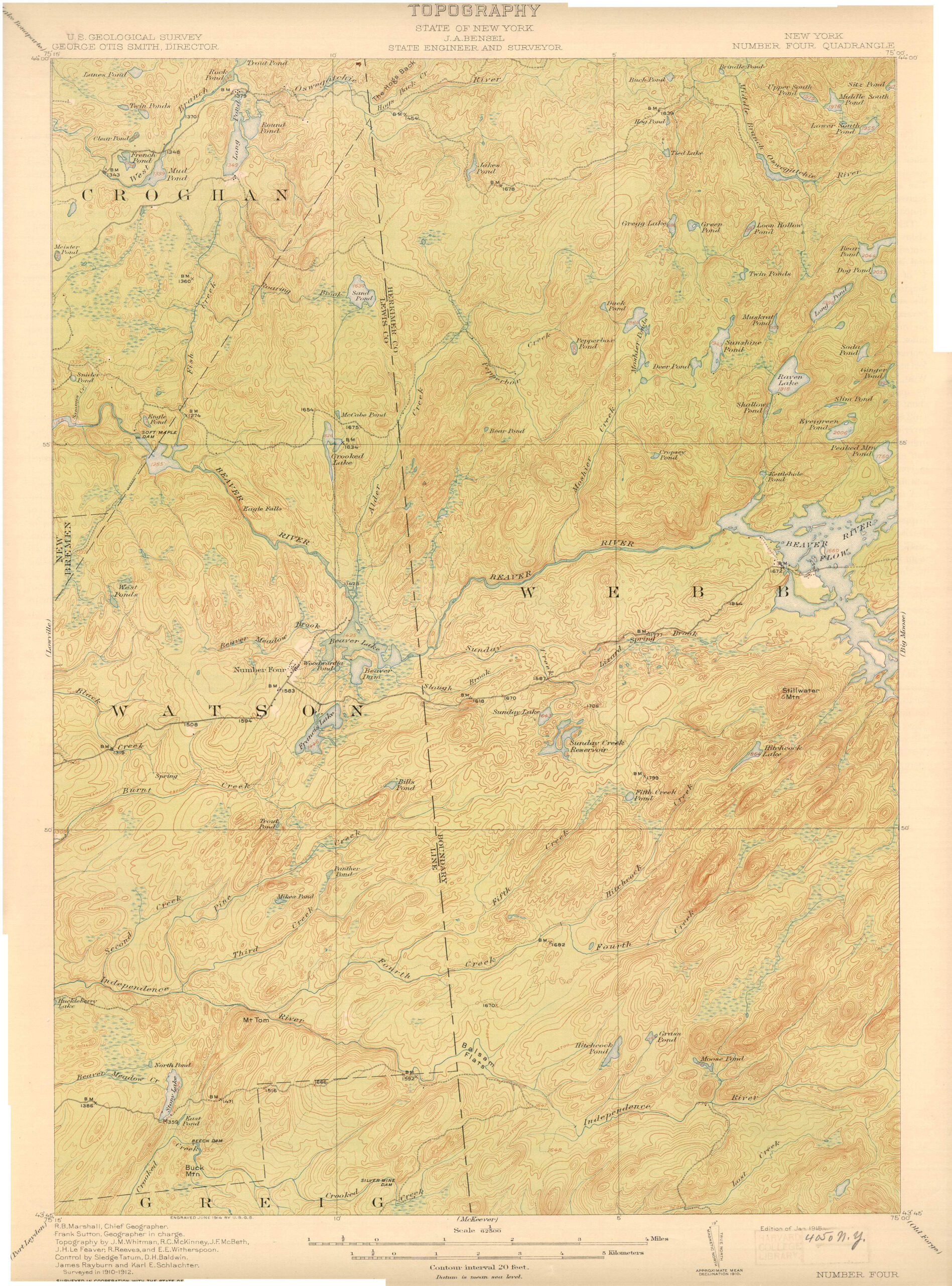
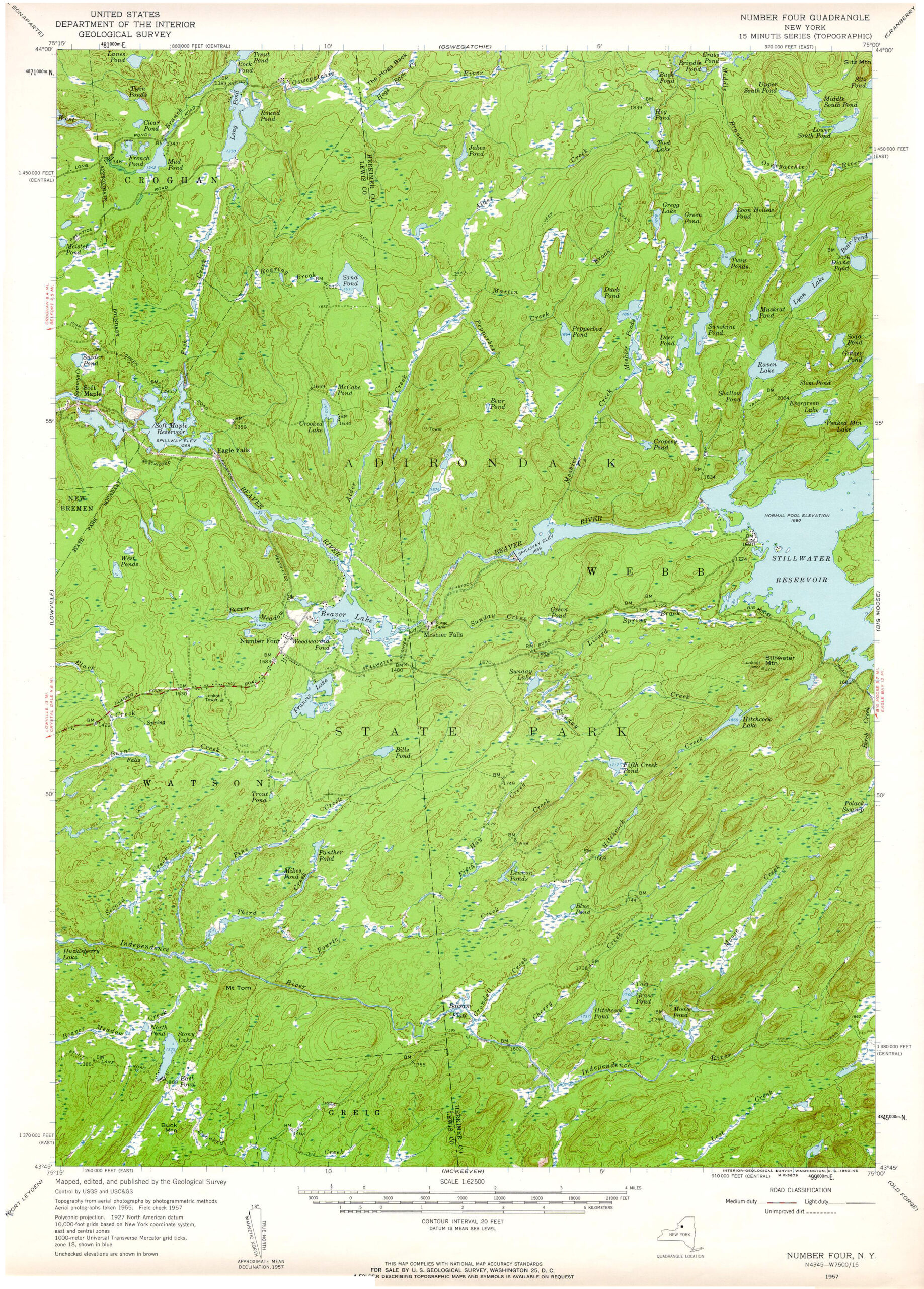
Today this is the third largest designated wilderness in the park, and one of its most celebrated. But at the time the area was first protected as wilderness in 1972 it consisted of only 62,780 acres – about half its current size. The Five Ponds Wilderness as we know it today is the result of a successful latter-day land acquisition program by the State of New York.
At the time the Forest Preserve was afforded constitutional protection in 1894, only a few tax sale parcels were in the public domain in this region. Then came the acquisition of thousands of acres of virgin forest north of Stillwater in 1897 from William Seward Webb, followed by the ravaged timberlands south of Wanakena in 1919, which were formerly owned by the Rich Lumber Company. These tracts formed the nucleus of what would become the modern wilderness area.
More than half a century would pass before the state truly focused its efforts on this region, completing one blockbuster land purchase after another: Nehasane in 1978, the Fisher Forestry Tract in 1982, Lows Lake in 1985, Watson’s East Triangle in 1986, Otterbrook in 1989, and Bog Lake in 2006. Within a the span of a single generation, a region that had spent much of the last century off-limits to the public had been pieced parcel by parcel into a wilderness of spectacular proportions.
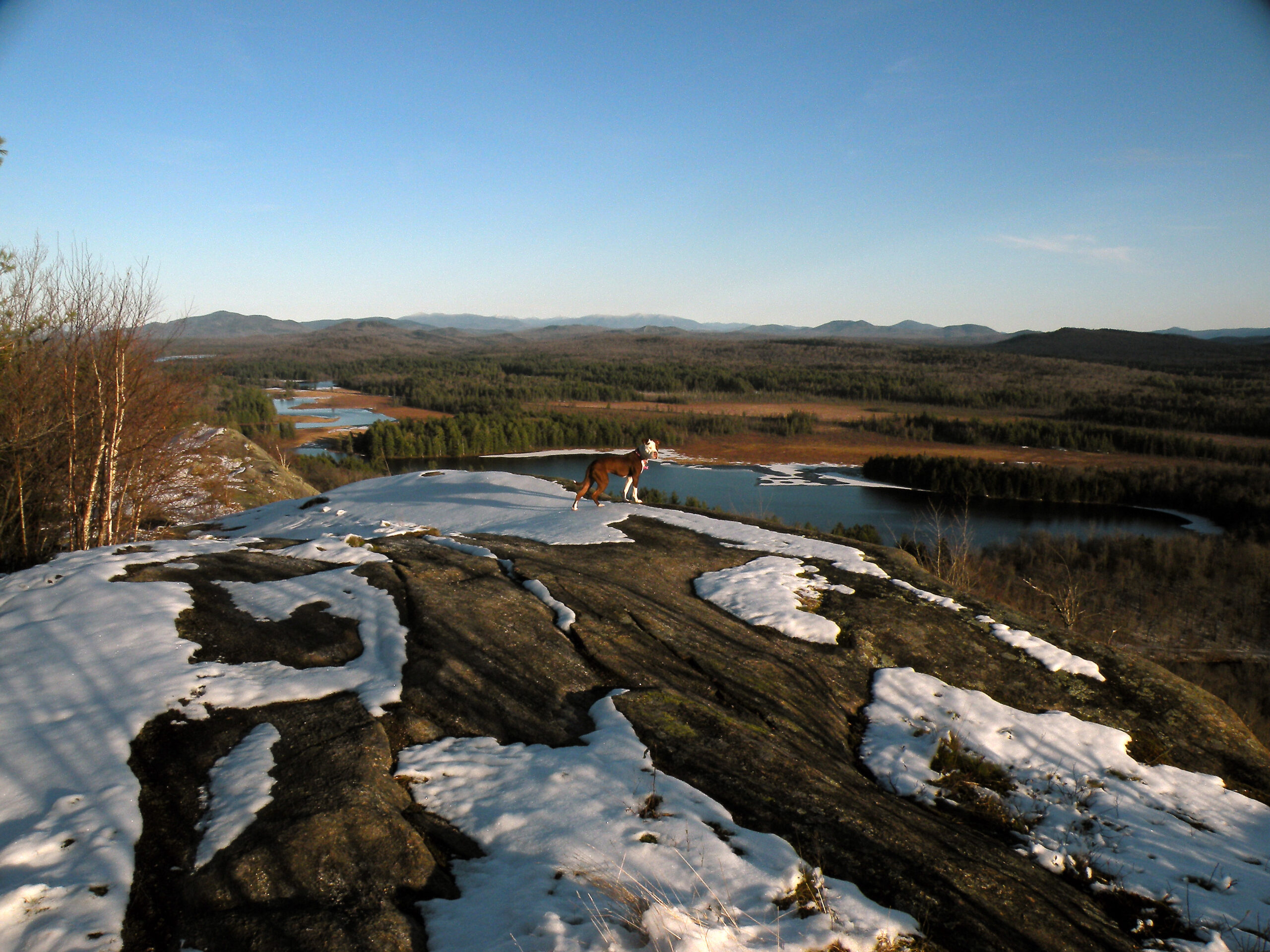
This is a rolling, glacial landscape, with almost as many miles of eskers as there are rivers. The eponymous Five Ponds are themselves a cluster of Ice Age artifacts, where blocks of ice from a dying glacier left watery depressions on each side of one of the area’s largest eskers. The ice has been gone for a dozen or so millennia, with a forest of tall white pine now taking its place along the shorelines.
Except for the original tax lots, most of the northern half of the wilderness – all of it located in St. Lawrence County – was once industrial timberland. The kingpin acquisition was the Rich Lumber Company tract, which was penetrated in its heyday by two logging railroads and then severely burned – all within the space of a single decade. The rail grades became fire truck trails, and the winding Oswegatchie River became a route for motorboats.
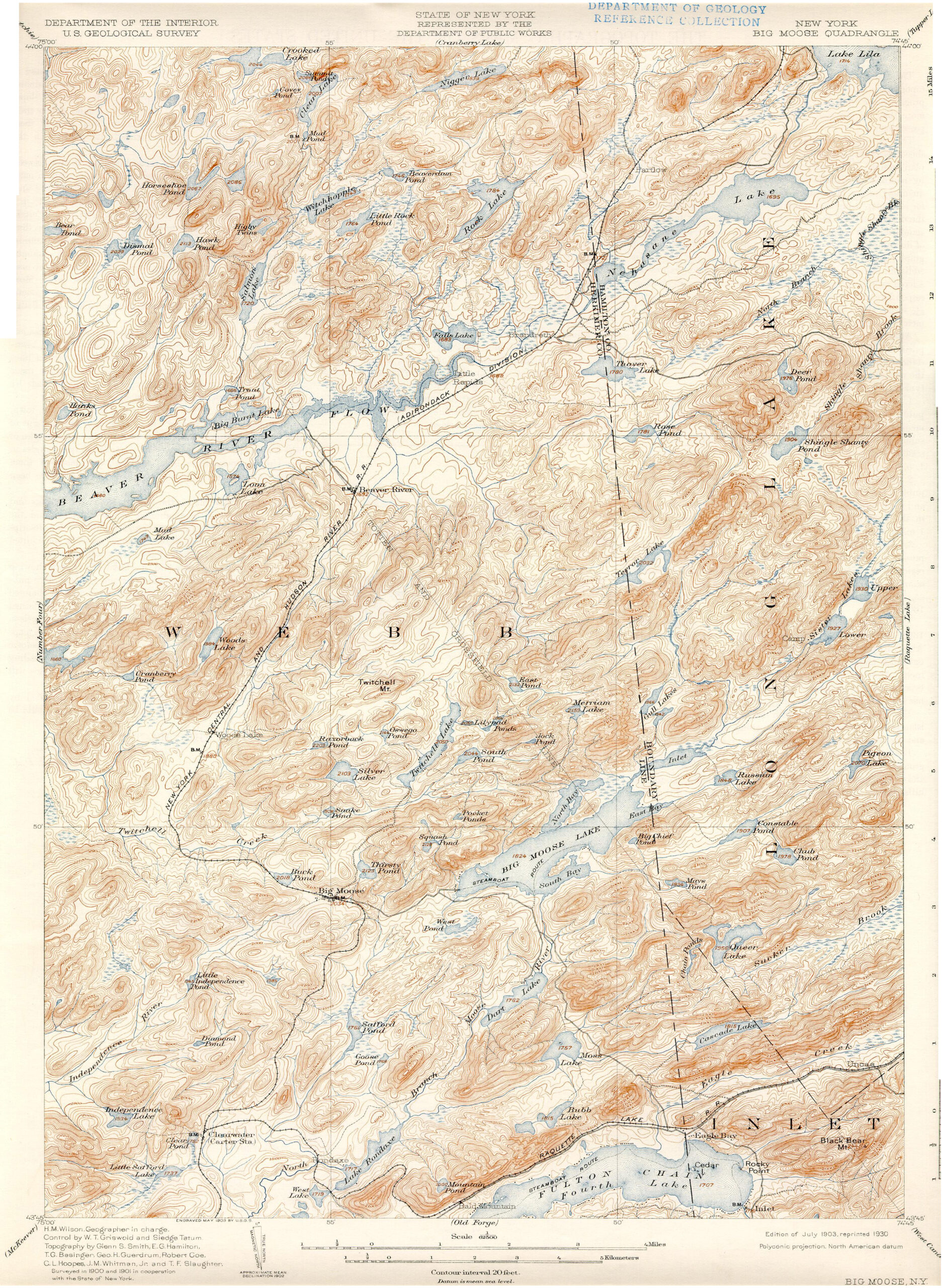
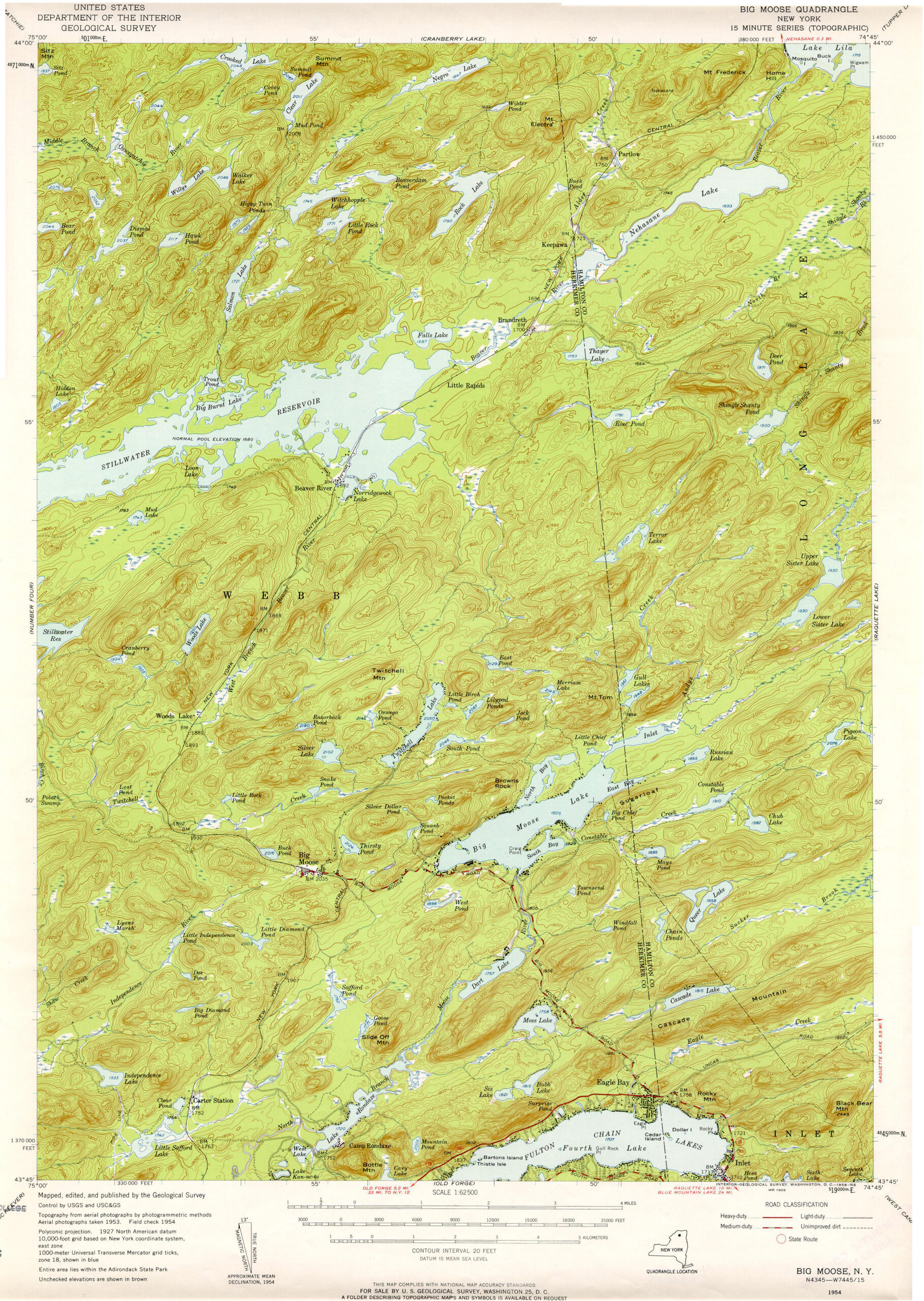
To the south, the adjoining Forest Preserve acreage in Herkimer County was acquired in a mostly virgin condition – never logged or burned, except maybe along the fringes here and there. We have Stillwater Reservoir to blame for this boon: when a state agency flooded the Beaver River, it cut off easy access to some of William Seward Webb’s extensive landholdings. The railroad baron sued for damages and won. As part of the settlement, New York State was required to purchase the marooned acreage – some seventy thousand acres of it, both north and south of the river.
The Webb land to the south is now the Pigeon Lake Wilderness. The acreage to the north of Stillwater was so remote and pristine that it impressed state land planners in the late 1960s: rather than seeing the truck trails and motorboats south of Wanakena as impediments to a wilderness designation, they were moved by the pristine old growth and glacial ponds — a living museum of pre-contact North America. For this reason we now have a Five Ponds Wilderness, with all the former motorized access that once occurred here banned decades ago.
Despite the spectacular growth in size, this is still very much a work-in-progress. No other Adirondack wilderness has as many private inholdings – or as many sanctioned access roads to reach those inholdings. To a degree, a purist might argue that not every acre of this wilderness is worthy of the designation quite yet. But the designations express a clear intent on the part of the state to protect a motorless area of truly impressive proportions. In theory, the growth of the Five Ponds Wilderness is not yet over, especially if any of the inholdings – some of which are notably large and impressive – become available for purchase.
This is a landscape to cherish, to savor, to protect. The snows are deep, the trails are long, the waters are dark with natural tannins. The old roads are filling in with new growth, and the lakes are recovering from the era of acid rain. The extensive damage from a 1995 windstorm is healing. The state has an appetite to acquire whatever land is available in this region. This very well could be the century of the Five Ponds Wilderness.
Please click through the tabs below to learn more about the Five Ponds Wilderness.
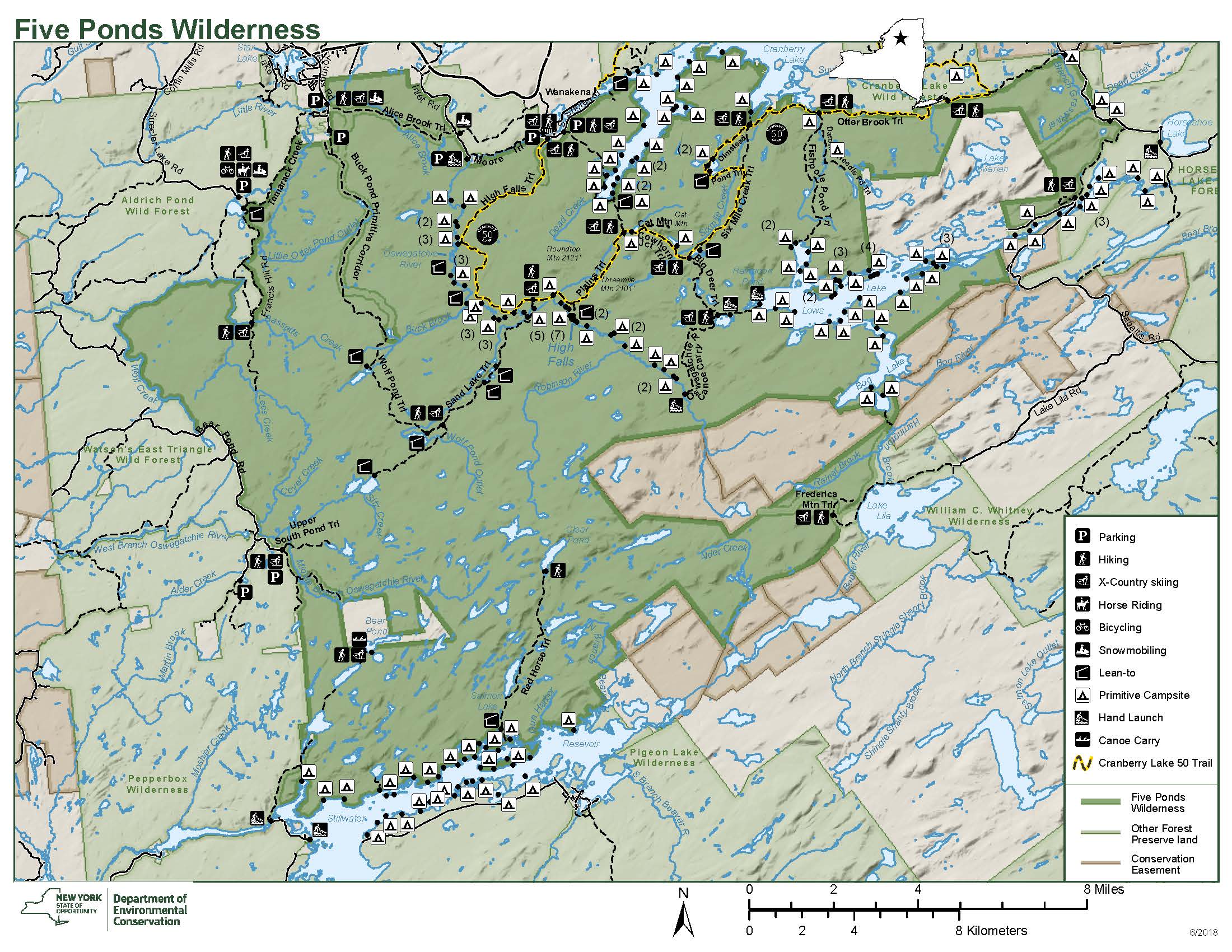
Size: 124,710 acres
First Designated: 1972
Unit Management Plan Status: Completed in 1994
Special Regulations: None; standard Forest Preserve regulations are in effect


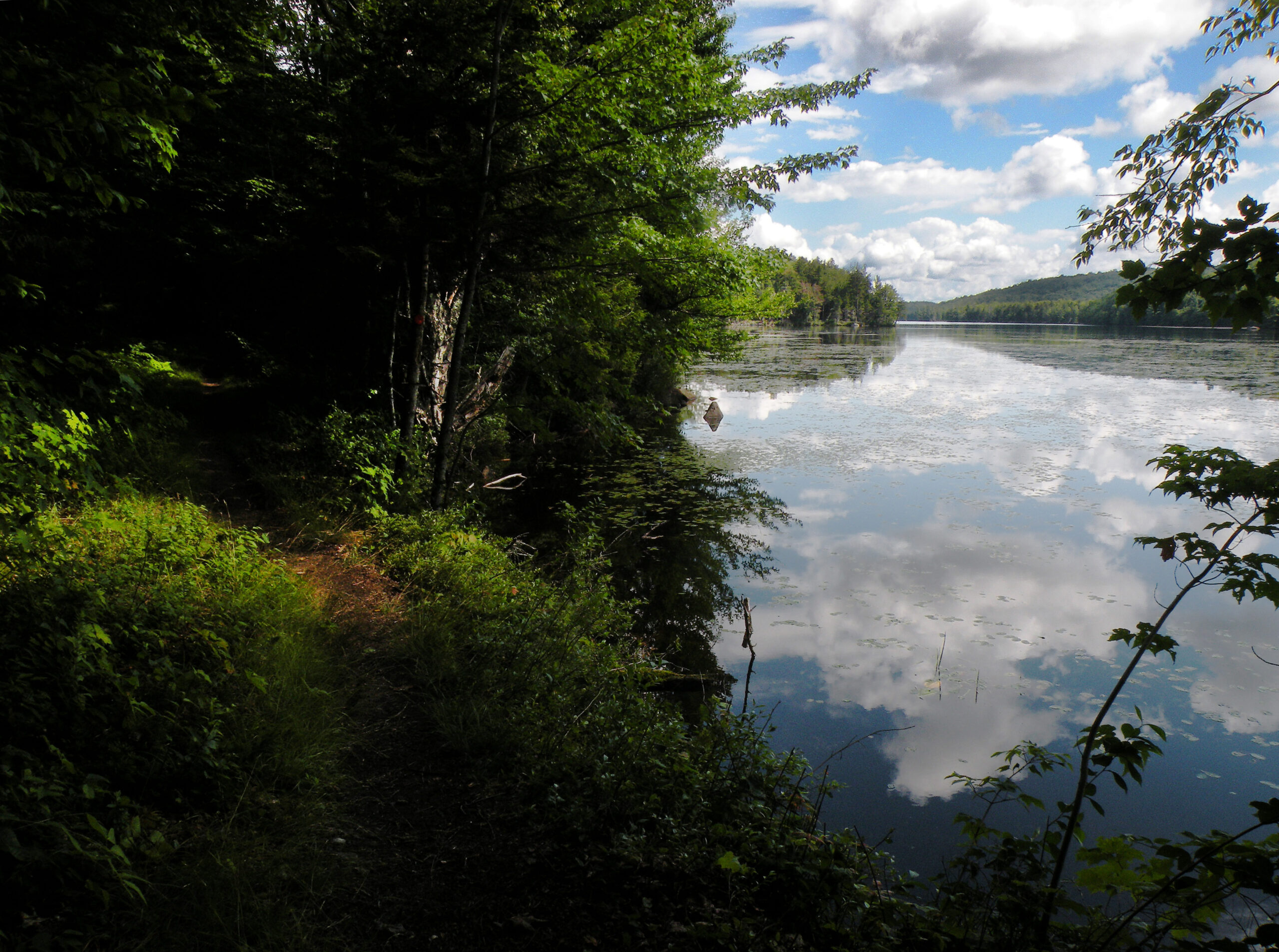
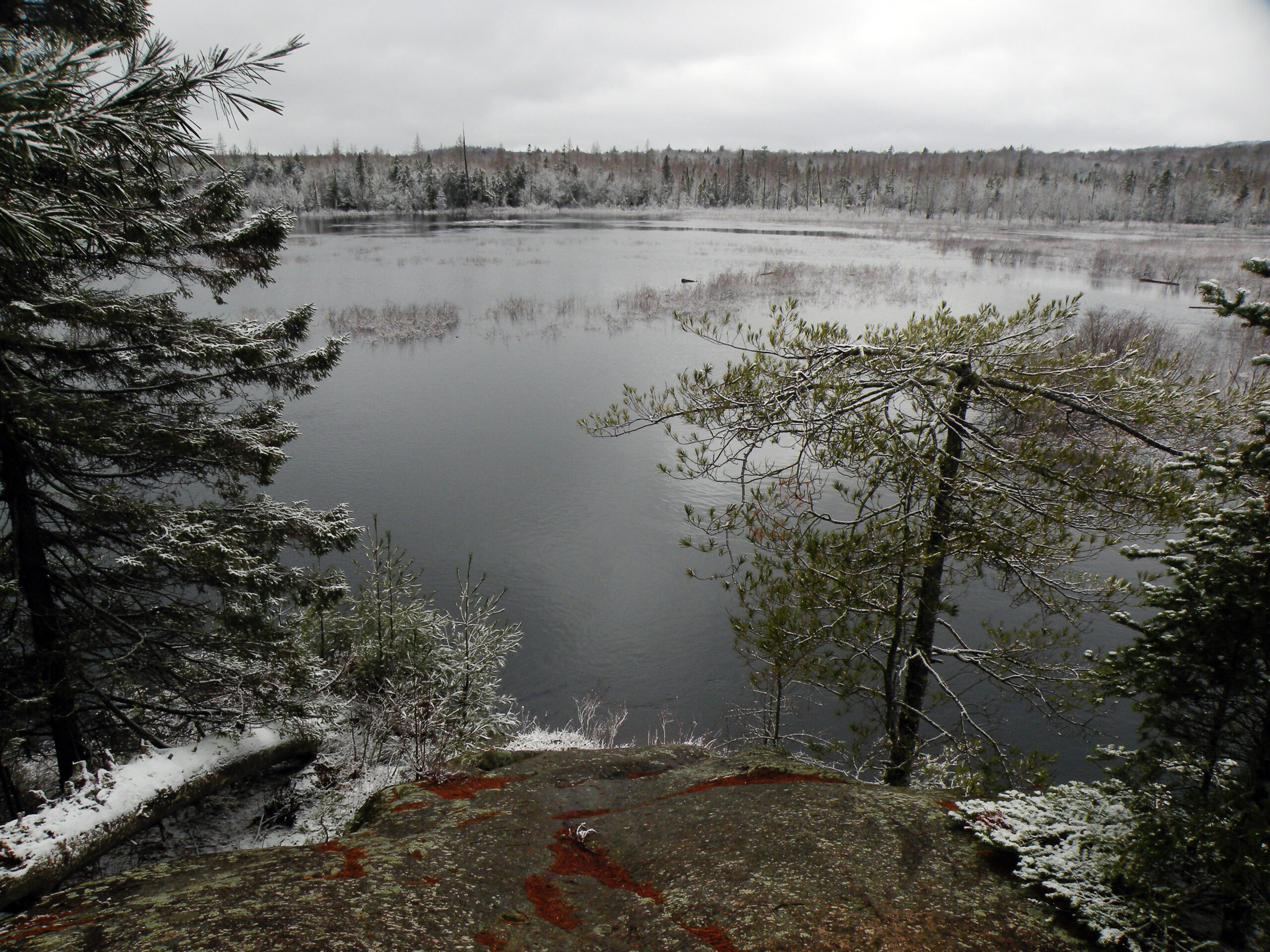
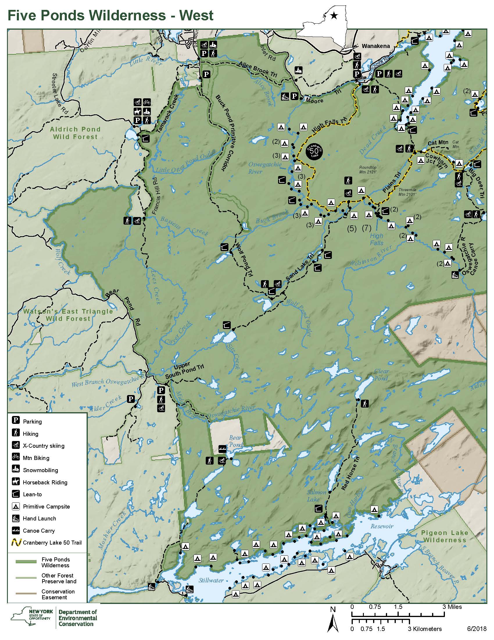
Water defines the Five Ponds Wilderness as much as its lands and forests; nowhere can one travel a full mile without encountering a stream, pond, or beaver flow. But despite the number of ponds – and despite the history of logging, fires, and blowdown – the forests are not to be dismissed either.
The area may be named for the Five Ponds located in the heart of the area, but the area could be just as aptly called the “Oswegatchie Wilderness.” Two of that river’s celebrated branches flow for many miles through the wilderness, including the wild and rugged Middle Branch and the ever-navigable “Main” or East Branch, which features more miles of paddle-friendly water than most people ever get to see.
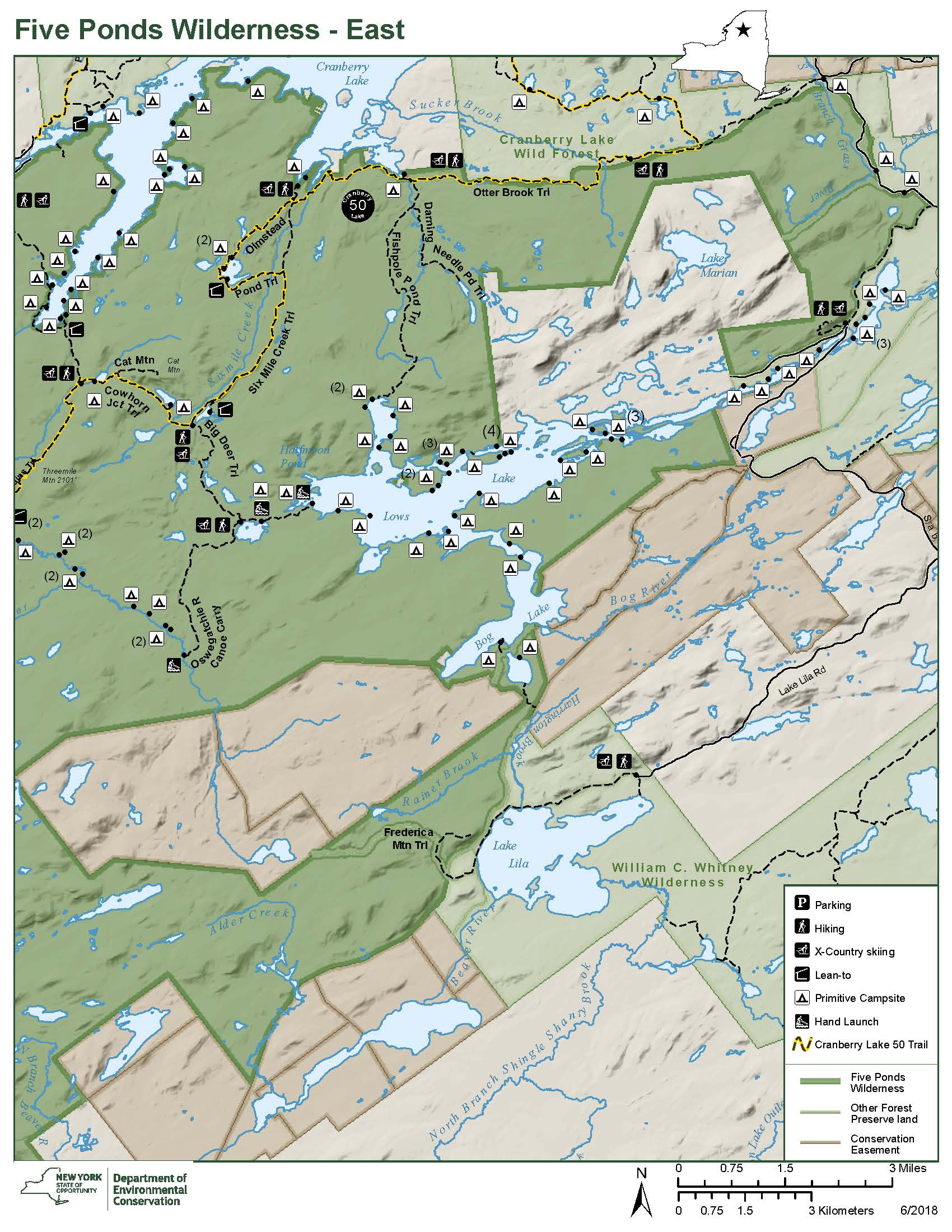
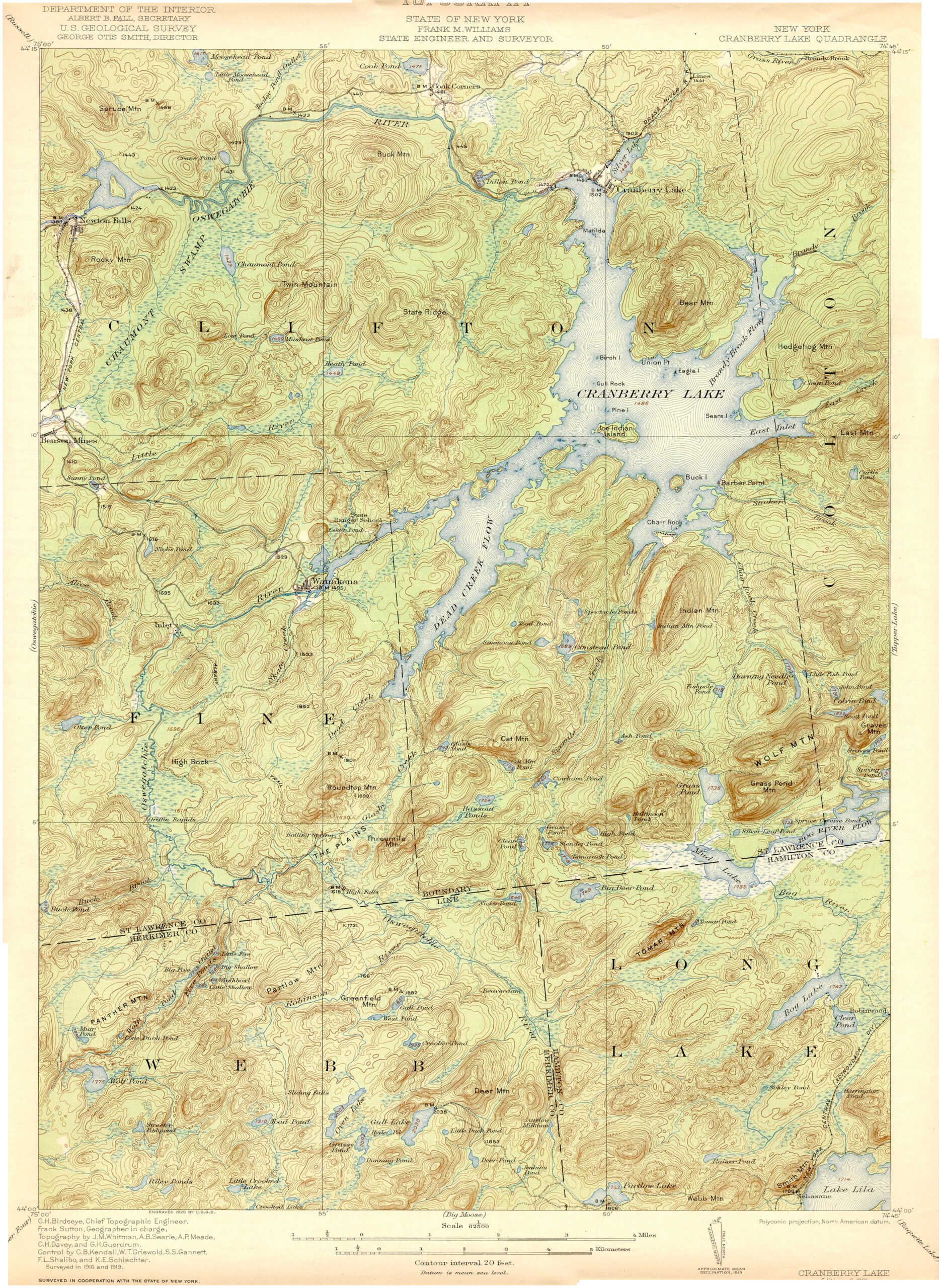
The presence of a large series of marshes and alderbeds on the main stem of the Oswegatchie should be regarded as nothing short of remarkable. This type of terrain was once deemed so worthless that the state planned to systematically convert most such features into reservoirs. This was the fate for three similar flows on the wilderness boundary: Cranberry Lake, Lows Lake, and Stillwater Reservoir.
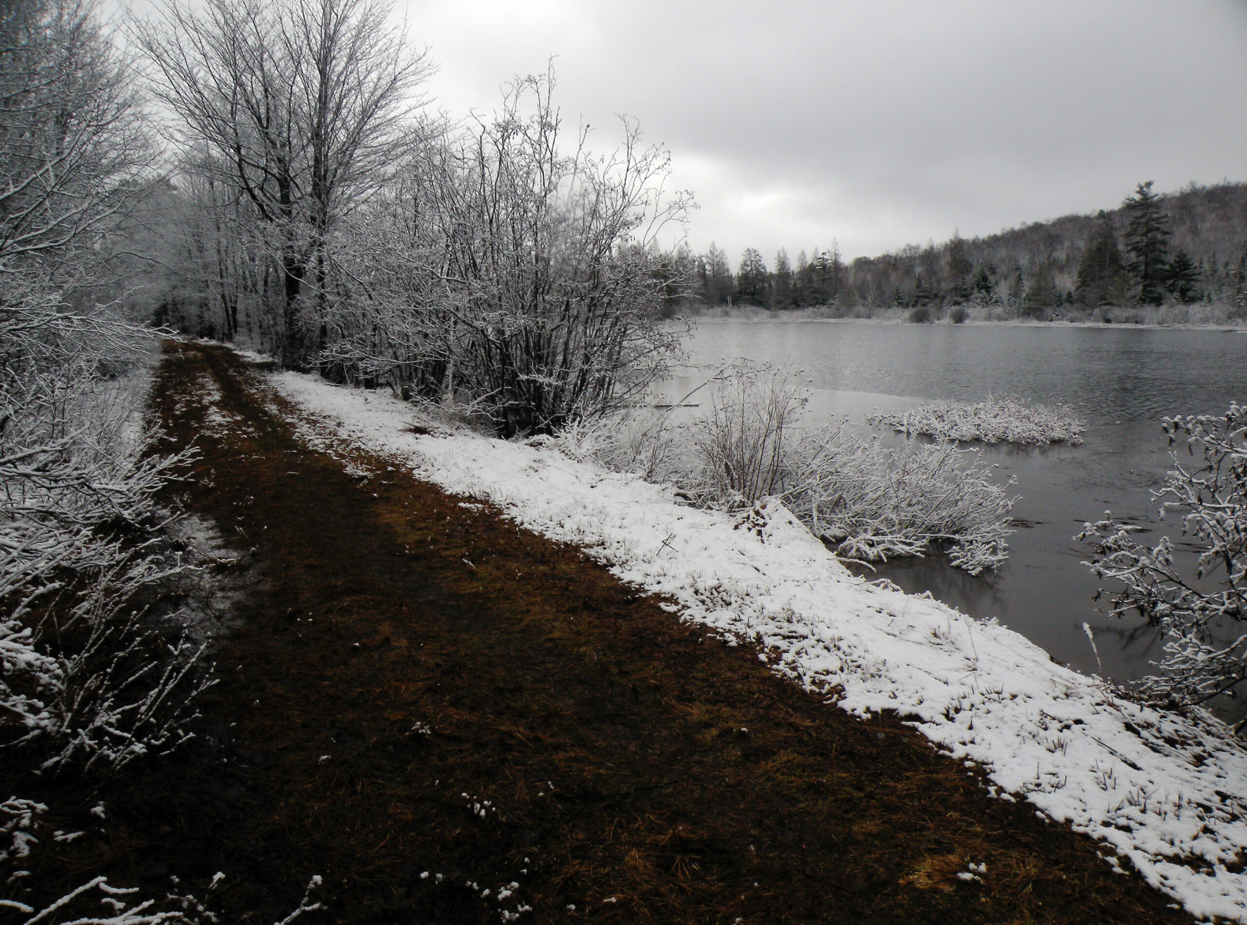
But the Oswegatchie above Wanakena survived undammed (not counting the tireless efforts of the beavers). Few other rivers of such quality extend into the heart of a wild area, far from the reach of highways. Nevertheless, even this untrammeled waterway floods into a vast lake early each spring, when the melting snow contributes a surplus of water faster than it can drain away. Locally this fleeting phenomenon is known as “Lake Oswegatchie.”
The lakes and ponds are so numerous that it is difficult to keep track of all of them. Those in the north tend to be small and scattered, with open shorelines rimmed by beaver-gnawed hardwoods and hardy white pines. The southern half of the wilderness is a stunning galaxy of ponded water, each with a tendency toward brushy shorelines and – where truly fortunate – stands of towering pine.
The era of acid rain was especially cruel to this region, rendering many of the pristine ponds too acidic to support fisheries – until the current century, when interstate agreements curbed the offending emissions of sulphur and other airborne chemicals. Thus an area that should be a fisherman’s paradise has enjoyed several decades of minimal human use, since fewer people seem to be attracted to such places when all they offer is solitude and scenery.
In addition to the lakes and rivers, the forests are equally notable. The introduction above explains how the land was acquired, with logged-over forests mostly to the north and a core of virgin forest to the south. The visual contrasts between the two regions can be stunning, with sun-loving stands of black cherry filling some of the areas that had once been burned, and pockets of stunning yellow birch and white pine in the old-growth stands. A severe windstorm in July 1995 blurred the lines a bit, leveling thousands of acres throughout the wilderness and ravaging some of the old growth. Nevertheless, the recovery has been entirely left to nature thanks to the wilderness designation, and fears of widespread forest fires never came to pass.
Beginning with a few scattered parcels acquired by the state at tax sales, and combined with the northern half of the 1897 Webb acquisition, what is now the Five Ponds Wilderness was pieced together from a long string of Forest Preserve purchases and reclassifications, the most recent being in 2009. Many of these additions involved lands that had been logged and managed previously by corporations and private parks, and as such they contain a variety of historic features. Some of the more notable sites are described here.
Logging came to this part of the Adirondacks relatively late – in the early years of the twentieth century rather than the nineteenth. Therefore it was conducted with a greater emphasis on modern technology than elsewhere, especially in the way harvested logs were removed from the woods. Rather than floating the timber down a river to an awaiting sawmill, which was the norm on the Hudson and Ausable rivers, railroads were the transportation method of choice here.
One of the early adopters of this practice was the Rich Lumber Company, which acquired 16,000 acres southwest of Cranberry Lake in 1901. The company’s presence here was brief, lasting just a bit over a decade, but its impacts were profound, shaping the regional map ever after.
The hamlet of Wanakena is itself one of the Rich’s legacies. What is now a quiet residential community began as the company town; a large sawmill stood on the south edge of the settlement, and two railroad grades branched out into the backcountry. The eastern grade went no farther than Dead Creek Flow, but the western route followed the Oswegatchie almost all the way to High Falls.
When the company pulled out of the Adirondacks in 1912, its mill town persisted and chartered a new role for itself as the host of the New York State Ranger School. The state acquired all of the company’s lands south of Wanakena in 1919, including the former millpond and both railroad grades, although by this time the forest had been severely burned.
The northwestern corner of the Five Ponds Wilderness has a similar provenance. The Newton Falls Paper Company operated on the Middle Branch of the Oswegatchie, including much of what is now the Aldrich Pond Wild Forest, from about 1915 to 1922. It operated a rail line to a “jackworks” on the river, where logs were hauled out of the water and loaded onto awaiting cars. The foundations of an old wooden dam can still be found at this site.
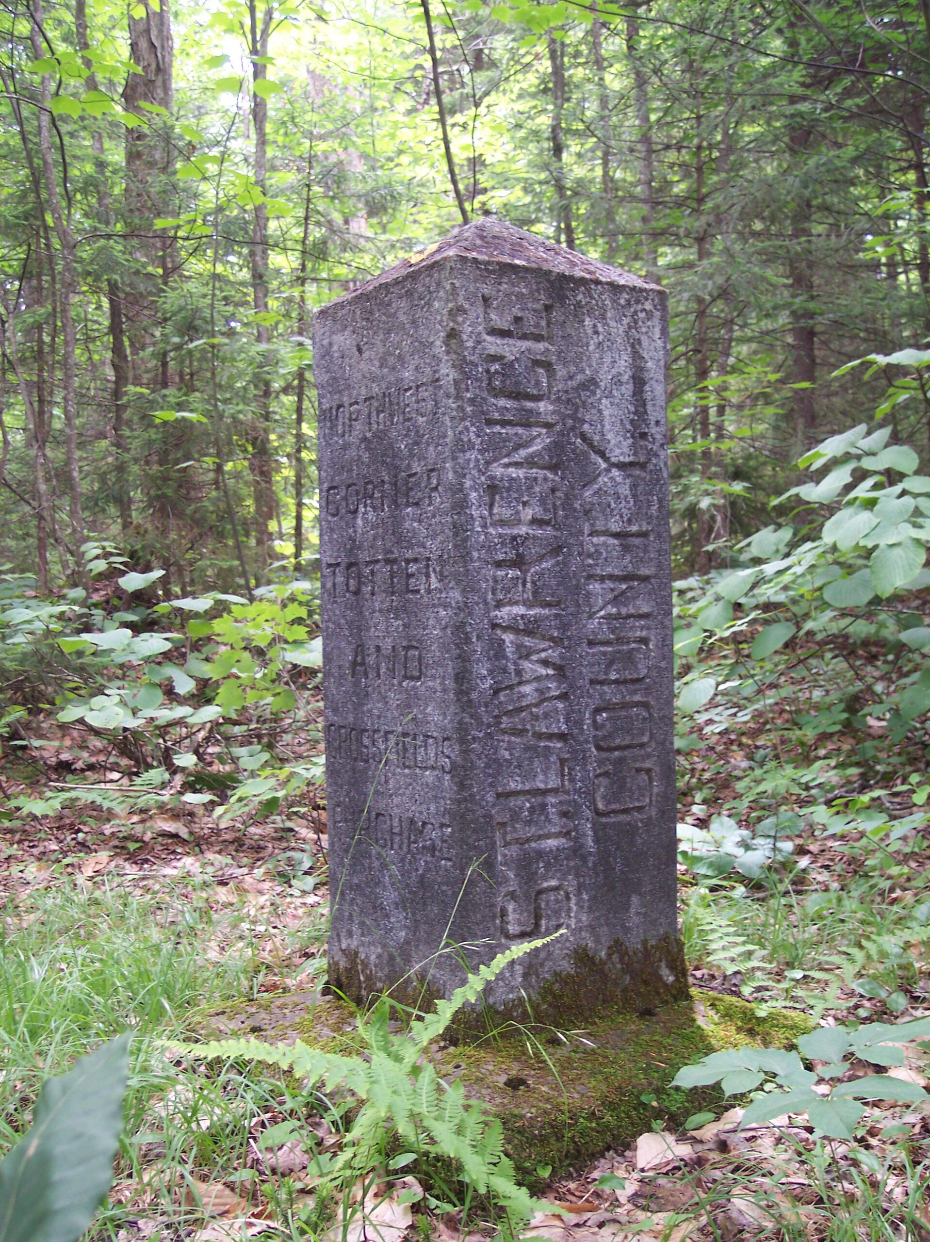
Verplanck Colvin was a young but ambitious surveyor in the employ of the state. In 1878 he and his crew traced a survey line that originally had been chartered over a century earlier by Archibald Campbell, delineating the northern boundary of the great Totten and Crossfield Purchase. This was one of the earliest land grants in the Adirondack region, dating to the old colonial government, but it drove the pattern of land ownership all the way into the modern era.
Colvin was interested in fixing the location of Totten and Crossfield’s northwestern corner, and by following Campbell’s notes he arrived at a location deep in the woods near the Middle Oswegatchie. The original Colvin marker was replaced in 1903 by a state crew, and this is the marker that can still be found at the “Great Corner.” Located within the Five Ponds Wilderness, the monument also marks the point where the shared boundary between Herkimer and St. Lawrence counties bends to the northwest.
The history of Fisher Forestry is perhaps more germane to the neighboring Pepperbox Wilderness, but the last major piece of that company’s lands to be added to the Forest Preserve now anchors the southwestern corner of the Five Ponds. This occurred in 1982, but in an unusual move another company, Creative Forest Resources, retained a timber reservation through 1990 – thus the tract was legally logged while officially part of the Forest Preserve. The result was an extensive road network and a young, scrappy forest. Still, the acquisition filled a major gap between the Five Ponds and Pepperbox areas and added a dozen small lakes to the Forest Preserve. A tiny inholding at Raven Lake is all that remains of what was once a significant family enterprise along the Beaver River.
Abbott Augustus Low acquired 40,000 acres in the Bog River watershed and established a forest empire. Through the 1890s and 1900s, Low built his own railroad spur and dammed the river at two places near Horseshoe Lake. In addition to forest products, his various enterprises included spring water and maple syrup.
Evidence of Low’s operations can be found throughout his former property, not the least of which is Lows Lake itself. In 1985 the state acquired 9,248 acres here, including all of the water surface and much of the shoreline. Elaborate foundations mark the short canoe carry between Hitchins Pond and Lows Lake, and although the lake itself is created by a huge dam it has been an integral part of the Five Ponds Wilderness since 2009.
The wilderness boundary extends all the way to the scenic overlook above Hitchins Pond. An adjoining area, descriptively named the Eastern Five Ponds Access Primitive Area, includes features such as the two concrete dams, a portion of the Adirondack Railroad, and certain state-owned islands that remain subject to non-wilderness private uses. However, some of the remaining pieces of the Low estate remain in private ownership, including a Boy Scout camp and a large private park. Together these form the largest inholding within the Five Ponds Wilderness.
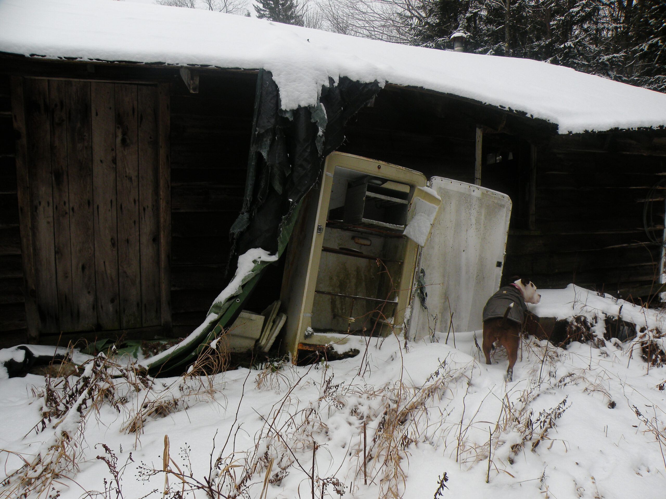
In 1989 the state acquired a 7500-acre strip of land between Cranberry and Horseshoe lakes. Named for the company who made the sale, it had once been part of the Emporium Forest Company’s vast holdings. The tract was subject to a recreational lease through 2005, and one structure still remains. Likely a bunkhouse built in the 1910s by a lumber contractor named Proulx, its final official use was as a remote hunting camp. The structure’s exterior resembles a Proulx bunkhouse seen in archived photographs from the Emporium days, but the interior was apparently modified at a later date. The cabin has no official status and was in severe disrepair when last inspected (December 2020). Its existence contradicts the state’s own policies regarding buildings within designated wilderness areas, and AWA has been advocating for its removal.
The Five Ponds Wilderness is a wild, well-preserved landscape, and it is also regarded as a regional asset in terms of recreation. Wanakena, the former company town that shares the same provenance as much of the wilderness acreage, bills itself as the gateway to this wild landscape – a commendable example of a local community expressing comfort with its wild heritage. There are plenty of interfaces where people can enjoy unique adventures, as well as thousands of acres of trackless forest, making this an area that offers something for a wide variety of people.
This status comes despite several potential handicaps: three large lakes that make some parts of the wilderness accessible only by boat, and large tracts of private land that block easy access of any kind to some areas.
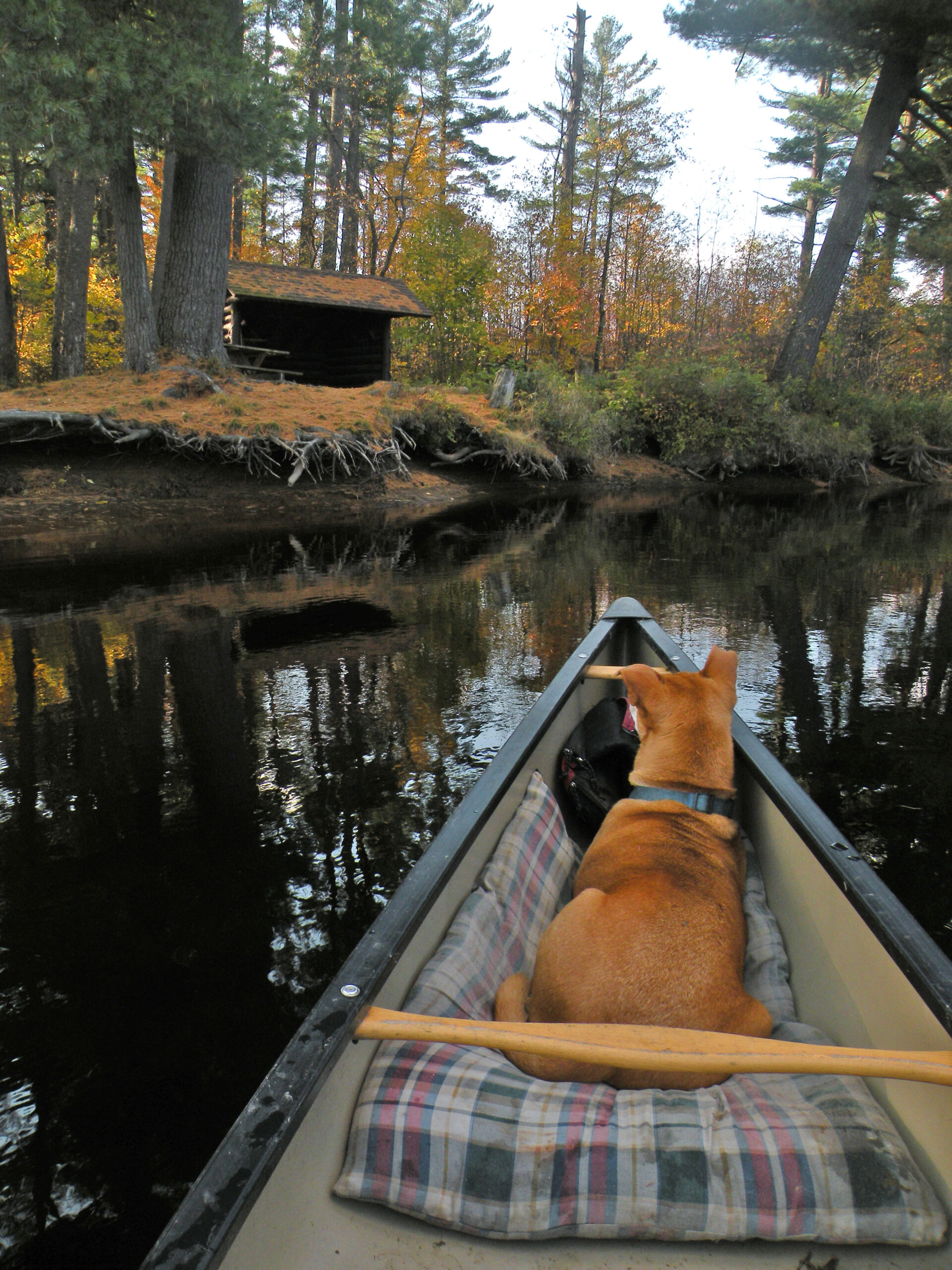
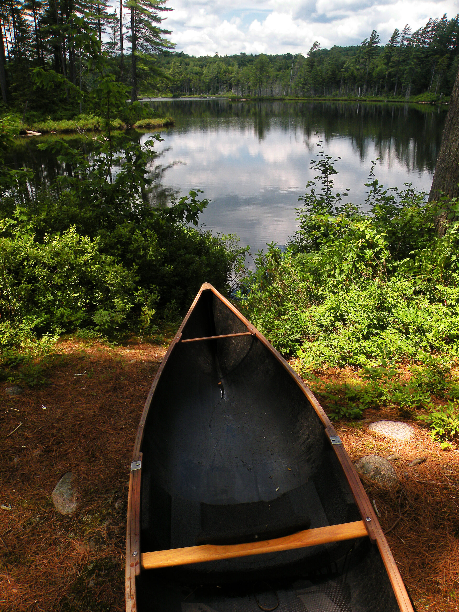
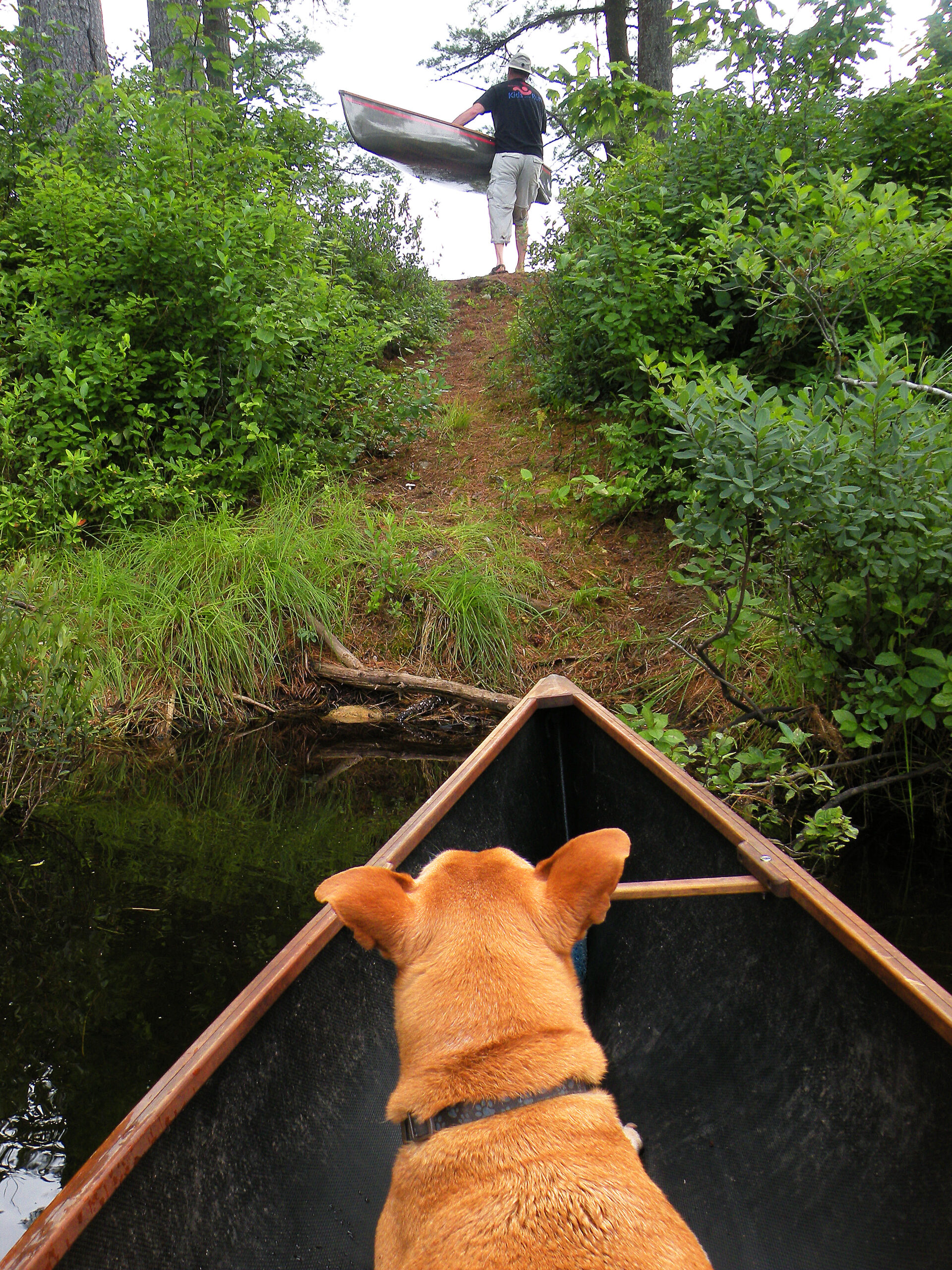
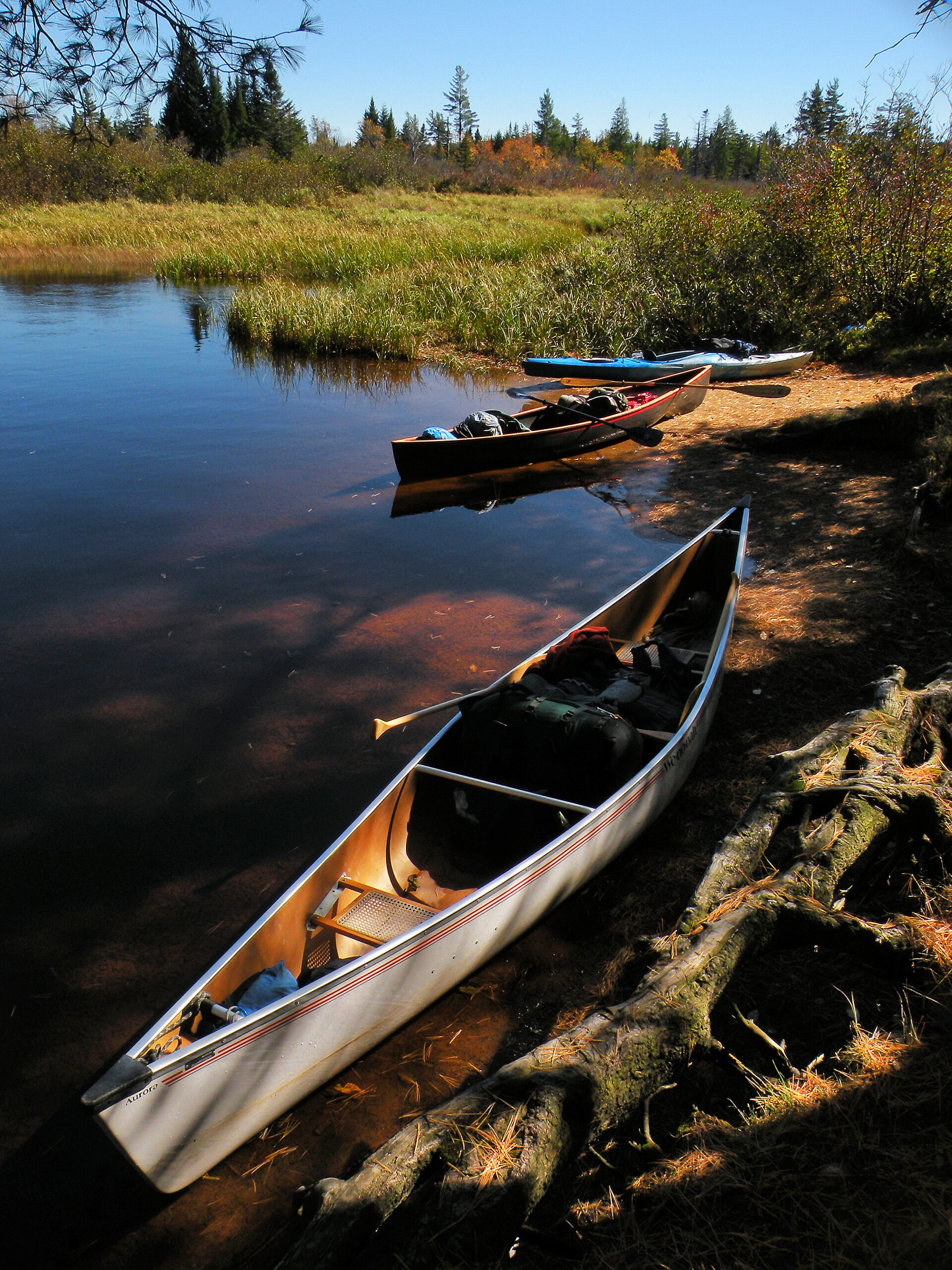
Many people equate the Five Ponds Wilderness with paddling adventures – a reputation that is well-earned thanks to the exceptional waterways that penetrate deep into the backcountry. The twin kings of this category are the Oswegatchie River and Lows Lake – one a natural worm track of slow-moving water, the other an elongated reservoir where a similar river system once existed. Though geographically close to each other, and with similar origins, these two waterways couldn’t be more dissimilar in their modern iterations.
The Oswegatchie is the premier river for flat-water paddling in the Adirondacks, known and loved by generations of paddlers. Its one fluke is that to enjoy it, one must paddle upstream, not down. Roads penetrate much of the watershed from Wanakena to Ogdensburg, but they go no farther upstream than Inlet Landing. This is where paddlers park, at the lowermost point on the river’s stillwaters. Thus every canoe and kayak must work against the current to access the wilderness, by simple geographic necessity.
The river twists so much that paddlers may pass the same landmark three times just to advance a linear half-mile. It remains navigable throughout the summer, and there are dozens of campsites to choose from. But all of the upstream paddling – combined with the frequent beaver dams – results in more river mileage than most people have the time or stamina to see; eventually the river withers into a maze of remote, beaver-dammed tributaries without ever becoming impassible, although most people turn around long before reaching that point.
By contrast, Lows Lake is broad and windy, overwhelming in size rather than twistiness. The lake is created by a large state-owned dam, and parts of the shoreline remain in private ownership, but the lake itself has been an official part of the Five Ponds Wilderness since a court ruling in 2009. Public motorized access is prohibited (although private landowners are exempt) and dozens of campsites are available. For the truly adventurous, the Headwaters Canoe Carry provides a 3-mile link for anyone willing to portage a canoe from Lows to the upper reaches of the Oswegatchie.
Other canoe carries – or hiking trails that can be impressed into similar service – exist elsewhere, including the Lyon Lake and Red Horse chains north of Stillwater, or the trail between Chair Rock Bay on Cranberry and Grass Pond on Lows. Basically, anywhere a trail links one body of water with another, someone has probably toted a canoe – no matter the distance.
Hiking and backpacking opportunities are equally robust, especially in the northern half of the wilderness. Trails range from manageable day-hiking lengths to “epic” backpacking loops. The epicenter of this trail system has historically been Wanakena, but viable entry points can be found near Star, Stillwater, Cranberry, and Horseshoe lakes, as well as the Watson’s East Triangle area to the west. The High Falls Loop strings together the routes of two lumber railroad beds from the early twentieth century, with High Rock, High Falls, and Dead Creek Flow as destinations. This route is overlapped by the Cranberry Lake 50, a backpacking route that encircles its eponymous lake.
The trail that extends from the Oswegatchie River to the Five Ponds, Wolf Pond, and Sand Lake has been revered by wilderness hikers for decades. For many years, the lean-to at Sand Lake was regarded as the remotest point in the Wanakena trail network, accessible from no other direction. The reputation remains, even if it is no longer grounded in truth: Sand Lake is just a few miles from public access points in the Watson’s East Triangle Wild Forest, which opened to the public in the 1980s.
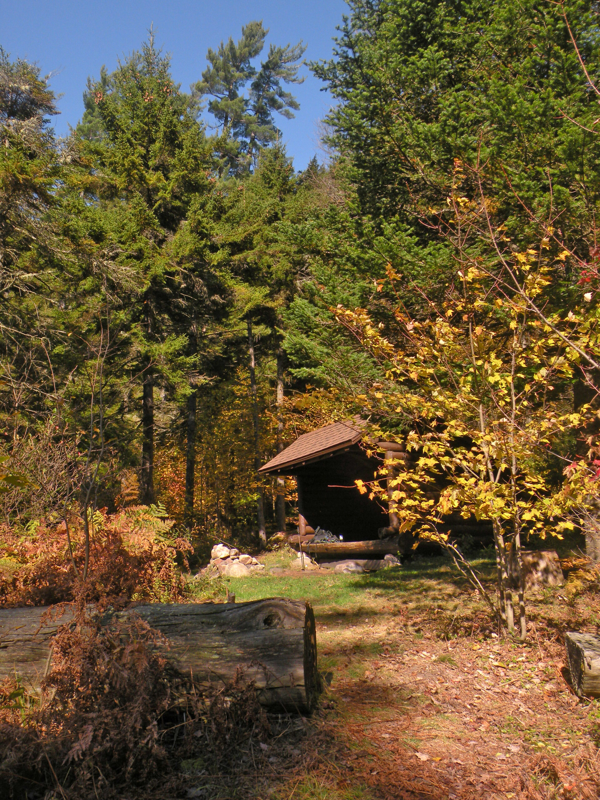
Campsites and lean-tos are abundant, and all have a close association with water. Until the current century, several of the lean-tos were floorless, somewhat like covered sandboxes. There are a dozen shelters, and many times that number in primitive campsites. Despite the popularity of its trails and waterways, there is no crowding at night.
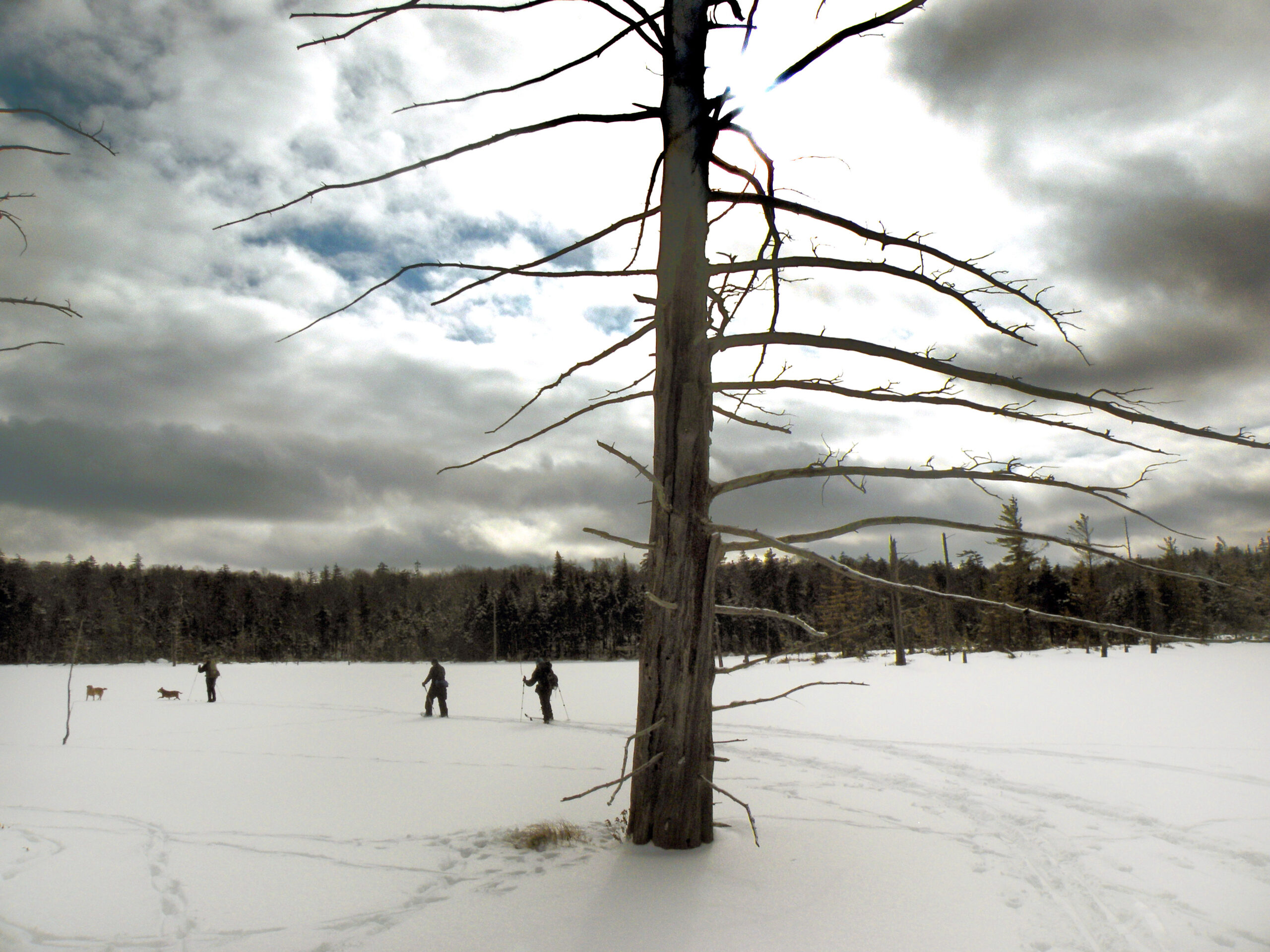
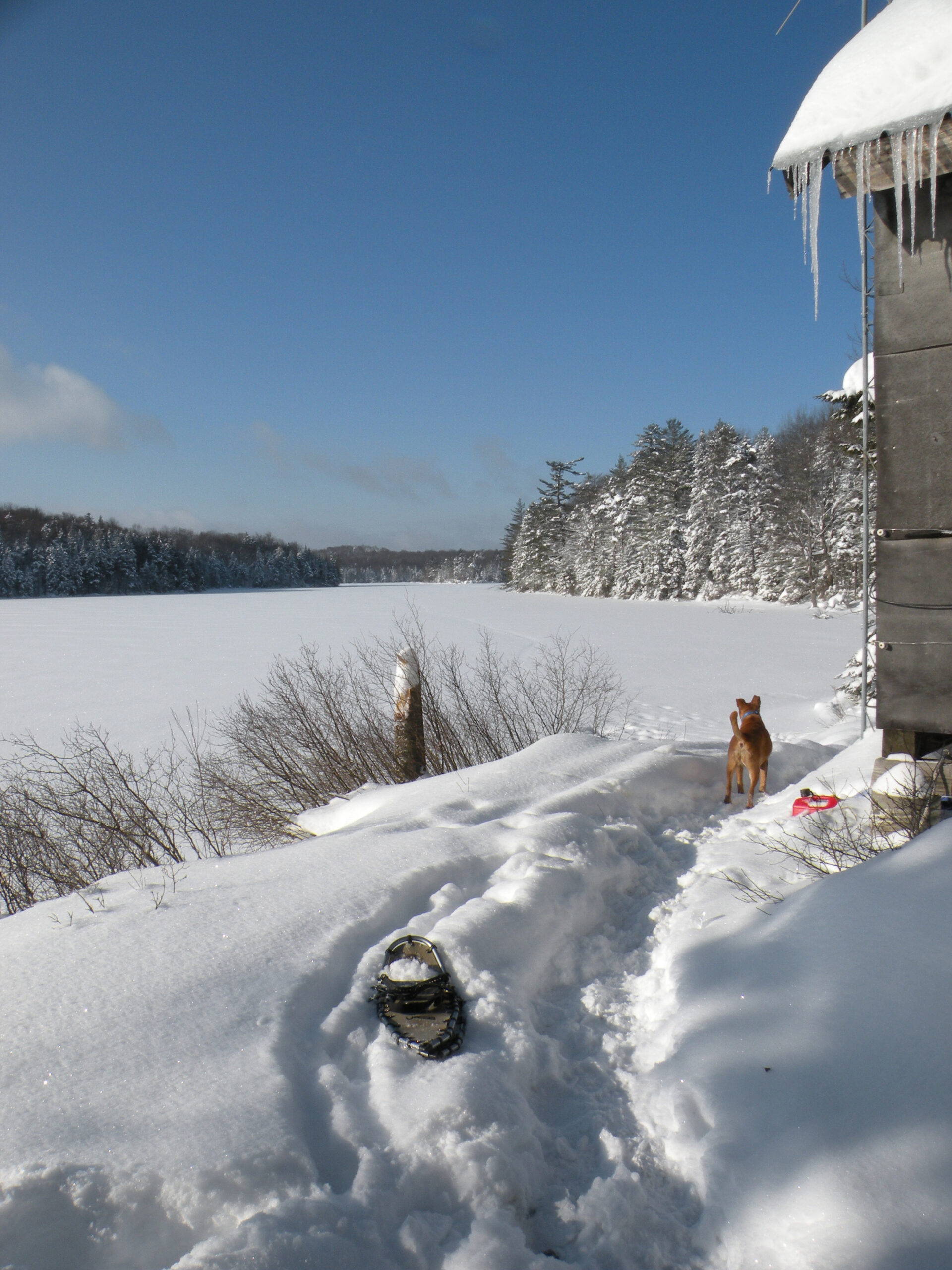
Winter snowfalls are ample enough to support a robust amount of ski and snowshoe use. “Pond hopping” is an especially good way to explore this area during snow season, when one can travel from one frozen waterway to another. That being said, many of the lakes have the curious habit of not freezing into completely solid surfaces; they are safe to cross, but for reasons that beggar explanation the surfaces retain a layer of slush even in the coldest weather.
As large as it is – second only to the High Peaks and West Canada Lakes in terms of size – the Five Ponds Wilderness is very much a work in progress. Despite a highly successful land acquisition effort since the 1970s, the area remains punctuated by large private inholdings. These areas total over 13,000 acres, collectively larger than several of the state’s protected wildernesses elsewhere in the Adirondacks. Individually, they range from small parcels to impressively large tracts.
The presence of private land in the vicinity of a protected wilderness landscape is not itself a concern. However, every one of these inholdings has a legal right of way for motorized access, each of which is managed as an exception to the wilderness. Added together, they total more than 25 miles of private road – far more than any other Adirondack wilderness area.
Most of the inholdings are the sites of private camps, many of them owned by modest hunting clubs. One is a voter-approved water source for the hamlet of Wanakena, with the related water main following a portion of the High Falls Loop. Some are accessed by well-maintained gravel roads, while others are serviced by long ATV trails. A few rights of way have been extinguished as the related inholdings were acquired, but subsequent boundary adjustments to the Five Ponds Wilderness have actually added more private inholdings – and therefore more miles of private roads. These exceptions to the wilderness boundaries suggest a ready-made list of priority land acquisitions, if willing sellers can be identified.
One issue with this high number of inroads is that they create multiple points for illegal motorized access to the wilderness backcountry – a phenomenon often called “trail poaching.” These routes exist to provide access to the landowners; most of them are not open to the public except for foot travel. Nevertheless some routes are used frequently by the general public, and sometimes people ride off the approved corridor into the wilderness interior. This has been a recurring problem at places such as Raven Lake.
In addition to the 25-plus miles of access roads, another 3.5-mile motorized corridor exists in the northern reaches of the Five Ponds Wilderness. The Alice Brook snowmobile corridor was carved by administrative action in 2000 as a “temporary” measure to connect the communities of Star Lake and Wanakena. Should another route become available outside the wilderness boundaries the Alice Brook trail will be restored to wilderness conditions, but the only possible location is the property of an abandoned iron mine. It is not clear whether a viable route exists there.
Ironically, acquisition of private land has not always solved all problems. In one location, a former hunting camp standing on land acquired in 1989 was never removed. The camp was part of an exclusive use agreement through 2005 but has been in a state of abandonment since then. Remediation of this site is a goal this organization is currently pursuing.
The following links leave the AWA website and take you to various pages on the Department of Environmental Conservation (DEC) website with more information on the Five Ponds Wilderness.
Five Ponds Wilderness Information Page. Learn important contact information and peruse a list of facilities.
Backcountry Information for the Western Adirondacks. Trail conditions updated weekly for the Five Ponds Wilderness and neighboring areas.
Five Ponds Wilderness Unit Management Plan (1994). Download DEC’s official management plan, approved in 1994. This plan was amended in 1996 and again in 2003.
State Land Regulations. Review the complete list of DEC regulations.
All photos © Bill Ingersoll. Site visitors are permitted to download an unlimited number of images from our website for personal, educational, scientific, or professional use only, with attribution. Commercial use and further distribution of images is prohibited without express written permission.


