
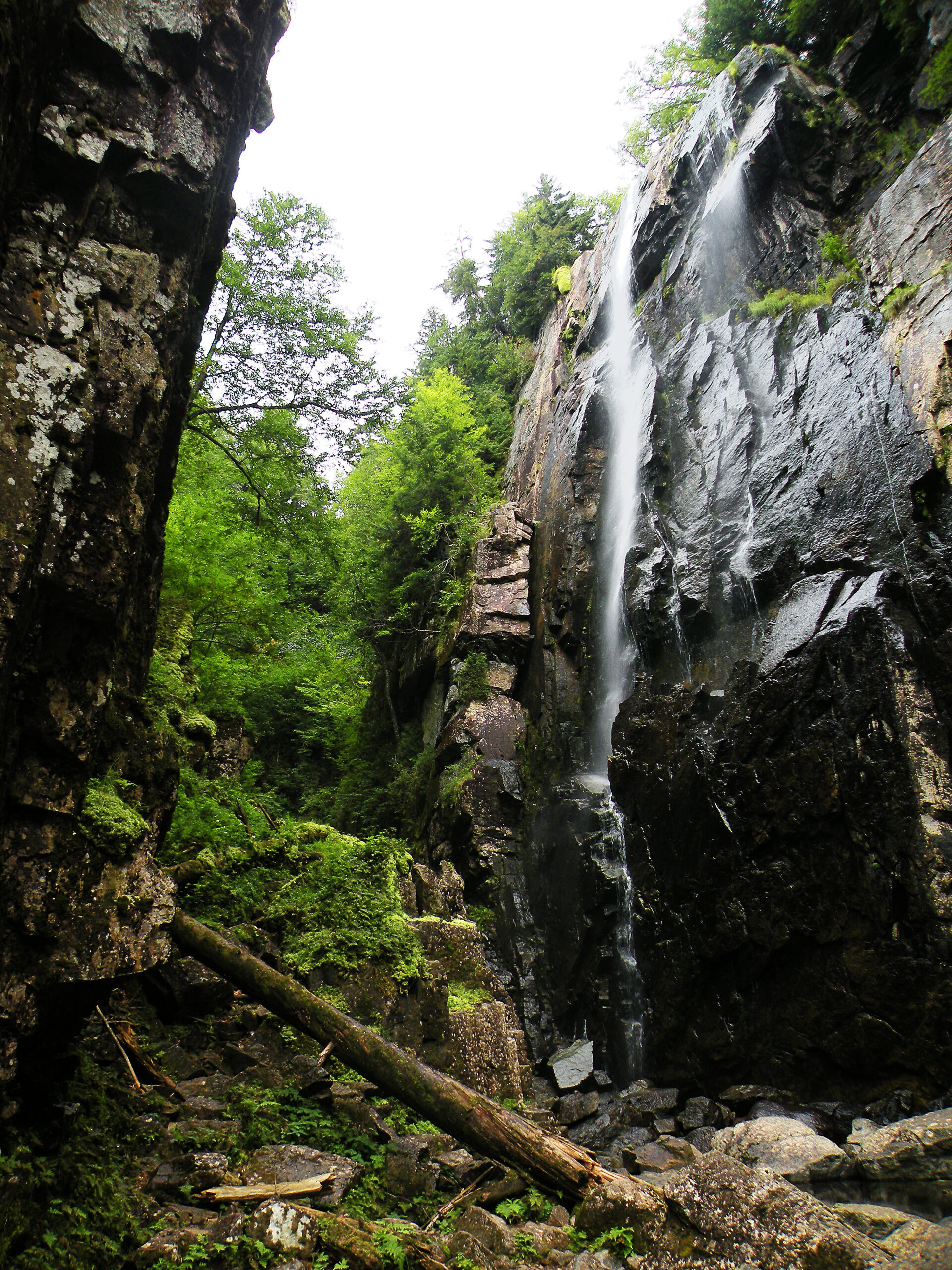
Twin Slides on Santanoni

Beyond all doubt, the High Peaks Wilderness is a land of superlatives. At over 272,000 acres in size, this is by far the largest protected wilderness not only in New York State, but in the entire northeastern region of the United States. It features Mount Marcy, the state’s highest summit, as well as dozens of other aptly-named High Peaks. Flora found nowhere else in the Empire State can be found on the loftiest summits, and our largest river springs from its mountain streams.
But there is also one other superlative figure that must be noted: the High Peaks Wilderness is far and away the most heavily visited region in the Adirondack Park, with allegations of overuse being a perennial cry since the late 1960s.
The wilderness credentials of this place are hard to deny, based just on the sheer size and ruggedness of the landscape alone; one would have to venture westward to the Rocky Mountains before encountering another protected area that matches or surpasses the High Peaks in terms of both size and quality. The highest summit, Mount Marcy, is 5344 feet in elevation – modest in the global scheme of mountains, but high enough to sustain an alpine habitat shared by precious few of its Adirondack neighbors.
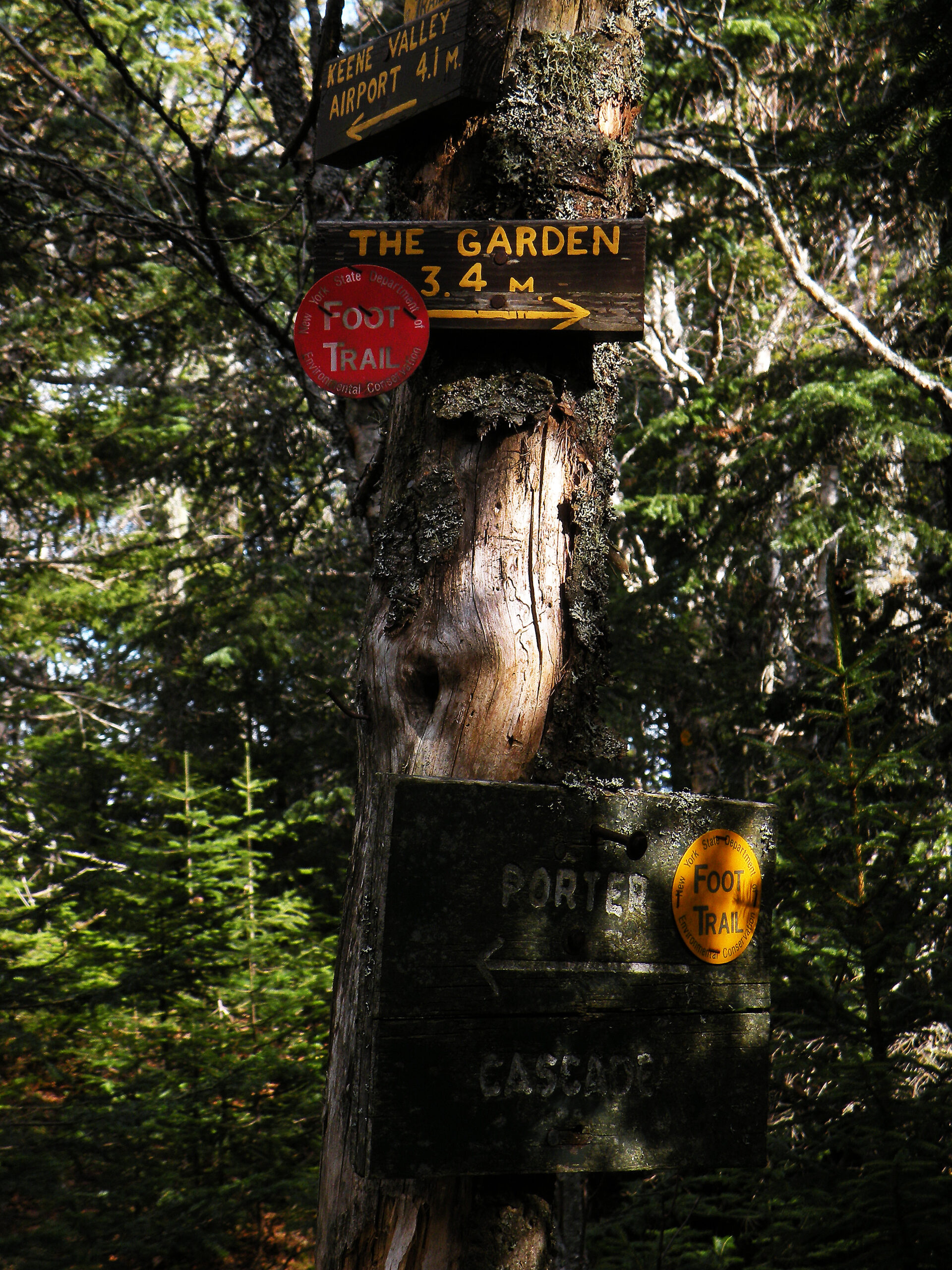
Nevertheless, all these superlatives come with a tremendous amount of recreational pressure. Ever since the state began a concentrated land acquisition program here circa 1920, the High Peaks region has been managed for recreation. The “conservation aesthetic” of marked trails, signed junctions, and standardized lean-tos was pioneered here; for years the recreational appeal of the region was actively touted by a variety of regional clubs as well as the state’s Conservation Commission.
But by the late 1960s, a variety of factors contributed to an increase in public usage; while these visitation rates have plateaued a few times, they nevertheless continue to climb from decade to decade. No other area in the Adirondack Park is as scrutinized, debated, and explored as the High Peaks Wilderness. Several generations of wilderness advocates have advanced potential solutions, and yet visitors continue to come. Does the area suffer from “overuse”? Are there too many people at any given time? The answers are as numerous as there are visitors, it seems.
None of this should detract from the fact the High Peaks Wilderness is a region of tremendous significance, as beautiful as any national park. If so many people harbor strong opinions about how it should be managed, that can only speak to the spell it holds over all who have been here. Still, the questions of how the area should be managed are valid, and this is a place that will remain forefront in many minds for years to come.
Please click through the tabs below to learn more about the High Peaks Wilderness.
Size: 272,143 acres
First Designated: 1972
Unit Management Plan Status: Completed in 1999; amended 2017
Special Regulations: Special regulations apply — see tabs below


For many people, it’s all about the mountains.
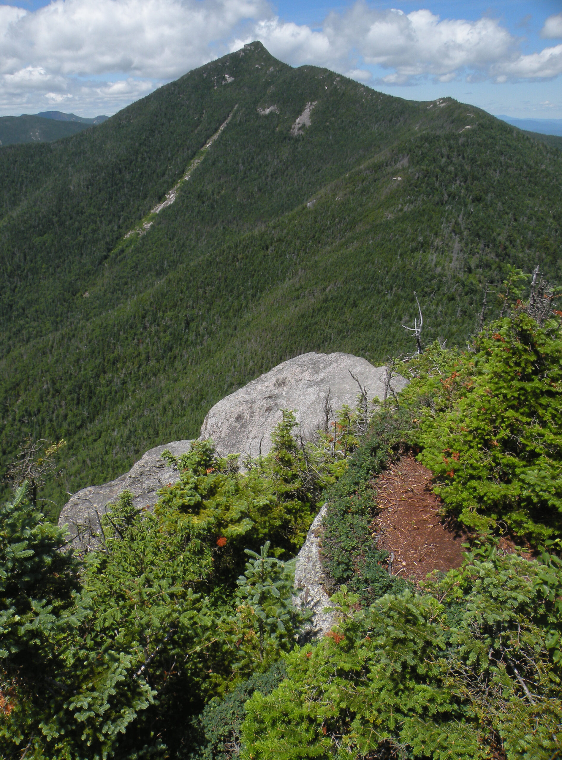
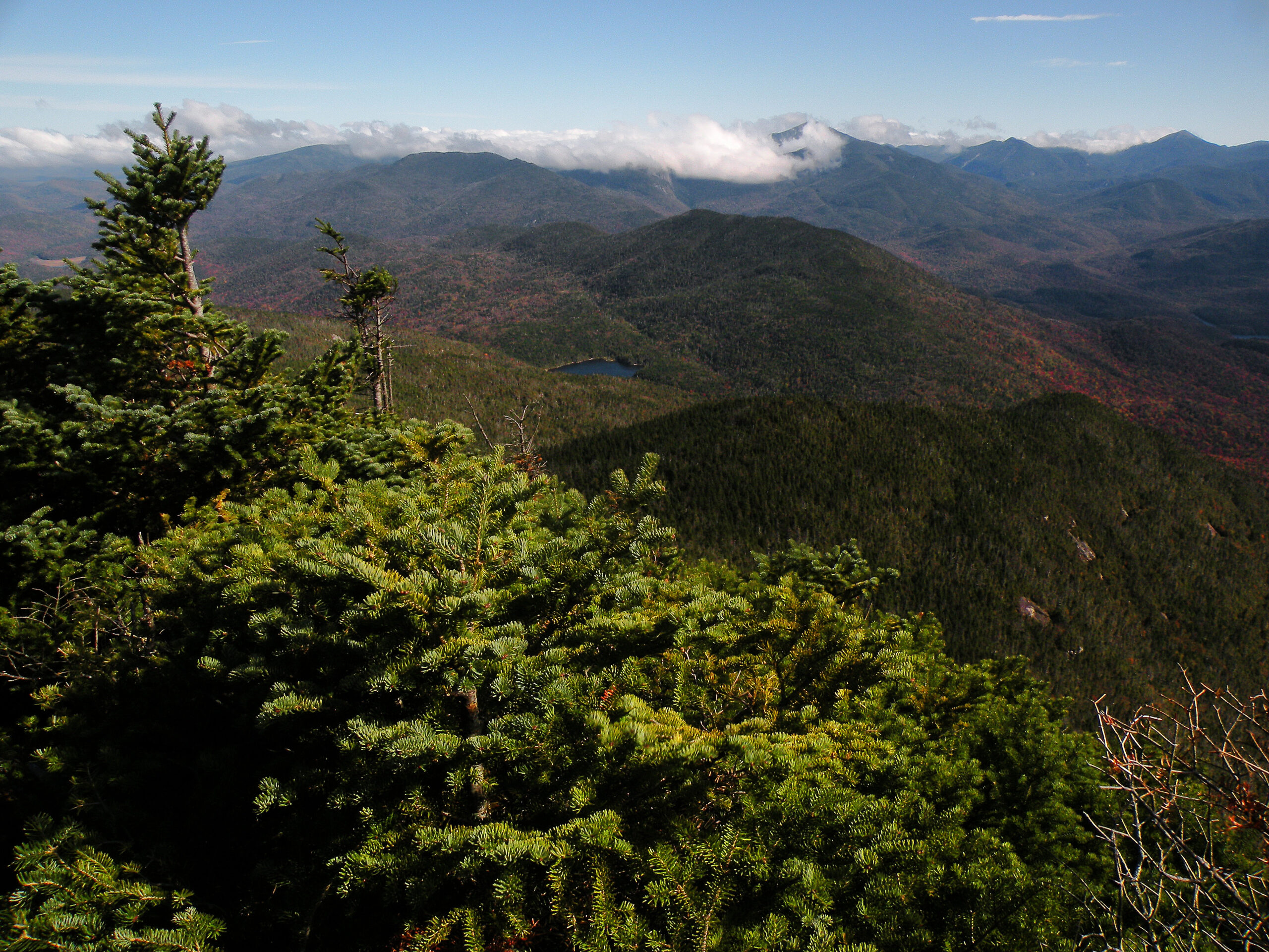
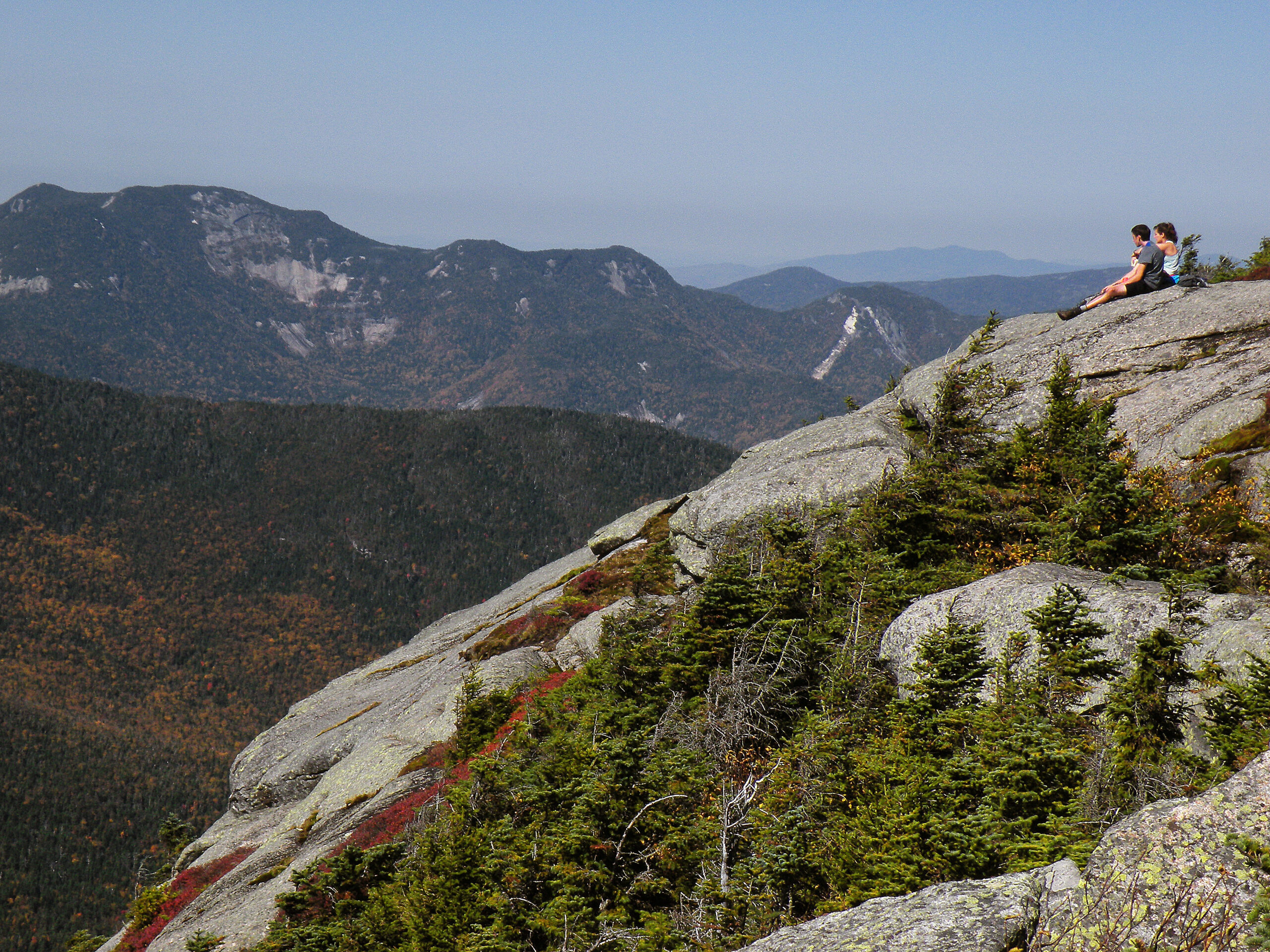
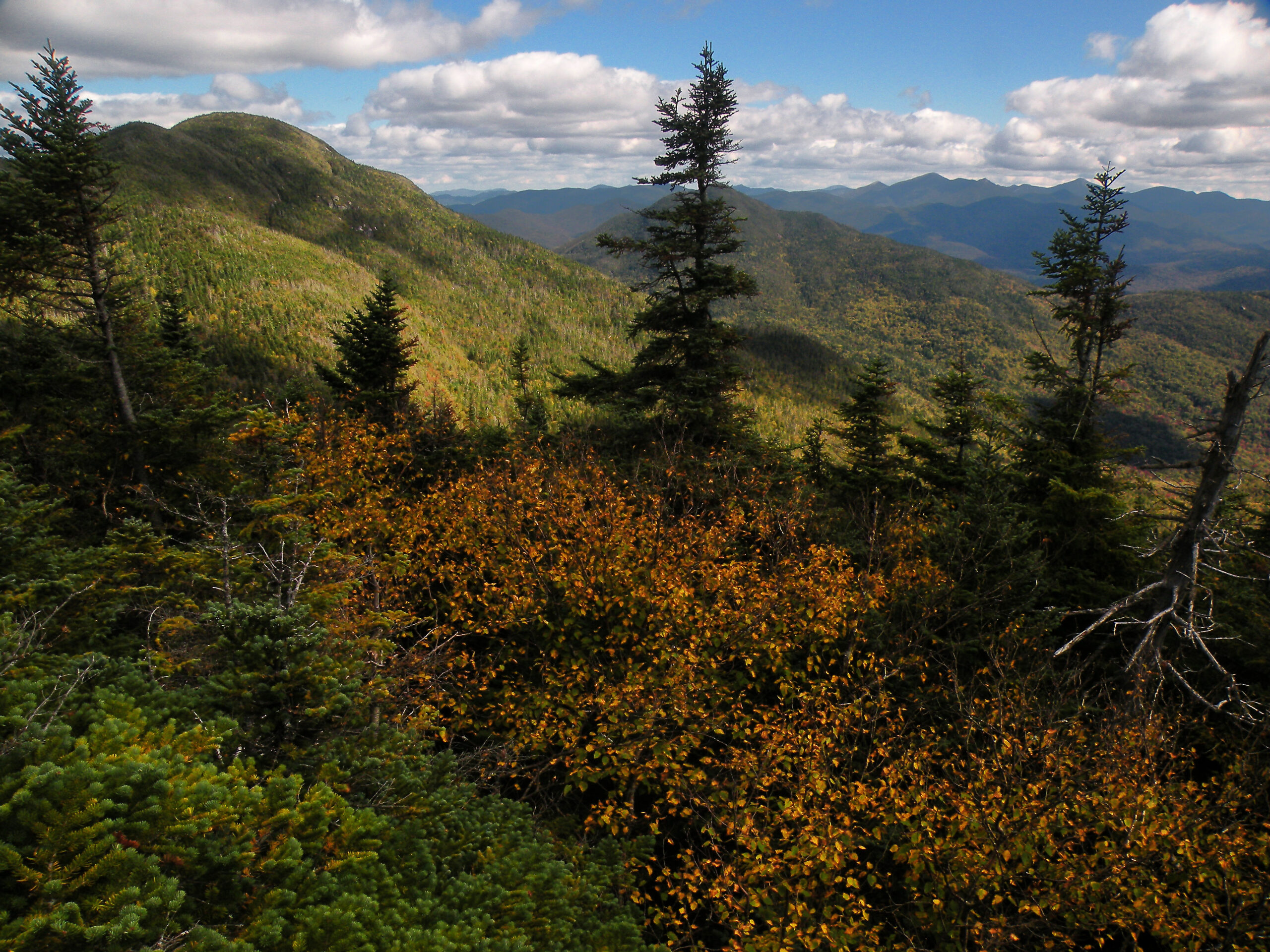
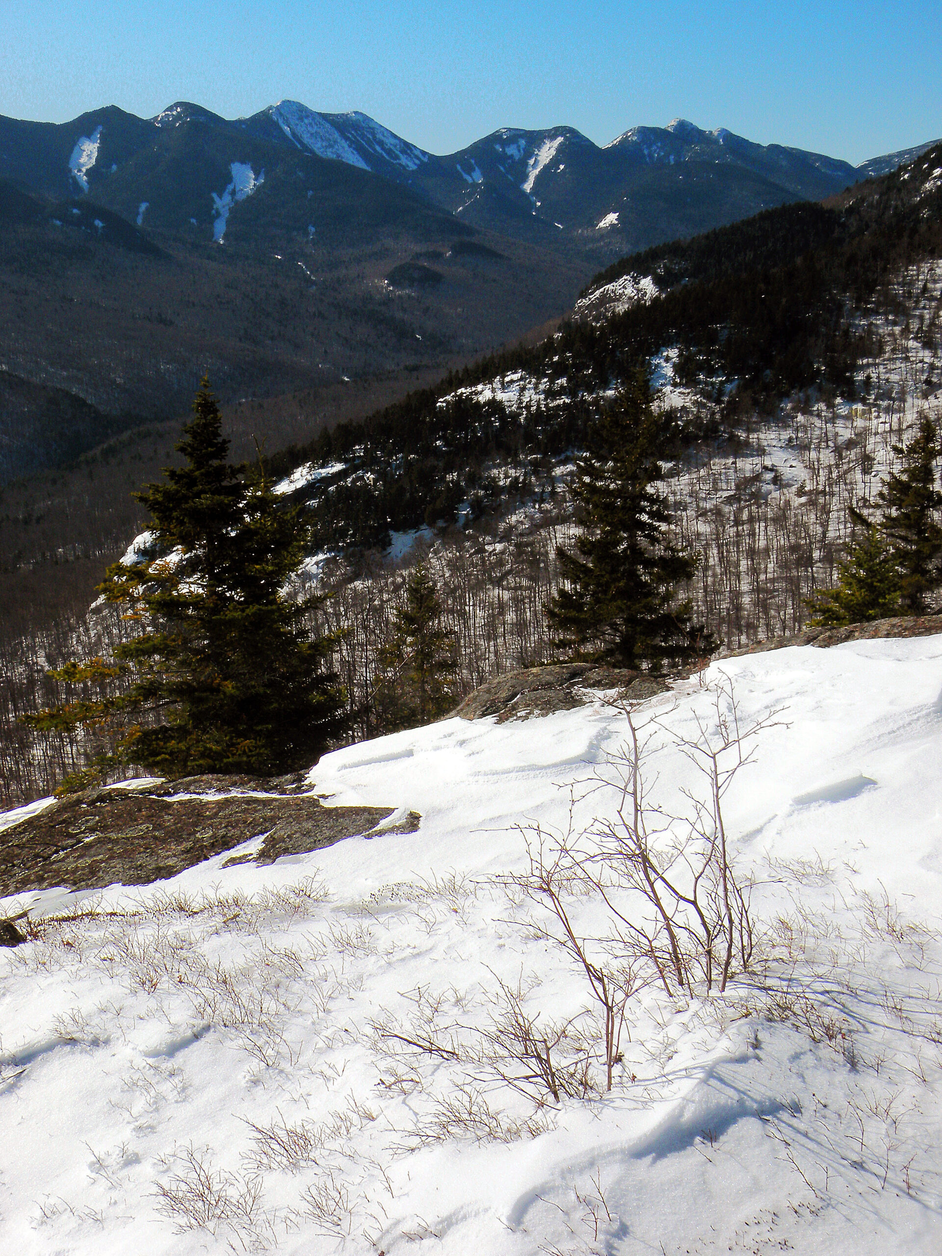
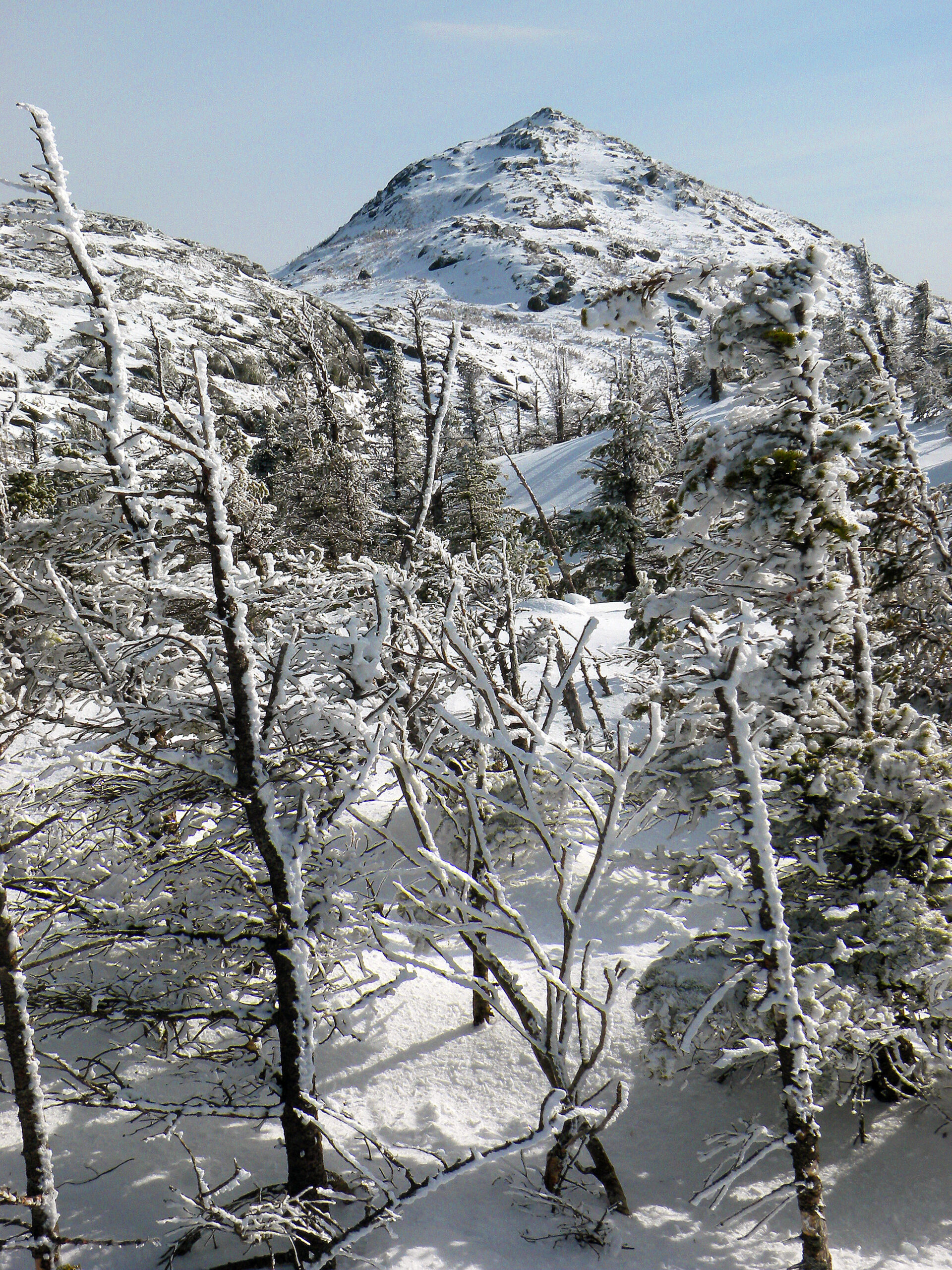
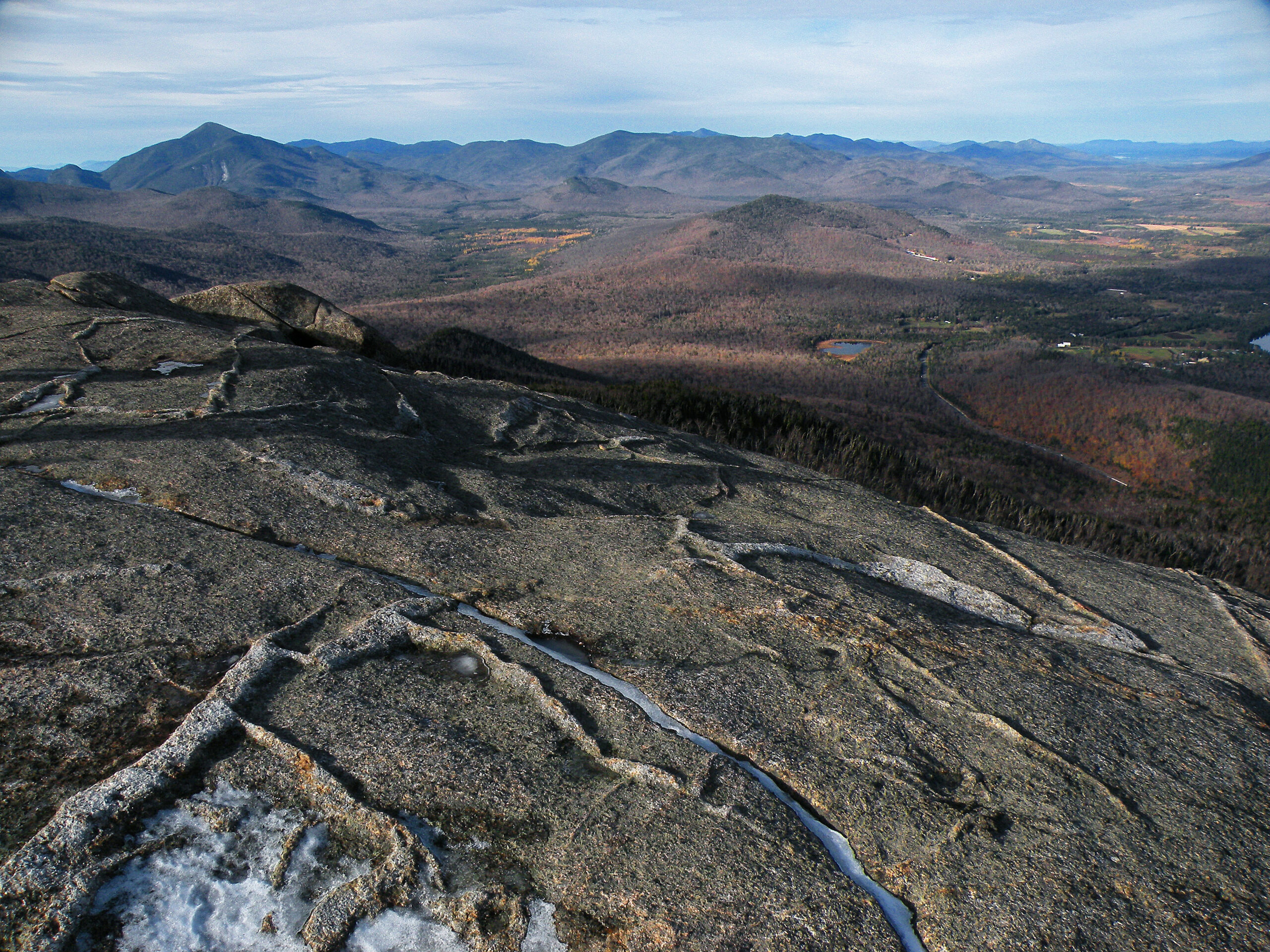
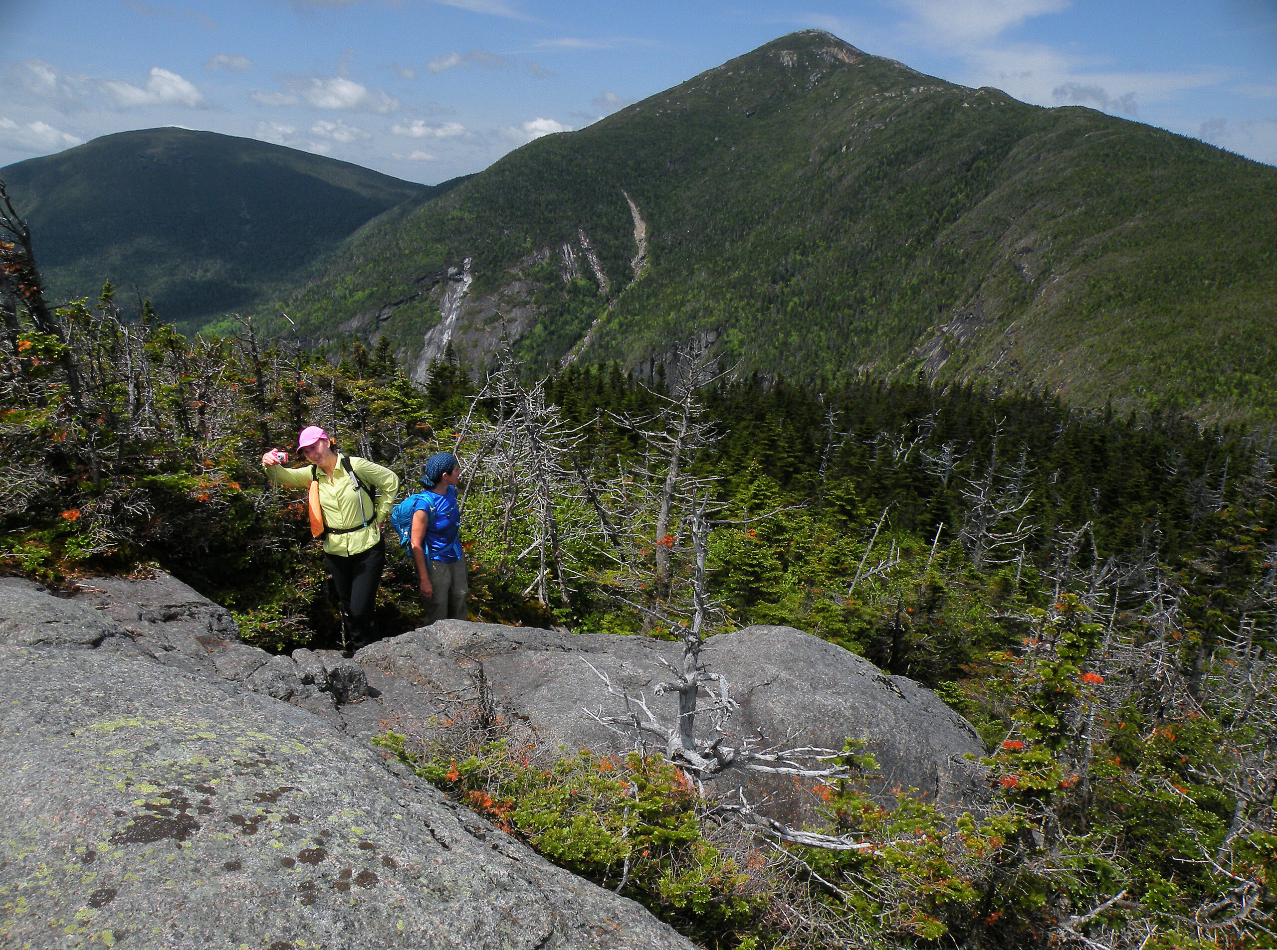
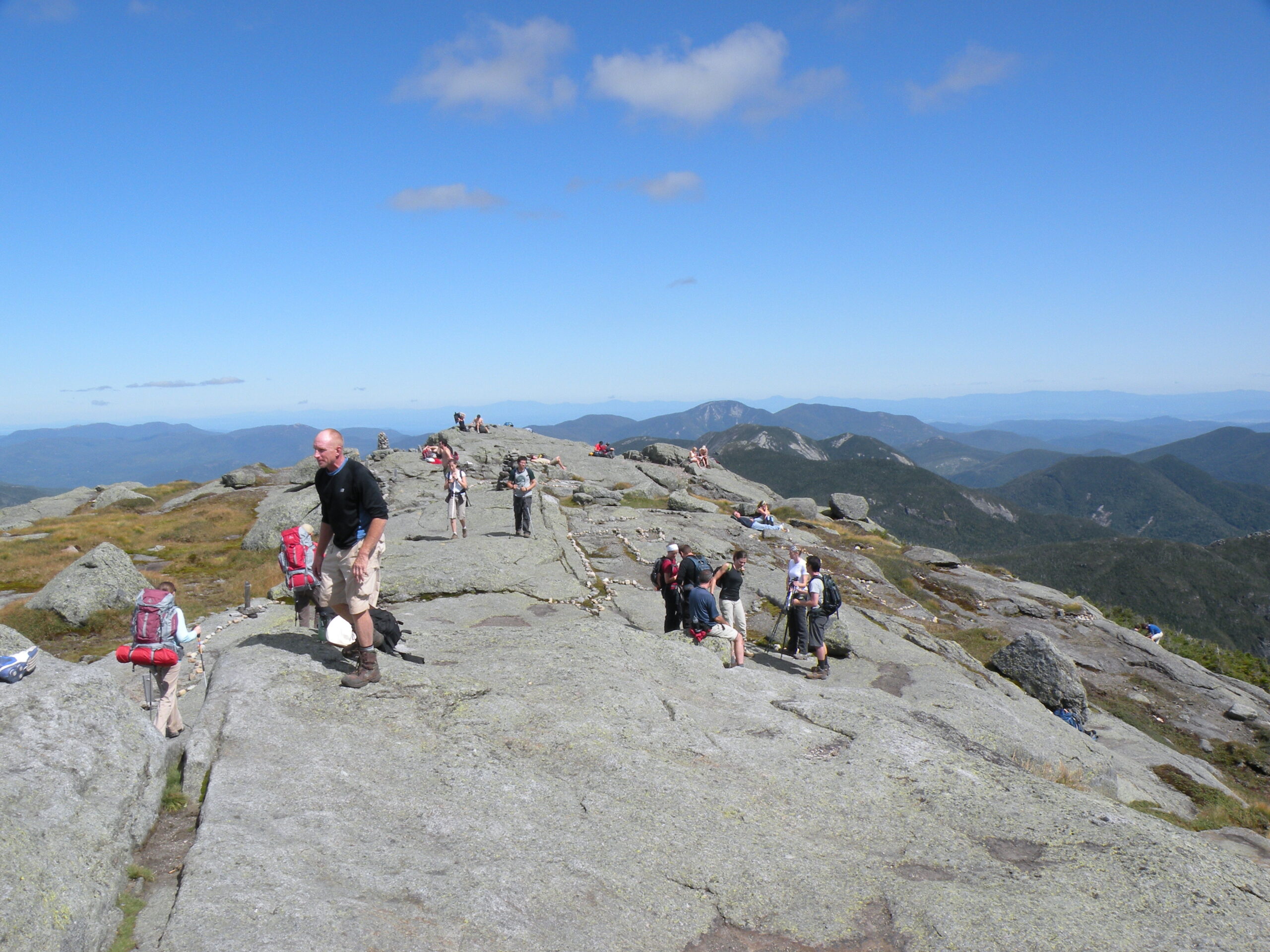
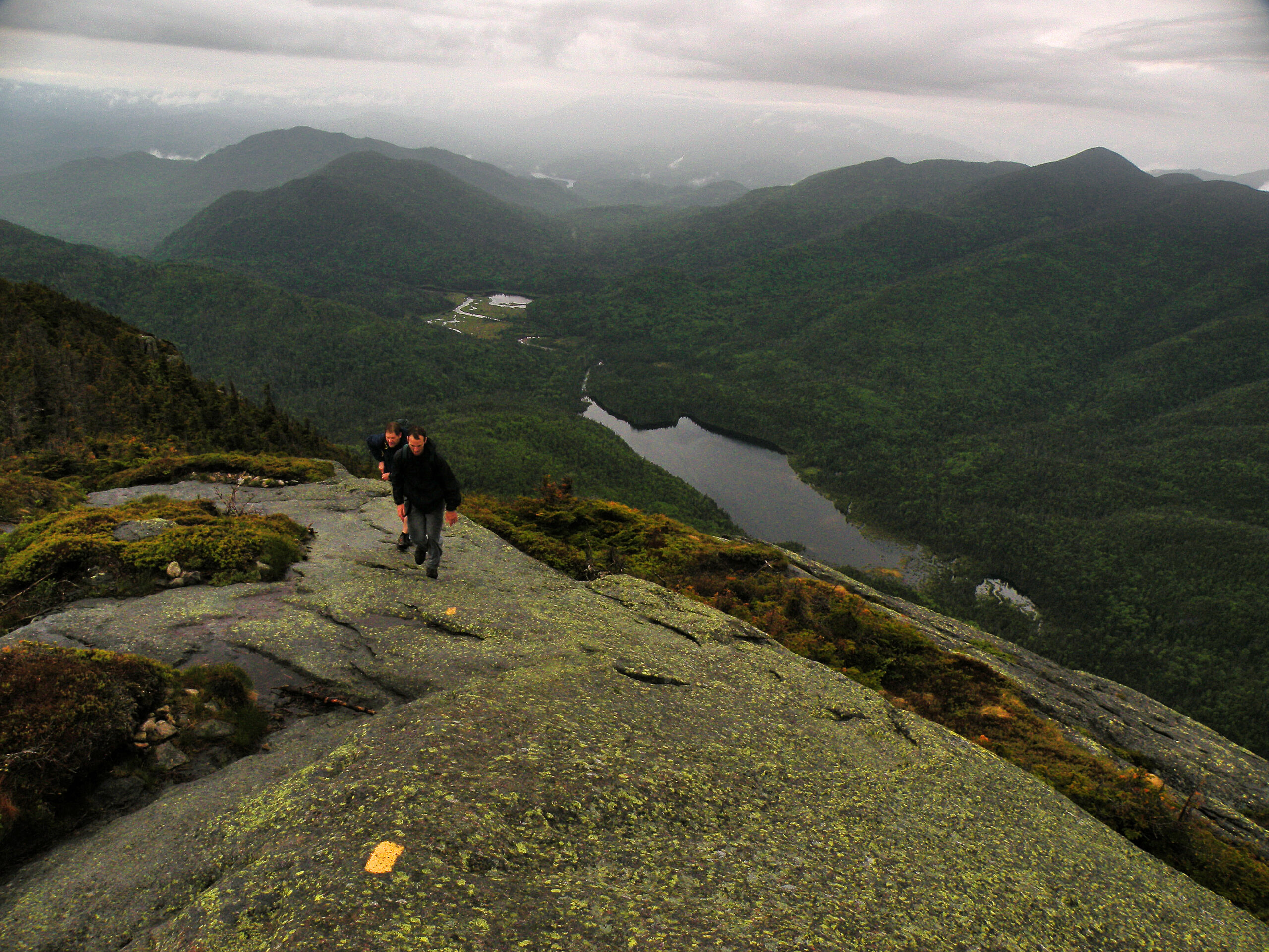
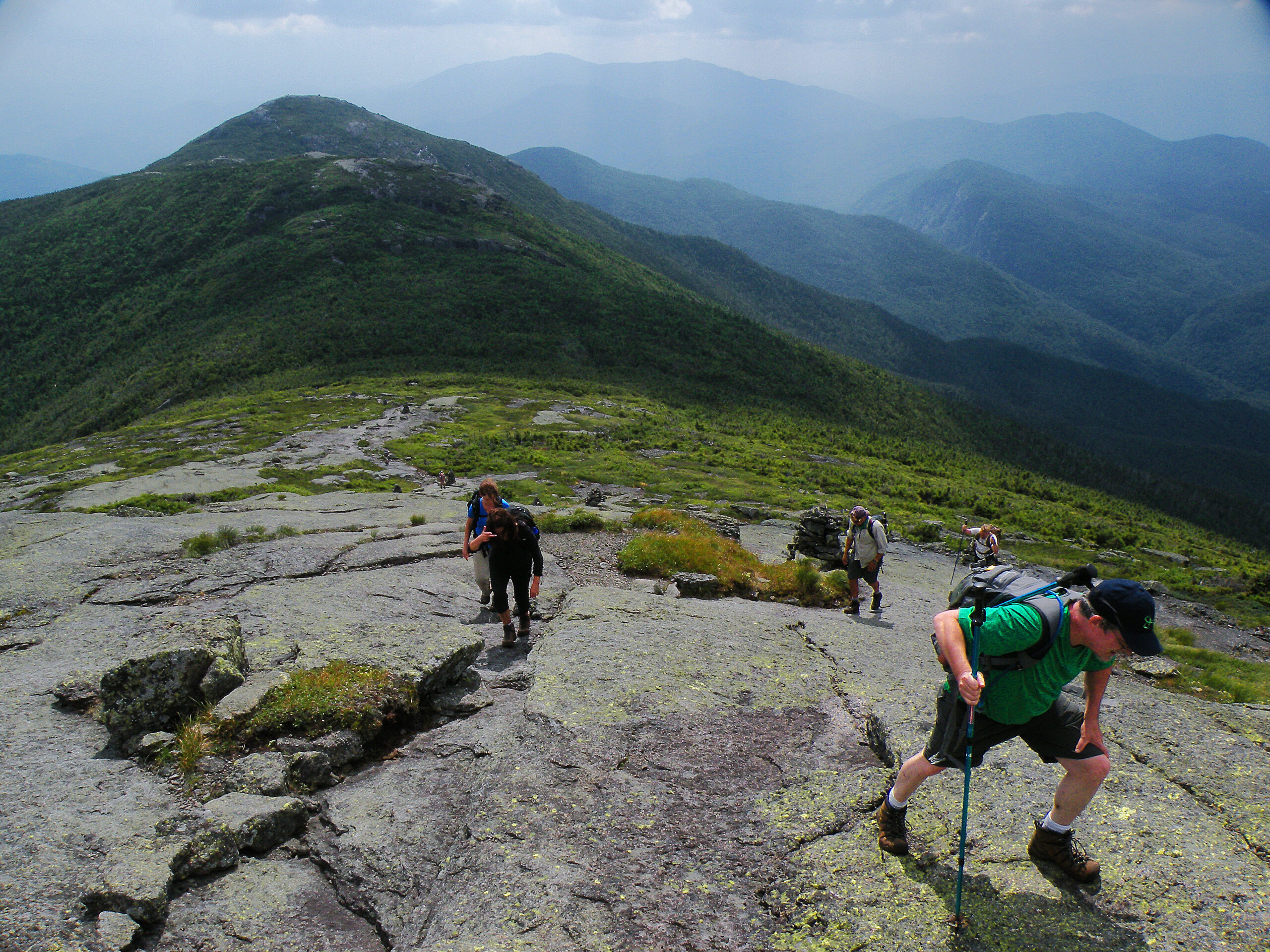
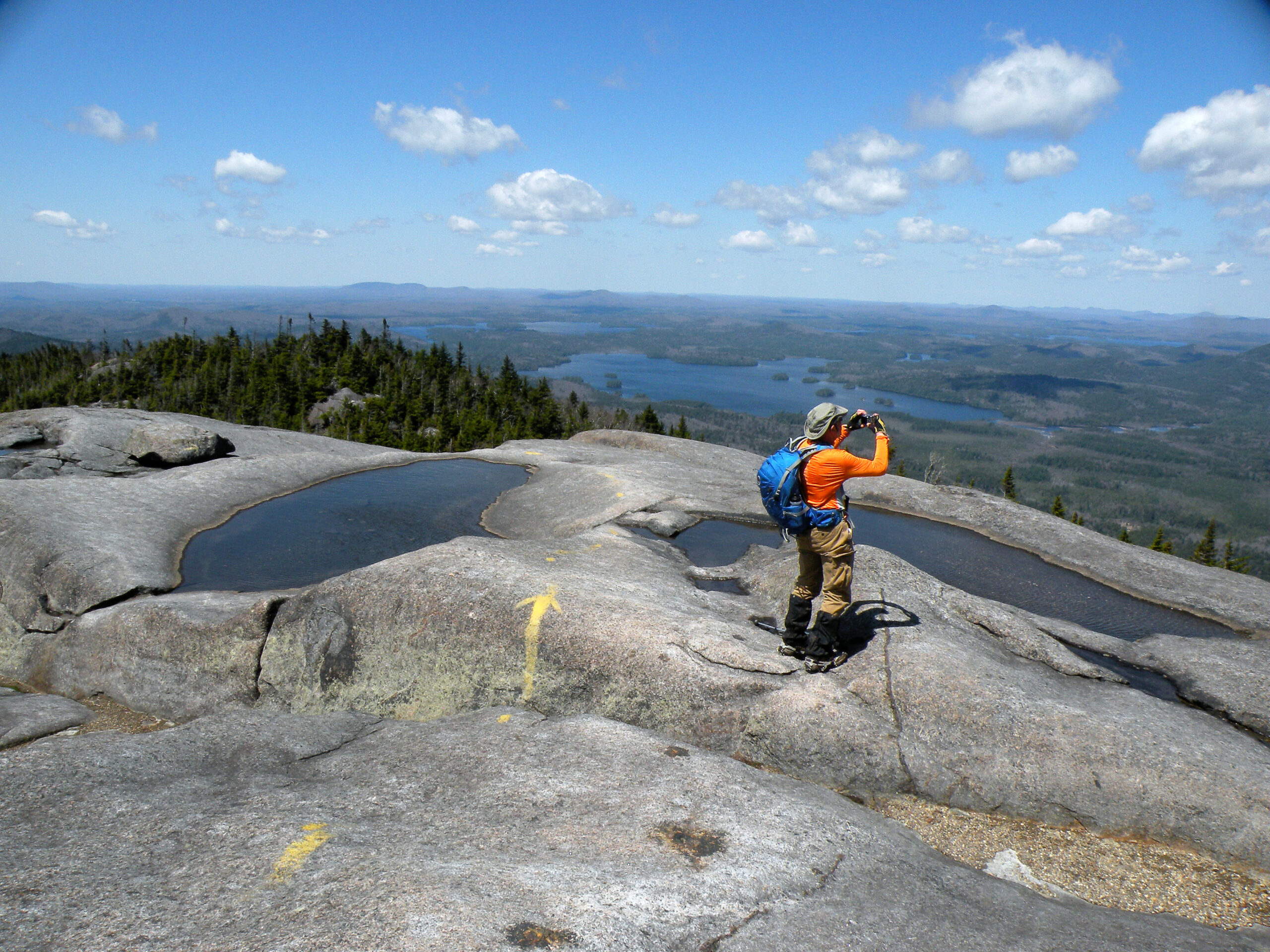
There are dozens of named summits in the High Peaks Wilderness, ranging in size from minor foothills to alpine summits. The highest is Mount Marcy, which at 5344 feet in elevation is the highest point in New York State. Although there are many other mountains in the world that would dwarf this peak, it is tall enough to have a naturally treeless summit, vegetated by ground-hugging alpine vegetation of a variety found only on a few of its neighbors, and then not again for many miles to the north.
Many other summits in the High Peaks Wilderness are similarly bare, but not necessarily because of climate. Forest fires tore through the region in the early twentieth century, devastating many acres of what is now wilderness. Very little of the easternmost slopes was left unscathed, and the effects can still be seen a century later in the form of rock-scarred ridges and birch-poplar forests.
Not surprisingly, the state began acquiring many of these lands not long after the fires rendered them economically worthless. This includes one of the most popular sections: the Heart Lake region, with a trailhead used by more people in any given year than any other in the Adirondacks. A massive human-caused fire in 1903 swept through the region and burned the original Adirondack Lodge to the ground as its proprietor fled for his life through Indian Pass. For the next decade the J & J Rogers Co. salvaged the remaining timber, and it was their corduroy logging roads and lumber campsites that formed the basis of the later trail and lean-to network.
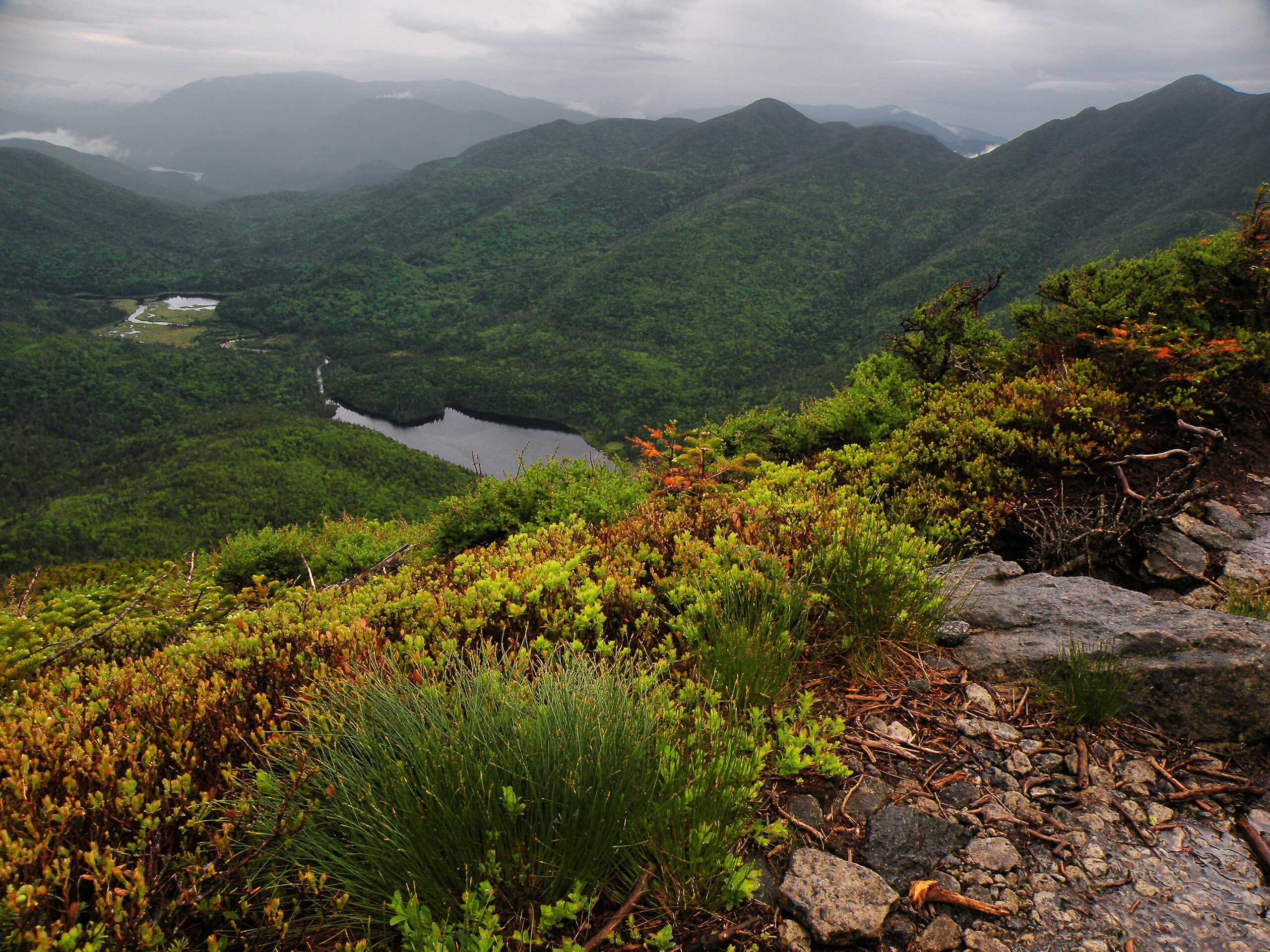
Small tarns may be found throughout the highest terrain, including the romantically named Lake Tear of the Clouds. Technically it’s the source of Feldspar Brook, but curators of Adirondack trivia will gleefully point out the pond’s status as the “highest pond source of the Hudson River.” Fittingly, Lake Tear is located at the foot of Marcy’s conical alpine summit.
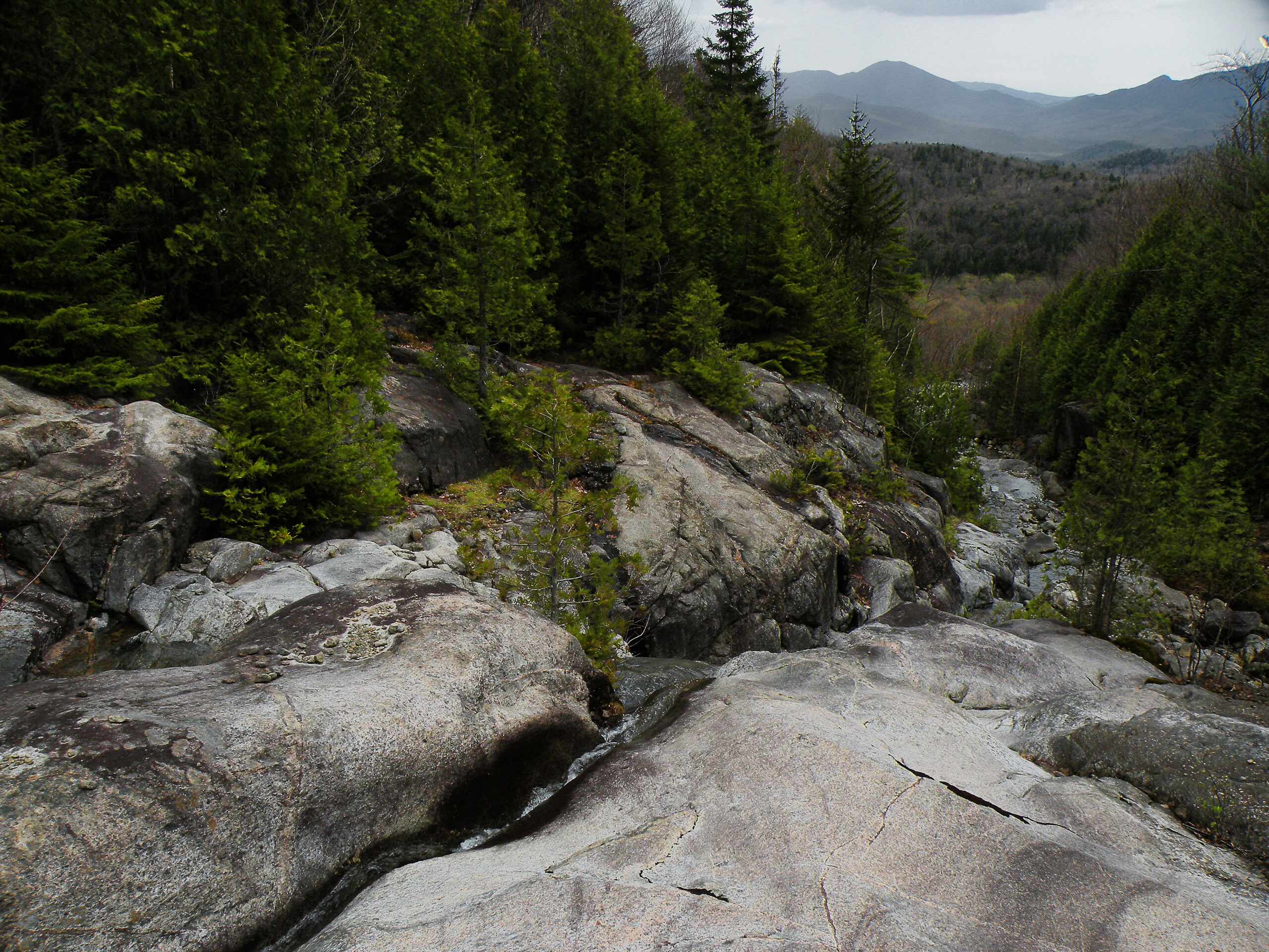
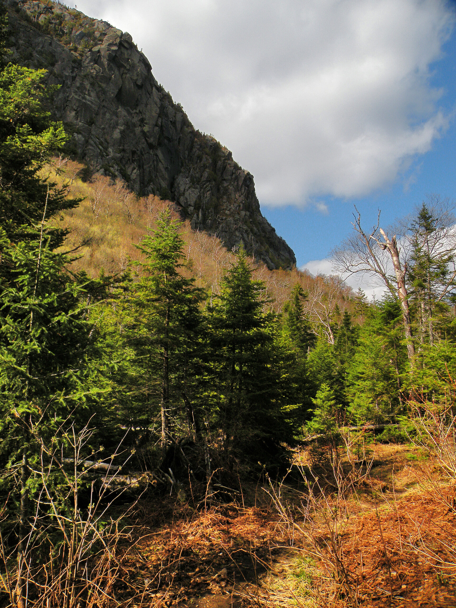
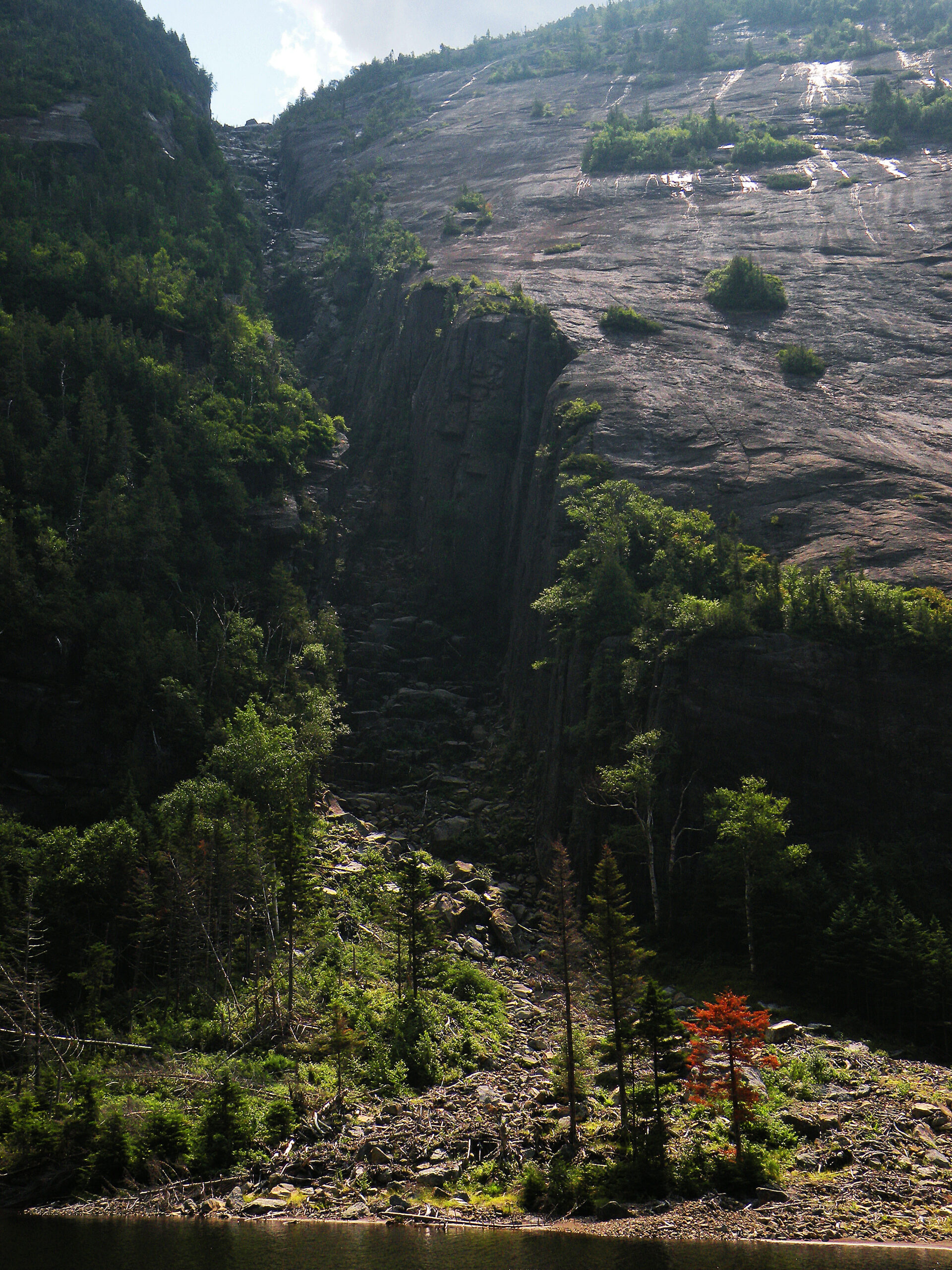
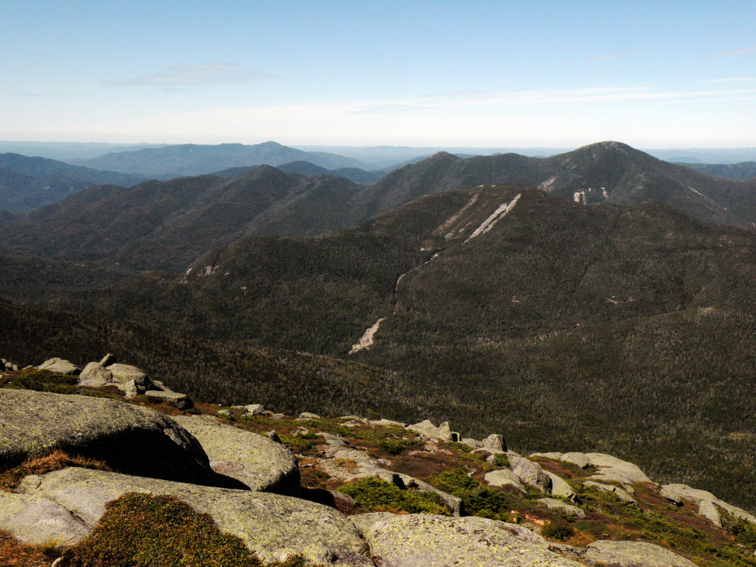
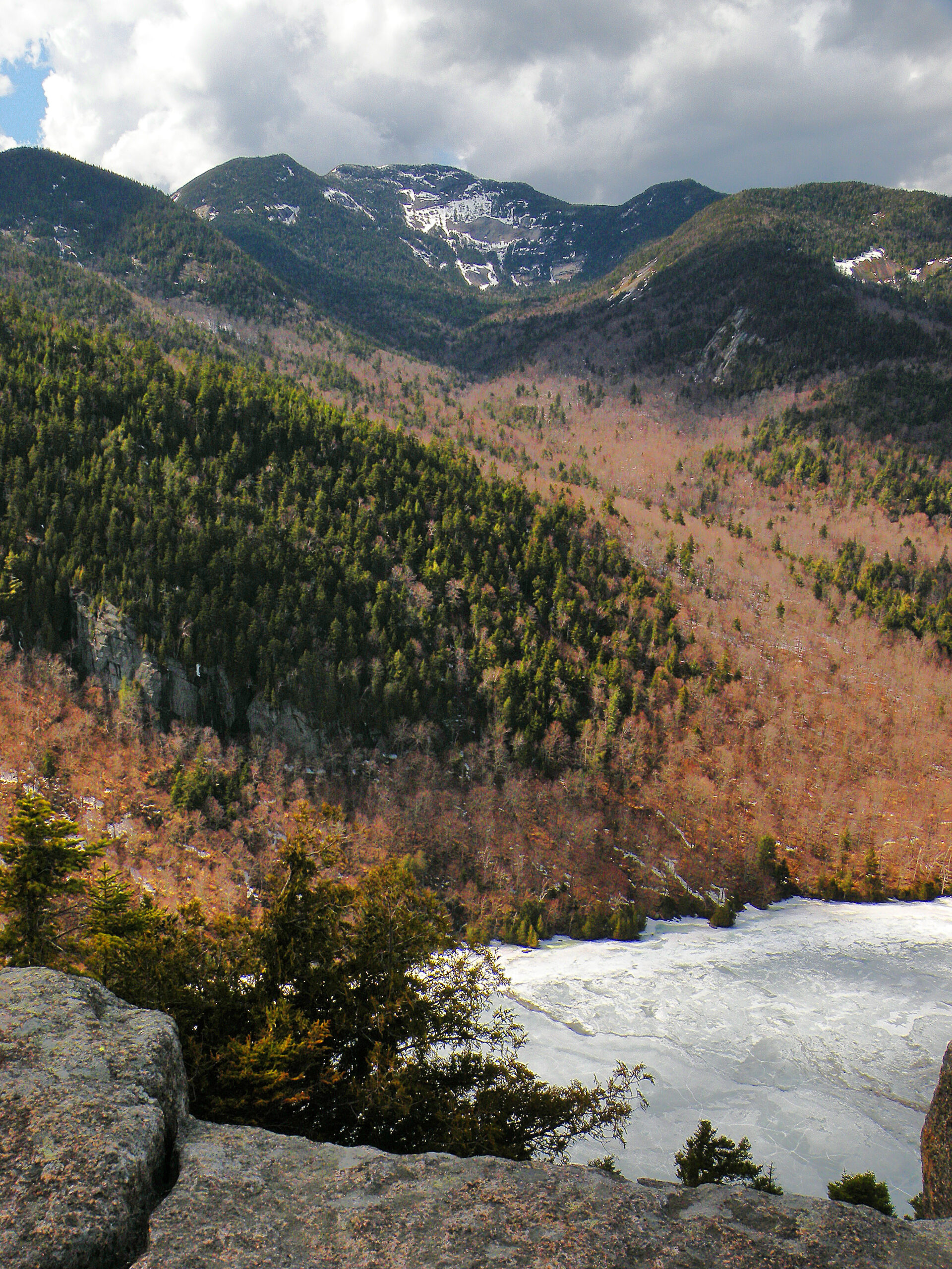
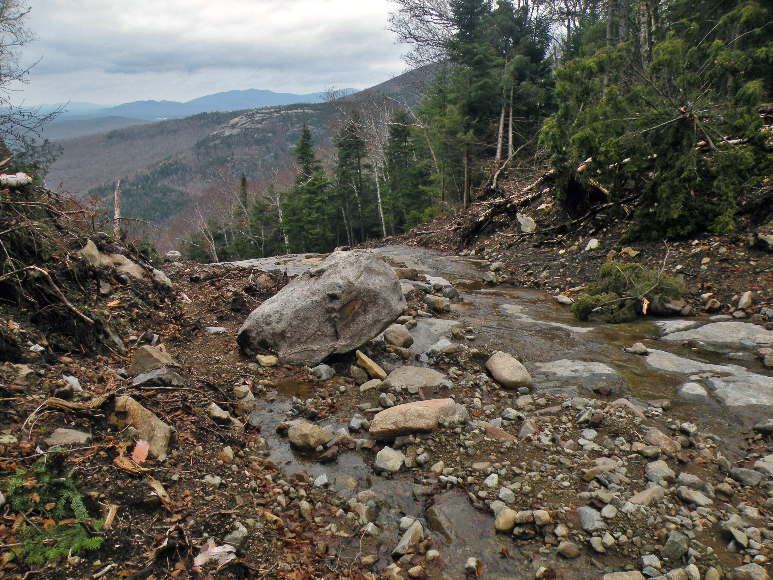
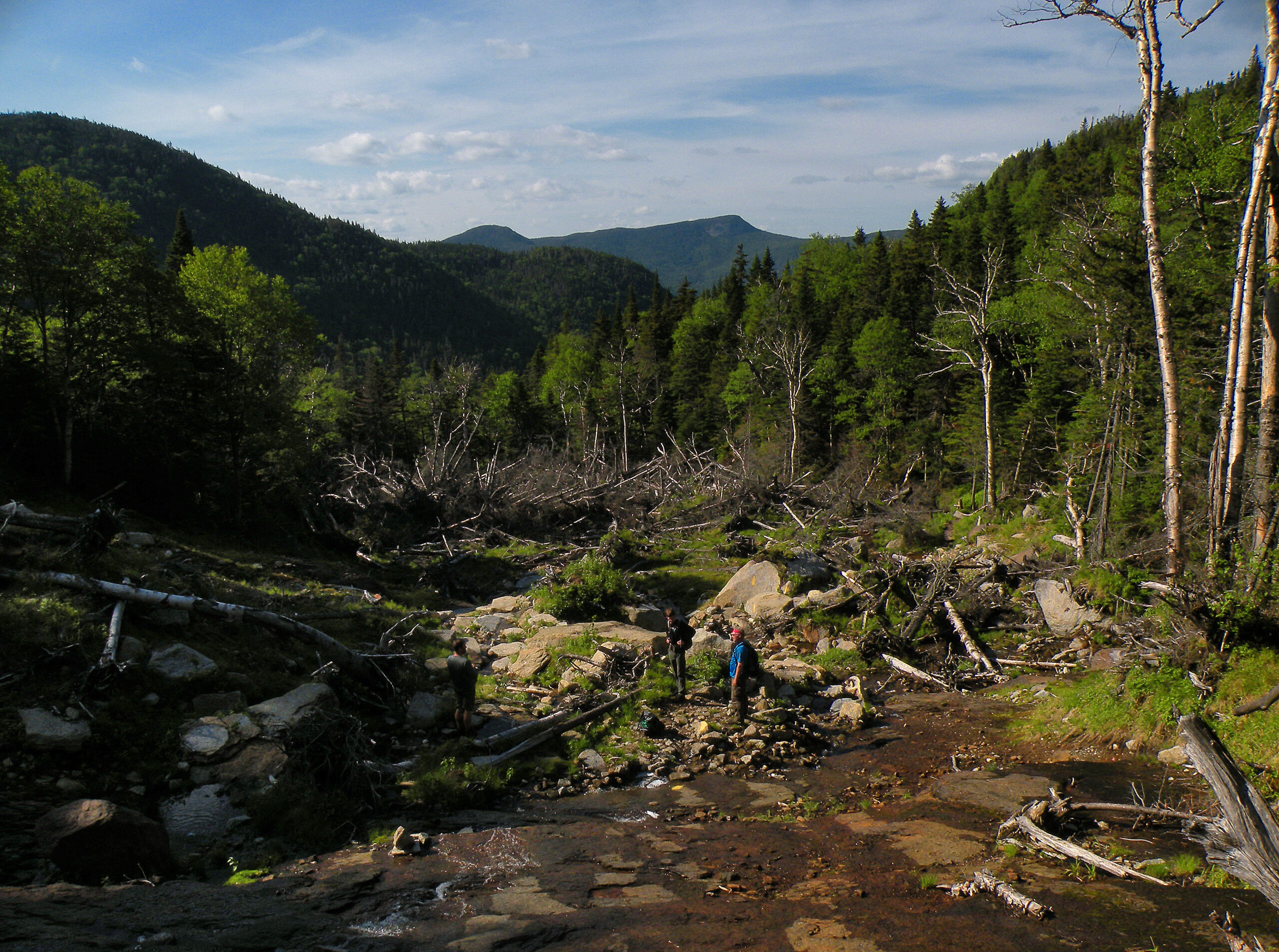
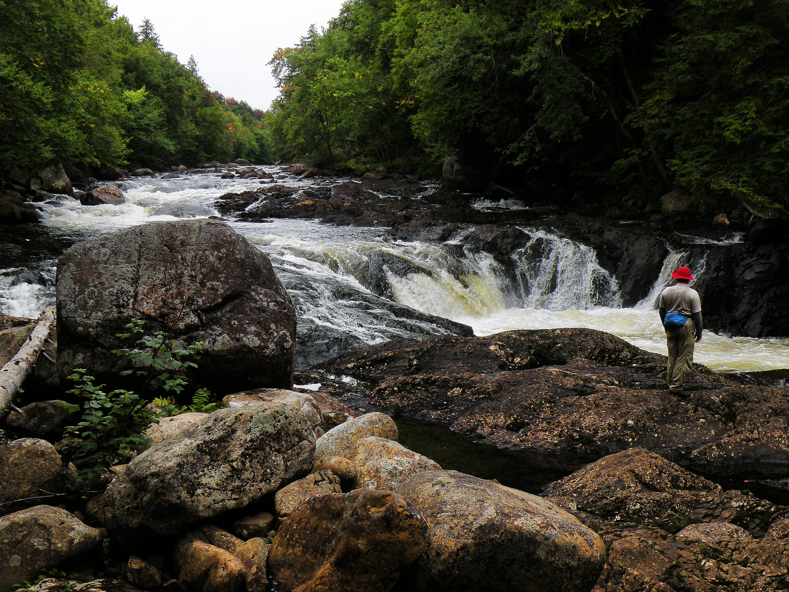
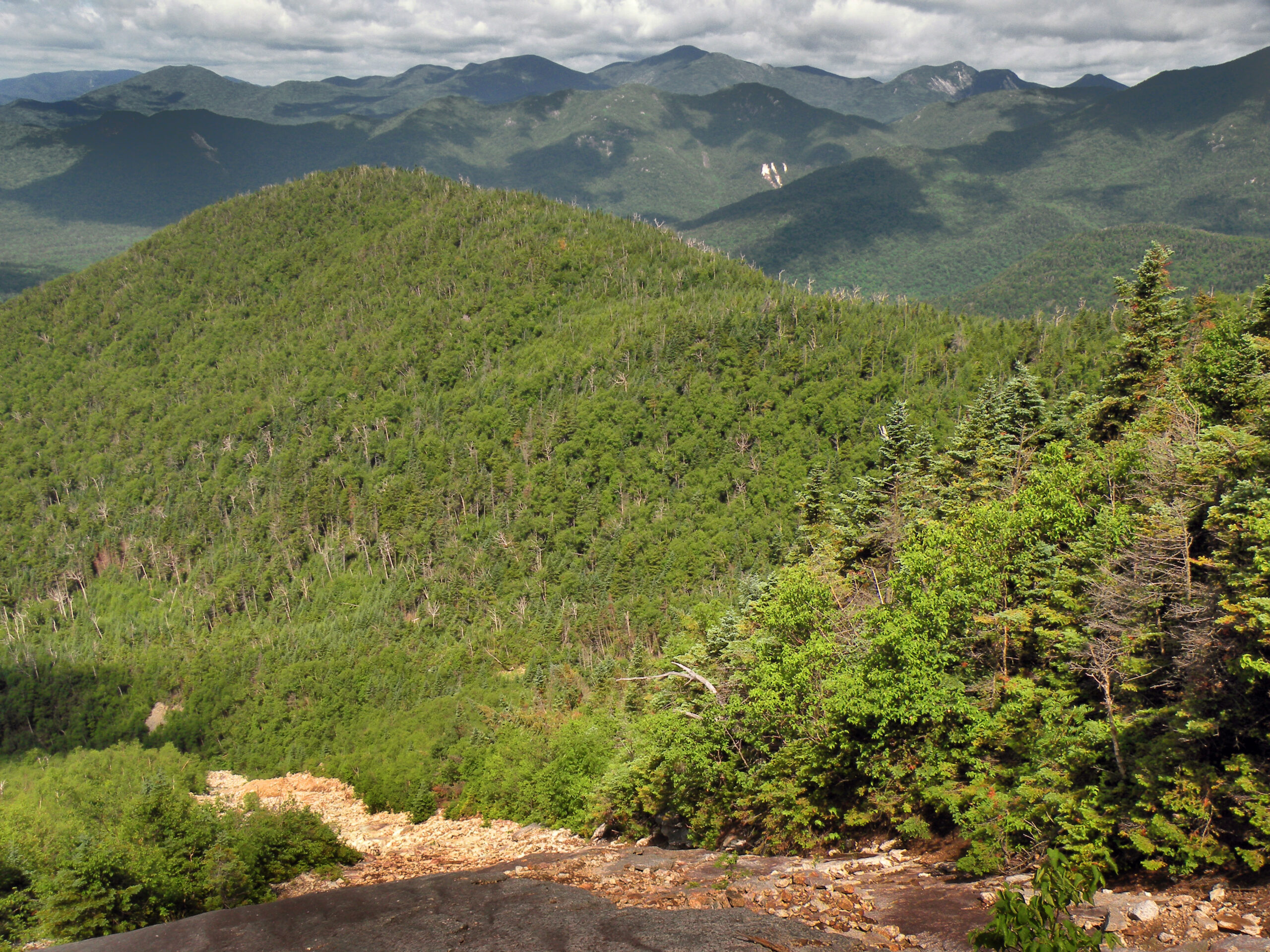
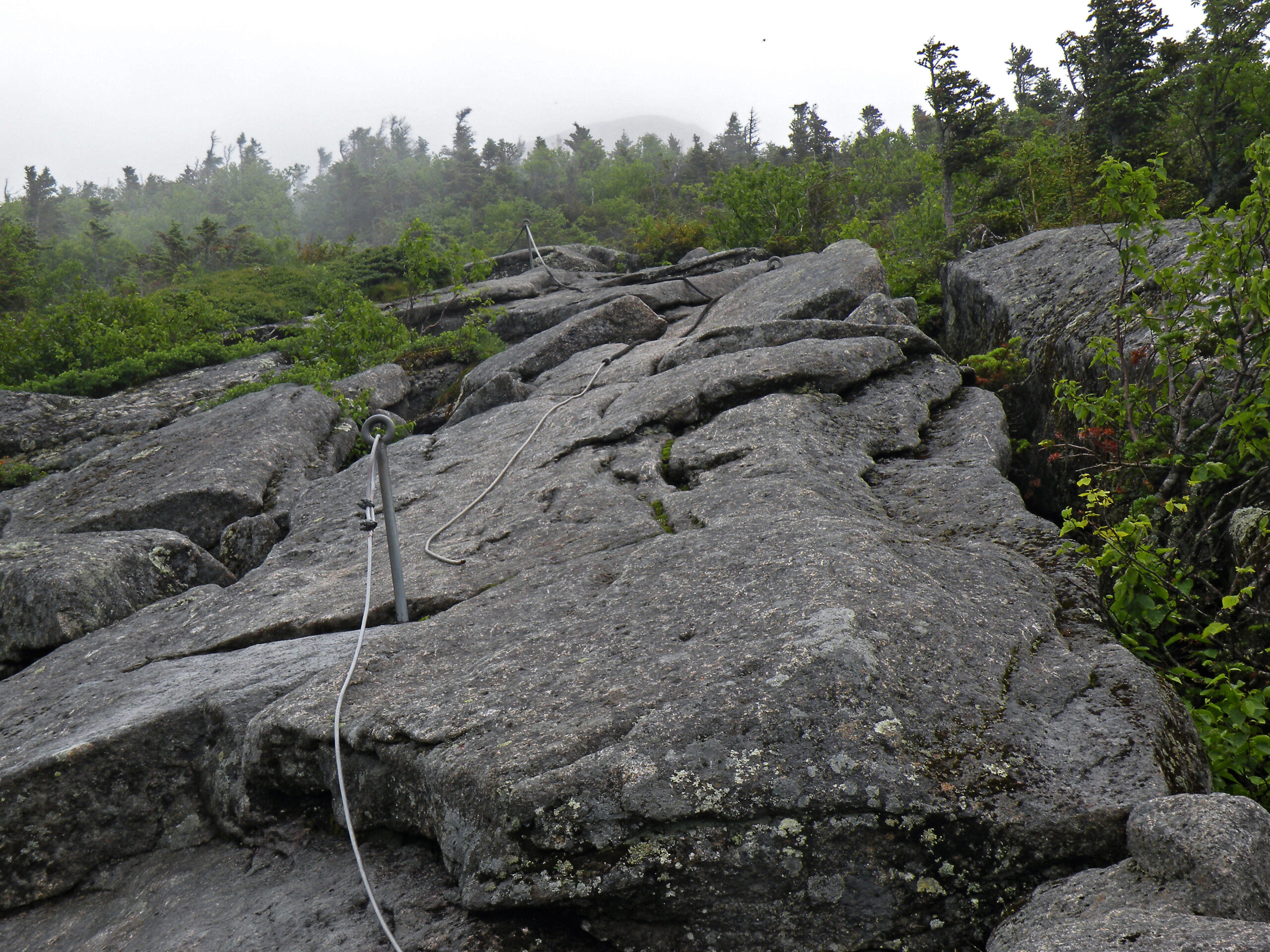
The Adirondacks are made up of hundreds of mountains, but there is no escaping the observation that the High Peaks exhibit more jagged profiles than their less-lofty brethren. The slopes are steeper, and more prone to landslides. Many of the peaks are scarred by the paths of past landslides, both new and old. While somewhat rare elsewhere in the park, they occur frequently here, where extreme rainfall events can loosen the mountain soils and cause them to lose their grip on the steep bedrock undersurface.
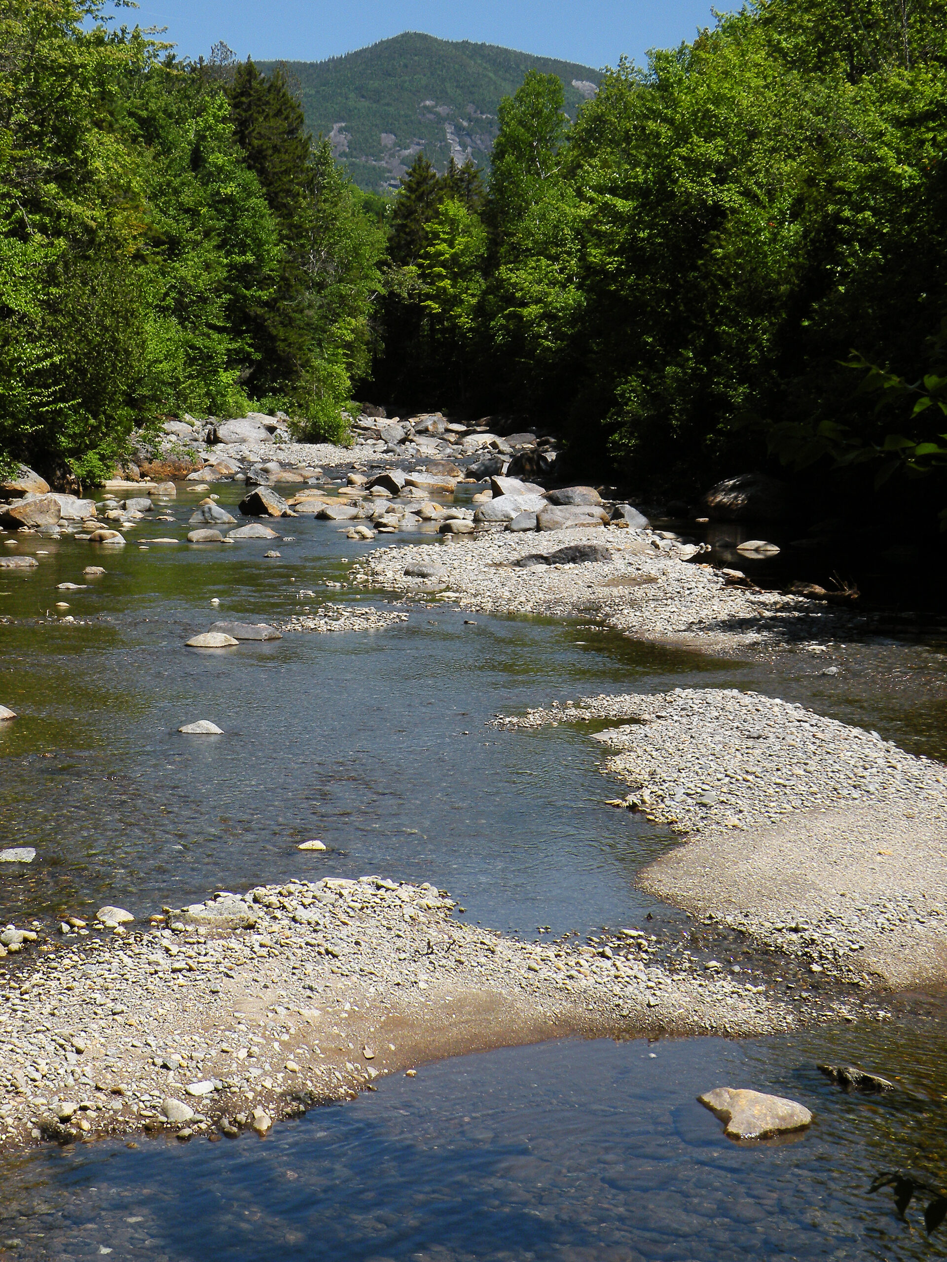
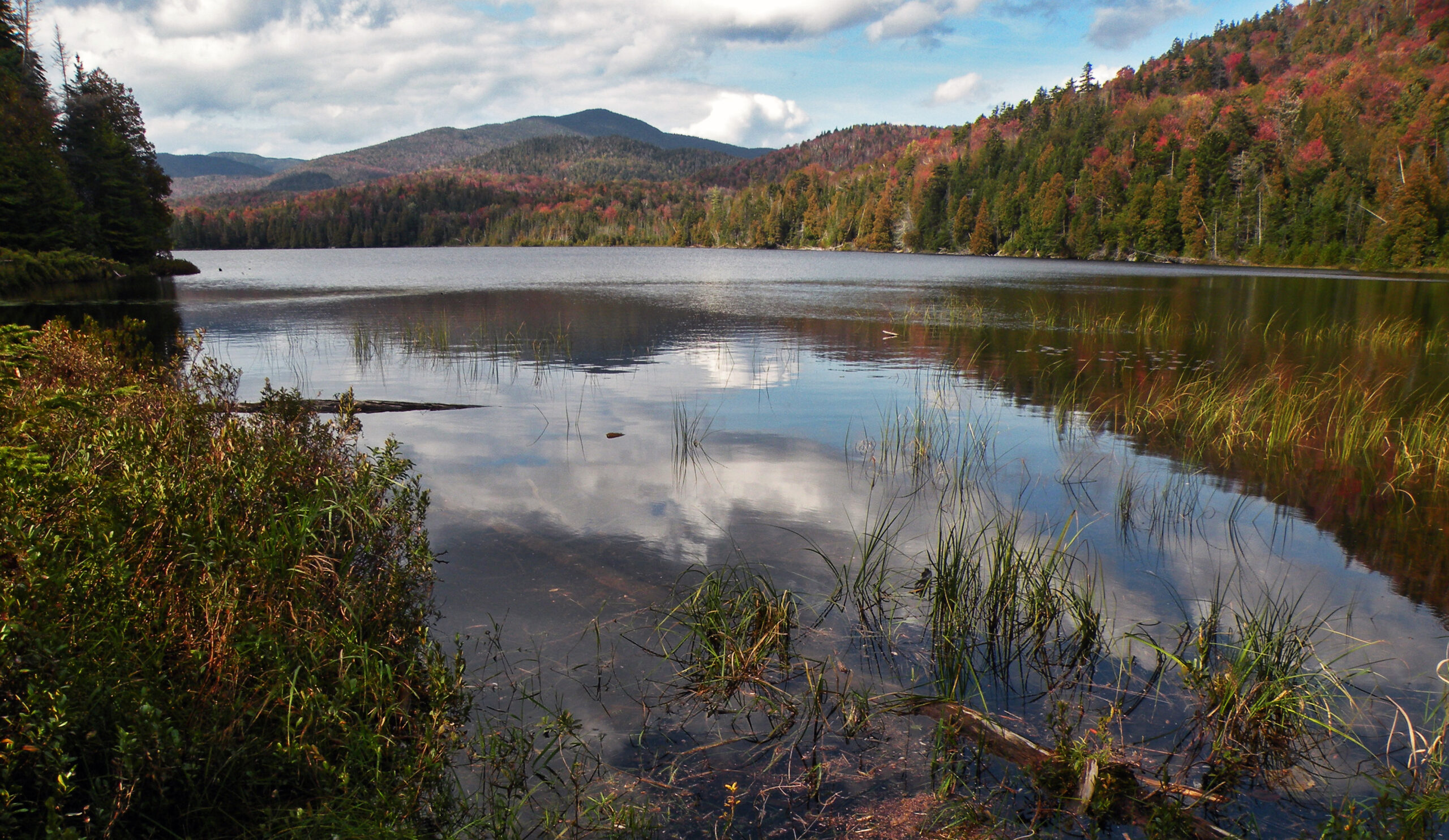
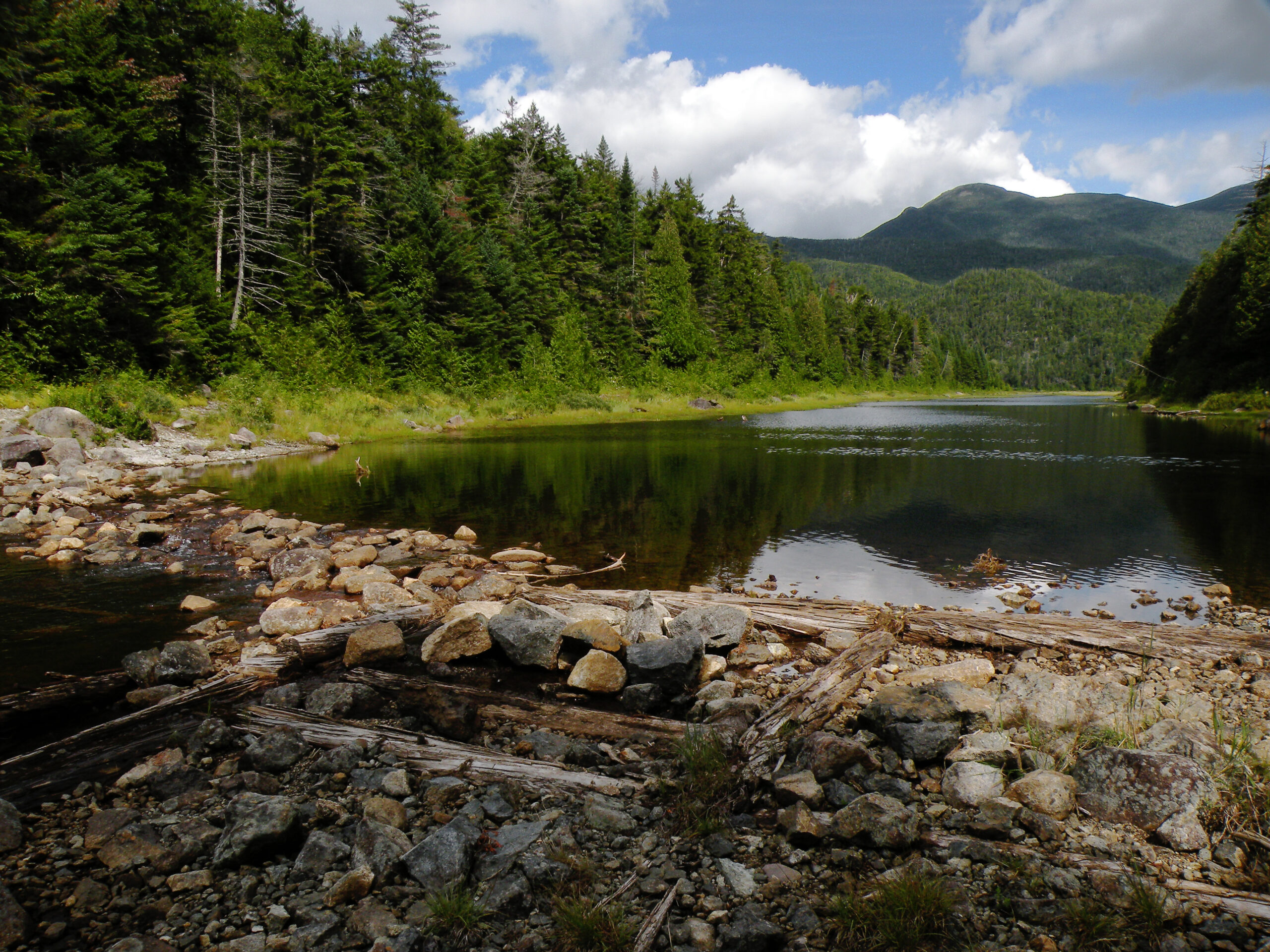
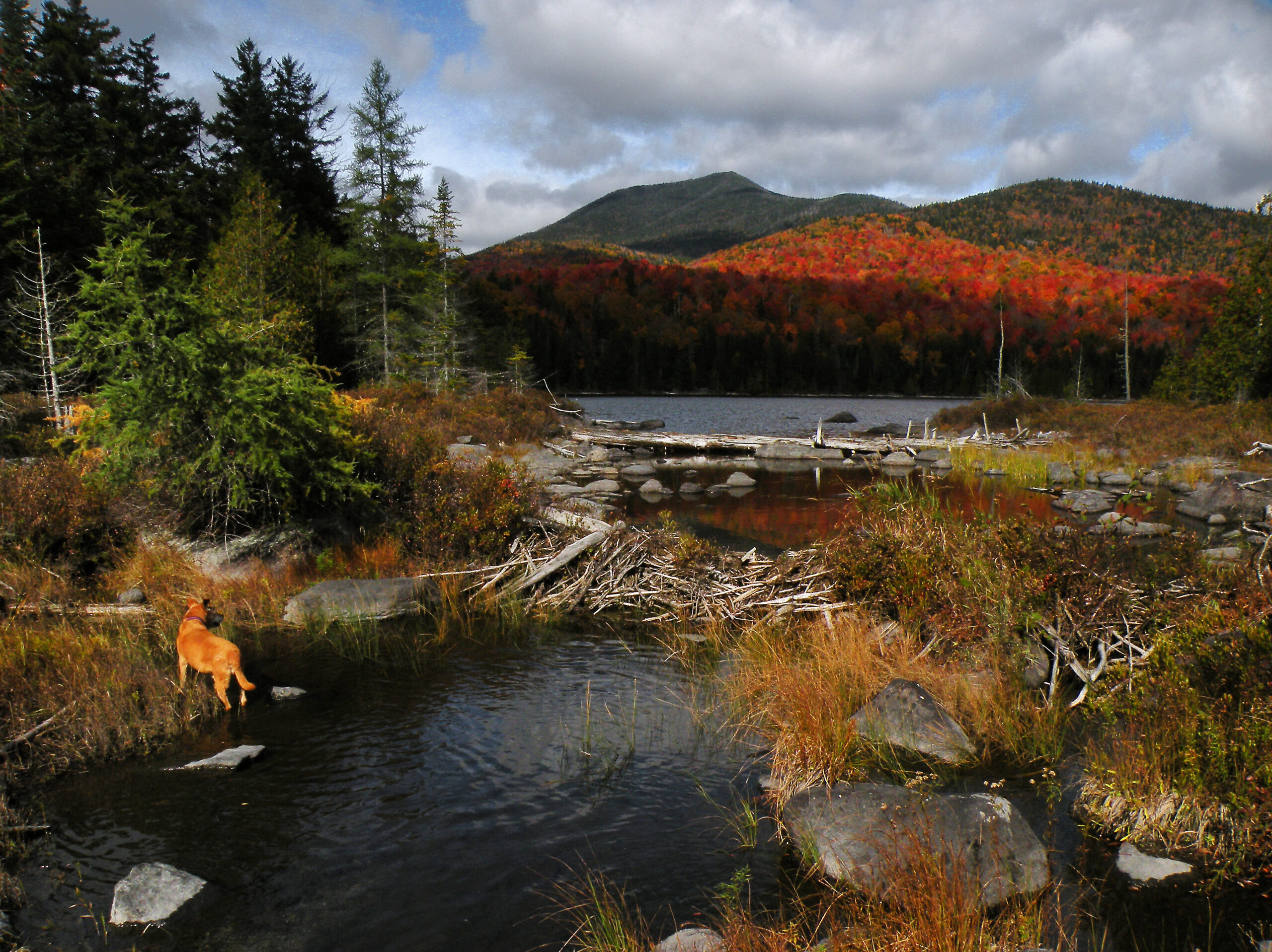
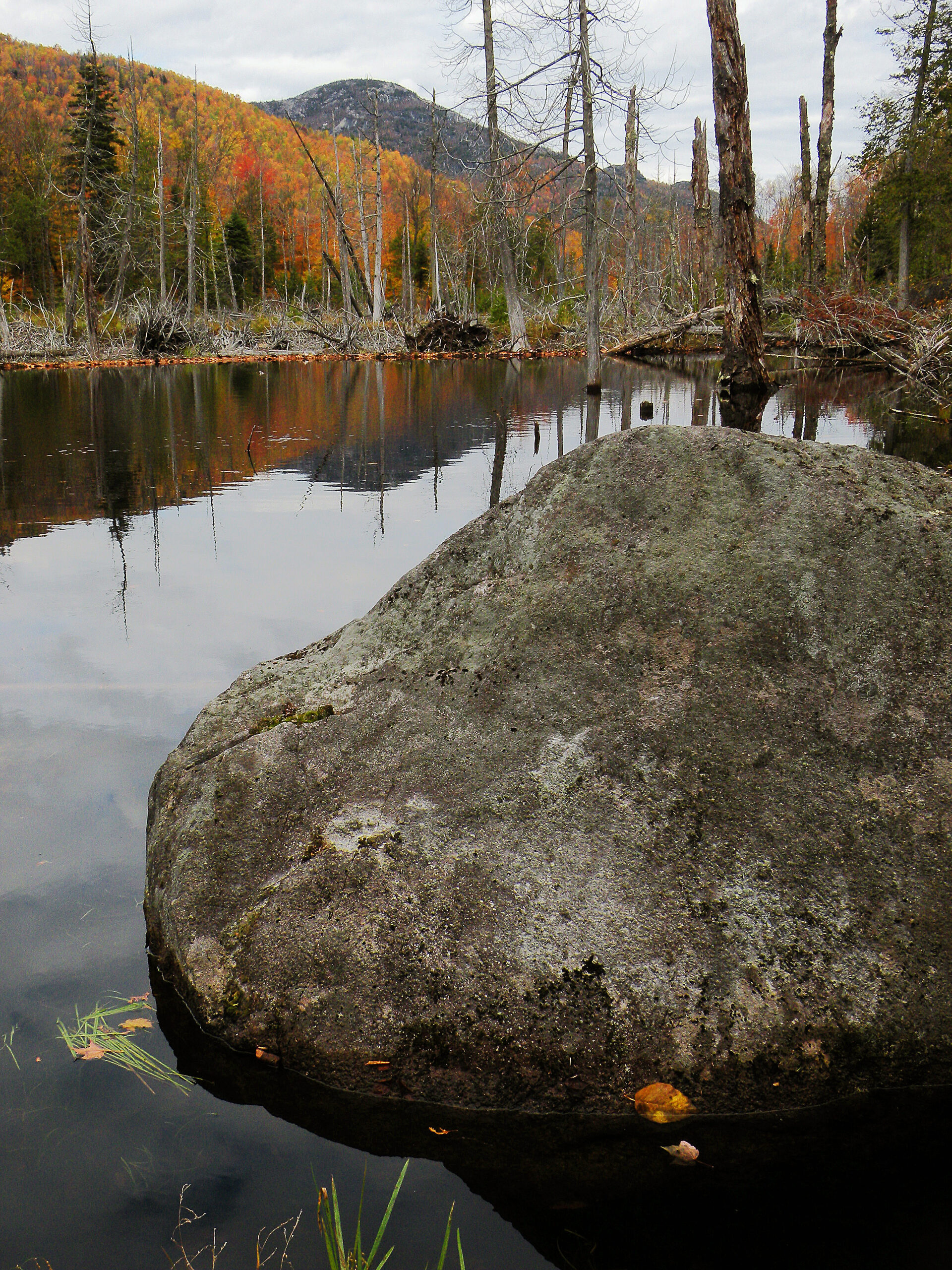
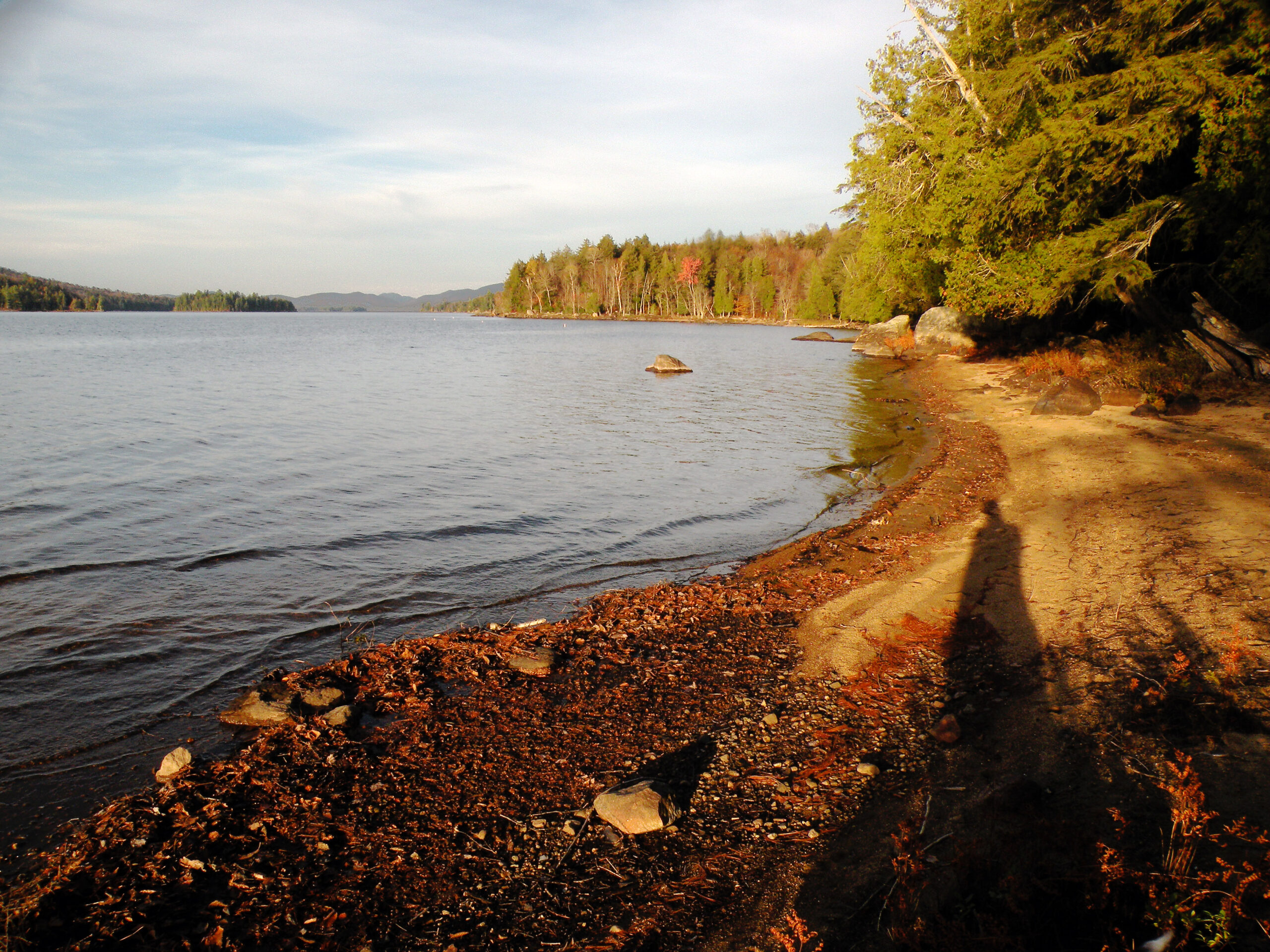
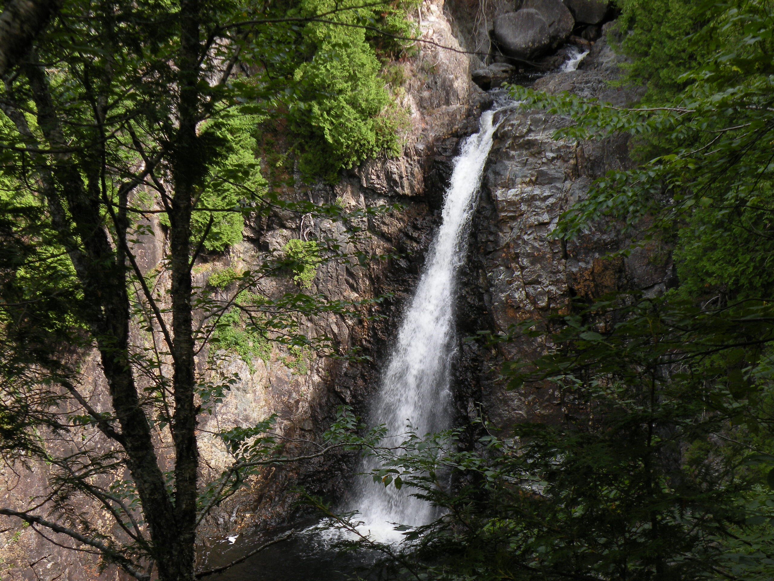
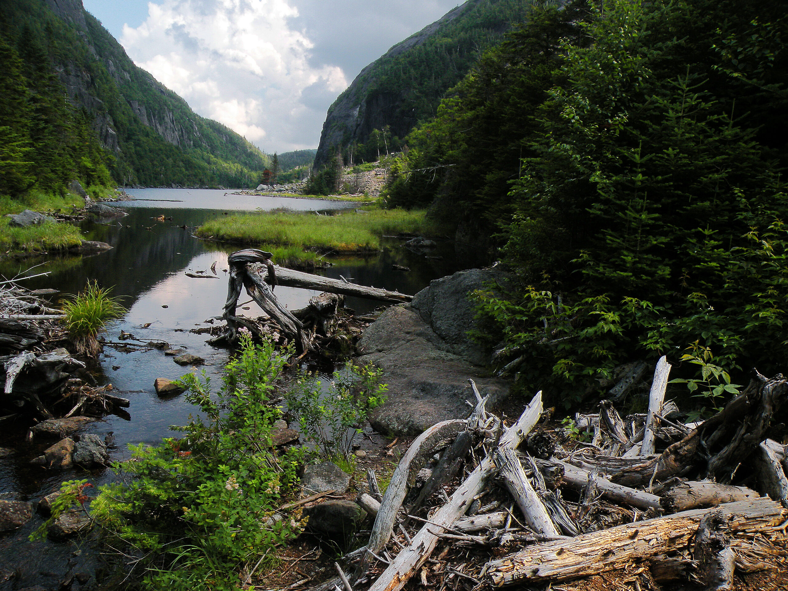
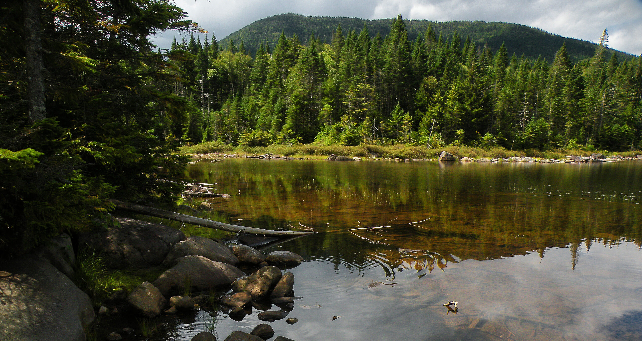
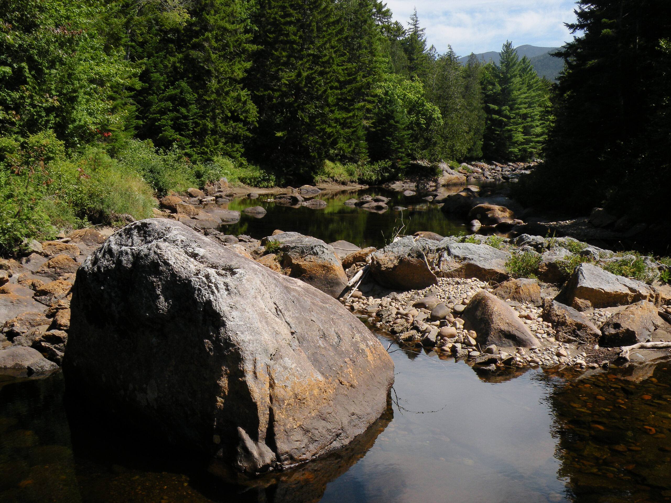
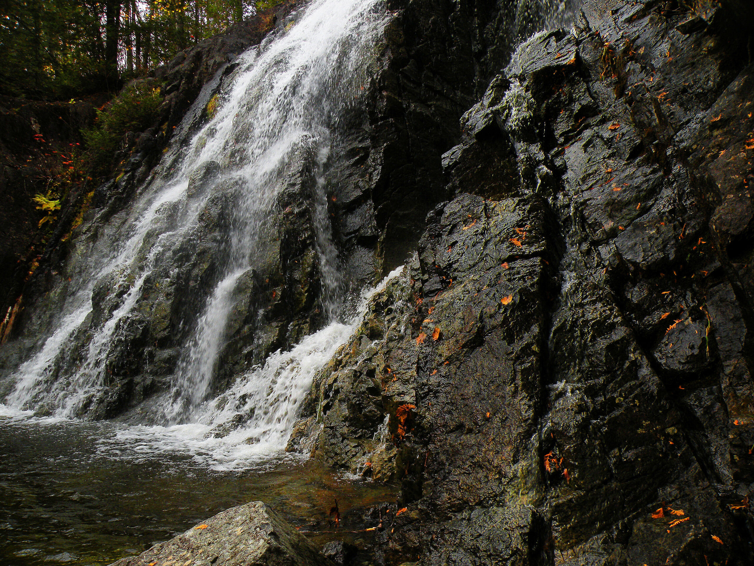
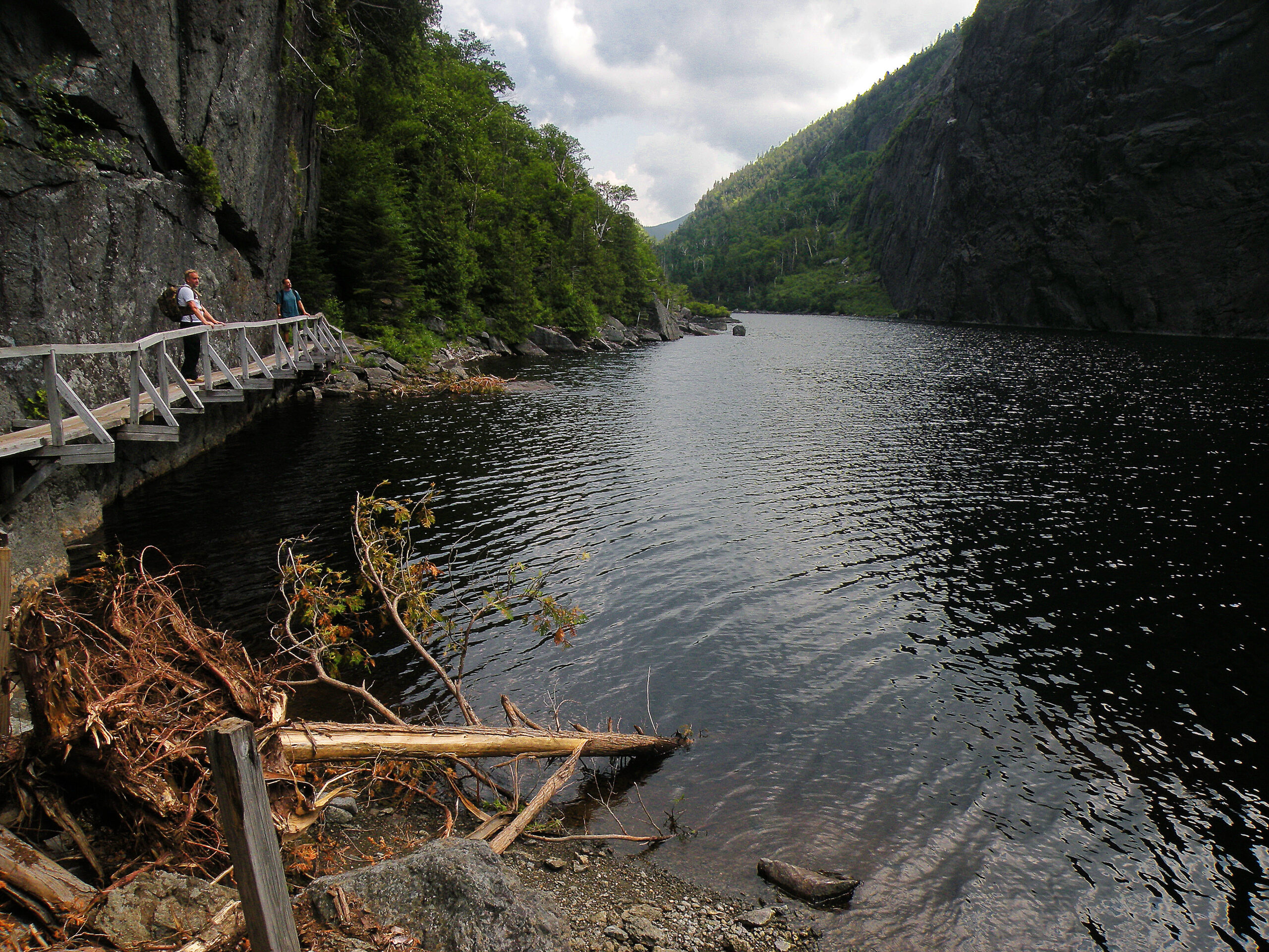
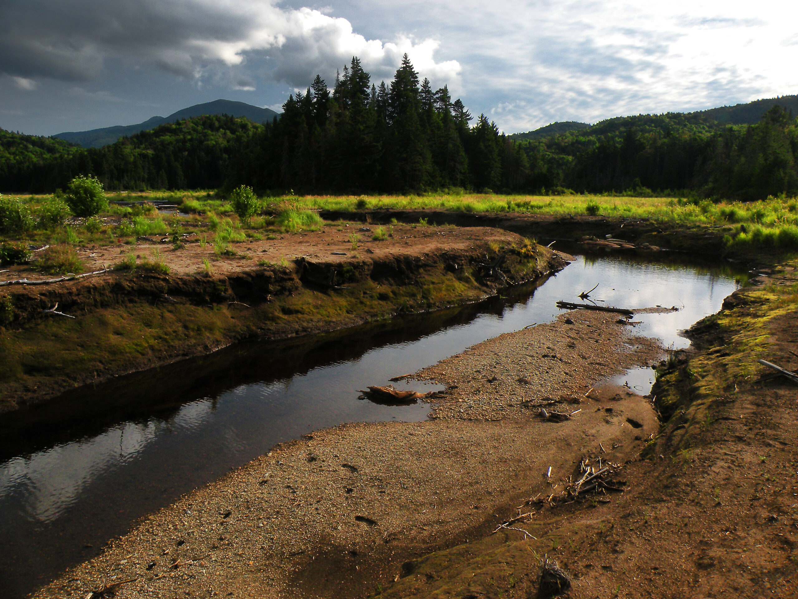
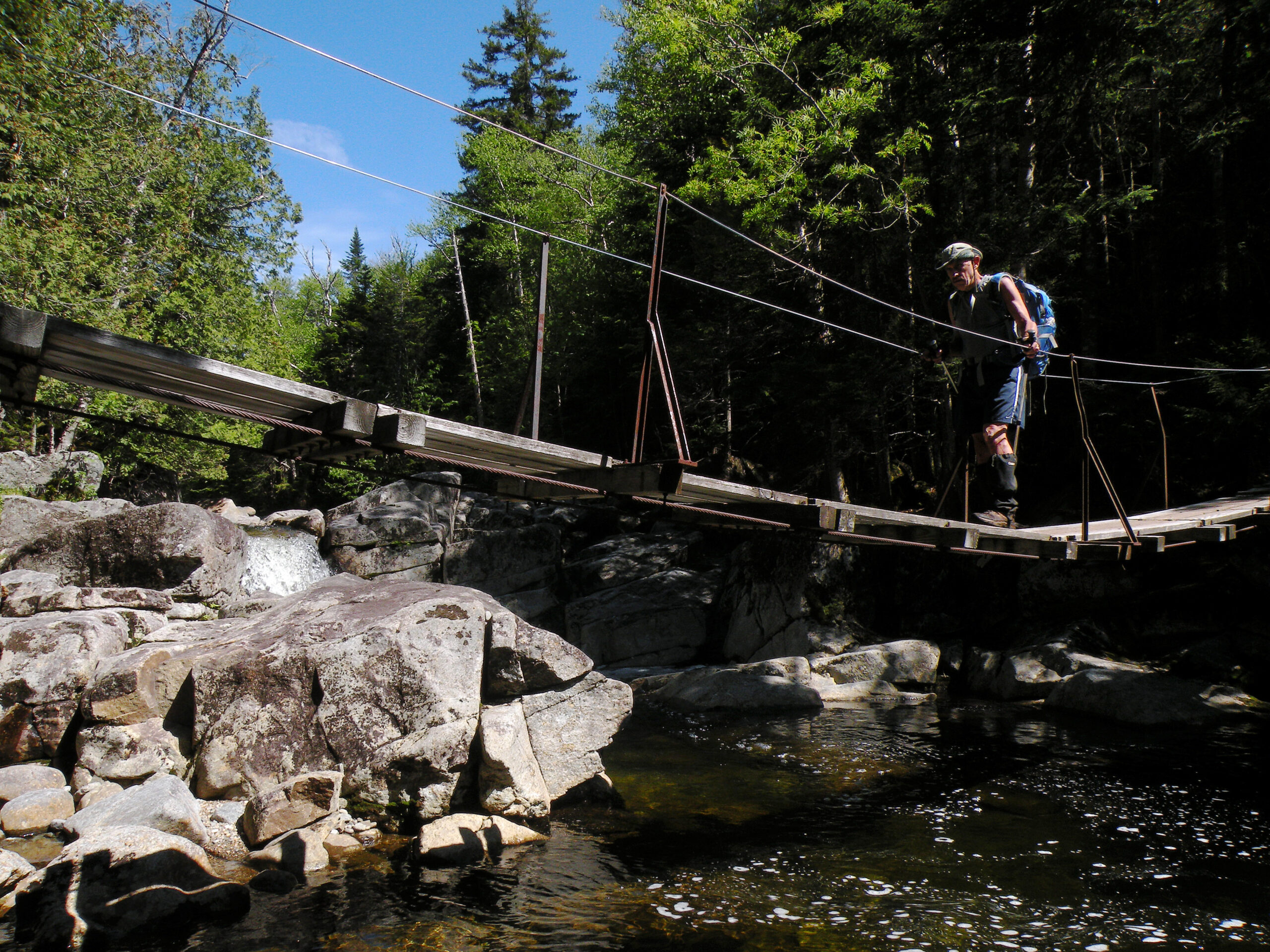
Waters radiate in every direction. The streams tumbling down these anorthosite slopes are clear and cold, lacking the tannins that brown nearly every other Adirondack waterway. Waterfalls are almost dime a dozen; only the most distinctive have names.
It is not until this mountain water reaches the lower elevations that it begins to coalesce into sizable rivers, including the Ausable, Boquet, and Hudson. But if the High Peaks Wilderness can claim proprietary rights to any river, it would be the Cold – the liquid artery of the western half of the wilderness.
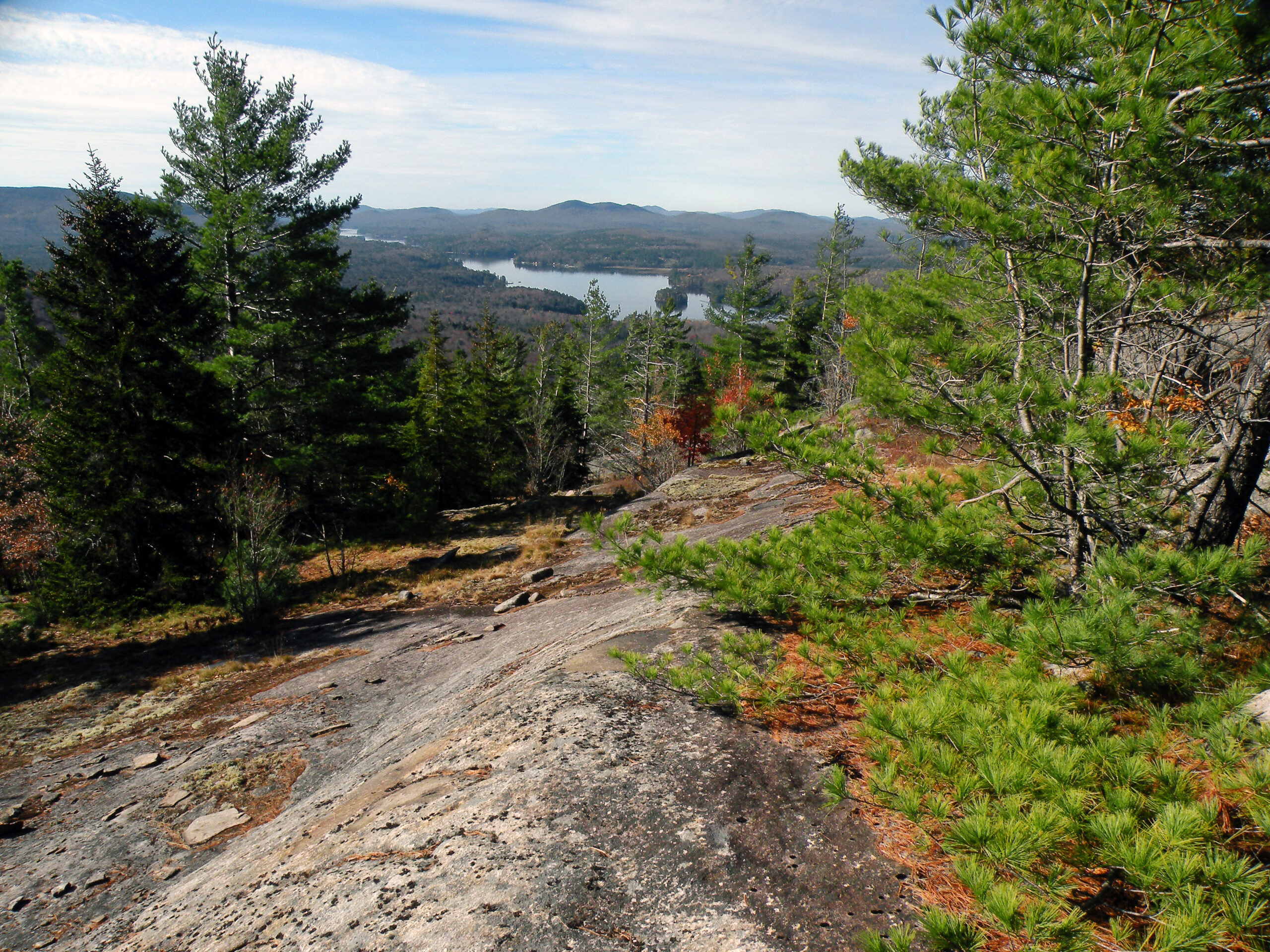
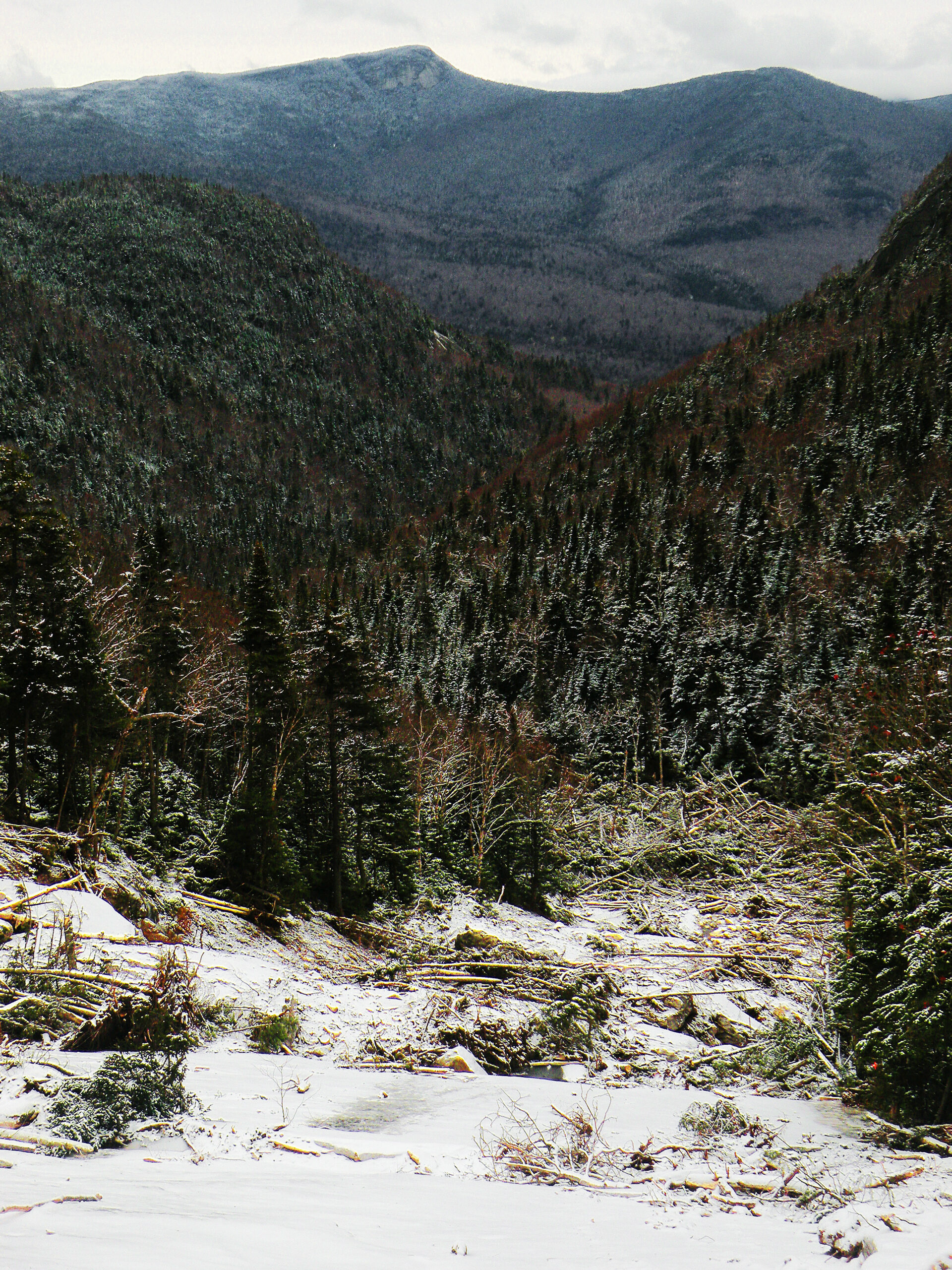
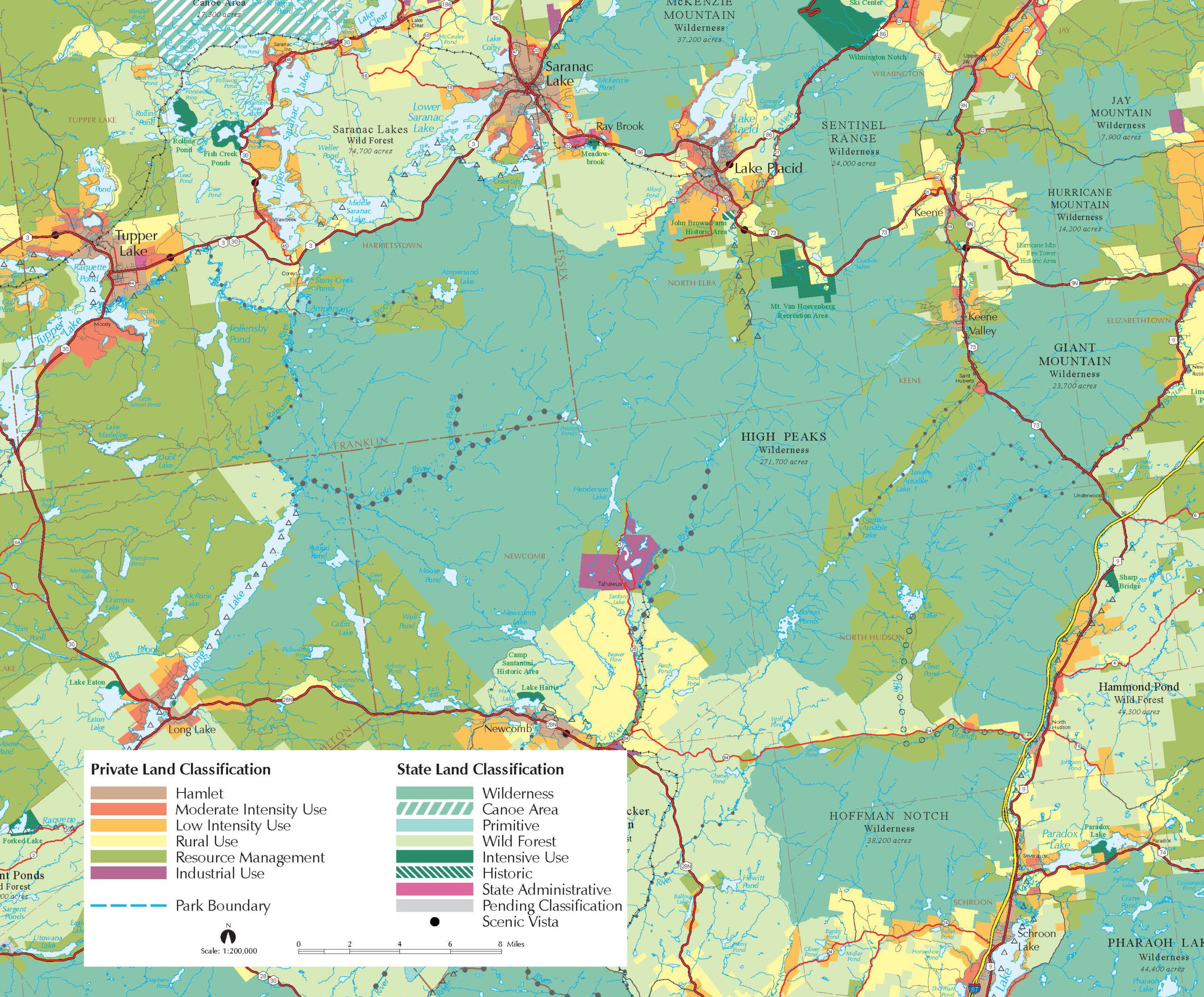
A region just shy of 300,000 acres is large enough to contain a variety of terrain types. The highest peaks are clustered in the east-central portion of the wilderness, with the Dix, Seward, and Santanoni ranges as outliers.
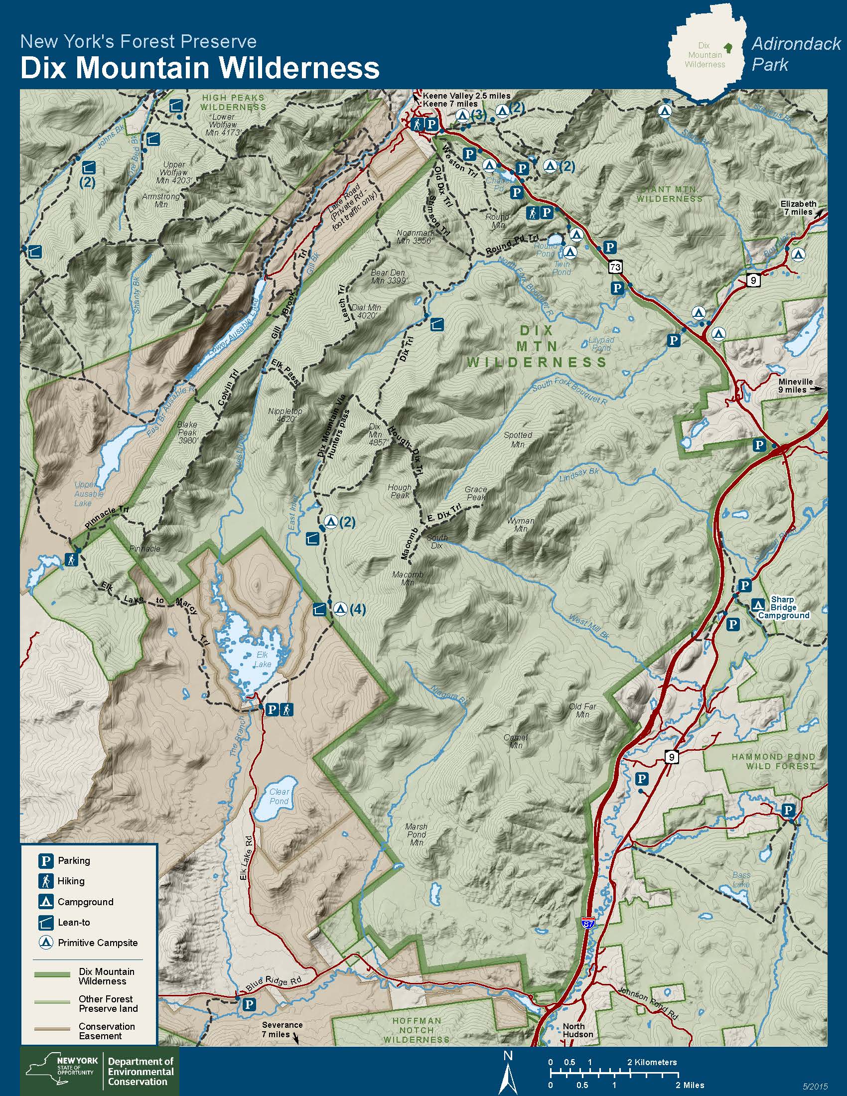
The Dix Range, which used to be the core of its own standalone wilderness until merged with the High Peaks in 2018, trails off into finger-like ridges to the east, bounded only by the Northway’s busy four lanes of traffic. Although heavily burned in 1903 and 1913, this area is every bit as rugged as the popular wilderness core, but its foothills are only seldom visited.
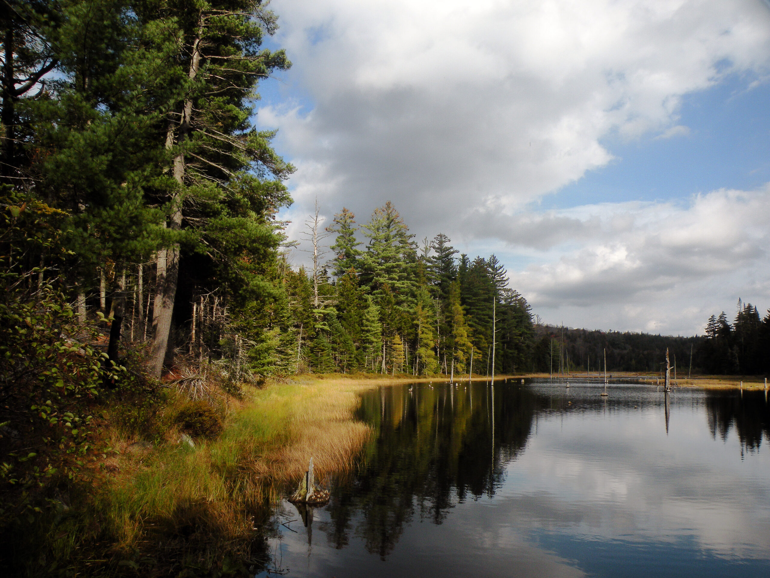
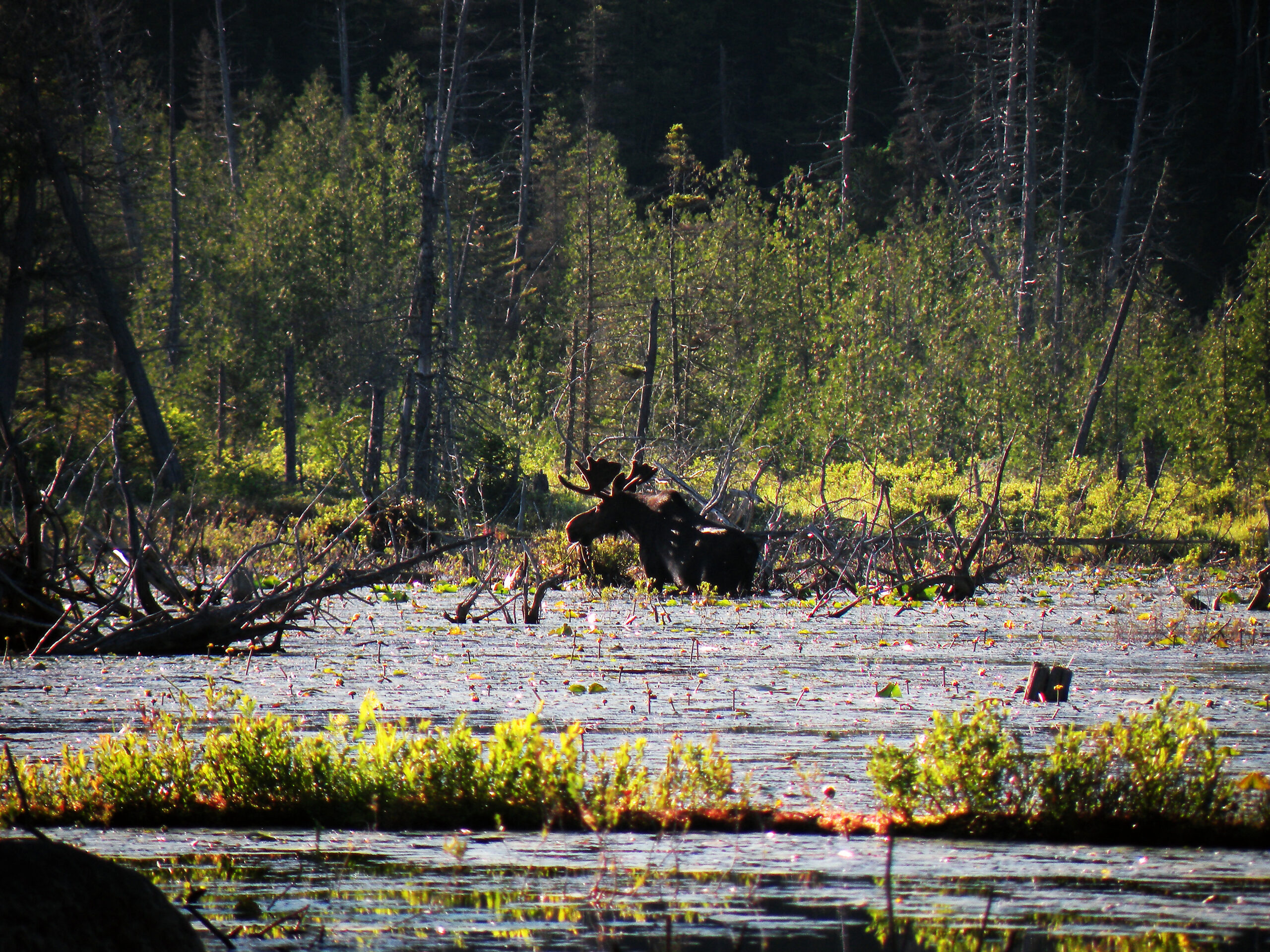
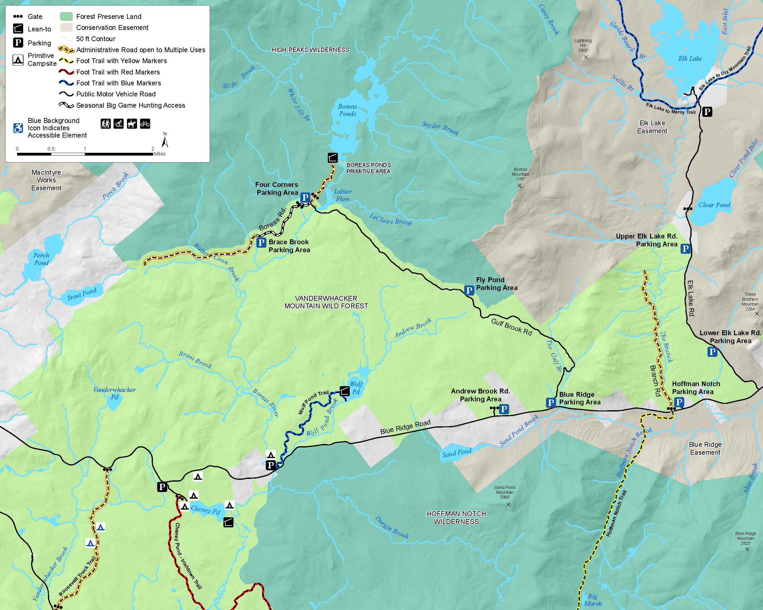
The southern slopes wrap around the vast iron and titanium mine at Upper Works, an unsightly intrusion into the wilderness, but the state’s most recent acquisition efforts have been focused here. Once a landscape of private parks and timberlands, the wilderness boundaries now include generous amounts of wild acreage near Santanoni Mountain and Boreas Ponds. The latter is a dammed body of water, but its vast network of connecting wetlands harbor populations of moose and offer some of the best mountain views of any waterway in the region.
The northern slopes are bounded by the busy (and populated) Tri Lakes Region, and here you will find the most trails – and the most people. This pattern of usage dates back to the late nineteenth century, and it has always been tied to the proximity of transportation routes to – and commercial services in – the surrounding communities. From the north, the mountains seem to rise spontaneously from the “lowlands” around Lake Placid and Saranac Lake.
In contrast to all of these other regions, the western half of the High Peaks Wilderness is vast and secretive. If “remoteness” can be defined as the maximum distance from motor vehicles, then the remotest spot in the state is found near the spot where Ouluska Brook flows into the Cold River. Other than the Seward and Santanoni ranges – the westernmost outposts of the High Peaks – this area is largely unknown. People who have hiked the Northville-Placid Trail along the Cold River may feel they know a thing or two about this area, but the empty spaces between the far-flung trails would be spacious enough to be protected as wilderness on their own merits, if they existed in isolation.
The long western boundary of this wilderness is completely unlike everything to its east. Here you will find a continuous waterway, from Long Lake to Axton Landing on the Raquette River. Nearly all of this is navigable, except for the treacherous rapids and flumes at Raquette Falls.
Click to enlarge
The High Peaks Wilderness has an extremely well-detailed human history, especially within the last two centuries. That story would be much too long to tell in this venue. However, it has been summarized in Bill Ingersoll’s popular post “A Very Brief History of the High Peaks Wilderness.” Follow the link below to read more.
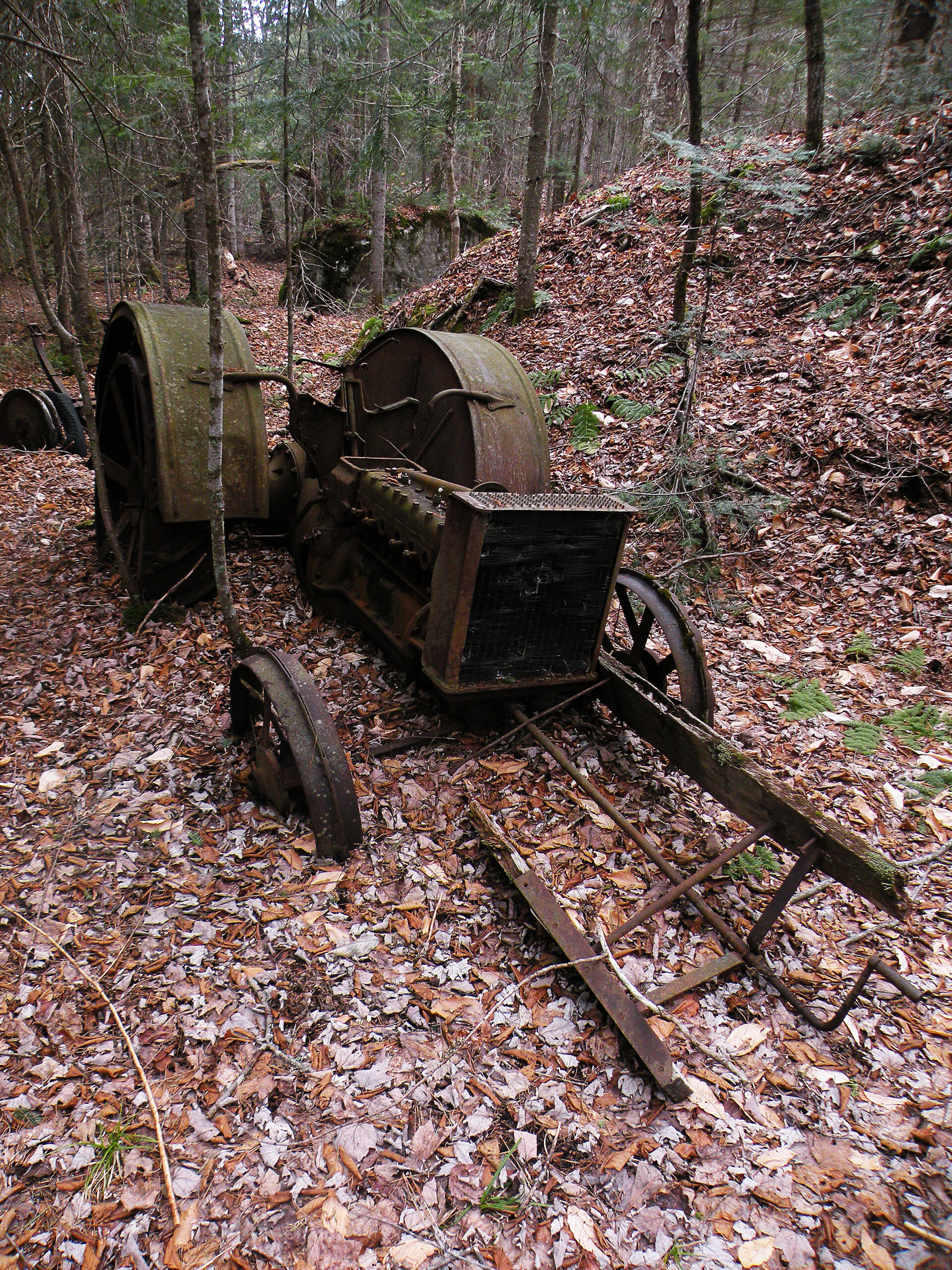
Evidence of human activities can be found throughout the High Peaks Wilderness. While this is certainly a world-class natural area worthy of protection, this does not preclude the fact that people have played a significant role in the area’s use and management, especially within the last two hundred years. As one explores the High Peaks, a variety of “artifacts” might be encountered, from plane wrecks to old dams, from corduroy roads to mechanical equipment.
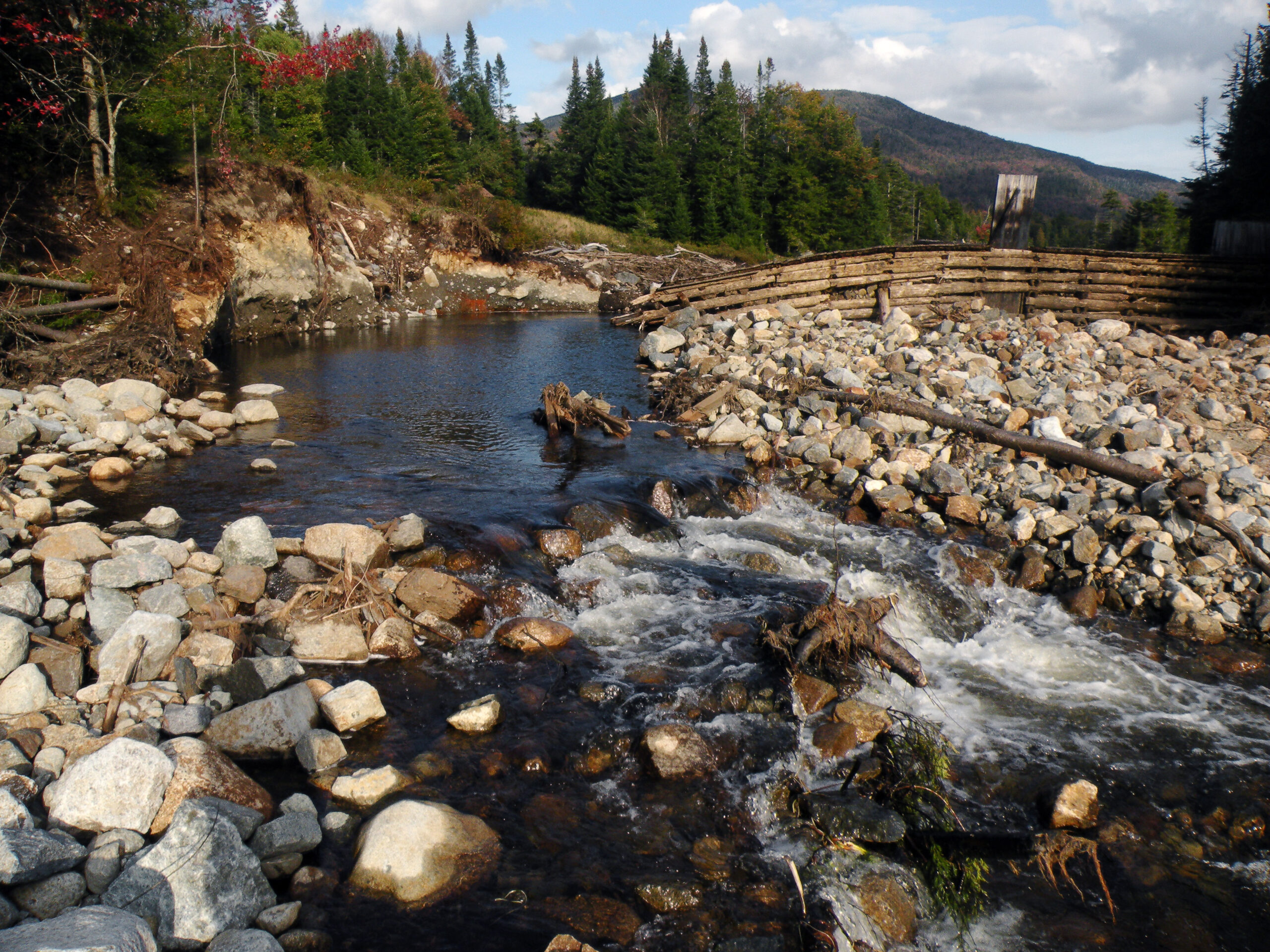
In some cases, these man-made objects have been removed. For instance, in 2011 a tropical storm breached a log dam at Duck Hole and severely damaged its counterpart at Marcy Dam. Both were constructed in the 1930s as conservation projects, replacing prior structures left behind by lumbermen. But today’s conservationists have decided to let nature take its course at both sites, similar to other such long-gone dams at Flowed Lands, Scotts Clearing, and Scott Pond. This leaves the log structure at Lake Colden as the sole survivor. (The modern dams at Henderson Lake, LaBier Flow, and Boreas Ponds have been carved out of the official wilderness boundaries.)
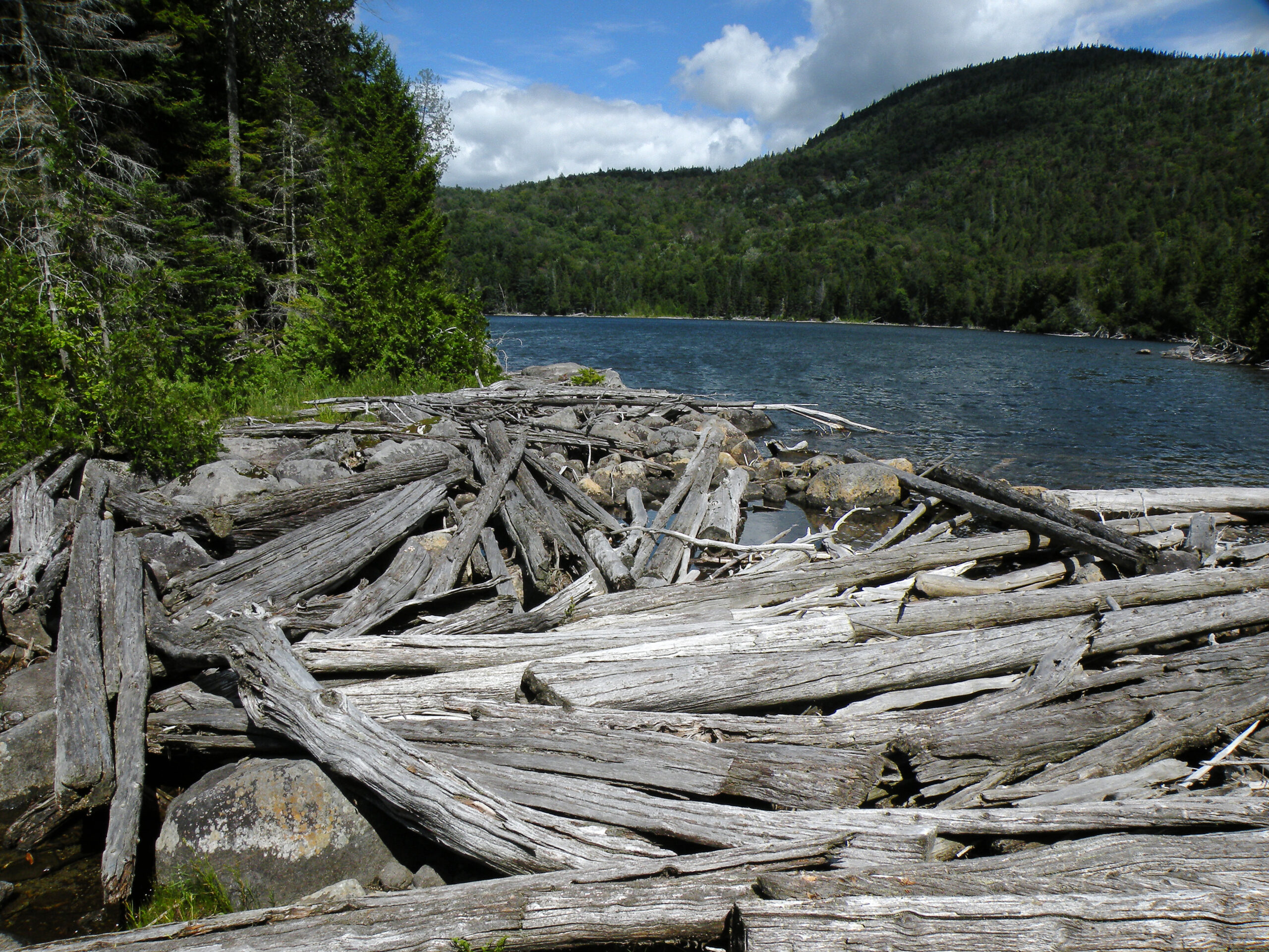
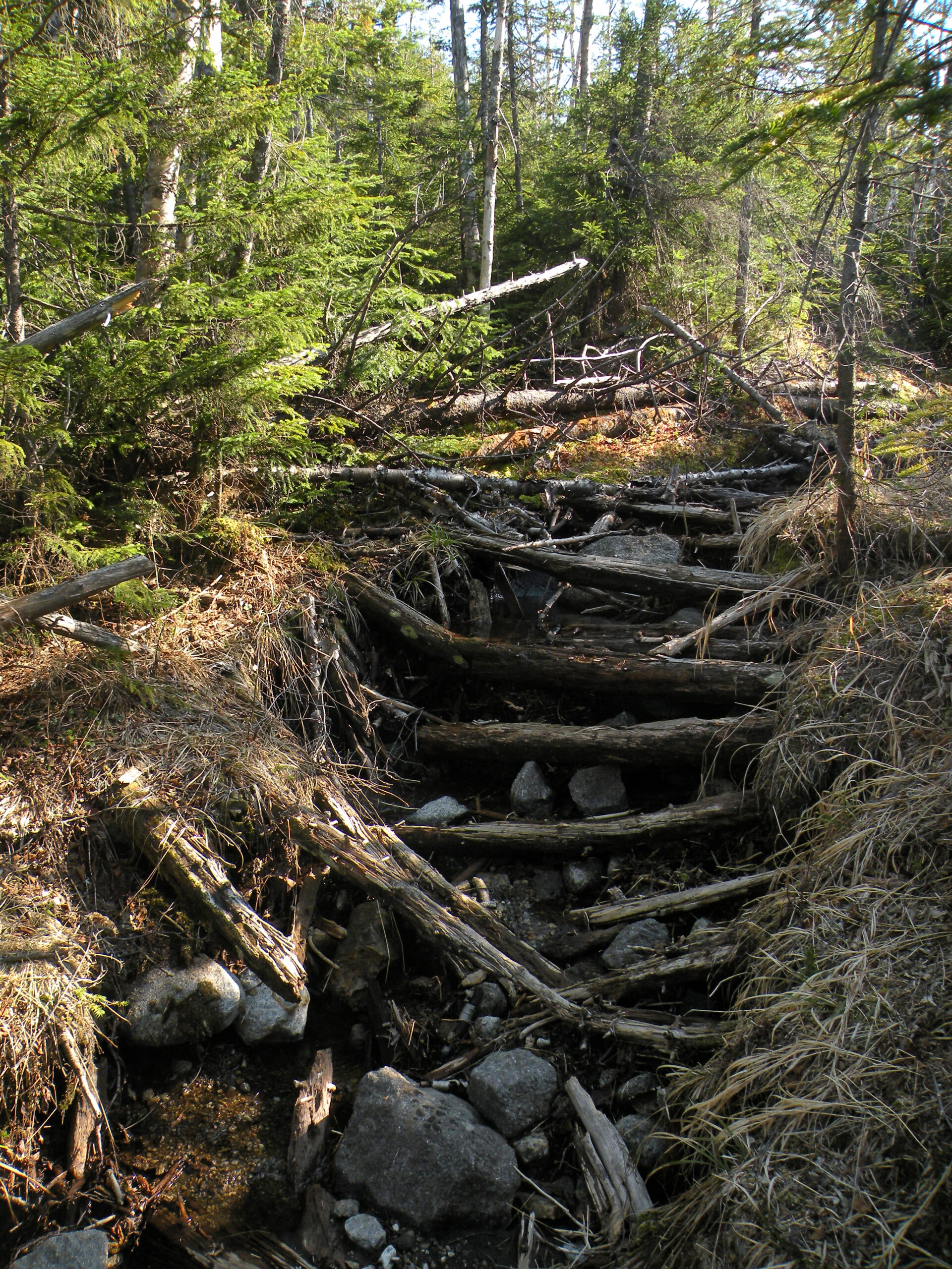
As with many places in the Adirondacks, logging operations covered much of the High Peaks landscape. When seen in the long view, these activities were remarkably brief, but some did occur at substantial elevations. Today the most lasting influence will be the infrastructure they left behind, including some hiking trails still in usage today that can trace their origins to former logging roads. It was once common to see such trails paved in corduroy, but most of these were later reworked as the corduroy failed. A few sections of corduroy trails can still be found, however, including one near Cliff Mountain.
A few wilderness parcels remained in private ownership until very recently, and here the signs of past activities are more pervasive. One peculiar site is the “raft” of abandoned spruce logs beached at the outlet of Lake Andrew; another is the set of mysterious foundations near White Lily Pond in the Boreas Ponds Tract.
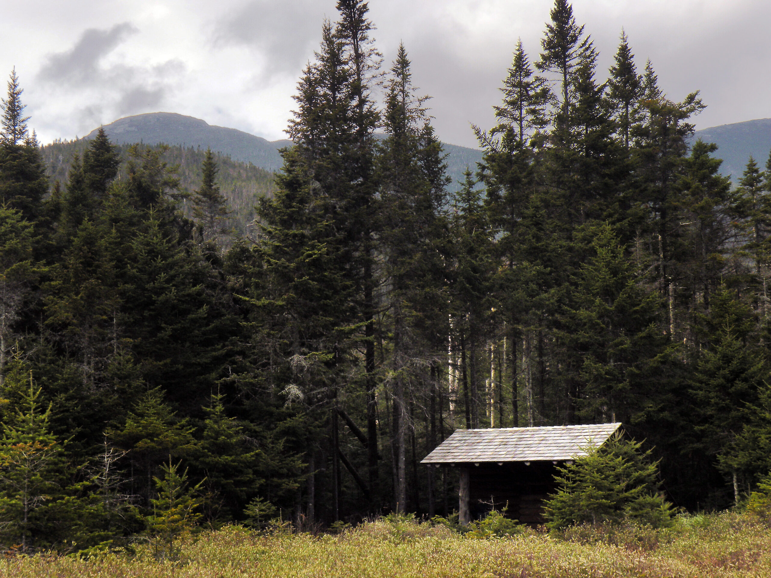
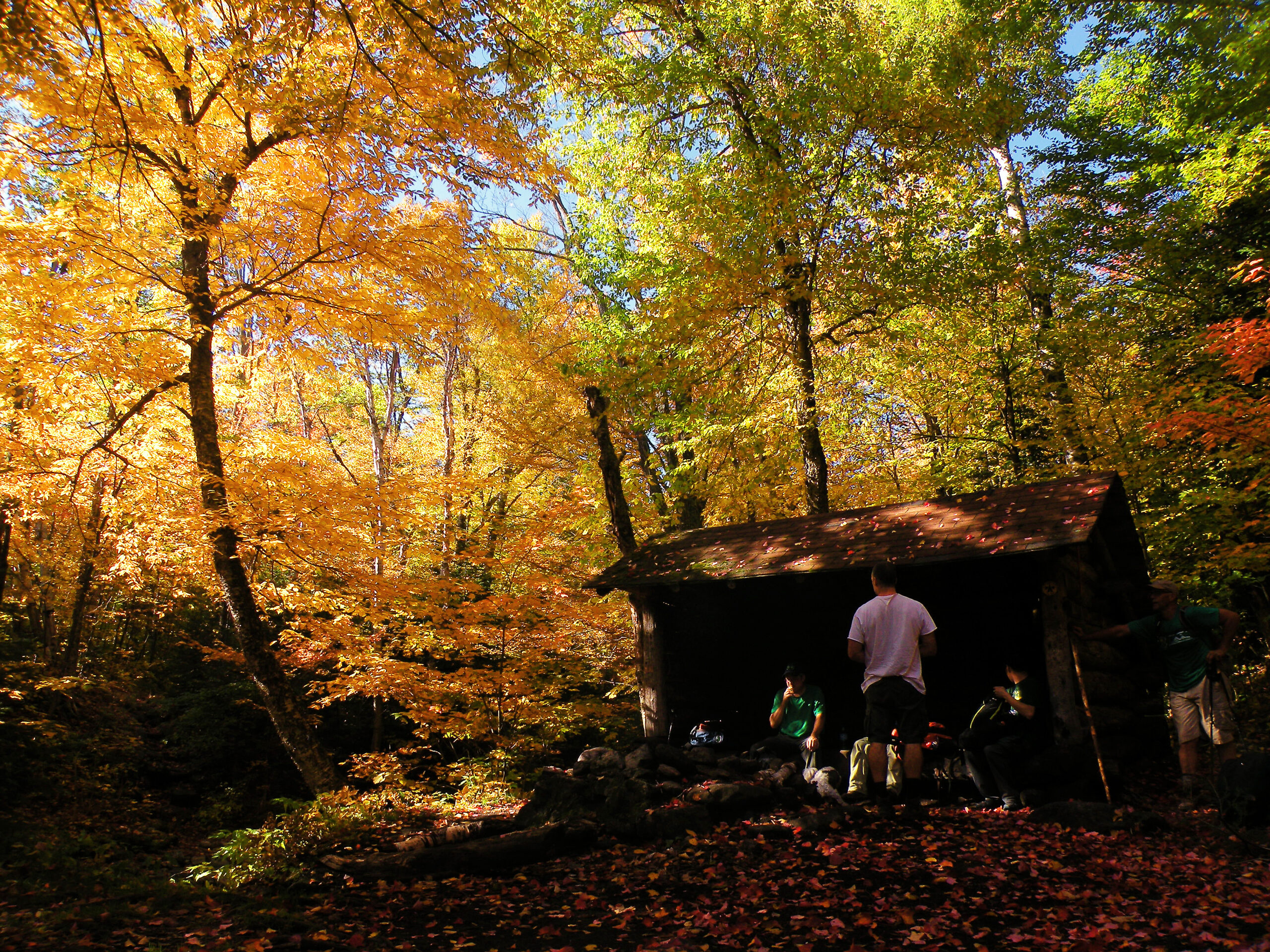
Sometimes a campsite itself is a historical location, marking a spot that has been in use for generations. Although DEC does not permit camping at Slant Rock now, this spot has been a beloved landmark for generations. Some of the lean-tos in the western High Peaks region were lumber camps in a prior age.
This is one of only two wilderness areas in the Adirondack Park with a restored fire tower within its borders. Technically fire towers are one of a long list of structures prohibited in a designated wilderness, therefore technically the Mount Adams fire tower stands on a postage-stamp-sized plot of ground managed by a land trust instead of the state – thus bypassing the ban. Nevertheless, the tower is one of the few historic structures within the High Peaks Wilderness selected for preservation.
So many people visit the High Peaks Wilderness every year – and in every season of every year – that the place hardly needs our help in promoting its presence. Most people already associate this region with mountaineering and its various individual pursuits: hiking, rock and ice climbing, and backcountry skiing. But there is more to this dynamic area than just the blatantly obvious.
Any discussion of the recreational opportunities, though, should start with the reminder that special regulations apply to the most heavily-visited portion of the wilderness between Heart Lake and Upper Works. The full text of those regs can be viewed in another tab on this web page, but the key points to know are:
In the outer regions of the High Peaks Wilderness, such as in the Dix Range or along the Cold River, many of these regulations are currently relaxed – although this could very well change in the near future.
But while this area has a reputation for heavy visitation rates, if not “overuse” as some observers might argue, this is not true of every single acre. Indeed, there are large sections visited by very few people, including an entire mountain range in the north-central region penetrated by no established trails at all. The western half of the High Peaks Wilderness is crisscrossed by a network of long horse trails, some of which see little annual usage.
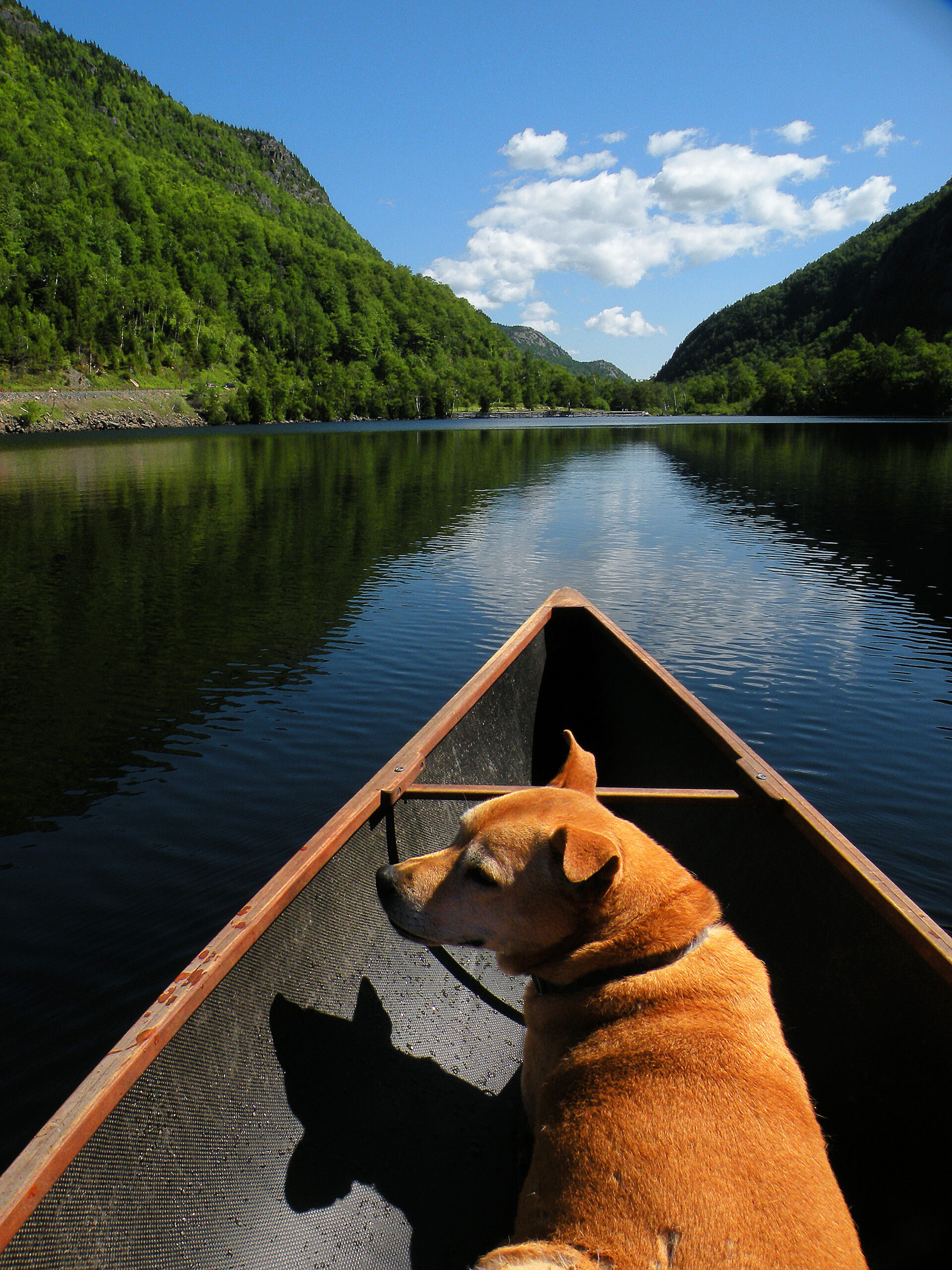
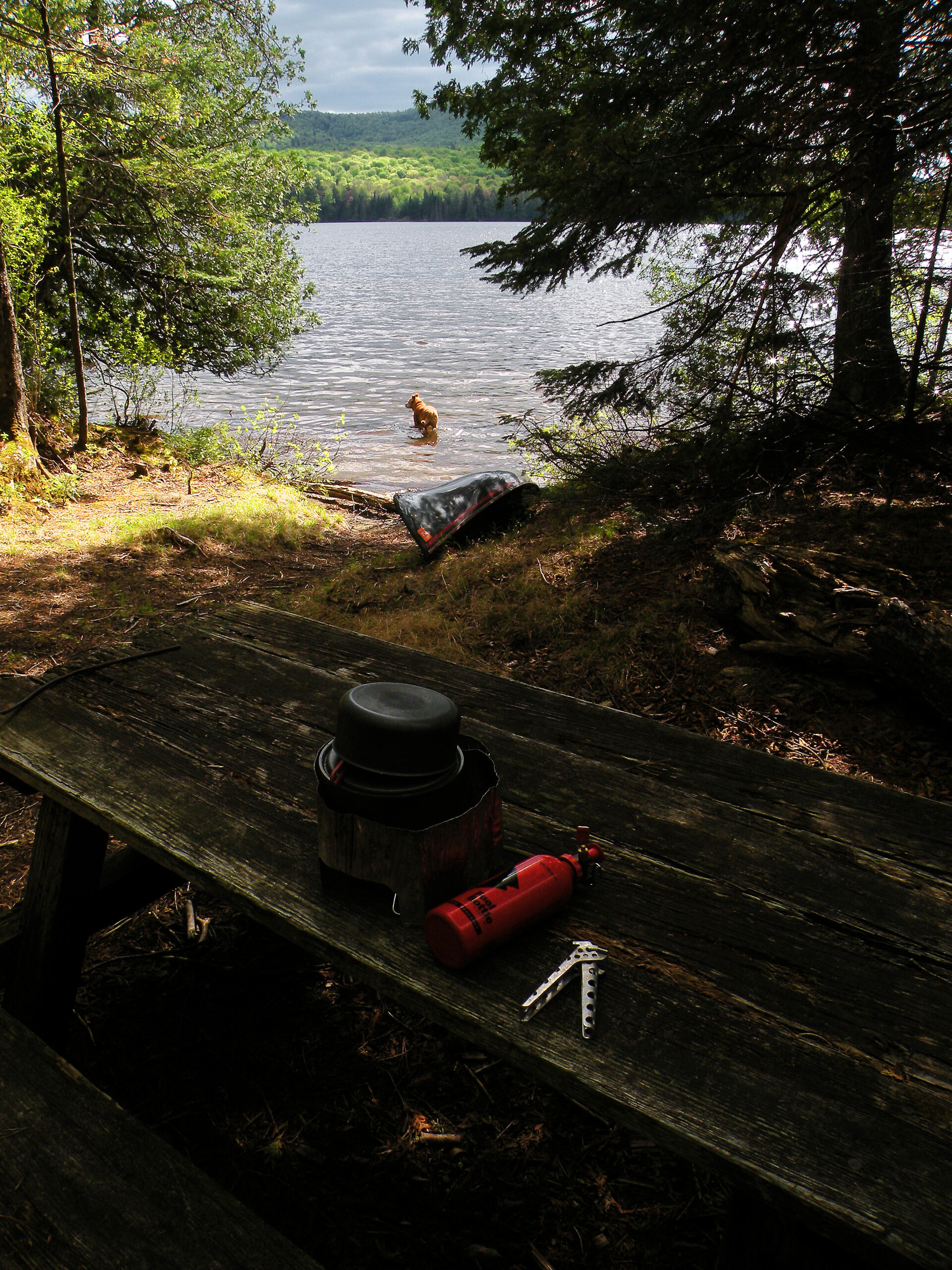
Canoeing is possible at a few peripheral waterways, including the recently-added Boreas Ponds. Hand launches are available at Chapel Pond and the two Cascade Lakes, both of which are roadside attractions hemmed in by tremendously steep slopes. Henderson Lake and the Chubb River offer more satisfactory paddle routes, but the major waterway is Long Lake and the Raquette River, which define the westernmost boundary of the High Peaks Wilderness.
The backpacking options are breathtaking to consider, although lean-tos and campsites can be crowded in the core central region of the wilderness. The bear canister requirement, combined with the ban on campfires, has resulted in a clear preference among many people for day tripping over backcountry camping. Nevertheless, backpackers constitute a significant minority. Such campsites as do exist in the higher elevations tend to be muddy and small – the bare minimum required for pitching a couple tents and setting up a cook stove. In the outer regions of the wilderness, where the regulations are relaxed, backcountry camping can be as pleasant as other regions of the Adirondacks.
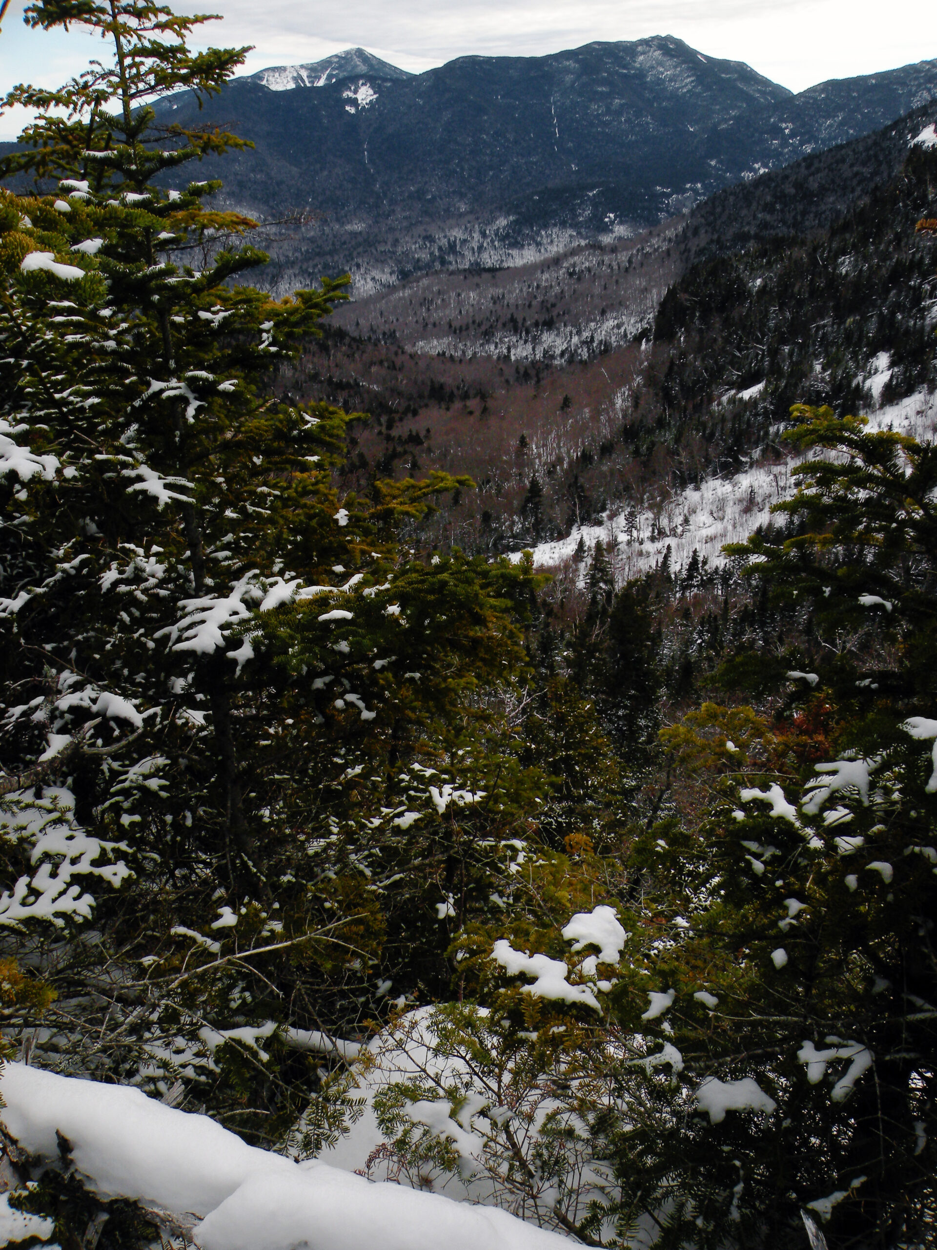
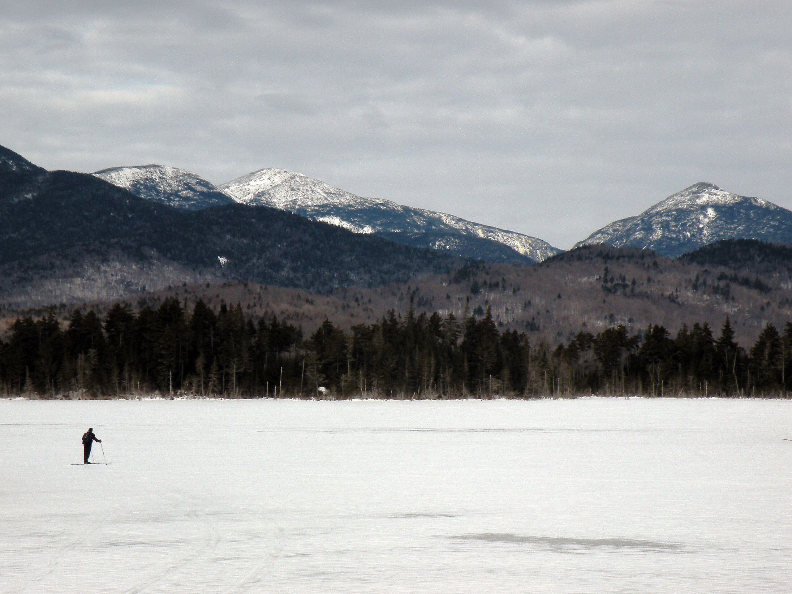
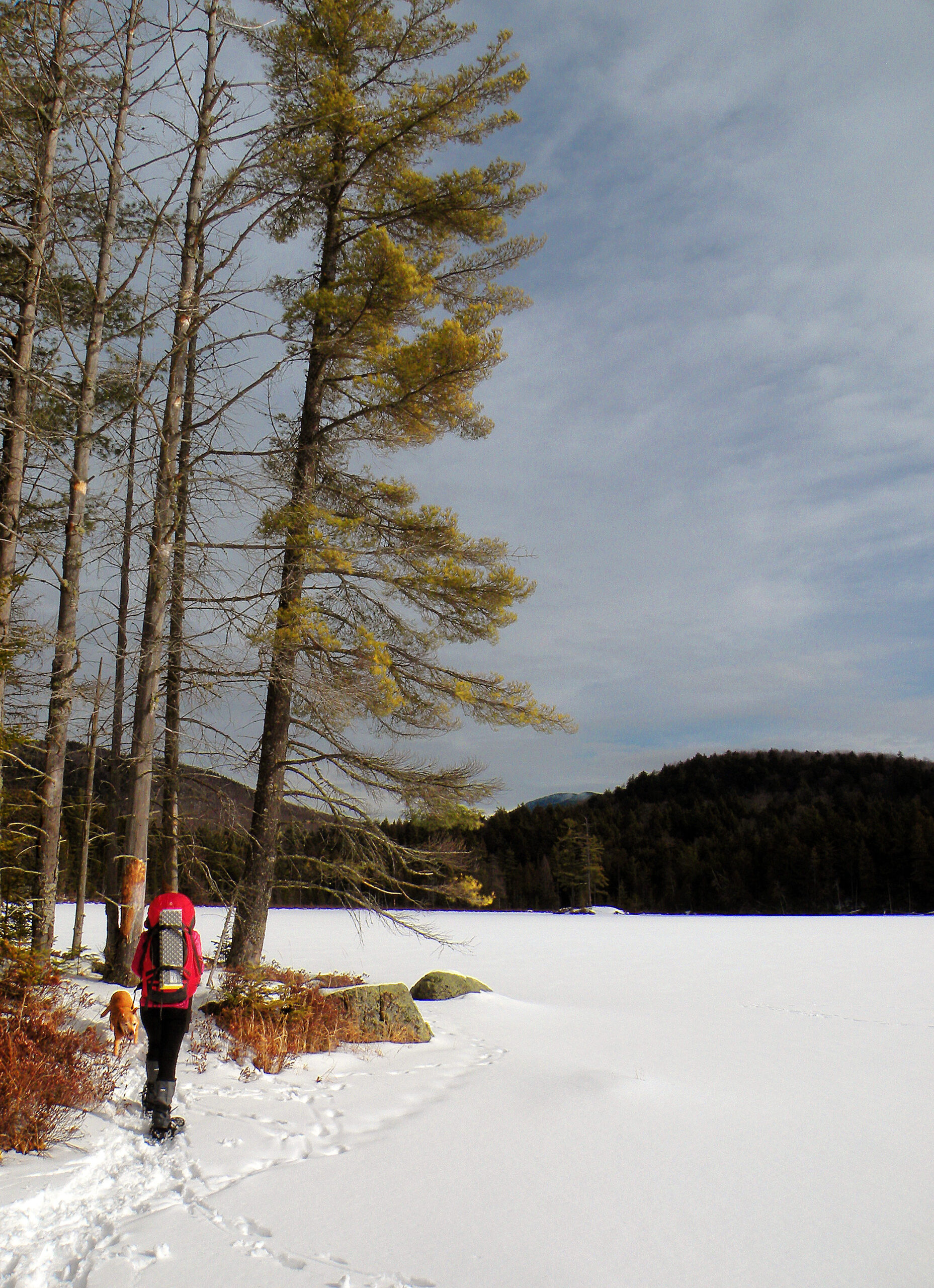
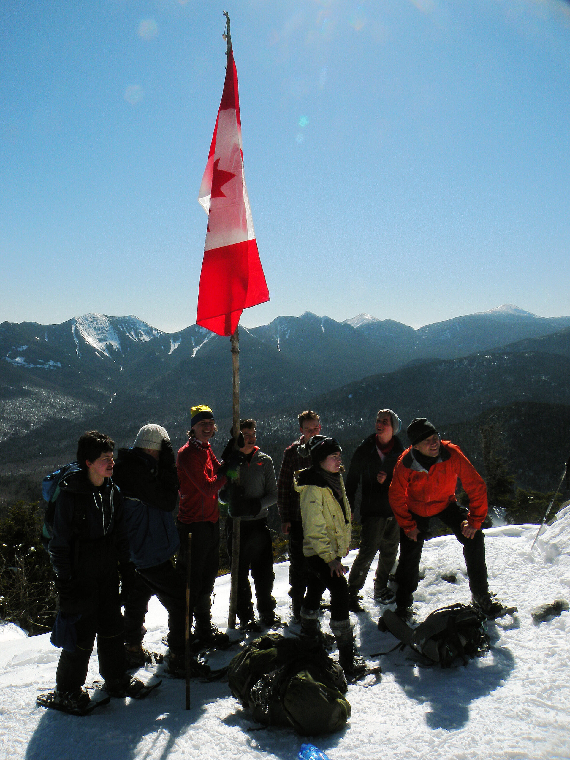
Winter in the High Peaks used to be such an ordeal that few people attempted to climb the mountains; indeed, the 46-ers started a separate list to record the achievements of those intrepid mountaineers willing to brave the near-Arctic conditions. Over the last several decades, however, a proliferation of updated winter equipment has democratized this season, making the trails only somewhat less busy than the summer and fall.
Nevertheless, a changing climate has led to longer shoulder seasons with intimidating amounts of ice build-up on the mountain trails, while still retaining a prolonged period of bone-chilling temperatures and deep snows in between. People die here. Others cheat death, but only because of the presence of a top-rate ranger service capable of pulling off incredible rescues. More than any other Adirondack wilderness, preparedness and physical fitness are crucial to accessing this area in winter – and enjoying the experience.
The number of rock and ice climbers has also increased, resulting in a human presence that seems capable of occupying every corner of the wilderness. Whether or not individual visitors see these numbers as either evidence of “crowded conditions” or simply as “normal and expected” seems beside the point; the observable results are seasonal stewards hired to patrol the summits and protect the alpine flora, a black bear population that routinely learns to equate hiking backpacks with sources of food, a massive building project to harden eroded mountain trails with wooden ladders, and evidence that all of this preserved habitat is nevertheless failing some fussy wildlife species.
Click to enlarge
Beyond a doubt, managing the High Peaks Wilderness is not so much about managing a landscape of trees and rocks, but about managing the people who come to scramble among them.
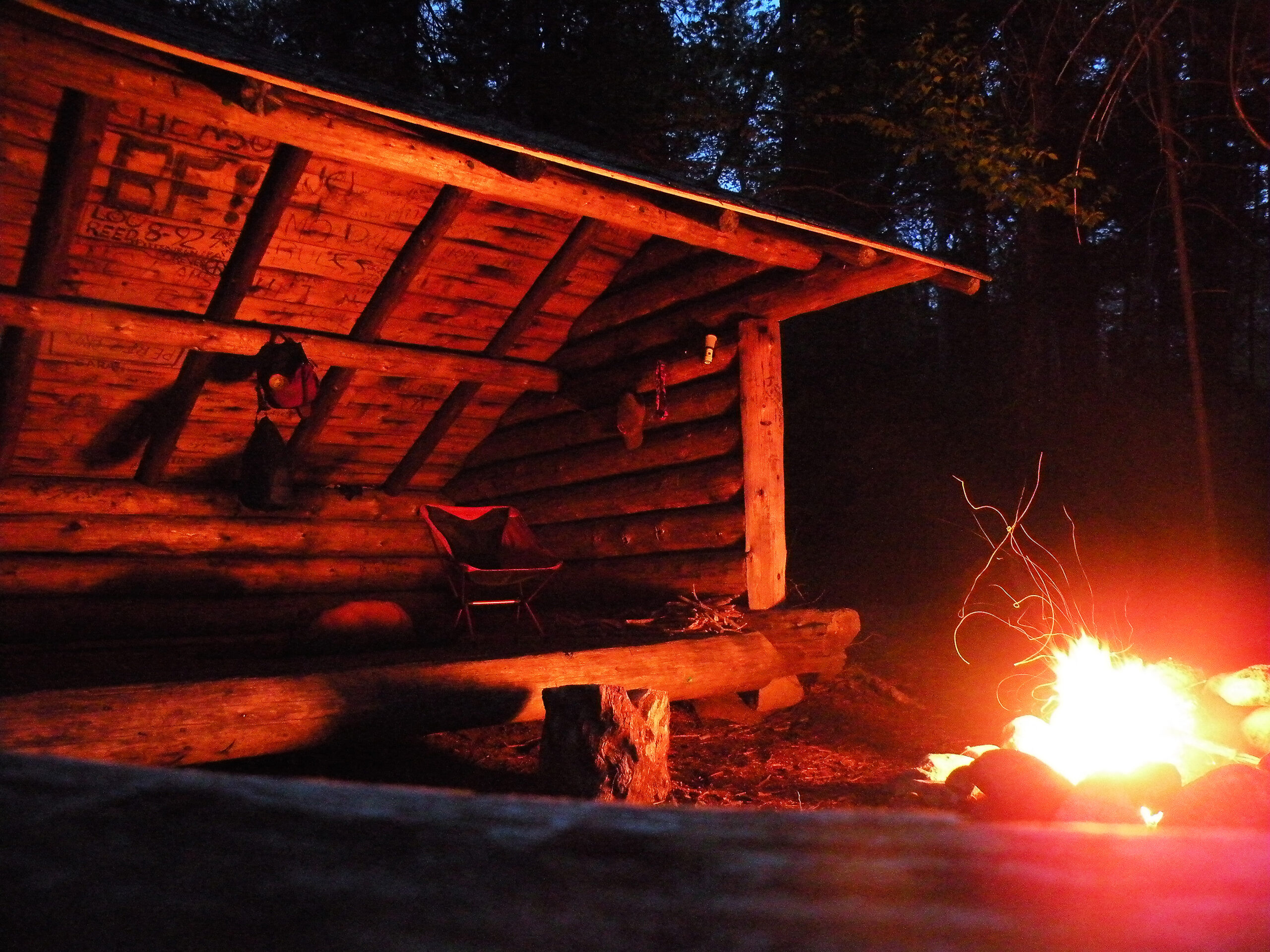
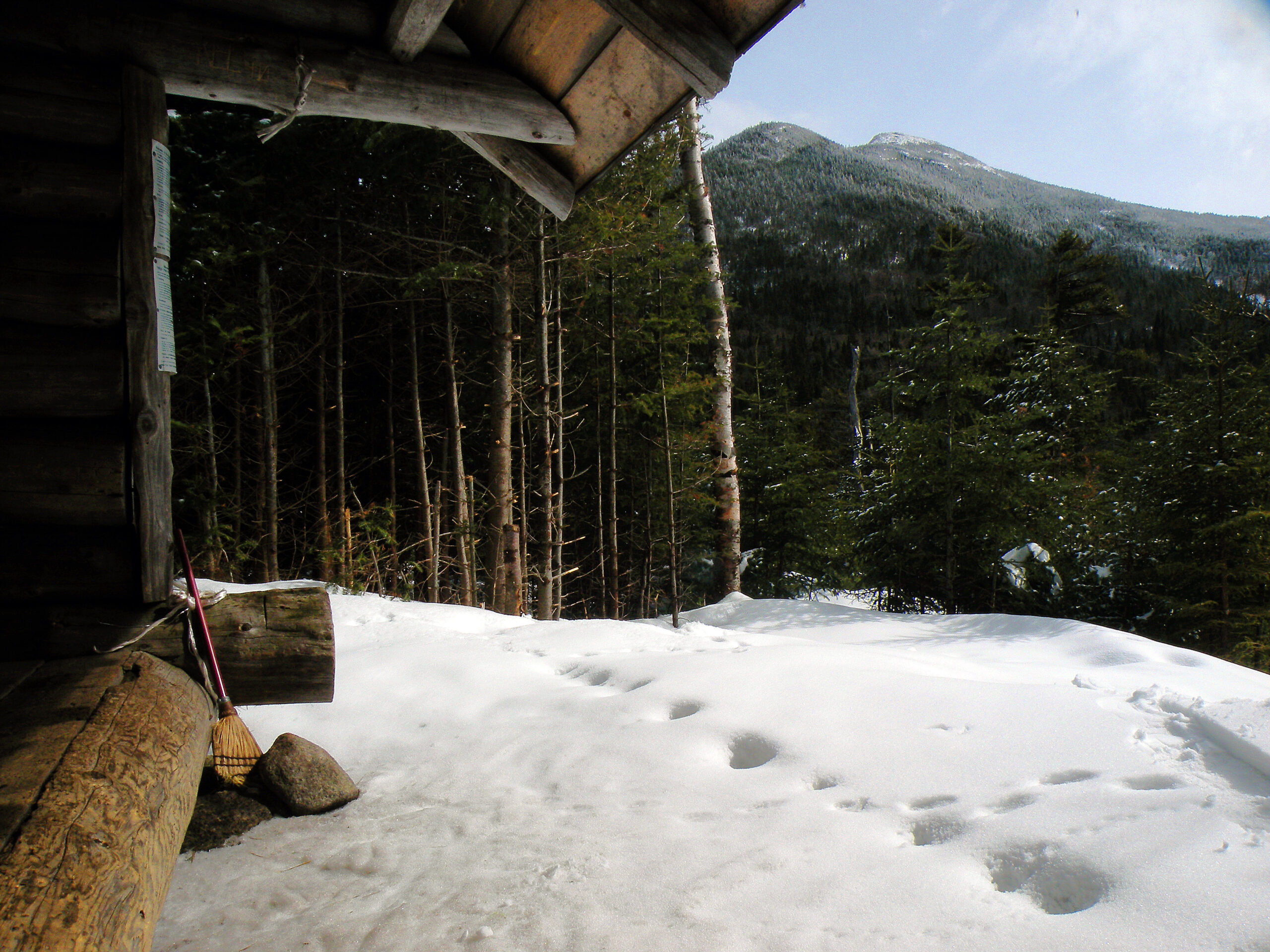
In the past, state officials actively sought to encourage public visitation of the Forest Preserve by providing facilities for recreation. In the Mount Marcy region, which had been a traditional mecca for “tramping” long before it was acquired for the preserve, this meant the marking of an elaborate trail network with lean-tos at regularly spaced intervals. For a period that extended from 1920 into the 1960s, state officials had no qualms about building any recreational facility the public might use, bounded only by constitutional constraints. This included not only trail-side lean-tos high up the slopes of Mount Marcy, but a stone shelter on the summit itself.
However, it did not take many decades for some of these high-elevation facilities to show signs of deterioration. Not only is Marcy’s stone shelter long gone, but so are the lean-tos at Plateau, Lake Tear, and Indian Falls.
Removing a few poorly-sited campsites has not solved the problem of ever-increasing numbers, however, and half a century later state land managers still grapple with many of the same issues they did during the Nixon administration. The big question many people ask, of course, is “how many visitors are too many?” This implies that a numerical cap can be applied to hold visitation rates to some pre-determined number, an idea that unsettles many people. So rather than using some kind of wilderness alchemy to determine the absolute number of people the High Peaks Wilderness can accommodate at any one time, the focus instead has been on regulation and education.
The result has been an actively managed wilderness, one that has received the lion’s share of stewardship funding in the Adirondacks (sometimes at the expense of other deserving projects elsewhere). The summits are staffed every summer by caretakers whose primary responsibility is to talk people out of trampling the fragile alpine vegetation, which many newcomers might mistake for simple grass. An overworked ranger force is tasked with locating and evacuating the injured and underprepared. Nevertheless, people continue to come – so many people that now even the trailheads have become overwhelmed, requiring additional stewards to be stationed at the busiest parking areas.
Since 2011, when the remnants of Hurricane Irene unleashed torrential rains and devastating floods, conservation personnel have chosen to allow nature to take its course at Duck Hole and Marcy Dam, two former ponds with dams breached by the storm. This was an admirable decision given the wilderness classification, where one of the primary goals is to perpetuate natural conditions in a setting relatively free of man-made structures.
However, during this same decade trail crews have upped their game when it comes to installing ladders and steps along many of the steepest trails. The idea is to harden the trails before irreparable erosion occurs, but the irony of dismantling dams and building ladders at the same time – in the same wilderness setting – cannot be ignored.
Going back to that original question, is there such a thing as too many people? This is a difficult question to answer given that little data exists to suggest specific solutions. However, there are observable “metrics” that all suggest grave problems do exist, and have not gotten better in the last twenty years:
If these “metrics” are really an indication of the health of the wilderness, then debates about parking areas and trail ladders could very well be a misunderstanding of the true issues. Perhaps the question we are really trying to answer is this: What are we really trying to protect? Are the High Peaks a hiker’s paradise, a place for people to experience physical challenge and scenic beauty? Or is it intended to be the “not so greatly changed Eden” that even the nineteenth-century Romantics might’ve recognized, a wild landscape still beholden only to the laws of natural history?
Perhaps if the solutions have been evading us for half a century, it’s because we’ve yet to ask the right questions.
The following links leave the AWA website and take you to various pages on the Department of Environmental Conservation (DEC) website with more information on the High Peaks Wilderness.
High Peaks Wilderness Complex Information Page. Learn important contact information and peruse a list of facilities.
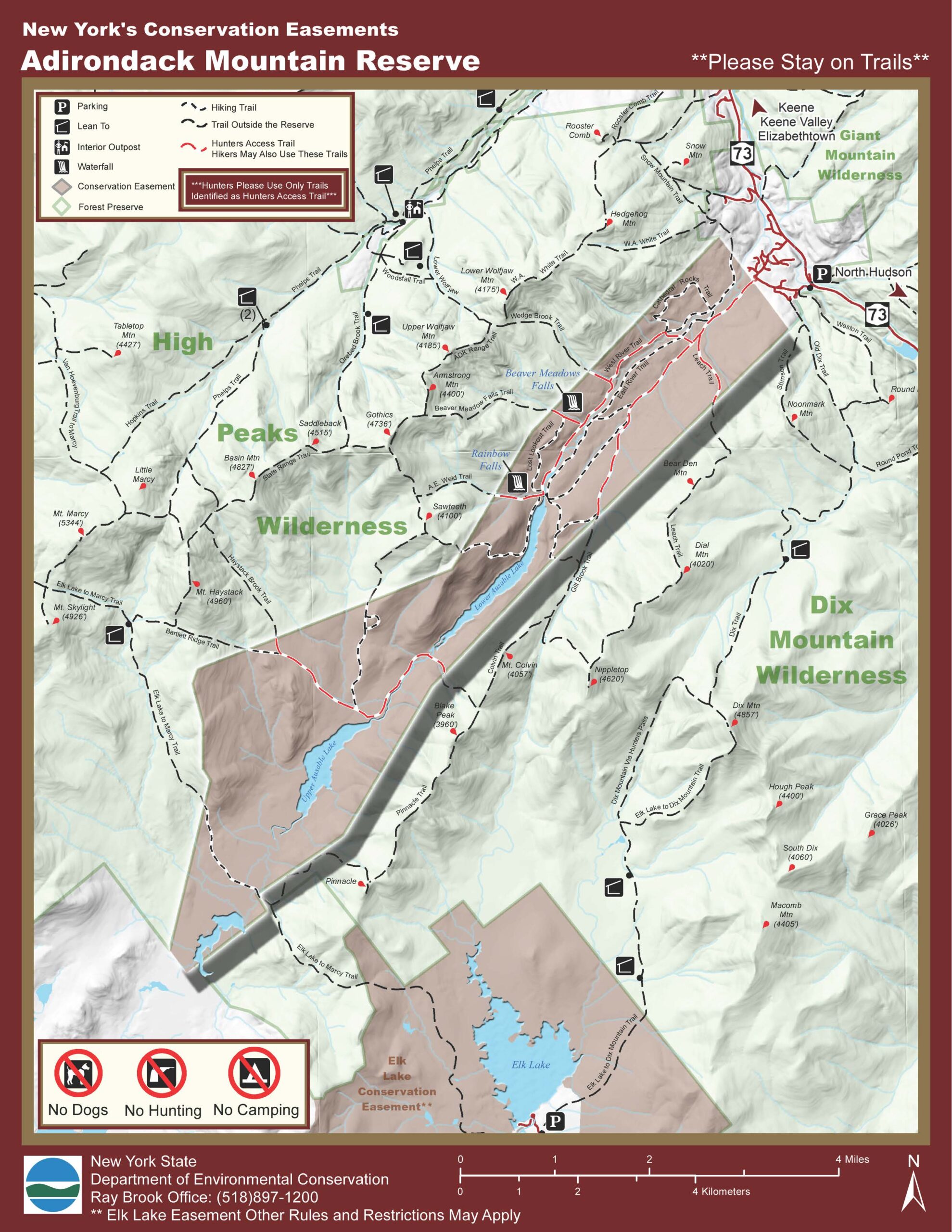
Adirondack Mountain Reserve Conservation Easement Information Page. Learn important contact information and peruse a list of facilities.
Boreas Ponds Tract Information Page. Learn important contact information and peruse a list of facilities.
Dix Mountain Tract Information Page. (Includes the former Dix Mountain Wilderness, which was added to the High Peaks Wilderness in 2018.) Learn important contact information and peruse a list of facilities.
Backcountry Information for the High Peaks Region. Trail conditions updated weekly for the High Peaks Wilderness and neighboring areas.
High Peaks Wilderness Management Plans. Download all of DEC’s management plans for the High Peaks Wilderness, including the original 1999 UMP, amendments from 2000 and 2018, and the 2004 UMP for the former Dix Mountain Wilderness.
(a) Applicability.
Unless otherwise specified, sections 190.0 through 190.6 and sections 190.8 through 190.9 of this Part apply to all units of State land in the Adirondack Park which are classified as wilderness by the Adirondack Park State Land Master Plan. In addition, specific regulations for individual wilderness areas in the Adirondack Forest Preserve are set forth in this section. In case of a conflict between a provision of this section and a provision of sections 190.0 through 190.6 and sections 190.8 through 190.9 of this Part, or a provision of Part 196 of this Title, the provision of this section shall apply.
(b) Definitions.
As used in this section, the following terms shall have the indicated meanings:
(1) Adirondack Canoe Route Zone means the strip of land within the High Peaks Wilderness Area which is situated within 500 feet of the mean high water mark of the eastern shore of Long Lake and the Raquette River.
(2) Bear-resistant canister means a commercially made container constructed of solid, non-pliable material manufactured for the specific purpose of resisting entry by bears.
(3) Campfire means an outdoor fire for warmth, cooking, repelling insects, or aesthetics, but shall exclude stoves using fuels other than wood.
(4) Eastern High Peaks Zone means that portion of the High Peaks Wilderness Area located to the east of the ridge line immediately west of the Indian Pass Trail.
(5) High Peaks Wilderness Area means those lands in the Towns of Keene, North Hudson, Newcomb and North Elba, Essex County; Harrietstown, Franklin County; and Long Lake, Hamilton County described in the most current copy of the “Adirondack Park Land Use and Development Plan Map and State Land Map” on file in the offices of the Adirondack Park Agency. The High Peaks Wilderness Area shall include the Adirondack Canoe Route Zone, the Western High Peaks Zone, and the Eastern High Peaks Zone.
(6) Overnight camper means a person who stays or intends to stay in the Eastern High Peaks Zone during the night.
(7) Primitive tent site means a tent site of an undeveloped character providing space for not more than three tents, which may have an associated pit privy and fire ring, designed to accommodate a maximum of eight people on a temporary or transient basis, and located so as to accommodate the need for shelter in a manner least intrusive on the surrounding environment. A primitive tent site shall be designated by an official department sign or disk.
(8) South Meadows-Flowed Lands Corridor shall mean that portion of the High Peaks Wilderness Area which is generally located between the McIntyre Range on the west and Mt. Marcy on the east and between South Meadows on the north and the State land boundary on the south, and which is more specifically described as follows: beginning at a point on Heart Lake Road (County Road 34) which is one half mile north of the intersection of Heart Lake Road and South Meadows Road; then running easterly in a line that is one half mile north of and parallel to South Meadows Road until it reaches the end of such road; then running southeasterly in a line that is one half mile northeast of and parallel to the Klondike Trail until it reaches a point which is one half mile northeast of U.S.G.S. benchmark 2567 on the Klondike Trail; then running southwesterly in a straight line to such benchmark; then continuing in a southwesterly direction to the ridge line which leads to the summit of Phelps Mountain; then running southerly up such ridge line to a peak northeast of the summit of Phelps Mountain; then running the ridge line from such peak to the summit of Phelps Mountain; then running generally southerly along the ridge line leading from the summit of Phelps Mountain over the summits of Table Top Mountain, Little Marcy, Mt. Marcy, Mt. Skylight, Mt. Redfield, and Cliff Mountain; then running southerly following a straight line from the summit of Cliff Mountain to the point where Upper Twin Brook intersects with the boundary of State land; then running generally northwesterly along the State land boundary to the height of land of the McIntyre Mountain Range; then running northeasterly along the ridge line to the summit of Mount Marshall; then running northeasterly along the ridge line from the summit of Mount Marshall over the summits of Iroquois Peak, Boundary Peak, Algonquin Peak, and Wright Peak; then running northerly in a straight line from the summit of Wright Peak to the southwestern corner of the Adirondack Loj property; then running easterly along the boundary between the Adirondack Loj property and the State land to the southeastern corner of the Adirondack Loj property; then running northerly along such boundary to a point which is due west of the intersection of Heart Lake Road and South Meadows Road; then continuing northerly along such boundary for one half-mile; then running easterly to the point of beginning.
(9) Tent means a temporary, collapsible shelter which is used for camping outdoors and is made primarily of fabric but which may have walls constructed from other materials.
(10) Tent platform means a platform, with or without walls and other attachments, erected as a base for tenting or similar camping activity.
(11) Trail means a marked and maintained path or way for foot, horses, or cross country ski travel.
(12) Western High Peaks Zone means that portion of the High Peaks Wilderness Area located to the west of the ridge of land immediately west of the Indian Pass Trail, excluding the Adirondack Canoe Route Zone.
(c) Group size restrictions.
(1) In the Eastern High Peaks Zone or Western High Peaks Zone, no person shall:
(i) be part of a day use group containing 16 or more people;
(ii) on or after July 1, 2001, camp as part of a group including nine or more people; or
(iii) be a member of an affiliated day use or camping group which exceeds the numerical limitations established in subparagraph (i) or (ii) of this paragraph, unless such group has separated into smaller groups which do not exceed such limitations and such smaller groups maintain a separation distance from each other of at least one mile at all times.
(d) Camping restrictions.
In the High Peaks Wilderness Area, no person shall:
(1) erect or use any tent platform or camp structure other than tents, tarps, lean-tos, or those composed of snow;
(2) camp at any location above 4,000 feet in elevation;
(3) camp at locations which are greater than 3,500 feet in elevation but equal to or less than 4,000 feet in elevation except at a primitive tent site; or
(4) erect a tent in a primitive tent site at a distance greater than 15 feet from the official department sign or disk.
(e) Campfire restrictions.
(1) No person shall ignite or maintain a campfire for any purpose at any location in the Eastern High Peaks Zone.
(2) No person shall ignite or maintain a campfire for any purpose at any location which is situated above 4,000 feet in elevation in the Western High Peaks Zone.
(3) At elevations of 4,000 feet or less in the Western High Peaks Zone and in the Adirondack Canoe Route Zone, no person shall ignite or maintain a campfire for any purpose at any location within 150 feet from any road, trail, spring, stream, pond or other body of water except that a campfire may be ignited or maintained at a primitive tent site or lean-to site.
(f) Miscellaneous restrictions.
(1) No person shall fail to register whenever passing a trail register established by the department in the Eastern High Peaks Zone.
(2) In addition to the requirements of paragraph (1) of this subdivision, no overnight camper in the Eastern High Peaks Zone shall fail to possess a self-issuing permit:
(i) acquire a self-issuing permit whenever passing a department registration facility; and
(ii) possess such permit during the duration of their stay in the Eastern High Peaks Zone.
(3) In the High Peaks Wilderness Area, no person shall:
(i) use any audio device which is audible outside the immediate area of a campsite;
(ii) use soap or detergent in any pond, stream or other water body;
(iii) dispose of any food scrap, food matter or food container in any pond, stream or other water body;
(iv) use any motorized equipment;
(v) operate any motorized craft on any water body designated as a wild river pursuant to the Wild, Scenic and Recreational Rivers Act, Environmental Conservation Law article 15, title 27;
(vi) fail to comply with a lawful instruction or order of a uniformed employee of the department;
(vii) fail to possess and use skis or snowshoes when the terrain is snow-covered with eight or more inches of snow;
(viii) fail to observe quiet hours between 10:00 p.m. and 7:00 a.m.;
(ix) mark trails with plastic ribbons, paint, blazes or other devices, cut or clear trails, or mark summits with canisters except by written permission of the department;
(x) leave a pet unattended or fail to maintain complete control over the pet;
(xi) fail to have in their immediate possession proof of a valid and current rabies inoculation for any dog which is accompanying them;
(xii) erect or maintain any commemorative features, such as signs, plaques or markers depicting cultural sites;
(xiii) undertake any research project except under permit of the department;
(xiv) fail to take reasonable steps to keep food, food containers, garbage, and toiletries from bears, and, during the period April 1st through November 30th, no overnight camper in the Eastern High Peaks Zone shall fail to use bear-resistant canisters for the storage of all food, food containers, garbage, and toiletries; or
(xv) possess a glass container, except that glass containers which are necessary for the storage of prescribed medicines shall be exempt from this prohibition.
(4) In the Eastern High Peaks Zone, no person shall fail to leash pets on trails, at primitive tent sites, at lean-to sites, at elevations above 4,000 feet, or at other areas where the public congregates, provided that this provision shall not be applicable to hunting dogs which, with a licensed hunter, are actively hunting during appropriate hunting seasons at locations other than primitive tent sites, lean-to sites, at elevations above 4,000 feet, or at other areas where the public congregates.
(5) In the South Meadows-Flowed Lands Corridor, no person shall camp except at a primitive tent site, provided that this section shall not be effective until such time as the department completes its designation of such campsites within such corridor, and provided further that until such time as the department completes such designation no person shall fail to comply with the camping instructions contained on any sign posted by the department.
(g) Each provision of this section shall be severable, and in the event that any provision of this section or its application to any person or circumstance is determined to be contrary to law by a court of competent jurisdiction, such determination shall not affect or impair the validity of the remaining provisions of this section, which shall continue in full force and effect and be applicable to other persons and circumstances.
All photos © Bill Ingersoll. Site visitors are permitted to download an unlimited number of images from our website for personal, educational, scientific, or professional use only, with attribution. Commercial use and further distribution of images is prohibited without express written permission.


