
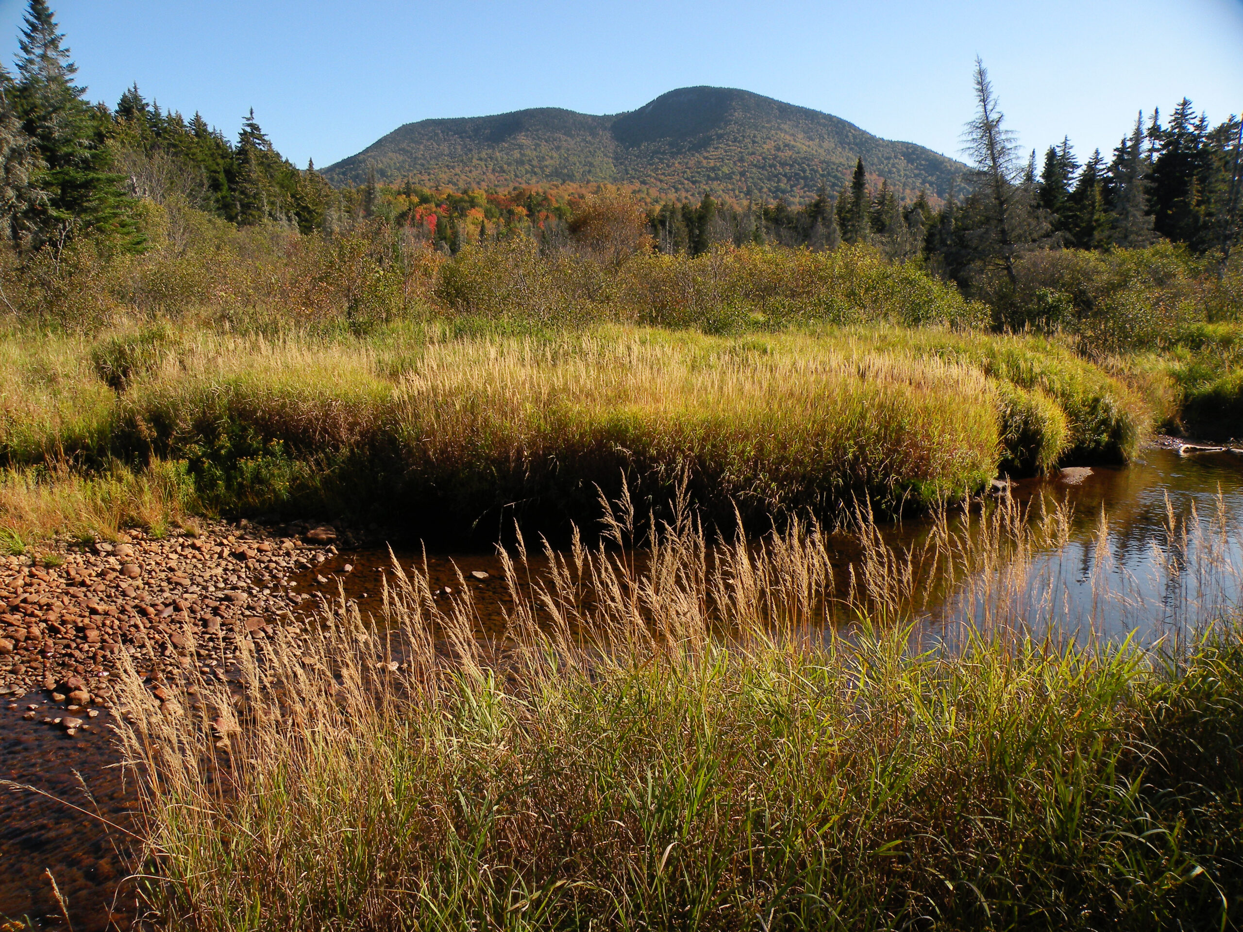
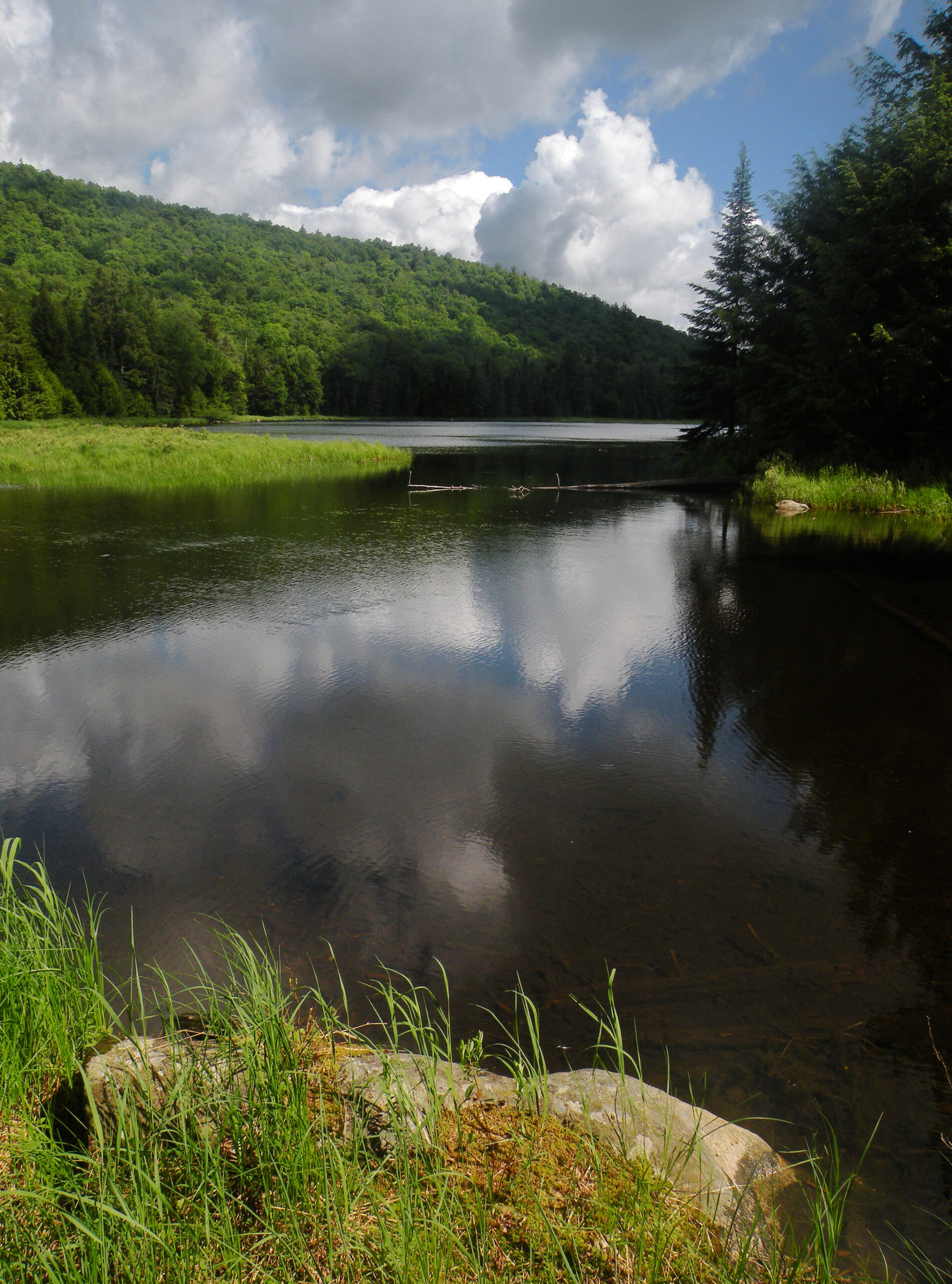
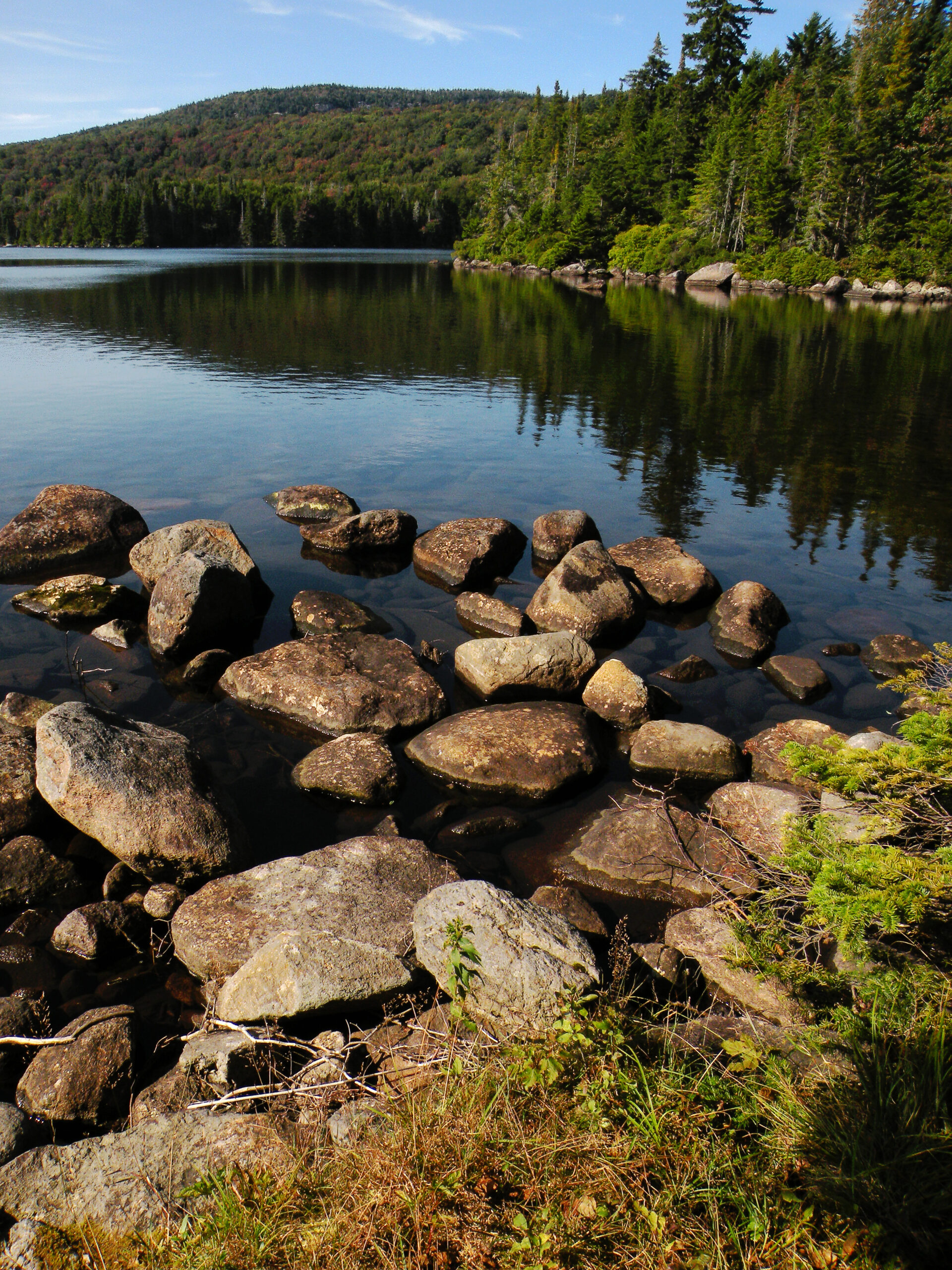
Cedar River and Blue Ridge Mountain

All of the Adirondack Park’s wilderness areas are unique in their way, each of them offering something that can’t be found in any of its siblings. But the West Canada Lake Wilderness is a rare blending of mountain and water, with no true equal anywhere in eastern North America, if not beyond: a galaxy of little lakes, all held up on a high-elevation plateau and surrounded by a lush temperate forest.
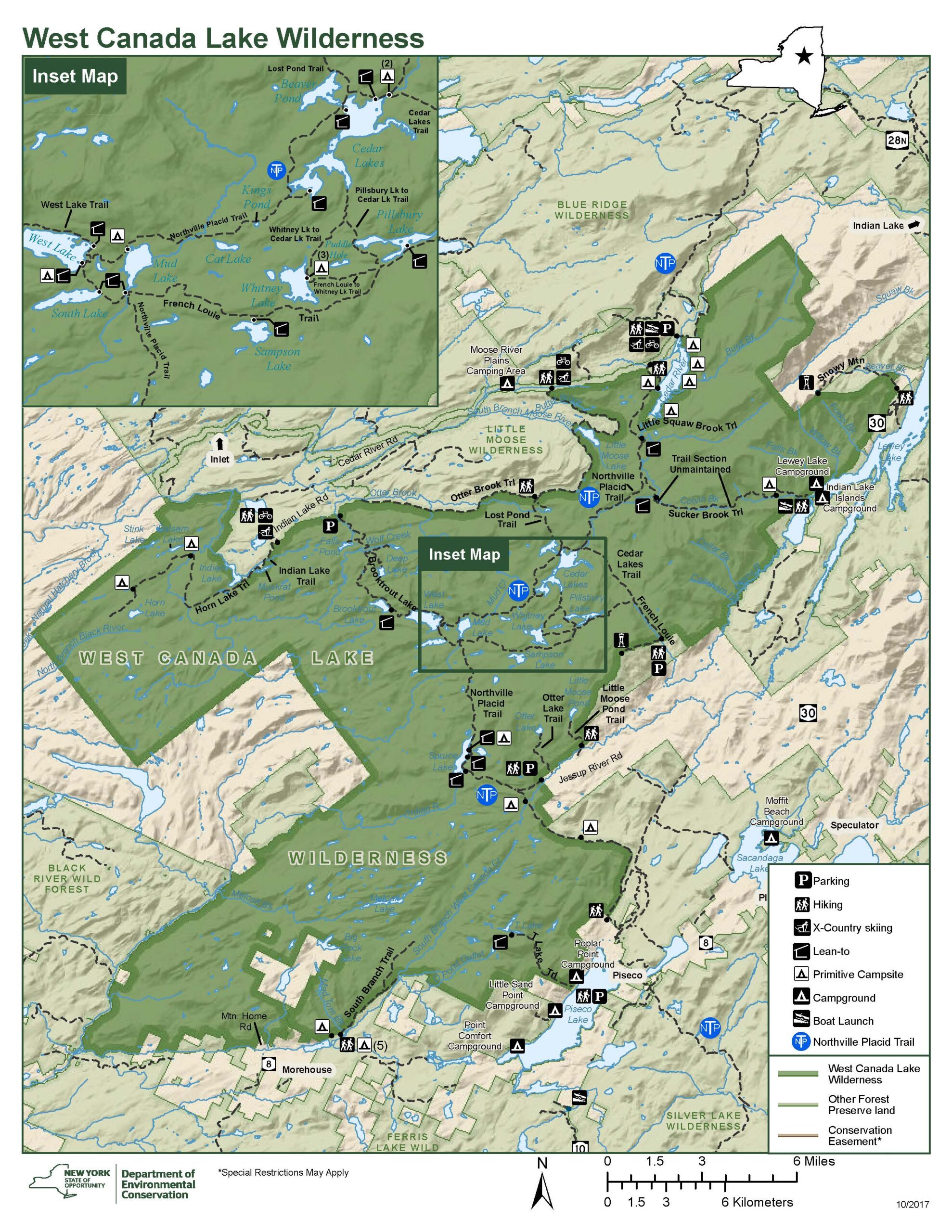
At 172,000 acres, this is the second largest protected wilderness in not just the Adirondacks, but in all the northeastern United States. It is second in size only to the High Peaks Wilderness, and these two giant regions are not without their similarities – particularly the deep layers of damp organic soils that tend to erode quickly with the passage of many hiking boots. Thankfully, though, the West Canada Lake Wilderness has managed to escape the unchecked visitation growth curve that has been plaguing the High Peaks since the 1960s, and thus wilderness adventures are still possible here in a relatively unregulated setting.
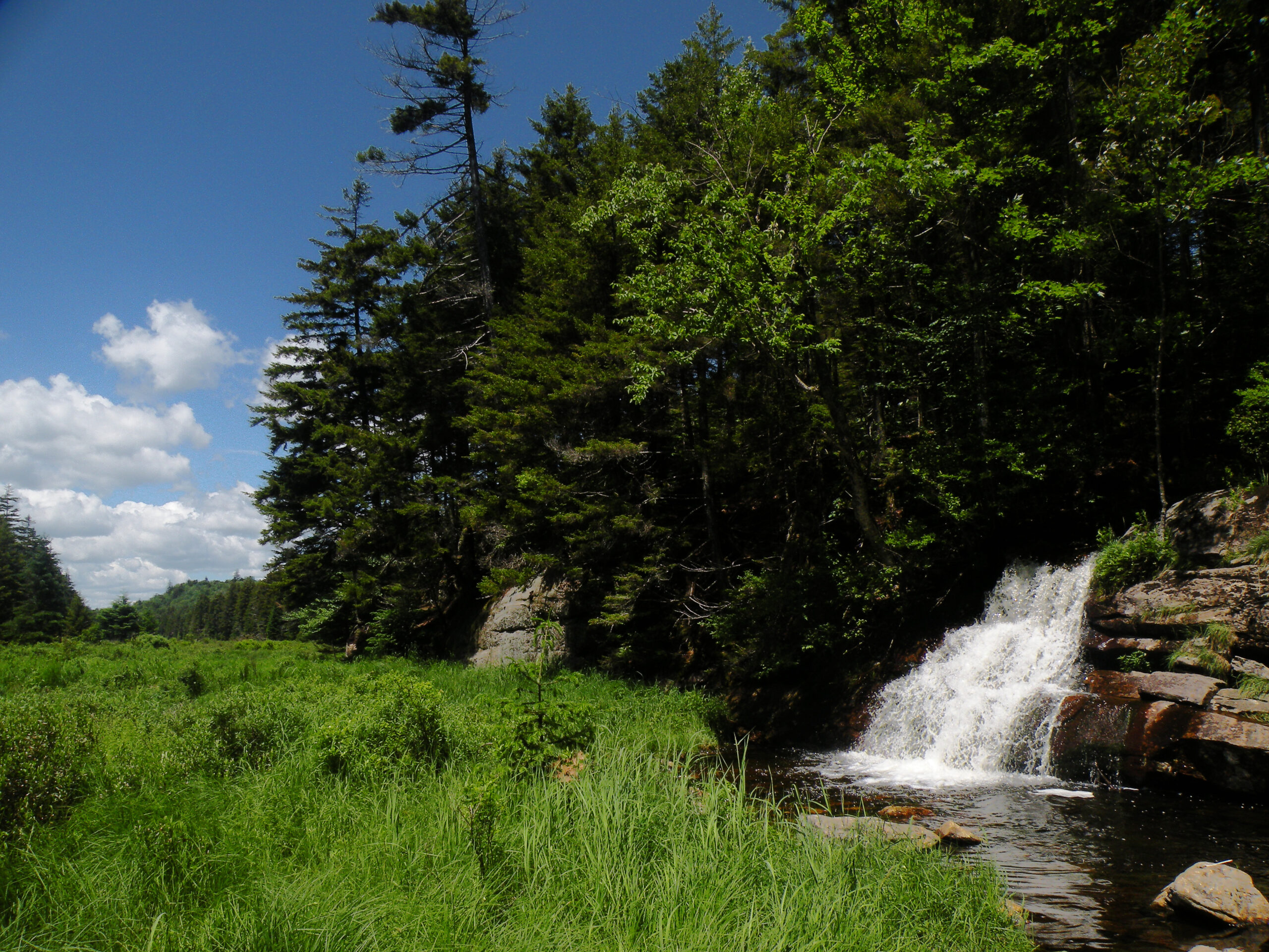
What is the primary environment of the West Canada Lake Wilderness? With a region so vast, there are several. The eponymous lakes are of course the most iconic, but the designated boundaries also include a broad range of settings: rugged mountains, wide valleys, and impenetrable fens. The snows are deep, and the rain is frequent. This is a true headwater area, with significant streams radiating off the plateau in multiple directions. Forests of balsam fir and red spruce sprout prodigious sapling nurseries that often fill the understory; these trees grow fast and sometimes die in waves, creating cycles of forest growth that can be observed in a human lifetime.
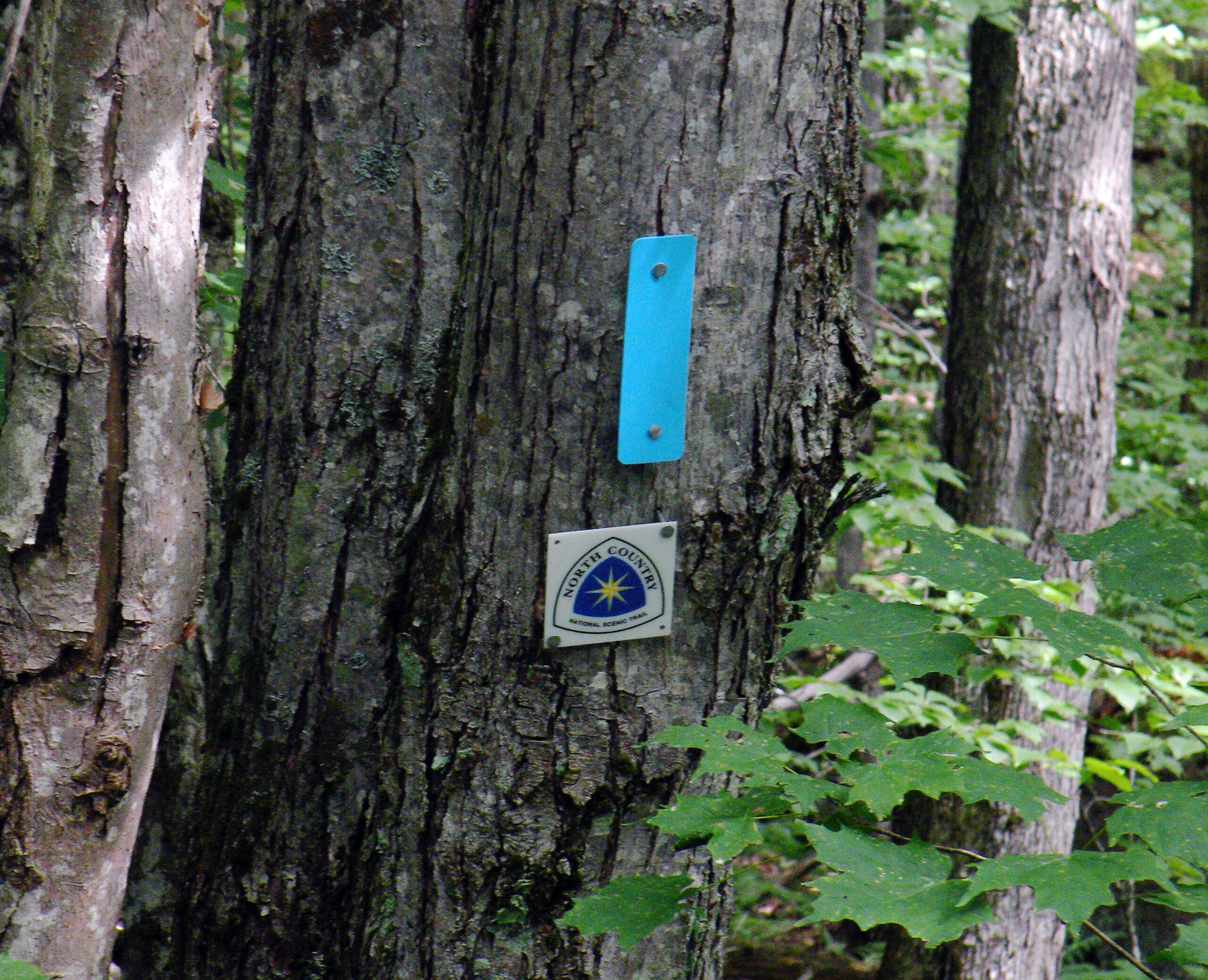
Much of the area’s recreational pressure is funneled through a small number of trails, and overnight visitors must contend with a starkly finite number of campsites. While the area hasn’t suffered yet from excessive visitor numbers, there are vulnerabilities that should be plain for any wilderness manager to see. No management plan has ever been written for this place, and that could itself become a problem if visitor numbers rise and no mitigation measures exist. And indeed we absolutely can anticipate a rise in visitor numbers soon as new long-distance trails like the North Country National Scenic Trail are extended across the wilderness.
Thus what we have in the West Canada Lake Wilderness is an outstanding natural resource, one that has been cobbled together over numerous land purchases into one of the most distinctive preserves anywhere. It is ours to enjoy, but also ours to protect – and the time might be coming to an end when we can passively sit by and let recreational management issues sort themselves out.
Please click through the tabs below to learn more about the West Canada Lake Wilderness.
Size: 172,025 acres
First Designated: 1972
Unit Management Plan Status: No management plan has been completed for this area
Special Regulations: None; standard Forest Preserve regulations are in effect


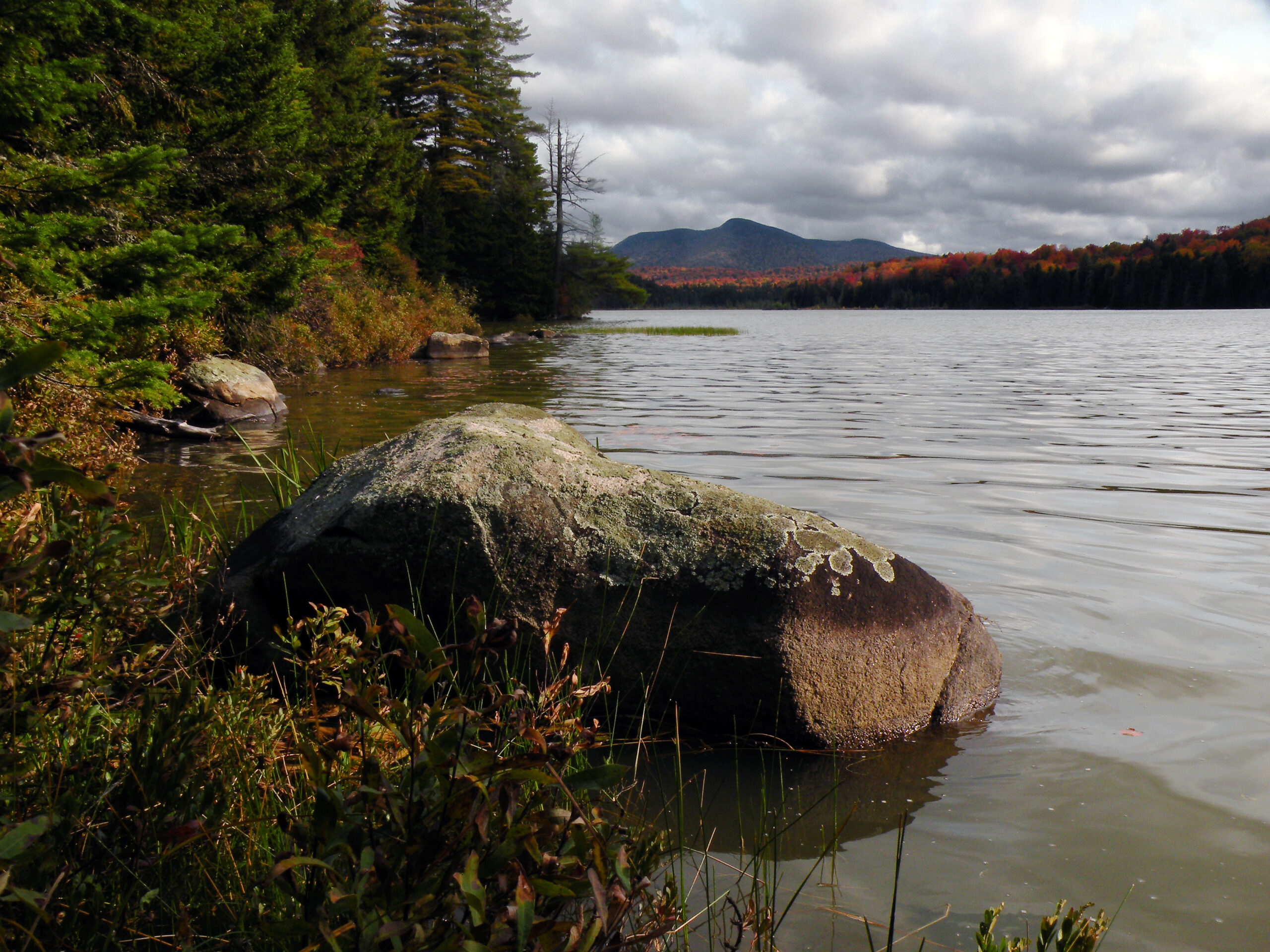
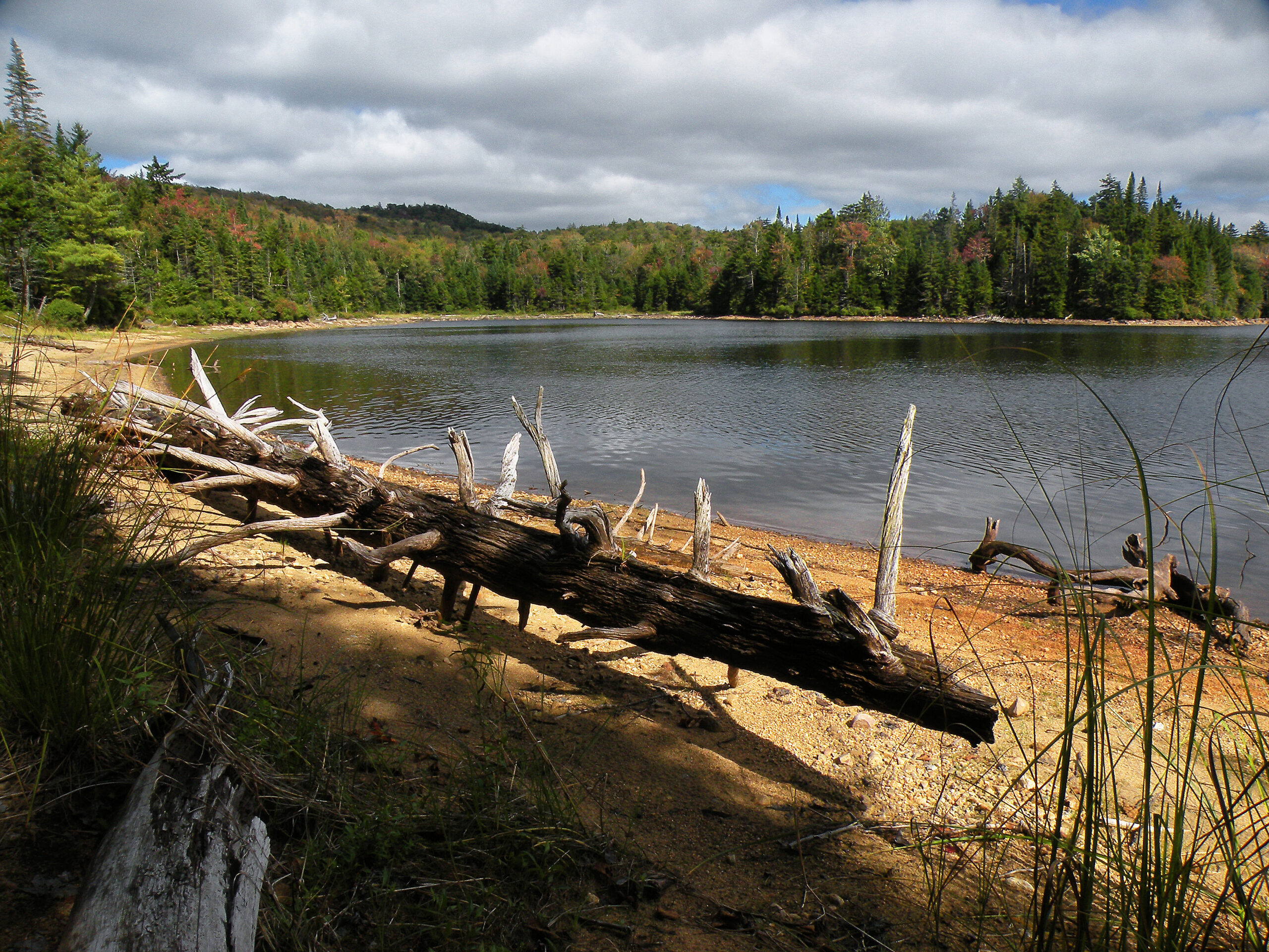
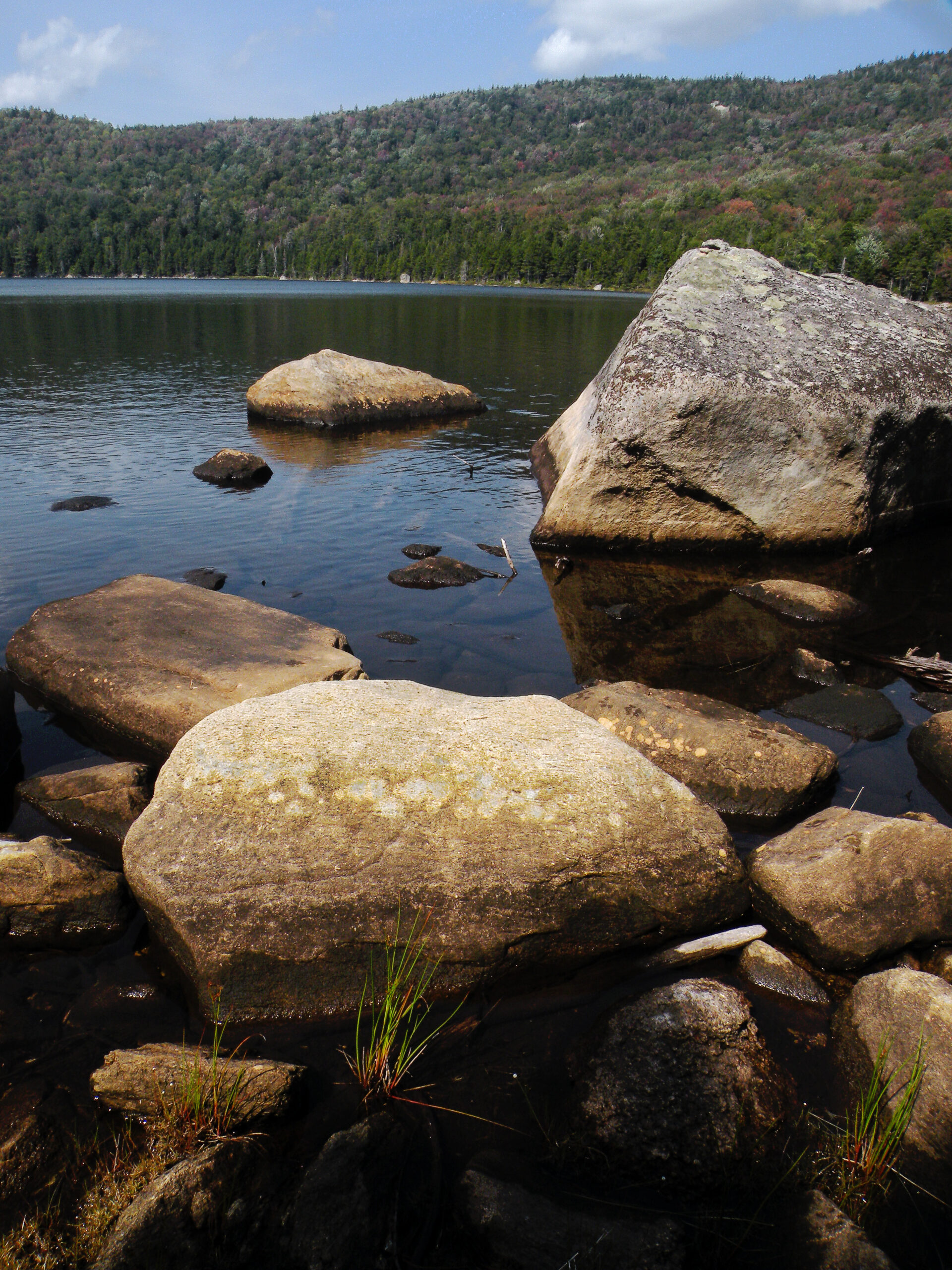
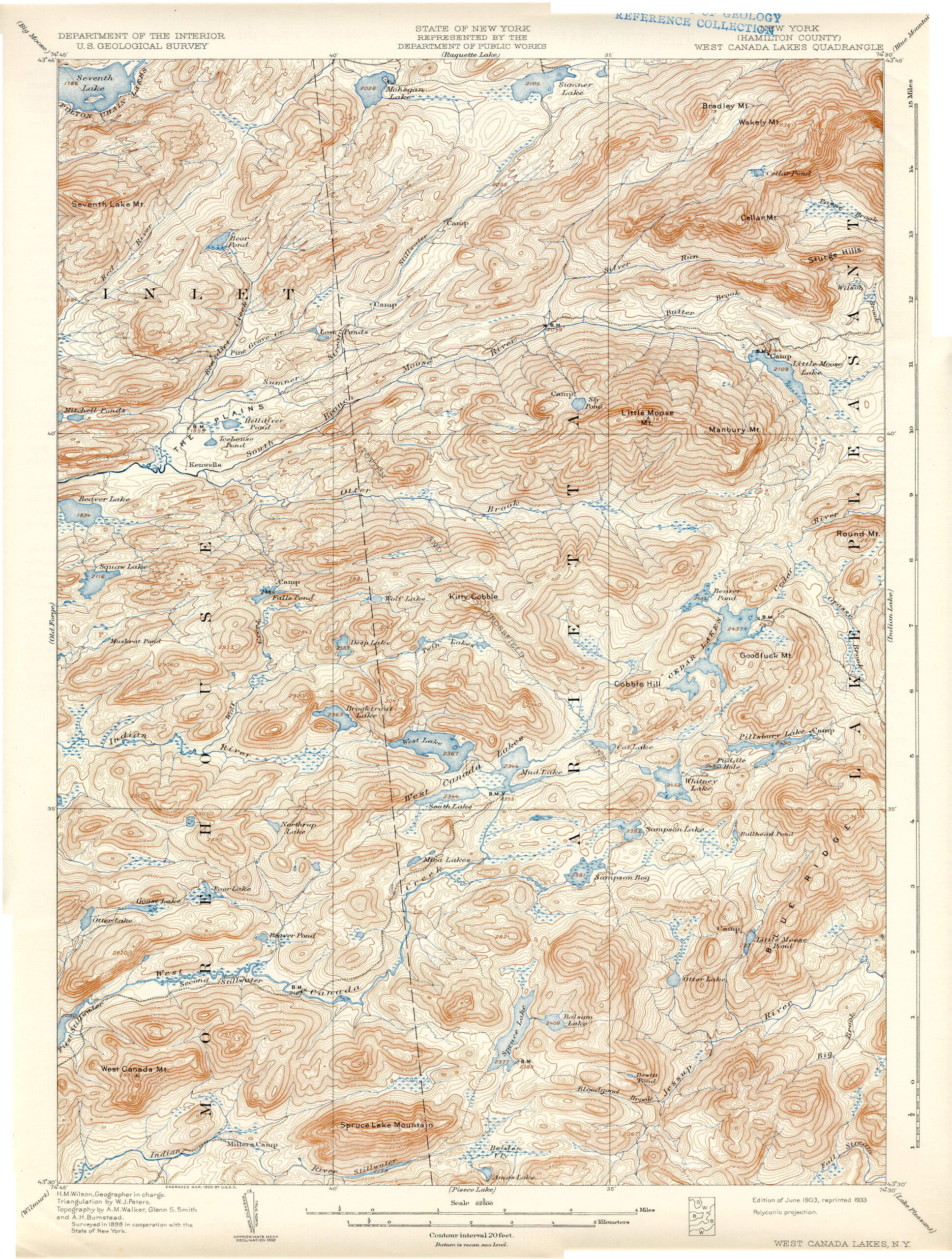
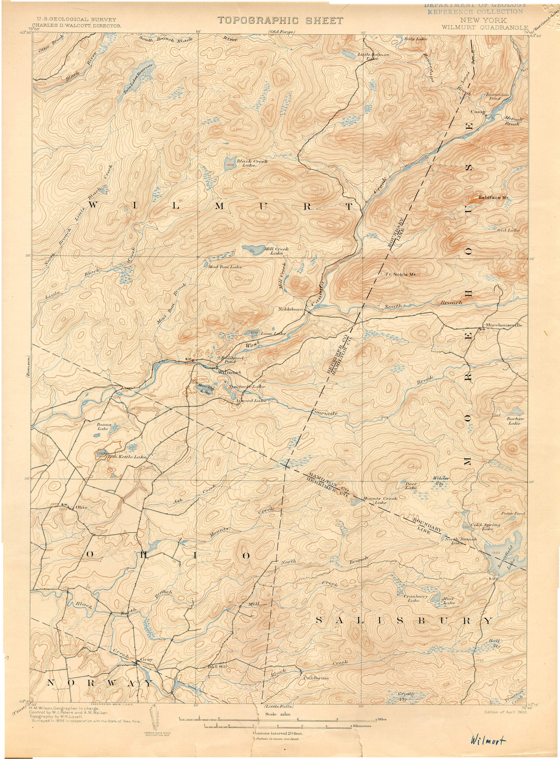
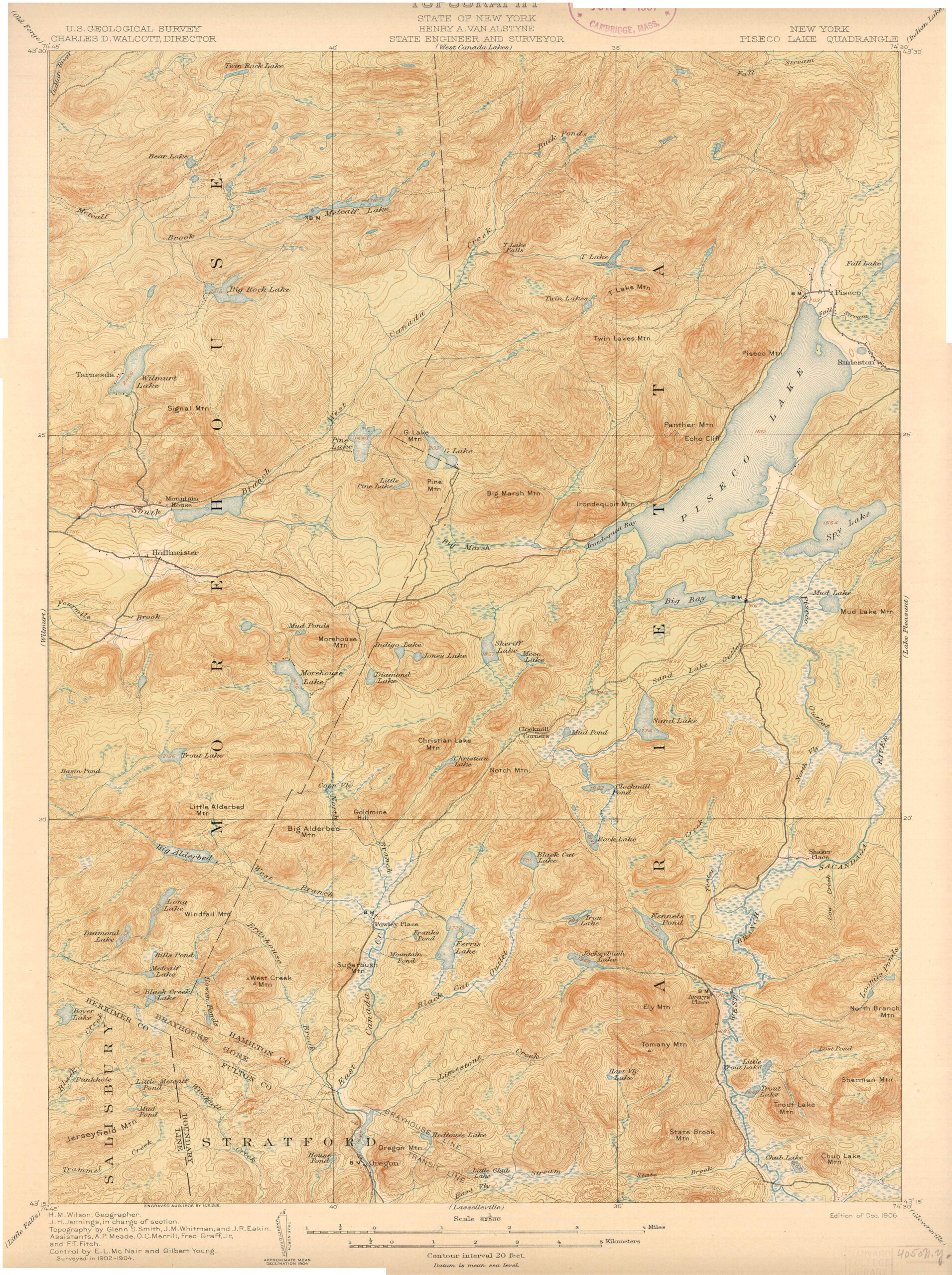
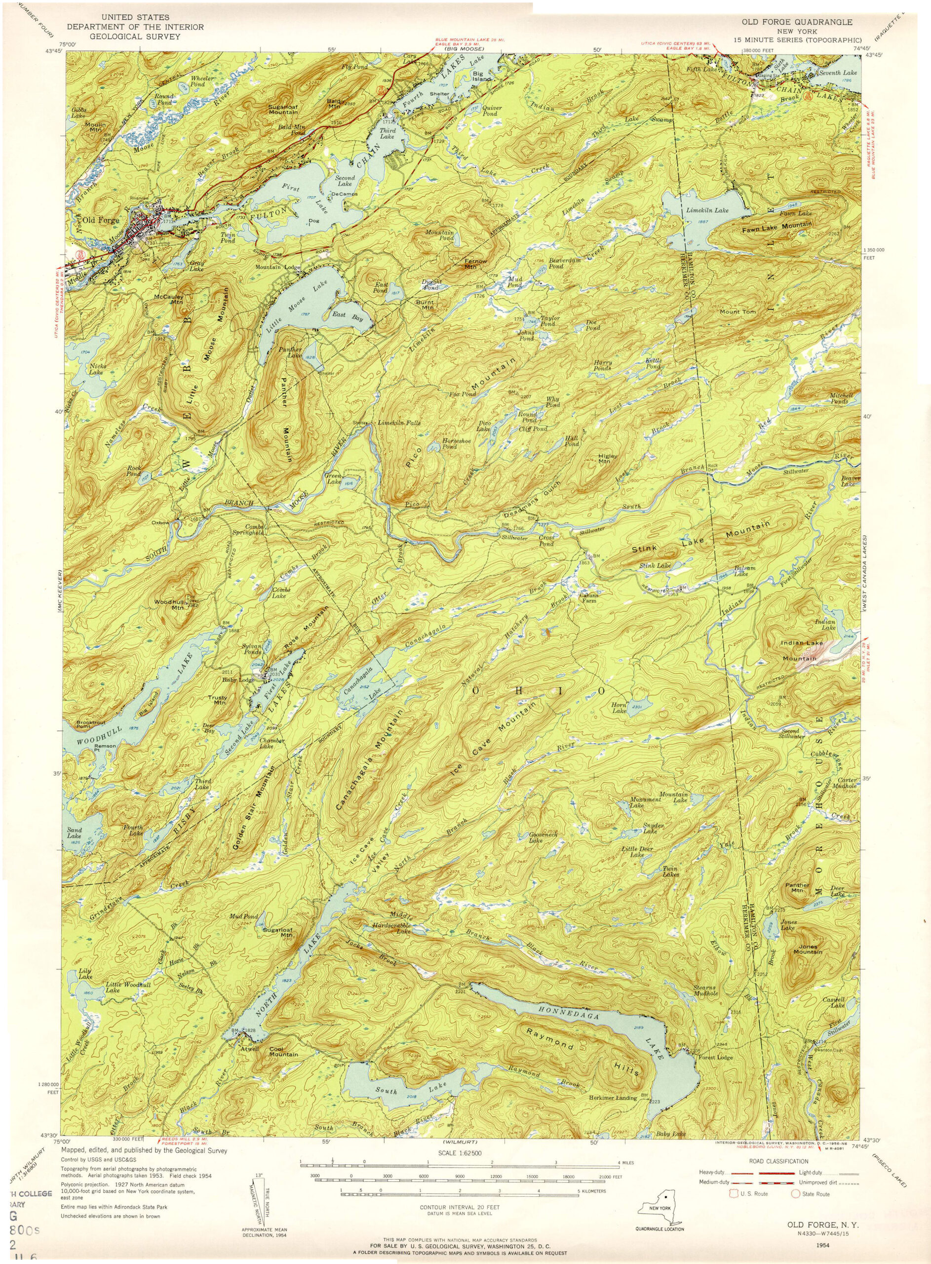
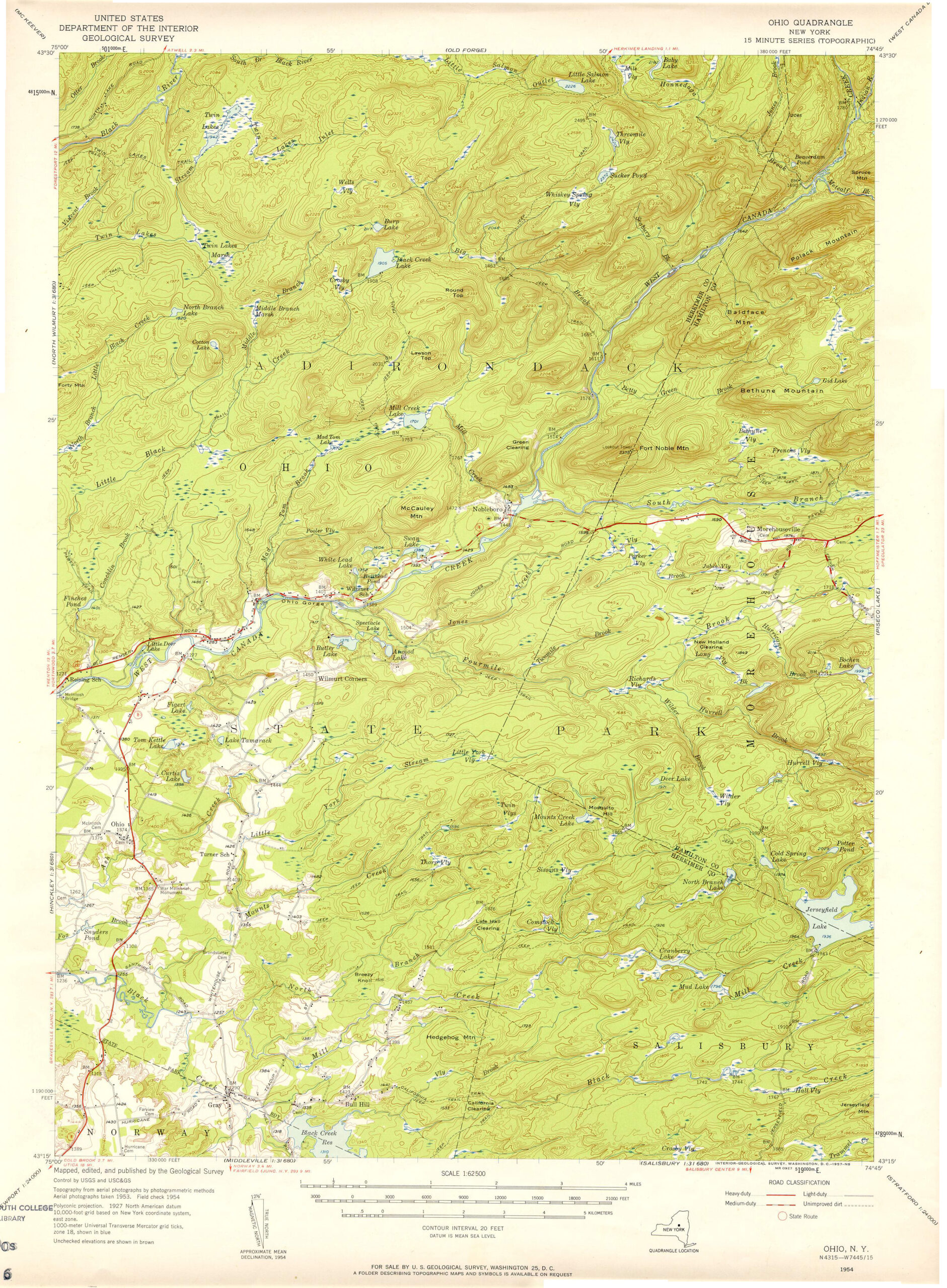
Of course, the features most associated with the West Canada Lake Wilderness are the lakes themselves. Specifically, the West Canadas are the trio of relatively large backcountry lakes clustered at the geographical center of the area’s northern half: West Lake, South Lake, and Mud Lake. Together they create the headwaters of the West Canada Creek, one of the major tributaries of the Mohawk River.
Mud Lake is exactly as advertised, but the other two are deep lakes with cold, clear water. The name “West Canada” derives from the creek, and how during the Colonial era the East Canada and West Canada creeks were the eastern and western boundaries, or “kanatas” in the Mohawk language, in an arrangement between early settlers of the Mohawk Valley and their Native neighbors. The trio of headwater lakes sits just above 2300 feet in elevation, which in an Adirondack context is remarkably high for lakes so large.
In common usage, though, the term “West Canadas” is often applied to the entire neighborhood of lakes, including Pillsbury, Whitney, Cedar, Sampson, Brooktrout, and Spruce. Even though several of these lie in completely different watersheds, all of them share many of the same attributes. From these lakes flow the Cedar River and two separate Indian Rivers.
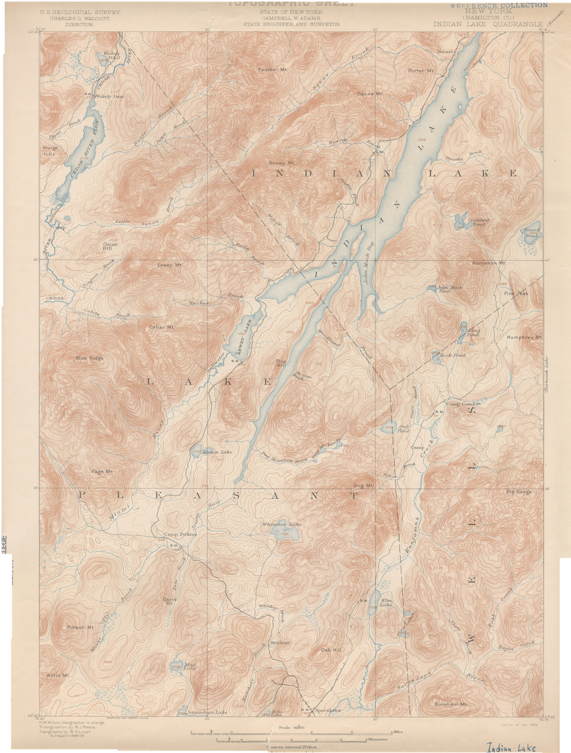
Although something of an outlier, Little Moose Lake near the northern boundary is the source of the South Branch Moose River, and the remote northwestern arm of the wilderness contains the headwaters of the North Branch Black River. Even the Jessup River, the primary feeder of Indian Lake, rises in the belly of the West Canada Lake Wilderness.
If you could lay this region like a slab of stone on a table and eye it edge-on you would see a distinctive slant to the terrain, from the generally lower western regions to the enormous mountains in the northwestern arm, culminating with Snowy Mountain, highest in the region. The wilderness includes all of Snowy’s southern slopes, including the Griffin Brook Slide, but not the summit itself. A prize for the most distinctive mountain profile might go to Blue Ridge, another summit in the Snowy Range, for the grand backdrop it offers to the Cedar River and Little Moose Lake.
Farther east and south, many of the numerous smaller mountains do not even bear names. This attests to the outstanding wilderness qualities of the area: a place so remote and “out there” that much of its geography remains anonymous.
Forest quality is directly tied to the era in which a particular tract of land was acquired for the Forest Preserve. Large blocks of real estate in the southern region and in the Snowy Range were bought up by the end of the nineteenth century, and here are the best opportunities to view stands of old growth. The state acquired the northern core of lakes in the 1920s after that area had been logged for pulpwood; here the forest is aging well, but it has not yet achieved the same status as the older parcels.
Blockbuster land deals in the 1960s (Gould Paper Company) and the 1980s (International Paper) filled in the gaps along the northern and eastern boundaries, and made the West Canada Lakes more accessible than they had ever been by establishing key trailheads at otherwise remote points along the boundary. But these parts of the forest, with their more recent logging history, are only just beginning to reach second-growth maturity.
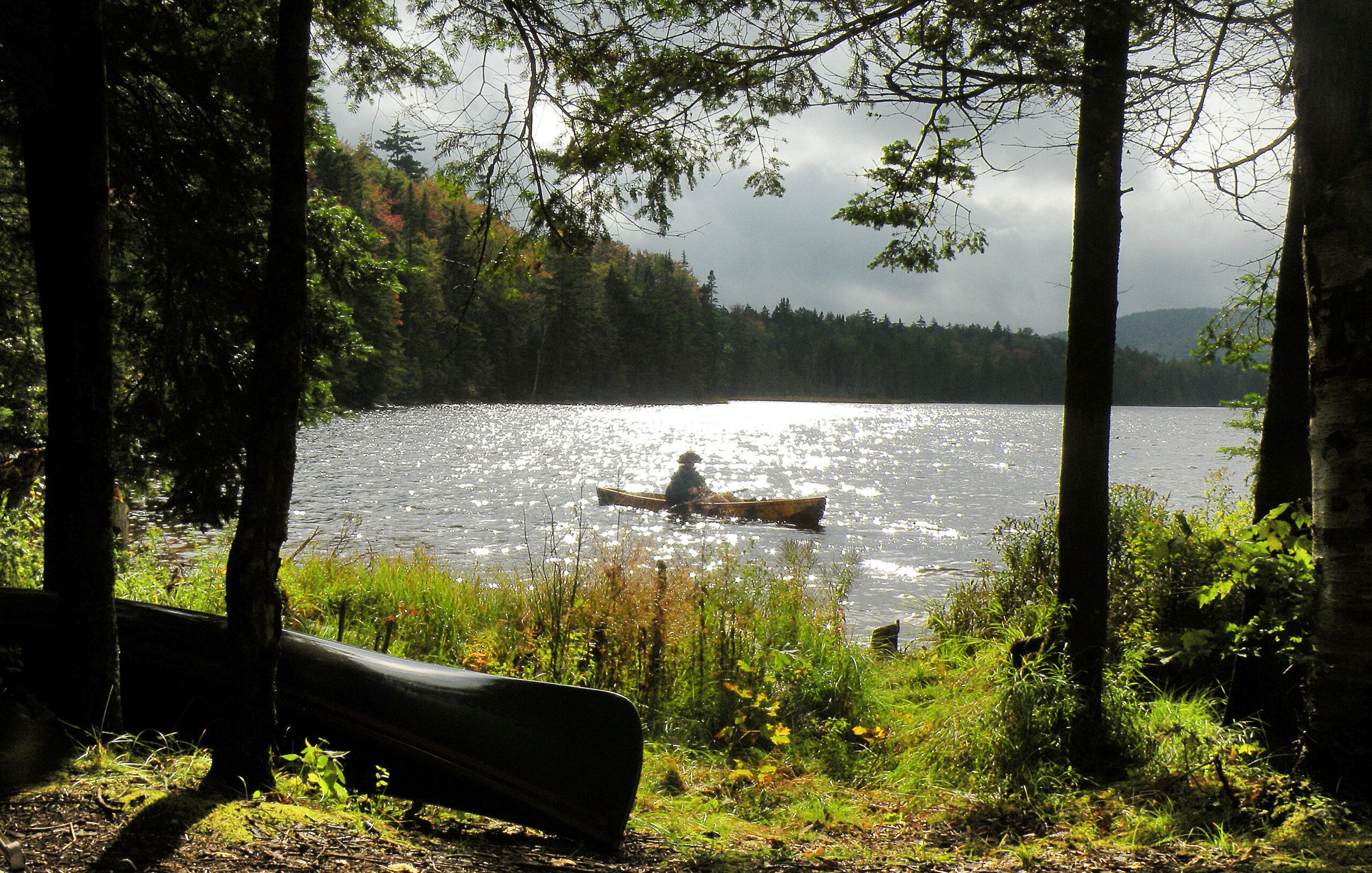
With so many lakes and ponds (by the state’s count there are 223 bodies of water, a number which probably includes ephemeral beaver ponds) this wilderness naturally has a long association with fishing. Indeed these waters were prized for their brook trout fisheries, and prior to wilderness status sportsmen often chartered floatplanes to reach the larger lakes.
By the 1980s, though, the chemical ravages of acid rain had rendered several lakes fishless – including the iconic Brooktrout Lake. It took years of lawsuits and interstate negotiations before airborne pollutions were reduced, thus allowing pH levels to rebound. The state first restocked Brooktrout with its namesake fish in 2005, and after success was encountered there other once-depleted lakes have been added to the stocking schedule.
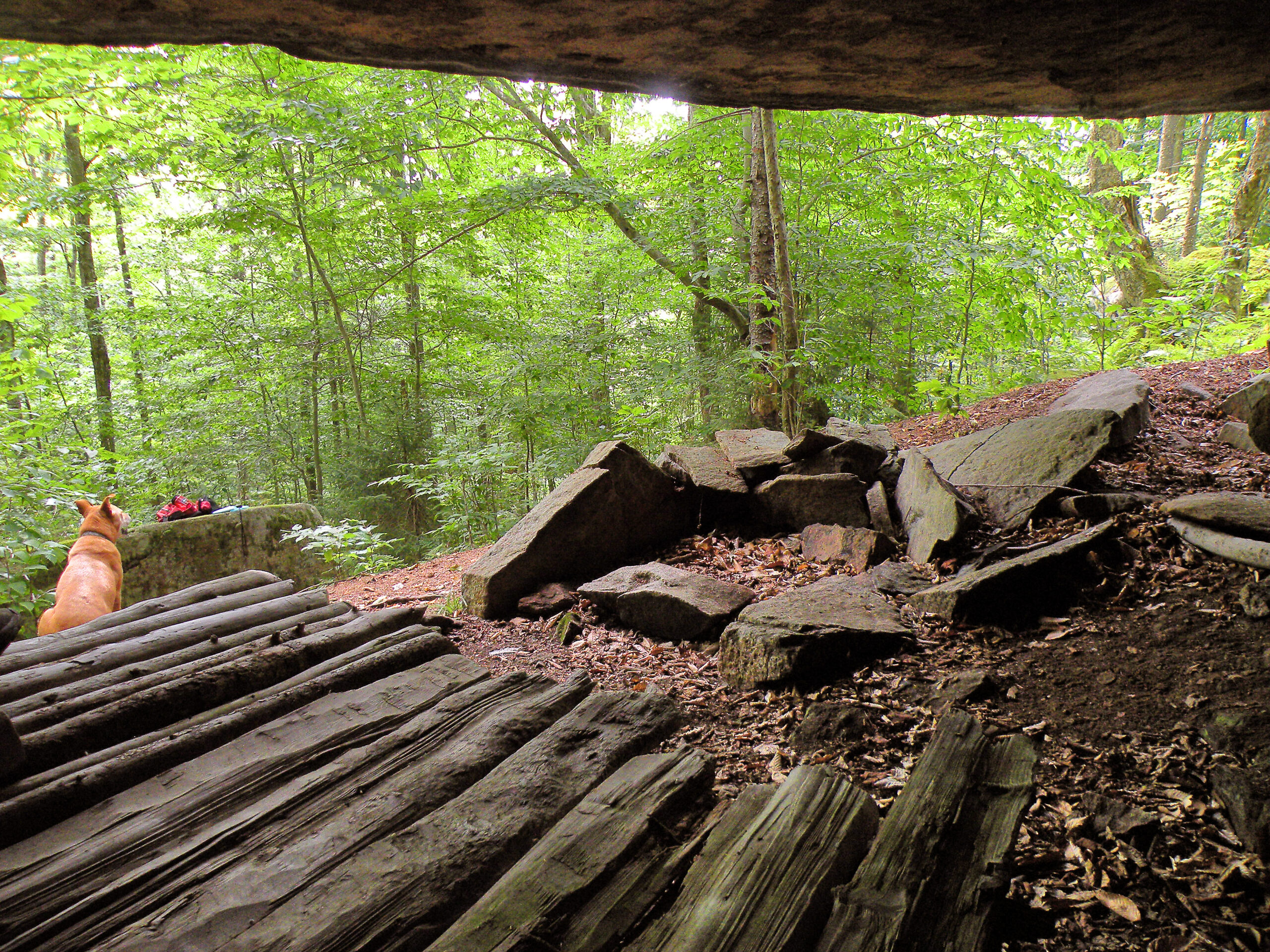
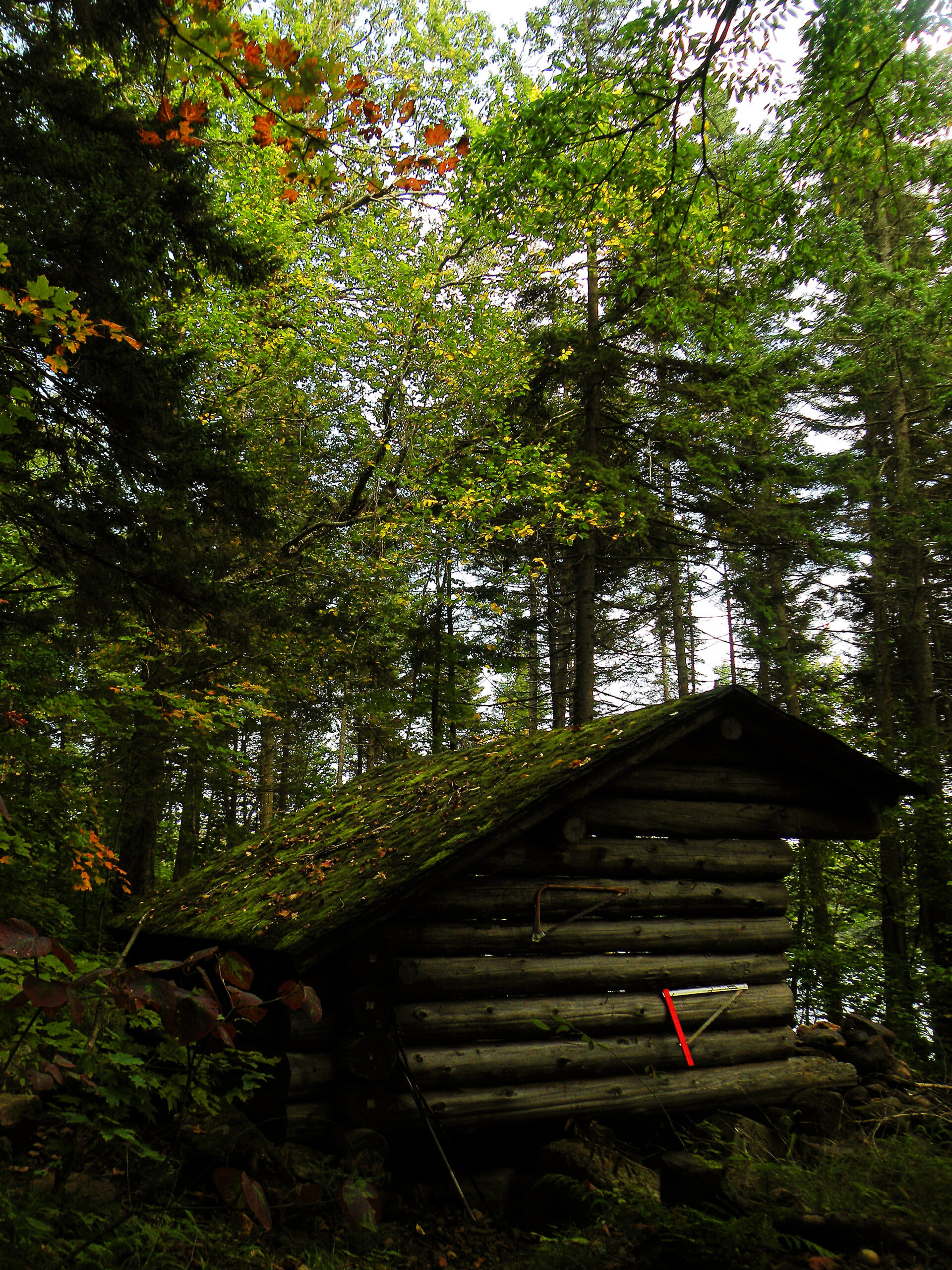
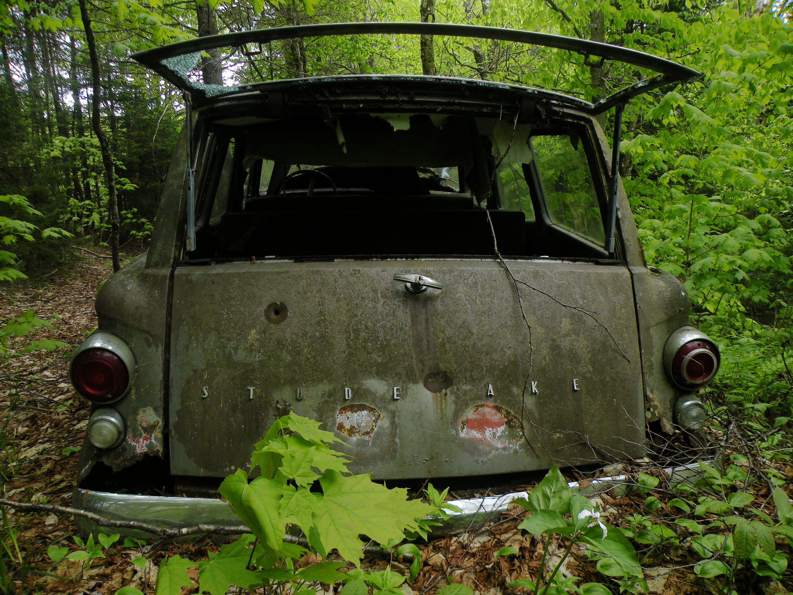
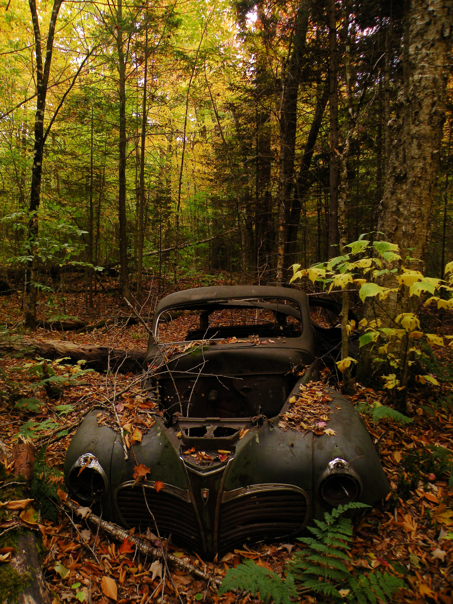
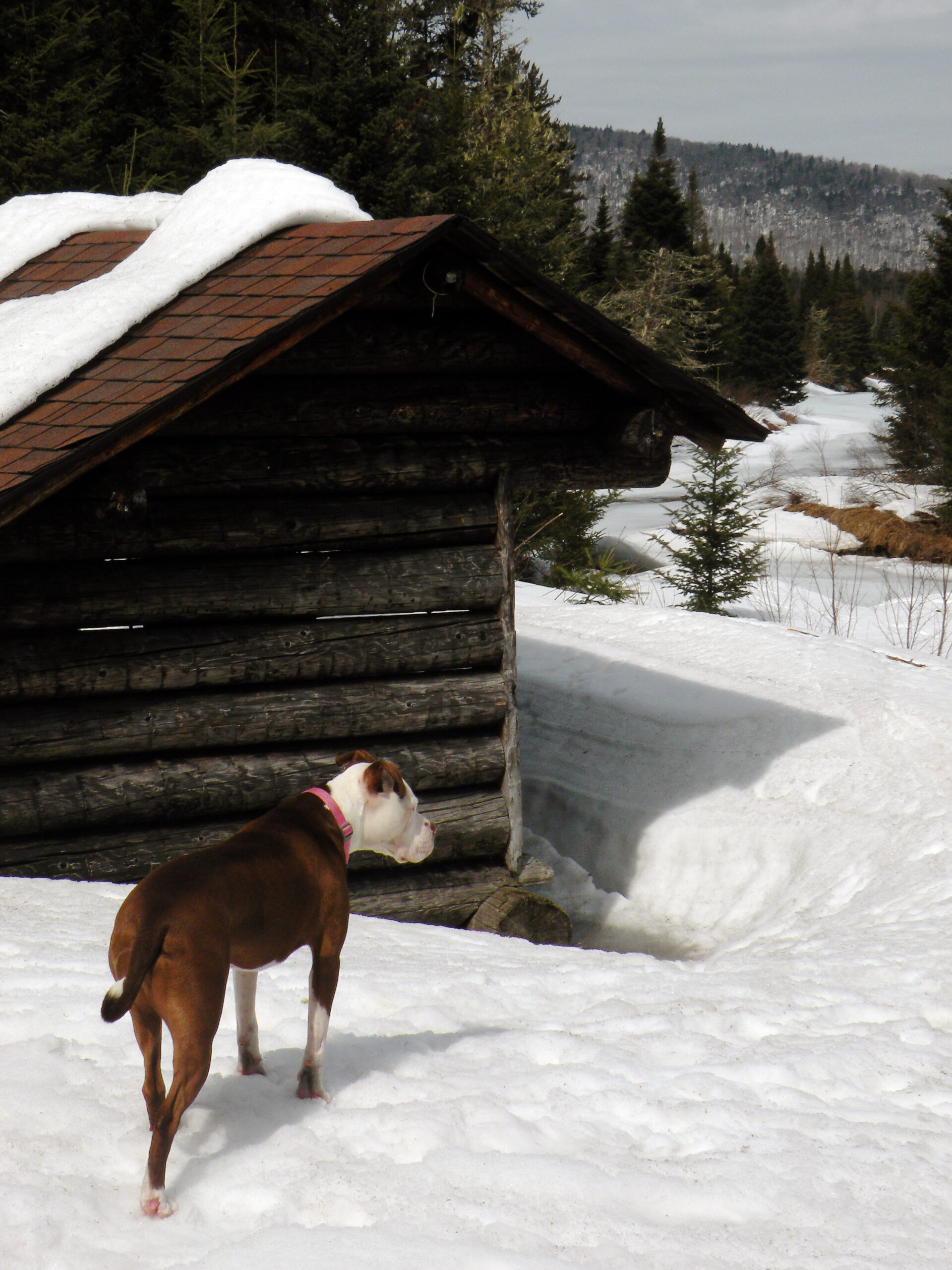
As with every other protected wilderness in the Adirondacks, the West Canada Lake region contains more than its fair share of signs of past human habitation. Most of this is from the post-WWII era, when some of the lands that are now part of the wilderness were forestry tracts populated with a variety of hunting leases. As the land was acquired the hunting camps were systematically removed, but not without leaving behind ample evidence of their existence. Sometimes these “artifacts” are eyesores, and sometimes they are genuine curiosities. There may also be a few sites within the West Canada Lake Wilderness of true historical significance.
Any discussion of the region’s history must begin with Louis Seymour, the French Canadian immigrant-turned-guide often known as “French Louie.” Seymour built cabins and shelters throughout the West Canadas, but his primary residence was a cabin at the eastern end of West Lake. For many years he hunted, fished, and trapped all across the wilderness, often on his own but also as the guide for the sportsmen who sought out his services.
French Louie was well known during his own lifetime, but his reputation survives (possibly with some embellishment) in the popular biographies that have been written about him. Louie himself left an enduring landmark at West Lake: the unfinished fireplace of what was going to be a new camp, a project he abandoned before his death in 1915. It can easily be found within sight of the junction between the Northville-Placid Trail and the connecting route to Brooktrout Lake.
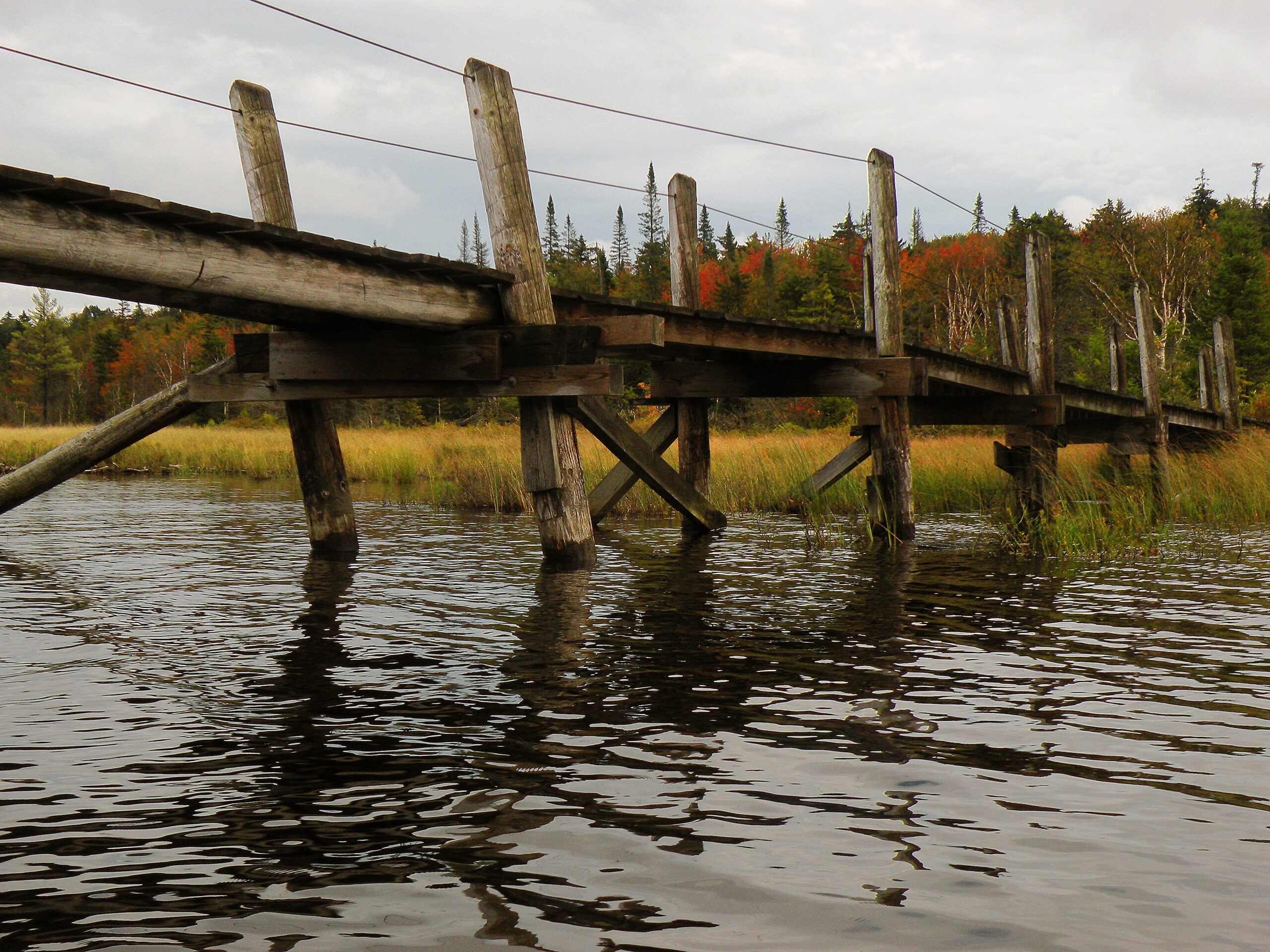
Later, Louie’s site at West Lake became a remote outpost operated by the Conservation Department. This ranger station, as well as a similar one at Cedar Lakes, was a lived-in facility, occupied by a caretaker (and sometimes his family) on a fulltime basis every summer. Both outposts were connected to the outside world via a telephone line, the remains of which can still be seen along the Northville-Placid Trail. When the area was classified as wilderness both stations were closed and eventually removed – but not without some resistance from the state’s ranger staff at the time.
In addition to a former ranger station, Cedar Lakes is also the site of an aging dam. Built in 1904 by lumbermen, it was later rehabilitated by state employees. The structure was intended to enlarge the three-lake change and unify them with nearby Beaver Pond, but in the twenty-first century it is in disrepair and no longer maintained. Nevertheless it remains a prominent sight alongside the Northville-Placid Trail.
Numerous other locations throughout the wilderness – and especially those lands previously owned by International Paper – were once the sites of post-war hunting camps, each standing on land leased by individuals from the company. Several of these sites had been acquired wholesale when the Perkins Clearing land exchange was completed in 1984, at which time the state consolidated its holdings at Pillsbury and Whitney lakes. Legal requirements mandated the removal of the camps, which was done in the most expedient way: burning them to the ground. This practice removed the building but left much of the metal hardware behind. In a few select places, abandoned vehicles are also parked forever near the sites of these former leases.
A complete inventory of the sites of historical interest would be lengthy, but in addition to the ones already named we can add the following to the list:
Please note that there is a very fine line between “old trash” and “historical artifact,” and there could be legal (not to mention ethical) implications for people who remove or damage protected objects. If in doubt, it is best to leave what you find where you found it.
Recreational access to a large portion of the West Canada Lake Wilderness occurs on a seasonal basis because so many of the access points are not maintained in winter – a season when some of the long gravel roads leading to the remote trailheads are used exclusively as snowmobile trails. Only a few wilderness entry points can be found on roads that are maintained year-round, while some parts of the wilderness boundary aren’t accessible to the public at all. Add to this equation the biting fly population, which maintains discouraging numbers well into July, and the result is a pattern of public usage that is skewed to particular areas and a particular time of year.
Past studies of visitor usage have shown portions of the Northville-Placid Trail see the largest volumes of people, with the largest numbers occurring around Columbus Day in October. The N-P Trail functions like an artery through the area, as does the popular 20.5-mile-long West Canada Lake Loop.
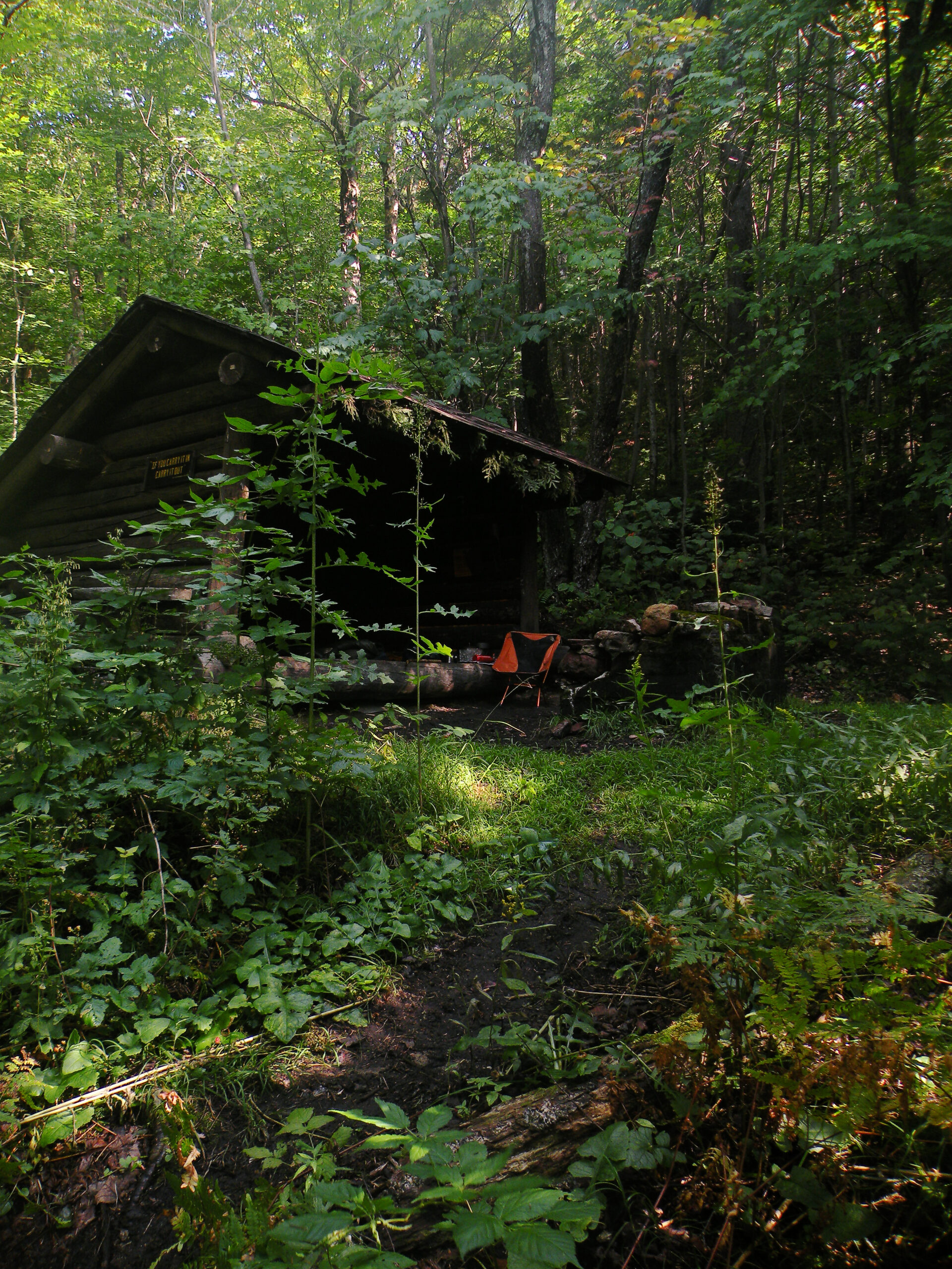
Because most of these visitors are also campers (out of necessity due to the long trail distances), this puts camping space at a premium. Lean-tos are generously spread throughout the cluster of lakes, many of them occupying choice locations. However, alternate sites are either unknown to most people or altogether nonexistent, resulting in a High Peaks-style crowding at some sites. This is fine when everybody gets along and is willing to share a lean-to, but just as often the latecomers seem inclined to camp at a “satellite” site nearby, creating clusters of ad-hoc (and not technically legal) campsites within a few steps of each other.
This phenomenon is common at Brooktrout Lake, Cedar Lakes, and increasingly at other points along the West Canada Loop. A contributing factor is that other than the lean-tos, plentiful as they are, alternate sites often don’t exist, or otherwise require expert local knowledge to find. Arguably there is some benefit to this clustered pattern of camping, in that it results in human impacts being concentrated over smaller areas – as opposed to dispersed camping where well-used sites are spread out to better maintain a sense of solitude. On the other hand, when two or more parties are camping within close proximity of each other and each is tending its own campfire, then this too can result in adverse impacts.
Part of the problem is that DEC has never issued a management plan for this wilderness, despite plans to extend the North Country National Scenic Trail across the West Canadas, and possibly even a “Hamilton County Trail.” The increased visitor levels of today are being shoehorned, for better or worse, into the identical number of facilities that existed thirty or forty years ago. If we wait until degradation begins to occur before we initiate management planning, then we will have squandered two generations’ worth of opportunities to address these problems.
Fortunately, the issues described above are primarily encountered from August through October, and only along key trail corridors. At other times of the year – and especially at locations far removed from the most popular trail corridors – opportunities for genuine solitude are abundant.
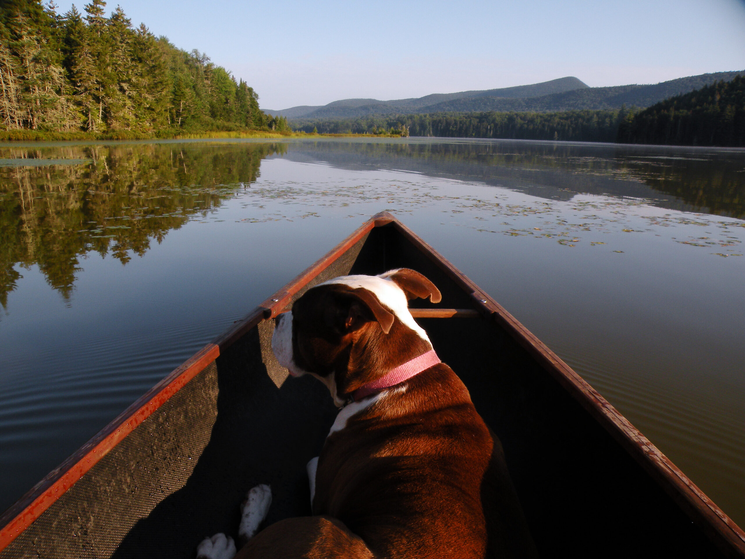
Paddling access is generally limited to the Cedar River Flow, the only lake with direct car access. However, in this age of ultralight pack canoes all of the other remote lakes can and have been paddled.
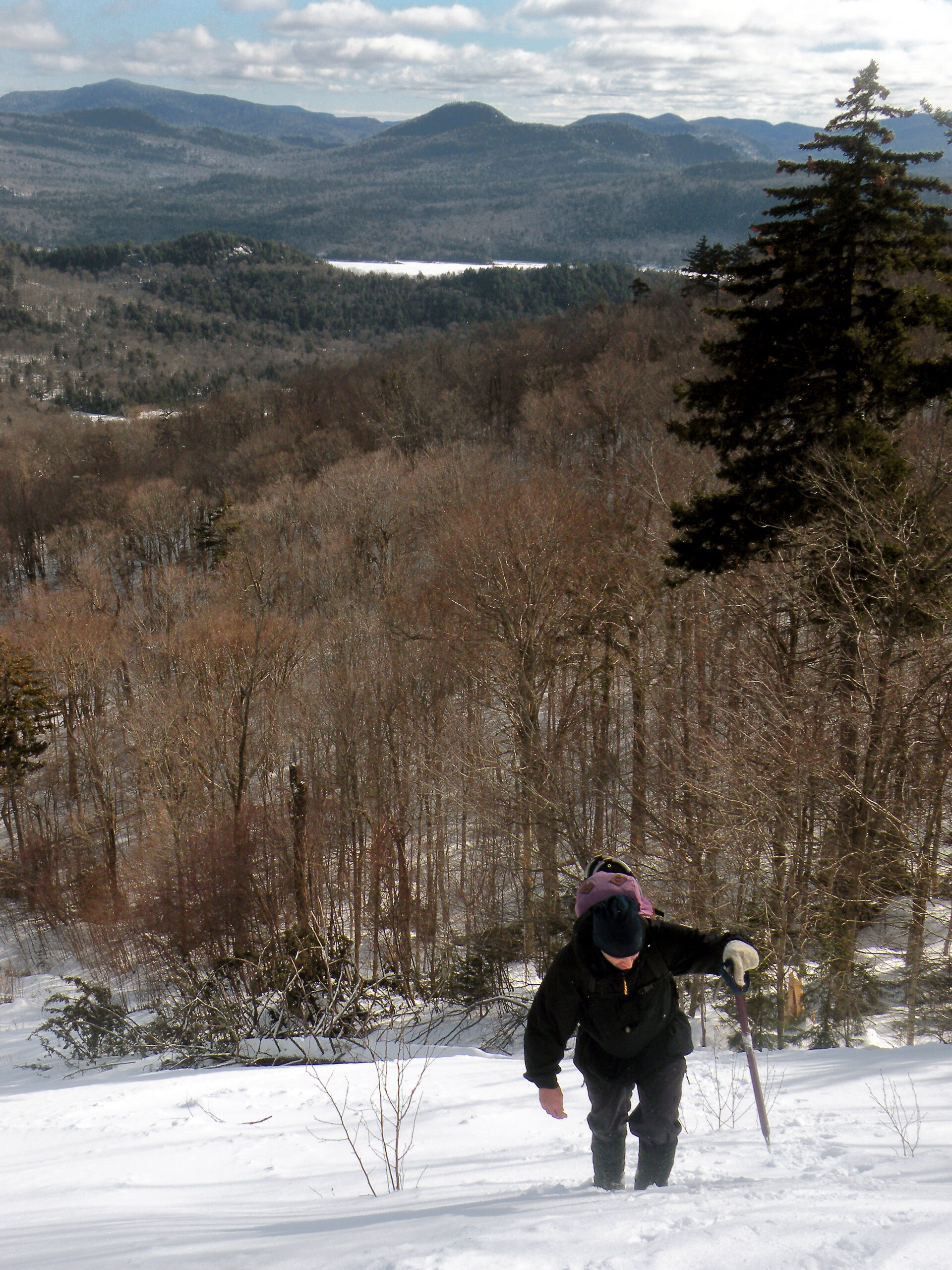
Winter access is very limited, though, with the most common points of entry being in the Piseco area. Unplowed access roads, as well as unplowed parking areas, have long frustrated attempts to visit the interior areas during the snowy months; windows of opportunity should be seized whenever they appear. What little can be seen of the northern half of the wilderness in the off-season suggests snowmobile trespass does occur on wilderness trails, particularly in the Moose River Plains and Perkins Clearing areas when the snows are deep.
The West Canada Lake Wilderness is a vast area, but it is not an infinite, indestructible resource. In the twentieth century it fell victim to the damaging effects of acid rain, and while the recovery of lakes like Brooktrout in more recent decades is commendable, it is becoming inexcusable that this premier wilderness still does not have a management plan in place.
Specifically, recreational management issues need to be addressed while there is still time to take meaningful actions. It is particularly concerning that signs and markers for the North Country National Scenic Trail are already appearing on some routes within the West Canada Lake Wilderness, even though this is a development that must first be approved in a formally vetted management plan. While the proposed route of the NCNST is probably as sensible as any, it nevertheless follows established trails for much of its traverse – and this means any new usage this trail brings will be in addition to the numbers already being observed.
The same goes with the proposed Hamilton County Trail, which currently exists only as a conceptual idea. This route would create a north-south hiking trail through its namesake county, overlapping at times with the Northville-Placid Trail but more often than not venturing laterally into new territory. And like the NCNST, the West Canada Lake Wilderness – by virtue of its central location, which almost makes it unavoidable – lies along the proposed path.
A good management plan would anticipate the changing visitor patterns these new trails might bring and propose solutions to address them. For instance, plans for new backpacking trails should logically mean a corresponding effort to ensure the camping opportunities are adequate, but so far this has not been the experience. In other areas that do have completed management plans, such as the Black River Wild Forest and the Siamese Ponds Wilderness, DEC officials have demonstrated a single-minded tendency to focus on establishing a continuous route for the NCNST, while resisting calls to simultaneously address the number and availability of campsites along the route.
For instance, the NCNST is effectively complete across the Siamese Ponds Wilderness, with the final section of new trail opening in 2019 to link segments of preexisting trail. However, no new campsites have been established along this trail corridor. What this means is that once the NCNST begins to see regular usage, hikers will either resort to making their own campsites or camping use will be concentrated at the handful of existing campsites and lean-tos.
Another key concern is the status of the Cedar Lakes dam. Originally constructed in 1904 and rebuilt by the state many years later, this structure is in poor condition. Rather than facing catastrophic failure, which is what happened to a comparable dam at Duck Hole (High Peaks Wilderness) in 2011, this one is slowly being undercut by flowing water.
What this seems to mean is that the Cedar Lakes dam is only partly effective at retaining water, and the result is a water level that changes dramatically with the seasons; in the spring the water line, flush with ample runoff, appears to reach its historic levels, but by summer all of that extra water drains out underneath the dam and the lakes drop to the native levels. Fortunately for the people who love the Cedar Lakes, they are large enough without the dam to still be beautiful. However, the annual changes in water levels are preventing the natural revegetation of the exposed shorelines, thus giving the lakes the appearance of a reservoir.
When the Duck Hole dam breached in the High Peaks, DEC chose not to rebuild it; and when Marcy Dam was compromised by the same 2011 hurricane the department began to dismantle that structure in phases. Those were sound wilderness management decisions – that aren’t happening at Cedar Lakes, because this area has no management plan. If the dam is not going to be rebuilt, then it should be permanently breached in the interest of (a) avoiding catastrophic failure of the structure, and (b) restoring natural water conditions on the lakes.
Other issues that a West Canada Lake management plan might address are winter access to the area, a boundary correction at Lewey Lake where some of the developed campground amenities extend into wilderness lands, and the removal of non-conforming structures at Little Moose Lake.
The following links leave the AWA website and take you to various pages on the Department of Environmental Conservation (DEC) website with more information on the West Canada Lake Wilderness.
West Canada Lake Wilderness Information Page. Learn important contact information and peruse a list of facilities.
Backcountry Information for the West Central Adirondacks. Trail conditions updated weekly for the West Canada Lake Wilderness.
State Land Regulations. Review the complete list of DEC regulations.
All photos © Bill Ingersoll. Site visitors are permitted to download an unlimited number of images from our website for personal, educational, scientific, or professional use only, with attribution. Commercial use and further distribution of images is prohibited without express written permission.


