Adirondack websites and social media are abuzz with news of a new pilot permit program that the New York State Department of Environmental Conservation (DEC) and Adirondack Mountain Reserve (AMR) have agreed to. Some of the stakeholder organizations represented in the High Peaks Advisory Group (HPAG) have endorsed this pilot. AWA has not. AWA also has not opposed it. Why? The short answer is we do not yet know enough, especially about how DEC and AMR plan to define and measure success for this pilot. In this post, I want to share some of the things I think our supporters should pay attention to as the pilot unfolds.
What We Know
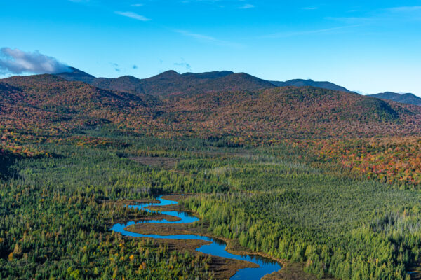
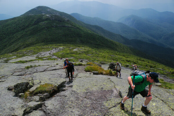
You may know all that follows in this section from reading DEC announcements and media coverage, but for the convenience of those who have not, here is a brief primer. The AMR is a 7,000-acre private park owned by the Ausable Club encompassing the narrow valley that contains the Ausable Lakes, the headwaters of the Ausable River. AMR itself is not wilderness; it contains private camps, a boathouse, and service roads among other human developments. Since 1977, the state has owned an easement limiting further development and securing public access to the trail network. This is a unique arrangement. No other place comes to mind which operates both a private preserve and public trail system. Anyone who has visited the AMR has probably felt some degree of tension between these aspects of the place. Finally, it is gorgeous — containing numerous waterfalls, riverside strolls, scenic overlooks, and popular access to several High Peak summits.


The state’s easement allows for restricting access under limited circumstances if the AMR and DEC agree on the issue and what to do. Besides matters of public safety, the main cause for limiting access seems to be threats “to the natural, aesthetic, scientific, and educational resources.” AMR made clear last year that they felt the resource was being degraded, had collected data to support their claim, and were seeking to implement some kind of restriction on public access as the easement allows. We have not been privy to the subsequent plans and conversations with DEC, but an authoritative outline of the resulting pilot “reservation system” as DEC prefers to call it is available here.
Some notable details: It is a pilot project intended to be carried out over three consecutive summer hiking seasons. The first iteration will be May 1 to October 31 this year. All visitors, regardless of means or place of entry, will need to use an online reservation website to secure a place. Reservations will be free of charge, but several time-based restrictions will be used. Exceptions are made for people who recently arrived in Keene Valley by bus and possibly for local residents. The hours of entry and egress at the main gate will be limited.
The Good
First of all, we need to recognize that experimenting with new approaches to resource management in the High Peaks is a good thing. HPAG’s final report (recommendation B-4, p. 18) explicitly called for piloting an effort to limit use, permitting or otherwise. Pete Nelson, who represented AWA in HPAG recently wrote about the meaning and intent of this recommendation. We also need to recognize that any new, experimental intervention is going to be messy. AMR and DEC, by virtue of its approving this effort, assume responsibilities and risks that we have urged them to take on. We should remember this when the website does not work as expected or when stories emerge of unintended consequences. This is a pilot effort. It is temporary. It is an opportunity to learn.
I doubt I am alone in believing that a reservation system is an excellent idea to manage demand for parking exceeding available spots. Nobody likes driving to a trailhead only to discover the parking lot is full.
Questions We Have
So why am I not simply bullish about this pilot? Many questions remain to be answered. Keep in mind that although AMR is a private park, the easements and access they convey are public property. AWA has staunchly advocated for more open and inclusive planning around management of public resources, and HPAG’s recommendation specifically invokes the Visitor Use Management (VUM) public planning framework as part of its pilot design. We think AMR and DEC’s planning even at the pilot stage would have benefited from engaging in some public conversations that invited feedback on their plan. If they had done so, here are some of the questions I would have asked and why.
What exactly are the goals for this pilot?
Lost in the announcements, so far as I can tell, are any specific goals for the pilot project. Goal has different meanings to different people, but here I mean what are the SMART goals? What are the strategic, measurable, achievable, relevant, and time-based goals that AMR and DEC have agreed to determine if this project is a success? In VUM, goals are typically defined in terms of capacity thresholds. The goals for the parking area are clear enough — allow the lot to reach, but not exceed parking space capacity. However, the pilot will also restrict access for people arriving on foot, by drop-off, by shuttle, and by bicycle regardless of parking lot status. Presumably this is driven by a capacity constraint further back. Have capacity goals been defined for routes and destinations in the AMR? What other goals are being set for the project such as to manage potential external impacts: for example, shifting visitors to nearby destinations that may be just as stressed or more sensitive to overuse or disparate impacts on certain kinds of visitors?
How will data be collected and managed?
Assuming clearly defined goals, what data will be collected to measure progress on each goal? Who will be responsible for that collection? Are they competent and trusted to collect that information? How will the data be assembled and analyzed? What will be made available to public stakeholders? How will baseline data be assembled to study change relative to past seasons? These are not easy questions to answer, but they are in my view the most important dimension of the pilot. An experiment will not provide much insight if it does not generate complete and accurate data relevant to the goals driving it.
How will the registration technology be evaluated?
The new registration app appears to be a homegrown solution developed and managed by AMR. I know from my own experience working over the last year towards developing our new visitor use management tool that a seemingly simple registration process can raise all sorts of design questions that are anything but simple. Has AMR retained a product management team to monitor and improve user experience with the app? Will AMR collect data needed to understand users’ paths through the system: How many who attempt to register succeed? How many who register successfully place reservations? How often are potential visitors turned away because of technical or usability issues? Can it capture demand in excess of supply — users who would like to register but cannot because the date they are seeking is unavailable?
How will user feedback be collected?
Will visitors be surveyed? What questions will be asked? I have noticed that some nature preserves I have visited lately make use of online exit surveys. For example, at the Nature Conservancy’s Lisha Kill natural area in Niskayuna, a QR code at the parking kiosk allows you to complete an online survey on your phone that reports details about you and your visit. A similar tool might be employed here — both at the physical parking lot and at the online registration site — to collect richer information about who is using the new system, what works, and what needs improvement.
What to Do Now
First of all, I encourage our supporters to review the DEC announcement and consider trying out the system if they visit the region this summer. If feedback is sought as part of your experience, please share generously. Also let us know what questions you have and your expectations for the pilot.
It is unlikely that the pilot this summer will change much beyond what has been announced. Let’s take this opportunity to see how it goes, get a clearer picture of DEC’s evaluation protocol, and gather our thoughts about what course corrections to suggest in the subsequent seasons.
Finally, please check out our open source visitor use management tool project. This tool emphasizes different approaches to VUM from the AMR project — namely education and information — and we are pursuing various possible ways to pilot it on a small scale this summer. We are always looking for feedback and potential contributors.


