
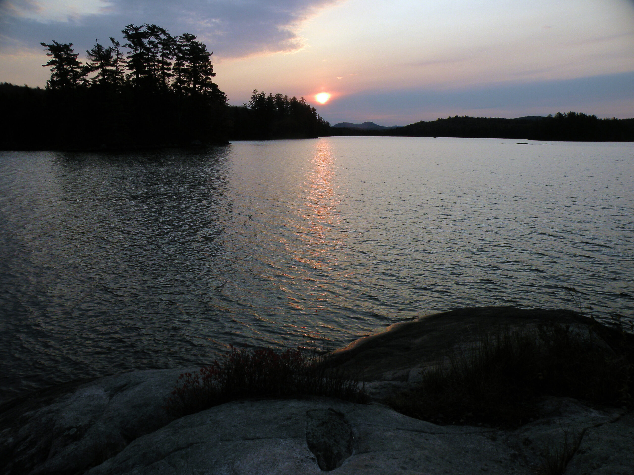
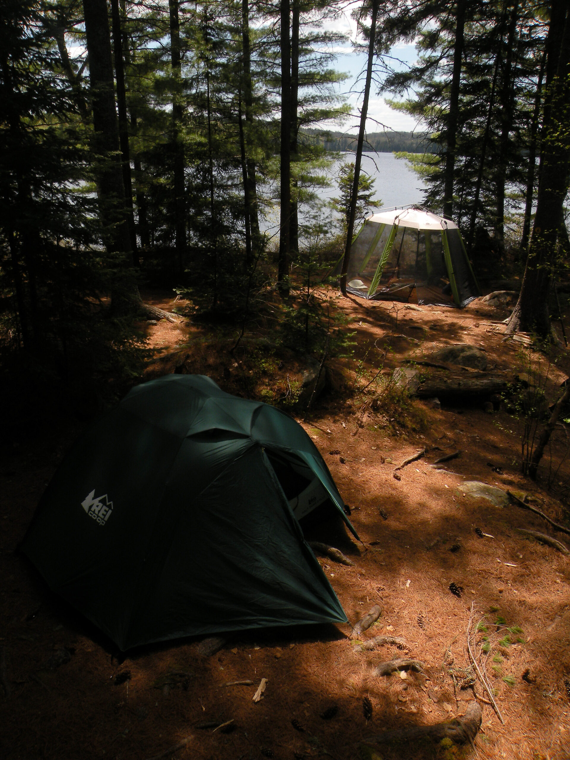
Cloudy Day at Little Tupper Lake

For many people, the William C. Whitney Wilderness is known as a premier paddling destination. The fact that it ranks among the smallest protected areas in the Adirondacks is beside the point, because within its boundaries are three of the largest lakes in the Forest Preserve. With over fifty designated campsites to choose from, and with miles of waterways to explore, this area is nothing short of a gem.
Named for a nineteenth-century businessman and politician, the Whitney Wilderness was pieced together in 2000 from two blockbuster land purchases, both of them the choicest fragments of former private parks. The state had previously purchased the west end of this tract in 1978 from the heirs of William Seward Webb, a land speculator best known for building the Adirondack Division railroad. The centerpiece of that purchase had been the 1400-acre Lake Lila, which remains the largest Adirondack lake in full public ownership.
Some 20 years later, New York State closed on the second of the two major purchases, adding thousands of acres to the Forest Preserve acquired from Whitney Industries in 1998. This tract included most of Little Tupper Lake and all of Rock Pond, as well as a ribbon of forest that created a land bridge with the Lake Lila parcel. Though far from complete, this was enough wilderness acreage to satisfy the State Land Master Plan.
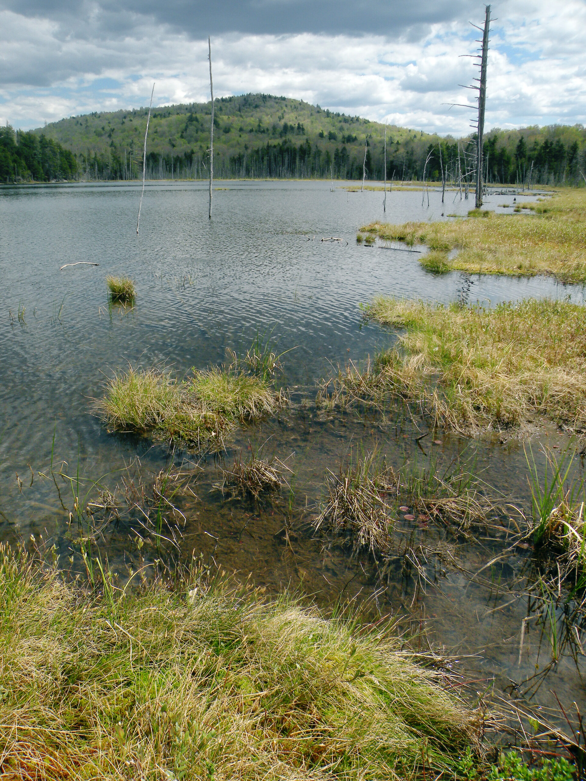
Between these three major water bodies are a dozen baby ponds and an array of navigable streams. But as a protected wilderness assembled from what had long been managed forests, Whitney is something of a paradox – and the area is not without its blemishes. This is an example of how a wilderness classification is not always an observation of what the land is, but sometimes a statement of intent about what it should become. If the lands and forests weren’t completely pristine at the time of the wilderness designation in 2000, nature has been given a free hand to make restorations as it sees fit. And so far, the results have been outstanding.
Please click through the tabs below to learn more about the William C. Whitney Wilderness.
Size: 16,041 acres
First Designated: 2000
Unit Management Plan Status: A brief stewardship plan was published in 1998, but an approved UMP has never been issued for this area
Special Regulations: Special regulations apply — see tabs below


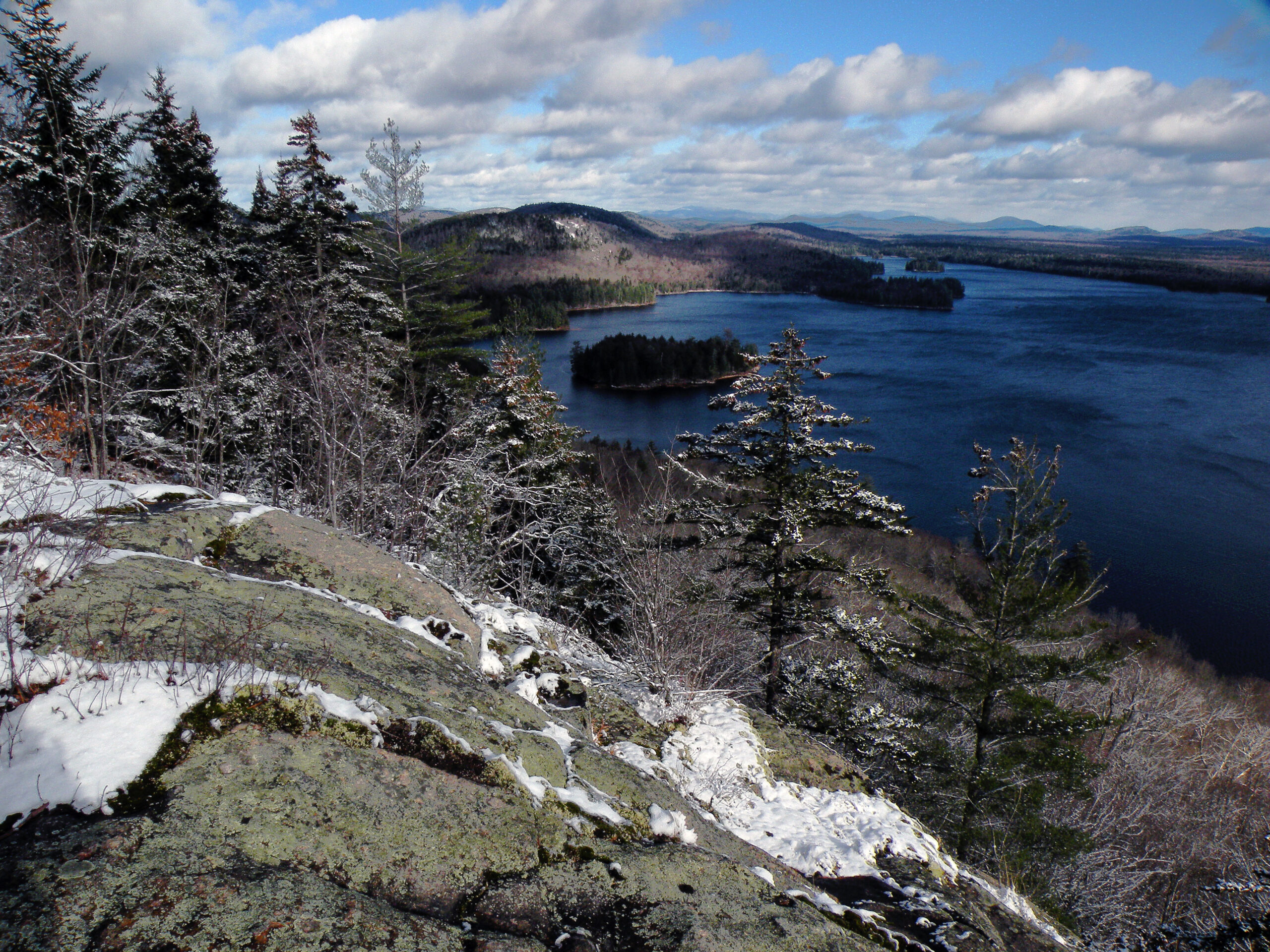
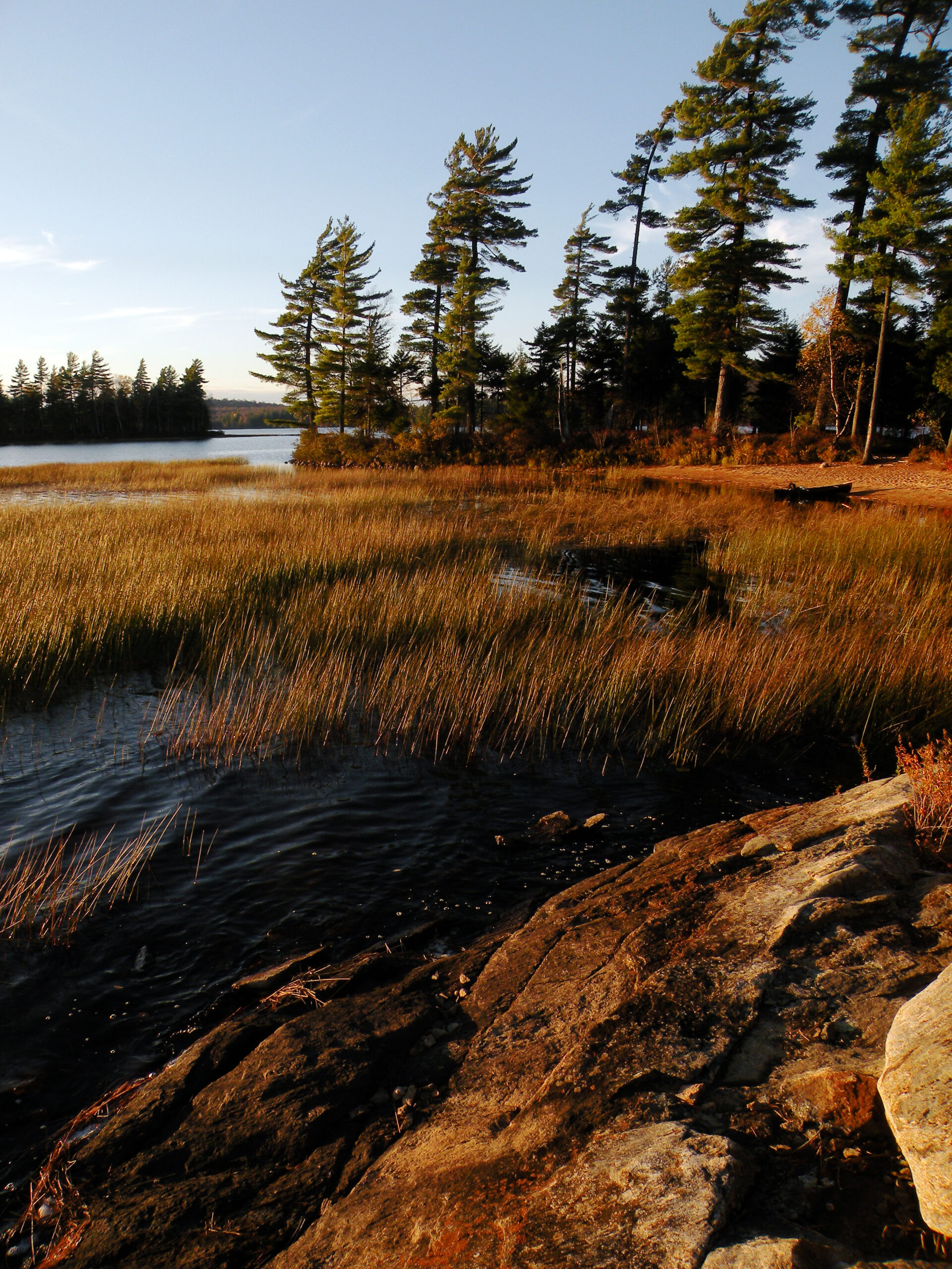
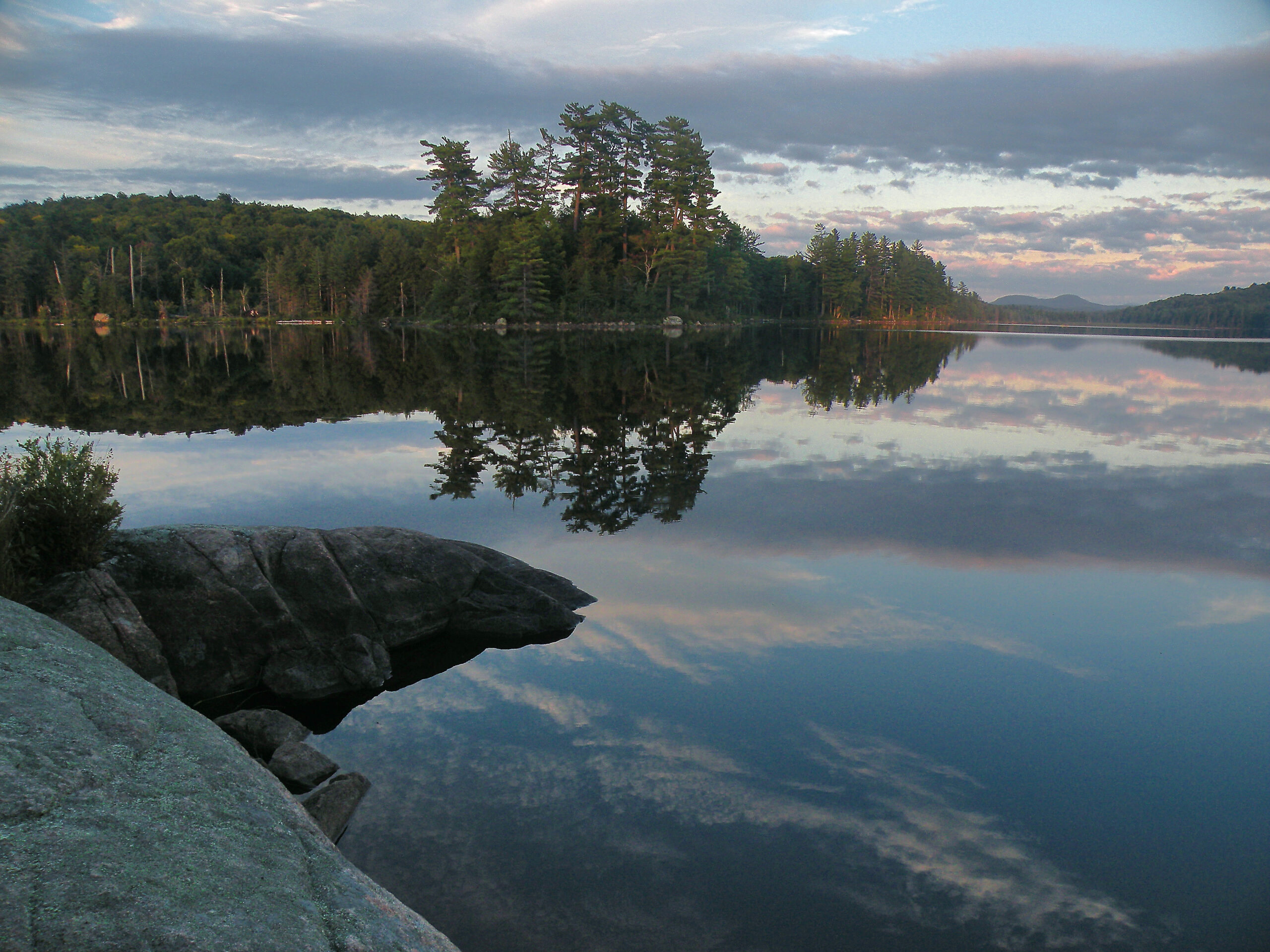
This is a wilderness defined as much by water as it is by land, with the combined surface area of its lakes, ponds, and other waterways accounting for 28% of the total acreage. The largest lakes, of course, are Lila at 1400 acres – the largest Adirondack lake entirely within the Forest Preserve – and Little Tupper, a 2300-acre waterway that is managed as part of the wilderness despite the presence of two private properties along its shoreline.
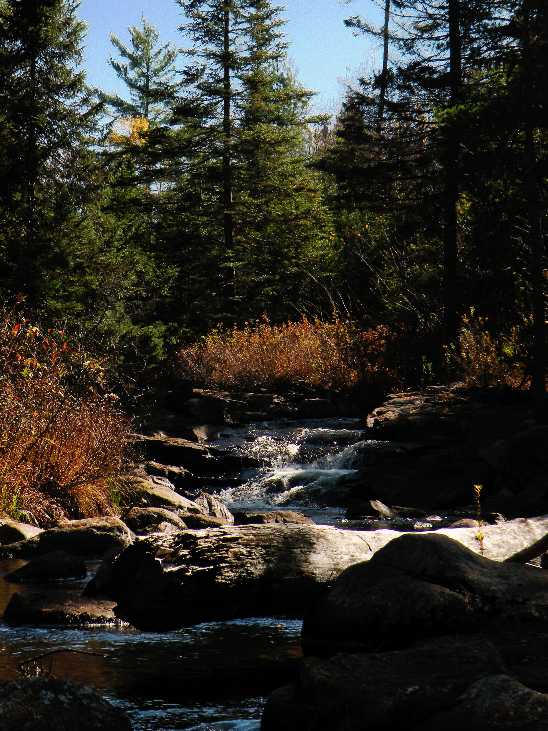
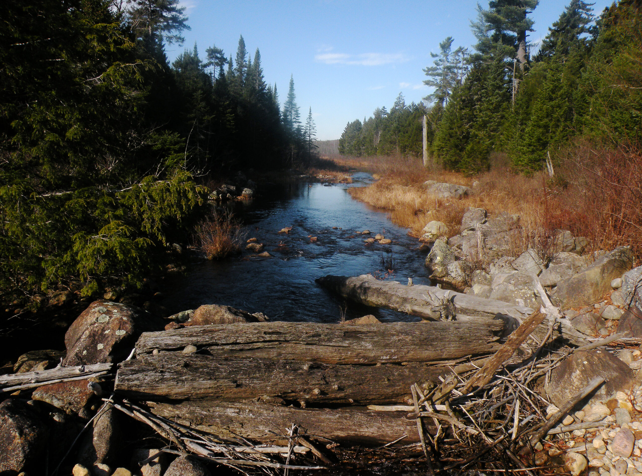
Indeed, these are wilderness lakes, with miles of undeveloped shoreline. Windswept pines grace natural sand beaches, and groves of spruce and hemlock cap the various small islands. Noteworthy streams radiate outward in all directions, some providing water flowing in from the adjacent private properties, and two major streams flowing out. Lake Lila in particular deserves mention for being the starting point of the Beaver River, one of the major drainages of the western Adirondacks.
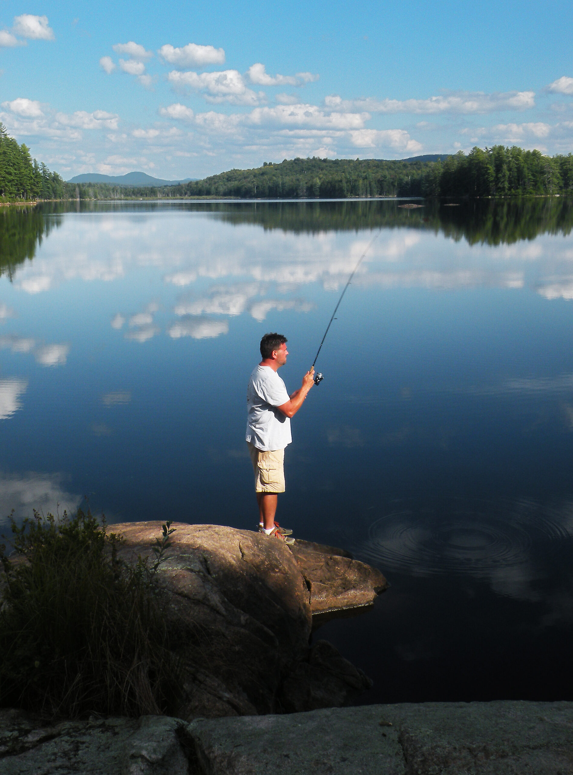
Lila’s fishery is celebrated by sportsmen mostly for its bass, a feature that draws numerous people every June despite the prevailing black fly situation. The Little Tupper watershed, including Rock Pond and Bum Pond, is home to a genetically unique strain of native brook trout – one that has been widely stocked across the Adirondack Park. While this strain will survive because of that stocking program, it is unfortunate that it has been threatened in its home waters by the illegal introduction of bass. This act of ecological sabotage probably occurred soon after Little Tupper Lake was opened to the public.
Between these two lakes is a stretch of remote forest bearing nine other named ponds, the largest of which is the outstanding Rock Pond, whose name belies its remarkable size. This area constitutes the bulk of the William C. Whitney Wilderness, in terms of its geographic area. Although the total acreage ranks among the smallest of the park’s protected areas, it nevertheless achieves a significant appearance of remoteness – by virtue of the fact it is a “land bridge” spanning a region that is otherwise off-limits to the public due to private ownership.
Forest quality would be unremarkable and otherwise consistent with neighboring areas, except for the unmistakable human history on display here. The twin tracts surrounding both Lila and Little Tupper were constituent parts of private preserves dating to the 1890s, each owned by wealthy businessmen who viewed their lands equally as investments as much as sporting grounds.
The result is a forest that shows the distinct marks of a century’s worth of active (and sometimes intense) forestry management. Although mostly undeveloped, what is now a public wilderness was heavily logged prior to state acquisition, and many of the impacts of those activities will linger for years to come. These include areas of open meadow created by a devastating 1908 forest fire, dozens of gravelly clearings, miles upon miles of roads and skidder trails, and the overall youthful appearance of the trees.
Somewhat more subtle are the pockets of Norway spruce and Scotch pines; as their names suggest these are not native North American tree species, but they were nevertheless the favorites of past foresters. Because they were planted frequently, pockets of both European conifers can be found at random places throughout the wilderness.
Fortunately, decades of hands-off management has resulted in significant regrowth, and the future health of the forest seems assured. Combined with the almost rampant beaver activity all across this wilderness, William C. Whitney is a prime example of how natural forces can undo the works of man when given both time and opportunity.
Curiously, the human history of this wilderness begins – and to a degree still involves – a major railroad.
Dr. William Seward Webb, for whom the Town of Webb in northernmost Herkimer County is named, is best known for building the Adirondack Division of the New York Central Railroad. This was a branch line that connected Utica with Malone in the northernmost reaches of the state, opening for regular freight and passenger service in 1892. Normally a railroad company would obtain a narrow right of way along its intended route, but when Webb encountered obstacles in that plan he simply bought entire tracts. This included thousands of acres throughout the Beaver River watershed.
Previously, the source of the Beaver was known as Smith’s Lake, named for a hermit who lived here many decades prior. Taken with its obvious beauty, and with his new railroad passing very close to the west shore, Webb chose this lake as the centerpiece for what was to become his private park. He renamed the lake after his wife Lila Osgood Vanderbilt and built Nehasane Lodge just below Frederica Mountain, named for a daughter.
After Webb’s death in 1926, ownership of Nehasane Park passed to his heirs, who in turn sold some 14,600 acres to the state (via the Adirondack Nature Conservancy) in 1978. This acreage has since been split between the Five Ponds Wilderness and the William C. Whitney Wilderness, with the railroad serving as the boundary.
A short distance to the east, Whitney Park began as a 68,000-acre tract purchased in 1897 by two business partners, Patrick C. Moynehan and William C. Whitney — one a wealthy lumberman from Glens Falls, the other a prominent lawyer, businessman, and former Secretary of the Navy under President Grover Cleveland. The land, previously owned by the Hamilton Park Club, was still mostly virgin forest, and the partners were able to pick it up at $1.50 an acre.
Whitney and Moynehan hired Henry Graves to write a forestry management plan for their property. Based largely on the survey that Graves had already conducted on the neighboring Webb property, the plan called for strict diameter limits to allow a second harvest in 36 years. From 1898 to 1909, only the largest spruce and pine trees — those with a diameter of 10 inches or larger — were harvested. The logs were floated down Round Lake Stream and the Bog River to Tupper Lake, where they were then sold to various mills. Hemlock bark was shipped by train to distant tanneries.
Whitney died in 1904, but his son Harry continued the partnership. In 1912, when the first cut was over and the partnership concluded, the tract became Whitney Park.
A second harvest began in 1934, in accordance with the original forestry plan. Although a railroad was laid out as far as Rock Pond, most of the logging was conducted with horse-drawn sleds. This time balsam fir was also harvested, as were hardwoods.
By 1970, when Graves’ scheduled third cut should have started, economic pressures forced Whitney Industries to change its strategy. They sold Grampus and Mohegan lakes to Litchfield Park in the 1960s, and Round Lake and Buck Mountain to International Paper in the 1970s. The remaining portion of Whitney Park, from Little Tupper Lake to Forked Lake, was then logged so heavily and so thoroughly that by the 1980s almost nothing was left — the forest had been liquidated. Whitney Industry’s logging practices, once highly regarded, became the butt of local jokes.
The last member of the Whitney family to administer Whitney Park was Marylou Whitney, better known as a Manhattan socialite and a frequent visitor at Saratoga during the racing season. The widow of Cornelius Vanderbilt Whitney, she proposed a fifty-lot subdivision on the 15,000 acres surrounding Little Tupper Lake. Such a development plan was so alarming that the state intervened and acquired all of the lands within the project’s scope.
Although these lands have been managed as wilderness since 2000, evidence of past human activity is abundant; even the forest itself is an artifact of the intensive logging that occurred here. The highlights can be summarized as follows:
Road network: Certainly, the extensive network of abandoned roads is difficult to ignore. At the time of the Whitney acquisition in 1998, some of these routes were still in a “pristine” condition, suitable for ordinary automobiles. The natural forces that have been acting on these man-made constructs have seen impressive results, and now the gravel surfaces are apt to be covered with new vegetation. Several large gravel pits remain, though, and one pair of roads along Lake Lila’s western shore are still in active usage as rights of way for landowners at Nehasane and Partlow lakes.
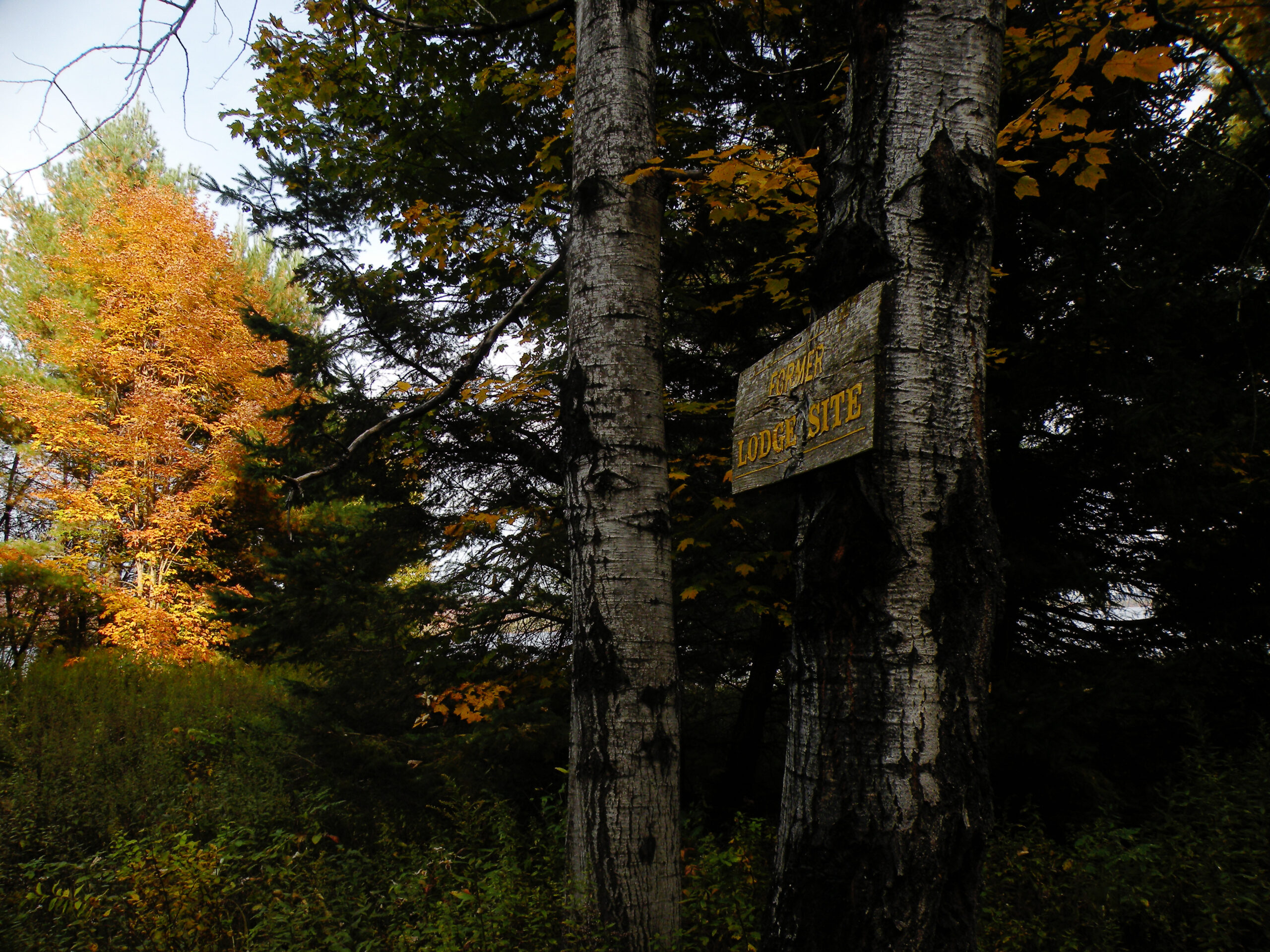
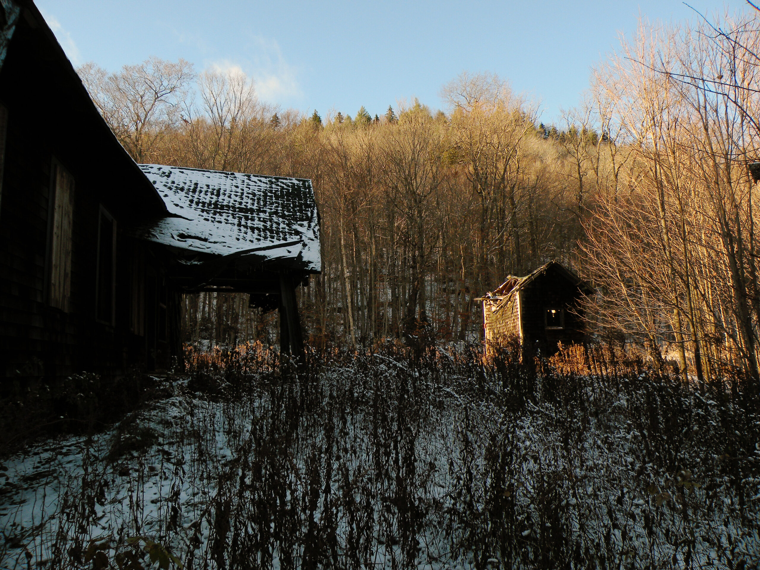
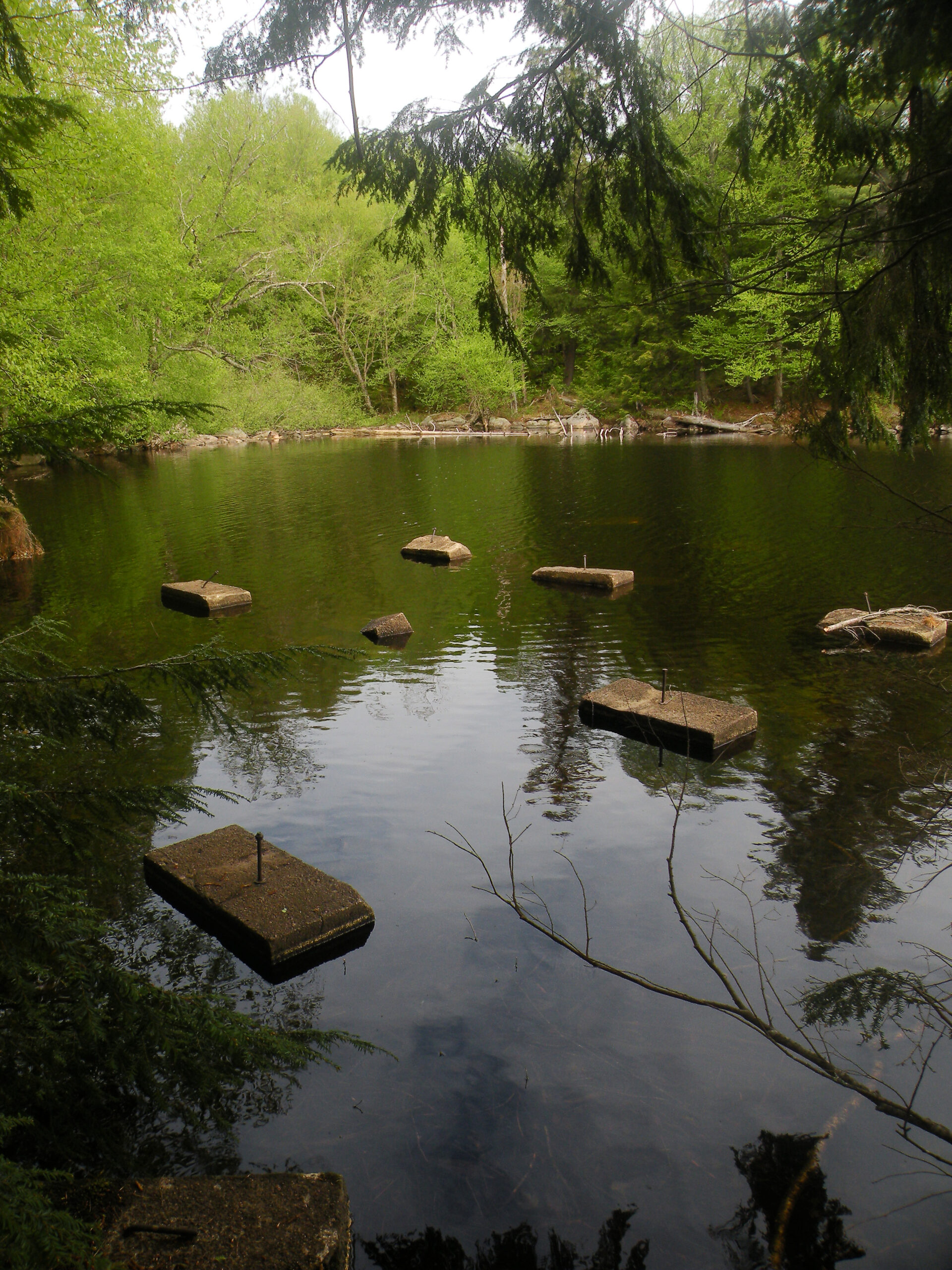
Nehasane Lodge: This impressive structure still stood on Lake Lila’s western shore when the state acquired the lake in 1978, but it was in poor condition by that time. Furthermore, its existence in the Forest Preserve was at odds with Article XIV of the state’s constitution. In an act still bemourned by some, the state removed the structure in 1984; the site is almost unrecognizable today, save for a sign identifying its location. On the other hand, Webb’s old Nehasane Station still stands beside his railroad, on a small envelope of land excepted from the wilderness boundaries. However, these structures have also deteriorated.
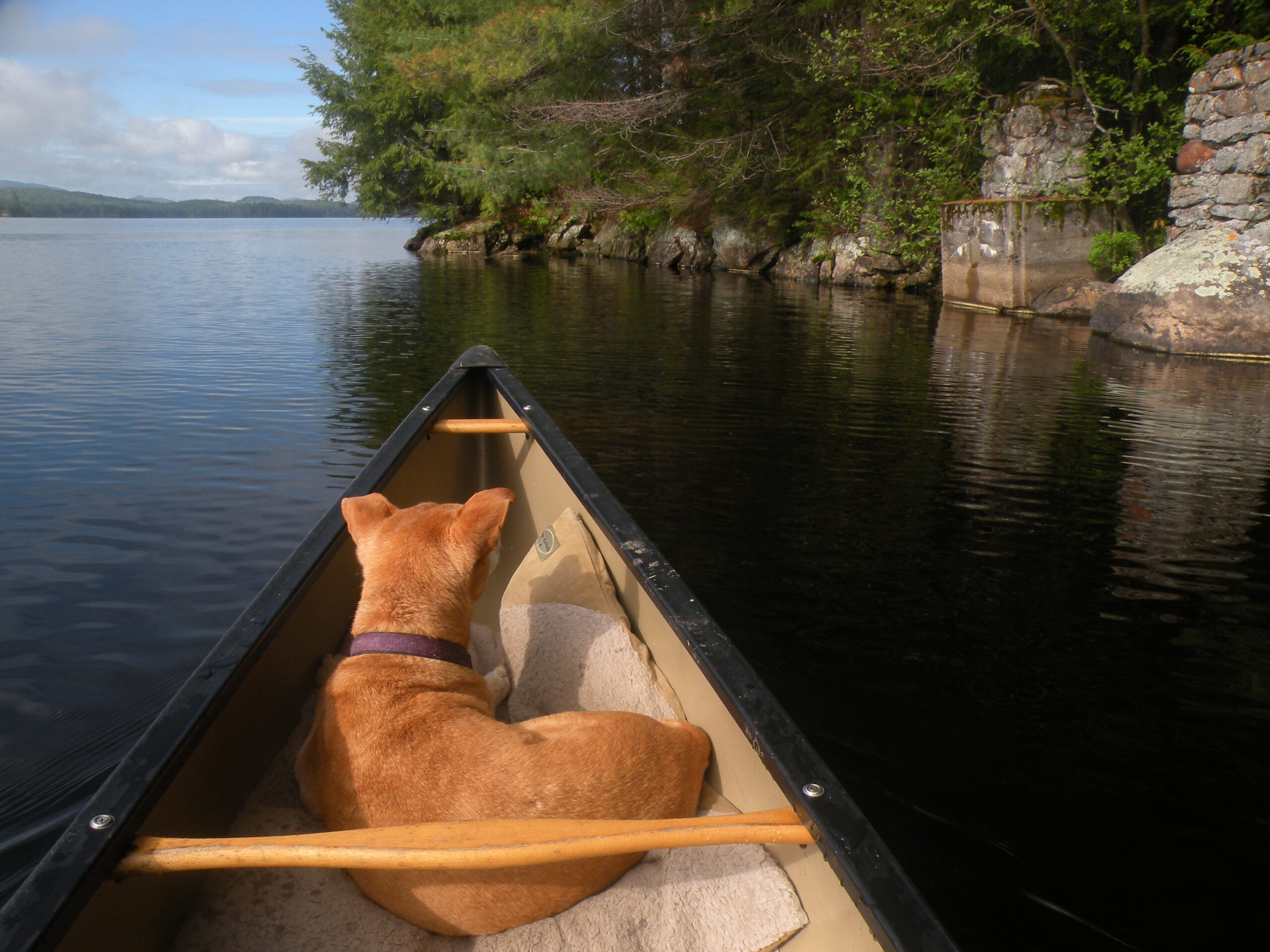
Regan Point: One designated campsite on Little Tupper’s north shore is well-known for its wealth of structural artifacts, including two stone chimneys and a set of pylons on the water’s edge. Unlike Nehasane Lodge, the existence of which was thoroughly erased, it is easy to trace the outline of this modest camp structure, along with its cistern-fed plumbing system. Regan Point was once the haunt of a Whitney family member, but now it a designated campsite.
Rock Pond Logging Railroad: In the twentieth century, logging crews often built temporary railroads as a means for hauling logs to market. One such grade constructed in the 1930s can still be seen in the vicinity of Rock Pond and Hardigan Pond. Much of it is thickly overgrown, and sections were later buried under the network of gravel roads, but one section with its remnants of creosote-laden ties serves as the canoe carry trail to Hardigan Pond. In fact, the tiny designated campsite at Hardigan sits directly atop the former grade.
1903 forest fire: Although an economic boom to the region, Webb’s railroad has also been faulted for sparking numerous forest fires all along its line. One of them burned well into what is now the wilderness, resulting in large clearings that have yet to be reclaimed by the forest. These can best be viewed in the vicinity of Lilypad Pond and Franks Pond.
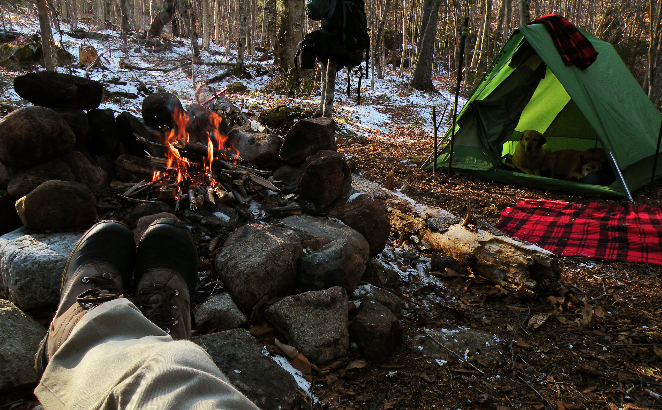
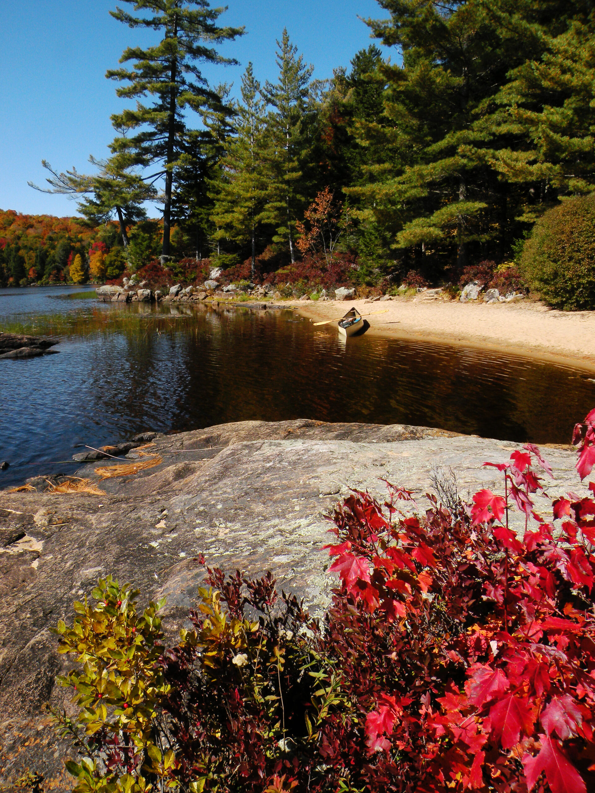
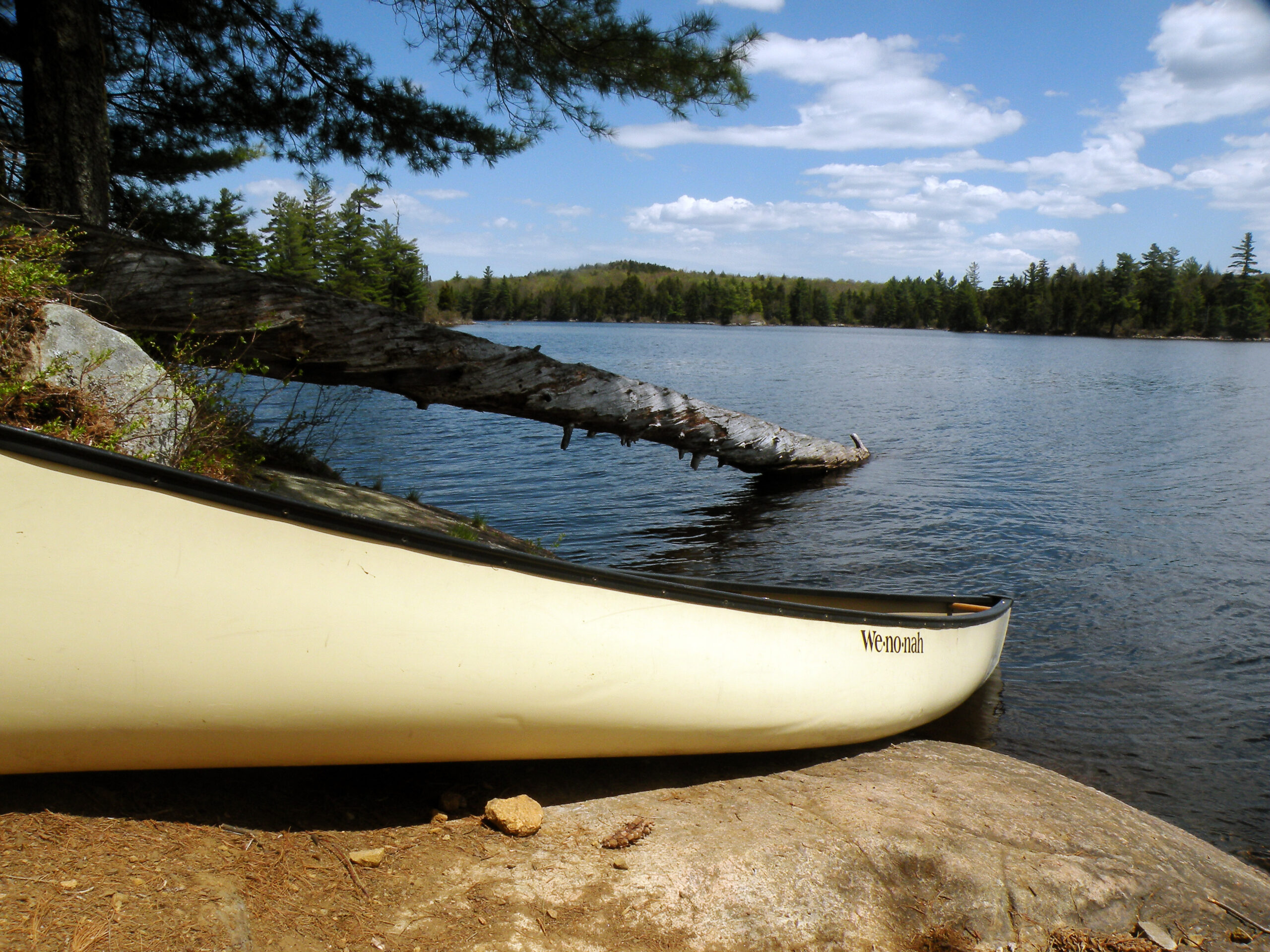
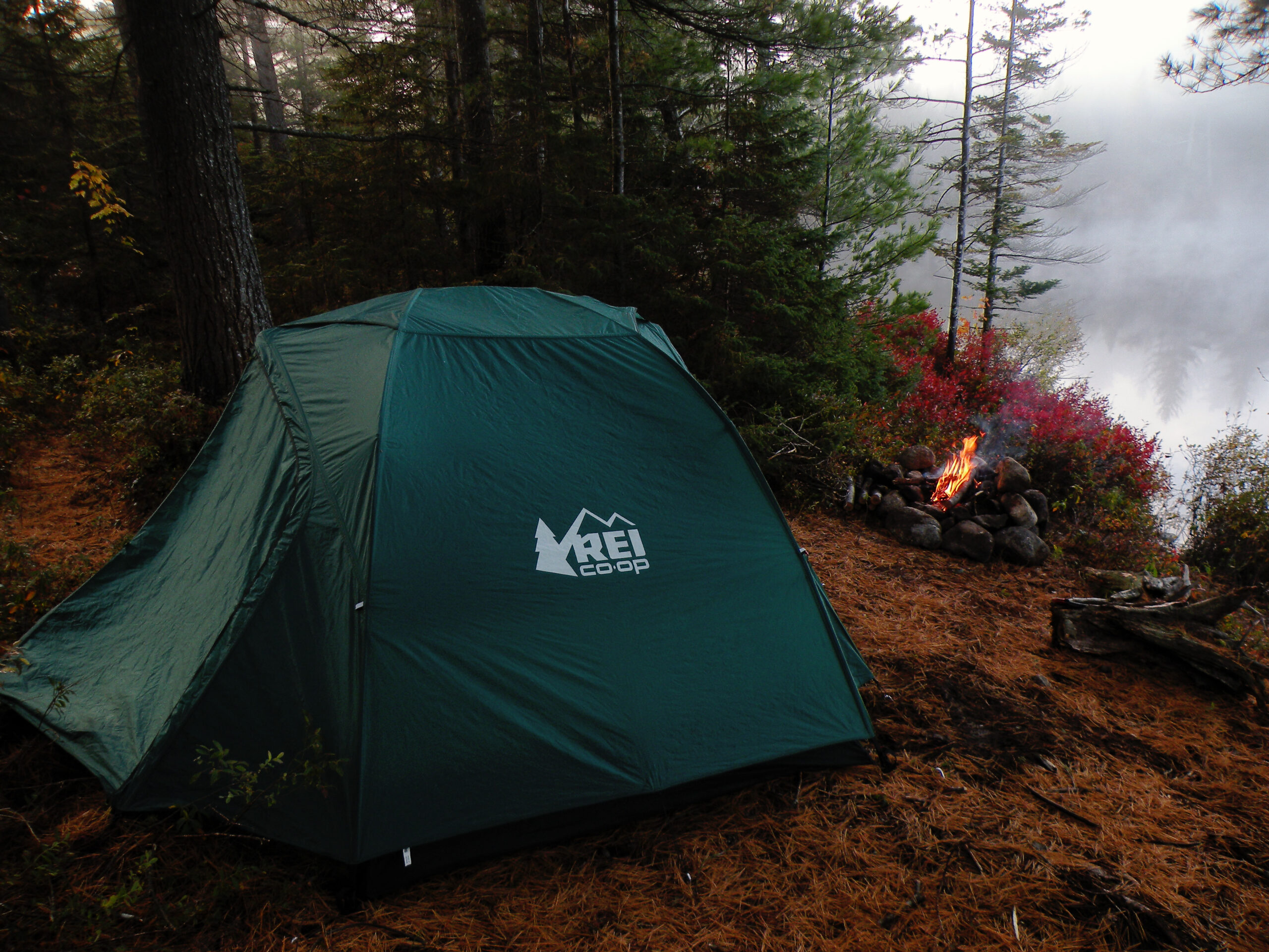
Since the Lake Lila acquisition in 1978, the primary form of recreation in this area has been paddle-based, as in canoeing and kayaking. The Adirondack region sports numerous lakes of course, but few are as large as Lila and Little Tupper, especially where motorboats and floatplanes are absent. With dozens of lakeside campsites to choose from, the William C. Whitney Wilderness is a prime destination for paddlers.
Indeed, the 0.3-mile carry trail leading to Lake Lila from the nearest public parking area is likely one of the busiest foot trails in the Adirondack Park – but only during paddle season. With its numerous sand beaches and scenic mountain overlooks, Lila has been a tremendously popular lake for many years; some people insist it is still the best lake in the vicinity, even with the subsequent purchases of Little Tupper and Round Lake.
The one landmark most commonly associated with Lila is Frederica Mountain… which, if you want to get technical, is in the neighboring Five Ponds Wilderness, despite its outstanding view of Lake Lila and practically the entire expanse of William C. Whitney. Webb’s Adirondack Railroad serves as the dividing line. But with just a short hike from the shoreline, the view from the summit is highly photogenic.
From a wilderness purist’s point of view, Lila might suffer from the presence of an active motor vehicle road hugging the western shoreline. Use of the road is light, and it is not open to the public (except for foot travel), but for some people its presence may detract from the lake’s sense of remoteness. The same might be said for the railroad tracks; should train service ever be restored, as has long been contemplated but never realized, the passage of locomotives might please some history-minded visitors but annoy others.
By contrast, Little Tupper Lake offers better opportunities for remoteness – if one is willing to paddle to its far southwestern reaches. The entire lake is managed as part of the wilderness, but its northern end is dotted by several non-wilderness facilities: a state ranger station complex, two private camps, and a section of Sabattis Road. Again, these are all possible annoyances for the purists, since each might be visible across the lake over long distances. But Little Tupper’s long, curving shape makes it possible to put these blemishes behind you, enjoying nothing but a rugged waterscape with varied shoreline attributes and ample camping opportunities.
Because the William C. Whitney Wilderness is closely connected with the neighboring Round Lake Wilderness and Five Ponds Wilderness, long-distance lake-hopping trips are also possible.
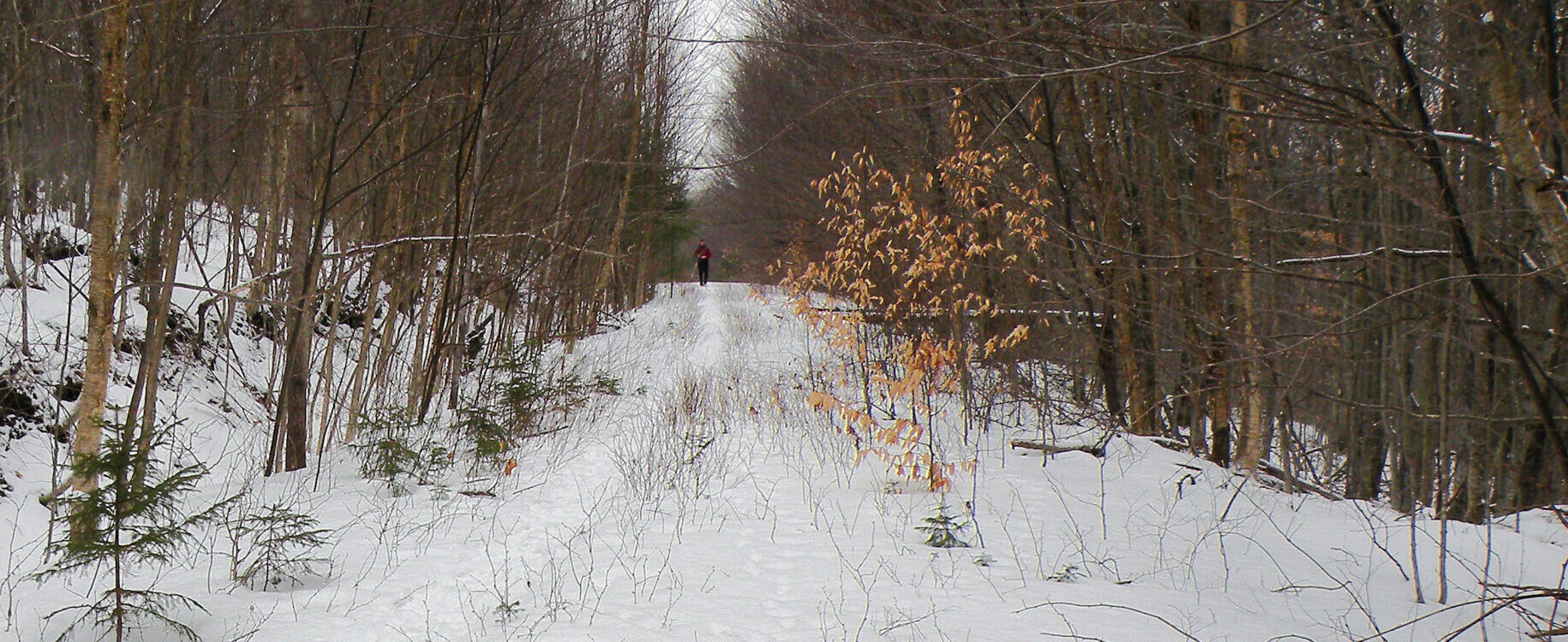
Outside of canoe season, most of the foot traffic in this area occurs in the eastern half, on the former roads encircling Little Tupper Lake. And even then most people seem to go no farther than Bum Pond. Because the long access road to Lake Lila is not plowed in winter, many people simply never go there (except, probably, snowmobilers riding the railroad corridor). Thus anyone wishing to take advantage of the excellent snowfall in this part of the Adirondacks is likely going to gravitate to one of the two trailheads on Sabattis Road.
But why no farther than Bum Pond? Possibly because the former road system is so extensive it likely wears people out after the first few miles. Even though Whitney’s meager 16,000 acres places it on the small side for an Adirondack wilderness, the area is anything but compact. You might describe this as a “wilderness corridor” cutting through a region that is otherwise privately owned; rather than being tightly encircled by roads and residential areas like the comparably-sized Hurricane Mountain Wilderness, the Whitney area is just a small piece of a much larger mosaic. It might be tiny today, but it has the potential to double, triple, maybe even quadruple its size someday, if only the state can find the funds and wherewithal to acquire some of the adjacent properties.
So even though any point within the William C. Whitney Wilderness is never far from one of its boundaries – as is usually the case in a smaller wilderness, where true remoteness is never possible – the acreage beyond Bum Pond is nevertheless remote from the nearest public points of entry. Thus hikers and skiers rarely penetrate this far, simply because of the sheer distances involved.
That is something of a shame, because as the logged-over forests slowly mature, and as the old logging roads gradually morph into wide trails, the area will become ever more appealing to land-based exploration. Some of the same primitive campsites used by paddlers are also attractive to potential backpackers, and the extensive road network provides a ready-made framework for a trail system. A route completely encircling Little Tupper Lake would be an excellent recreational asset – and easy to build, since in the former Whitney Park an old road can be found for practically every occasion.
The William C. Whitney Wilderness is not threatened per se, but there are several aspects of the management of this area of concern to anyone interested in its future. Not surprisingly, all of them pertain to human activities, not the wild landscape itself.
The state designated the William C. Whitney Wilderness in 2000, just two years after the state acquired Little Tupper Lake from the Whitney family. This large lake is interconnected with several other waterways, including Round Lake, Rock Pond, and Bum Pond – making all of these one continuous habitat, as far as its fishery is concerned.
And that fishery is certainly worth mentioning. Little Tupper and its neighbors are the home of a unique strain of brook trout, one that evolved here after the last Ice Age and nowhere else. The Adirondacks used to host dozens of such unique genetic strains, many of which vanished when sportsmen introduced nonnative fish species to the region. Indeed, protecting the Little Tupper fishery was one of the primary goals of preserving these lakes by first adding them to the Forest Preserve and then banning motorized access.
Unfortunately this effort was sabotaged not long after the Little Tupper purchase, when an unknown party dumped bass into the waterway. This predatory fish species now occupies the heritage trout waters, with no easy way to oust the transplants. Fortunately, the Little Tupper strain has long been a favorite of DEC’s stocking programs, and these are one of several surviving heritage strains now found in ponds throughout the Adirondacks. Nevertheless, it is unfortunate that the Little Tuppers are now threatened in their home waters.
Although it hasn’t resulted in the complete collapse of the trout fishery, the bass introduction has since had other negative effects. Specifically, this incident has caused various land trusts to think twice about selling other lakes with heritage fisheries to the state – including Follensby Pond near Tupper Lake and Little Charley Pond near Lake Lila. In the interest of preserving the aquatic wildlife, the land trusts have decided the Forest Preserve is not the best option – and thus significant opportunities to promote the growth of public lands have been disrupted by one cynical act.
The status of Webb’s railroad corridor has been the subject of much debate, complete with partisan organizations touting their competing visions for the future of the tracks. AWA has never taken an official stance on the status of the corridor, but we can offer this analysis of the relationship of the railroad with the surrounding wilderness lands at Lake Lila.
The question as currently framed is whether the railroad tracks should be repaired to allow regular train service again, or removed entirely so the corridor may be used as a multi-use recreation trail. After years of debate and even litigation, the state’s preference is to split the corridor into two sections: the northern end from Tupper Lake to Lake Placid will be converted into a multi-use trail, while the southern half from Thendara to Tupper Lake will be restored for the benefit of a Utica-based scenic rail tour.
It’s this southern half that is of relevance here, since this is the section that passes near Lake Lila, forming the westernmost boundary of the William C. Whitney Wilderness. Currently snowmobiles use this corridor in the winter, although they are hampered by the presence of the rails themselves, which require substantial snow amounts to be adequately covered.
At the point where the railroad passes near Lake Lila, there are no physical barriers to keep snowmobiles on the corridor. Although we have not observed this ourselves due to the inaccessibility of Lake Lila in the winter, we assume that some snowmobiles exit the corridor and illegally enter the wilderness, simply because there is nothing to prevent this. Therefore any action that increases snowmobile use of the rail corridor will likely have a corresponding increase in the number of enforcement issues at Lake Lila.
Additionally, the removal of the rails would likely lead to increased ATV trespass, whether these are officially permitted on the proposed multi-use trail or not. Thus removal of the rails could result in negative impacts on the wilderness.
On the other hand, if regular train service is ever restored, this would likely have an aesthetic impact on Lake Lila’s visitors, who for nearly fifty years of public access have never known the sounds of passing trains. But this impact would be limited to an intrusion on the lake’s natural soundscape, and not all paddlers may be equally concerned.
The train could itself be a form of access to the lake, dropping off paddlers and their gear and picking them up at a later time.
Regardless of the status of the rails, the condition of the buildings at Nehasane Station should be addressed immediately. With no substantial maintenance effort in decades, these structures are deteriorating. They are listed on the National Register of Historic Places, and thus may have some value in that regards. Nevertheless, years of inaction on the state’s part may itself be a decision, especially if the buildings decay beyond their ability to be restored.
As mentioned elsewhere, the William C. Whitney Wilderness is a strip of public land surrounded by tens of thousands of acres of private preserves. The potential for expansion here is tremendous, and highly desirable from a wilderness preservation perspective. However, so far three opportunities to expand this wilderness have passed without the acquisition of any new acreage.
The first opportunity came in 2006, when The Nature Conservancy acquired Shingle Shanty Brook from International Paper. This was a prime property directly connecting the Whitney area with the Pigeon Lake Wilderness to the southwest, including several lakes and miles of navigable stream. However, the property was so encumbered with third-party exclusive rights that public access would’ve been legally difficult, even if the land was added to the Forest Preserve. Not only is the land still privately held today, but the new owners recently won a lengthy legal battle to prevent public access even on a small portion of waterway abutting the Whitney Wilderness.
Another opportunity to acquire 2122 acres at Little Charley Pond northeast of Lake Lila was lost when the Adirondack Land Trust decided not to sell the land to the state. At issue was the discovery of another genetically unique strain of brook trout in these waters, one not previously studied. In light of the experience at Little Tupper Lake, public ownership of the property was deemed a poor option for protecting the fishery. This parcel was transferred to a private owner, subject to conservation easements, in 2018.
The most recent opportunity came in 2020, when the owner of the remainder of Whitney Park (Marylou Whitney’s widower) announced his intentions to sell the land. In this case, the owner expressed a strong disinclination to sell to the Forest Preserve (despite doing just that in 1998), and at any rate New York State’s ability to acquire vast tracts of land is currently hamstrung by the COVID-19 pandemic.
In the Adirondacks, we have learned to recognize the fragile alpine habitats of the High Peaks as a unique resource that is sensitive to human recreation – a lesson that was not learned until the summits were nearly denuded in the 1970s.
Conceivably, similar arguments could be made about the small islands that dot Little Tupper Lake, Rock Pond, and Lake Lila, which double as nesting areas for waterfowl in late spring and early summer. Unfortunately no studies are known that might quantify these potential impacts, but from direct experience they do occur; I myself unintentionally flushed two mothers from their nests while camping at a Little Tupper island in May 2020, and I have observed abandoned nests in the past at other islands.
This is another instance where the absence of a management plan may be detrimental to the wilderness resource. The islands, by definition, are confined spaces with plant and animal communities that may be disrupted by a frequent human presence. Research is needed to measure the growth of the physical size of the island campsites (i.e. the rate of vegetation loss) and the number of associated herd paths to determine if mitigation is required. And some of the smaller islands may need to be closed seasonally, the way some rock-climbing routes in the High Peaks are closed to protect peregrine falcon nests.
These actions require three essential steps: acknowledging a problem might exist, acquiring the data to determine to what extent impacts are occurring, and then addressing the problems with recommended solutions through an approved management plan. In over twenty years of public wilderness management, it is unfortunate we have never even begun the first step.
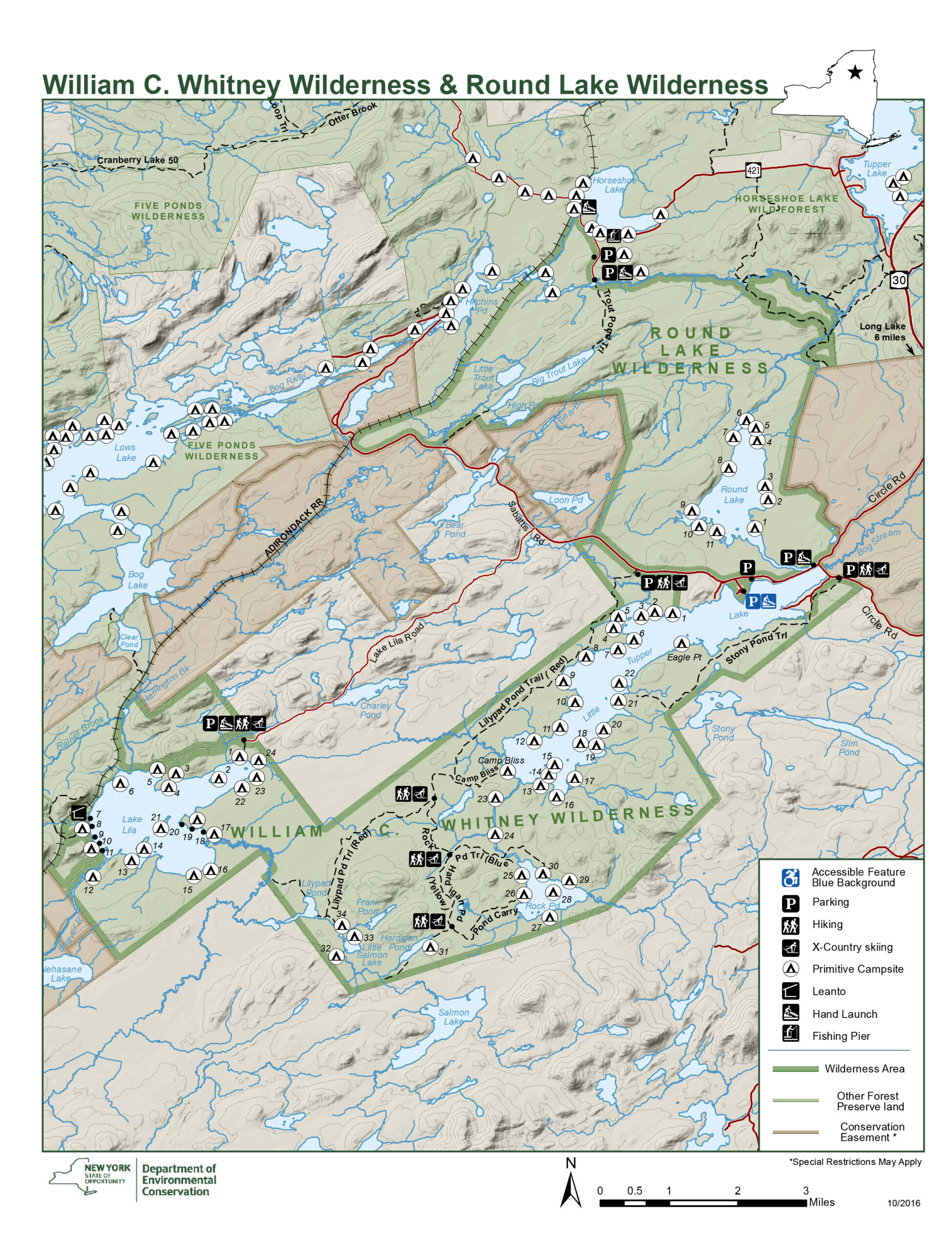
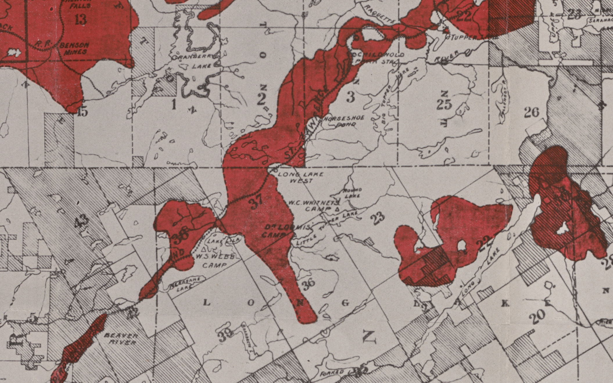
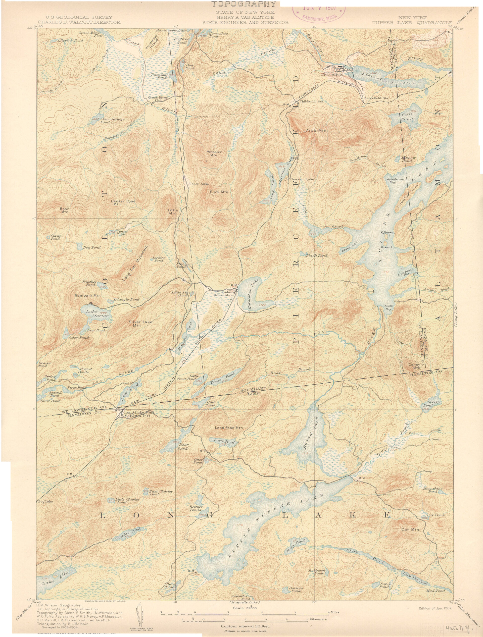
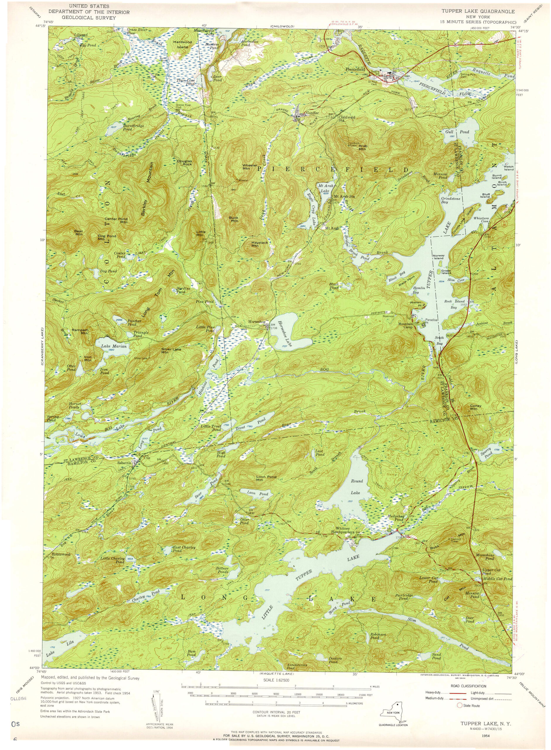
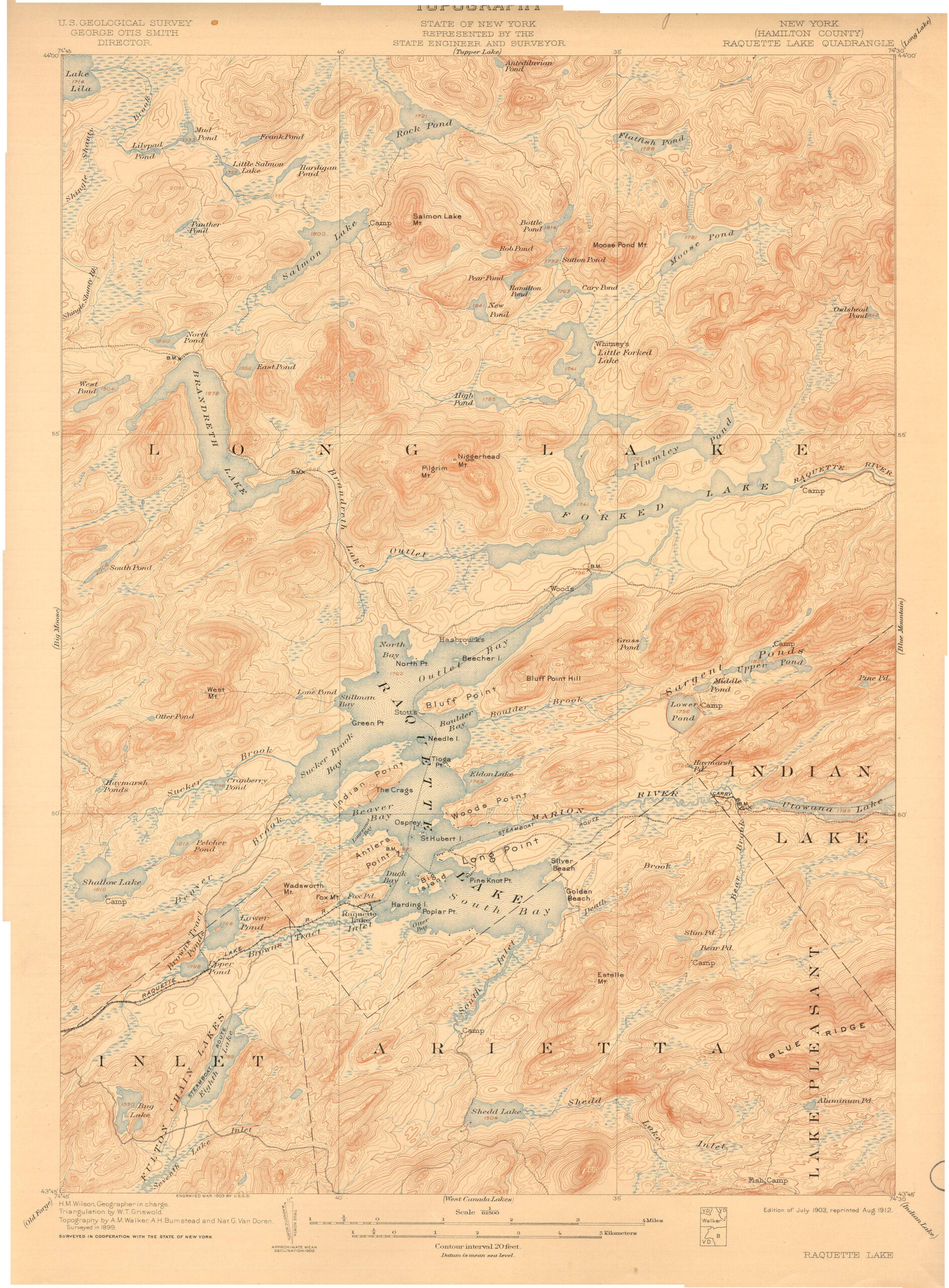
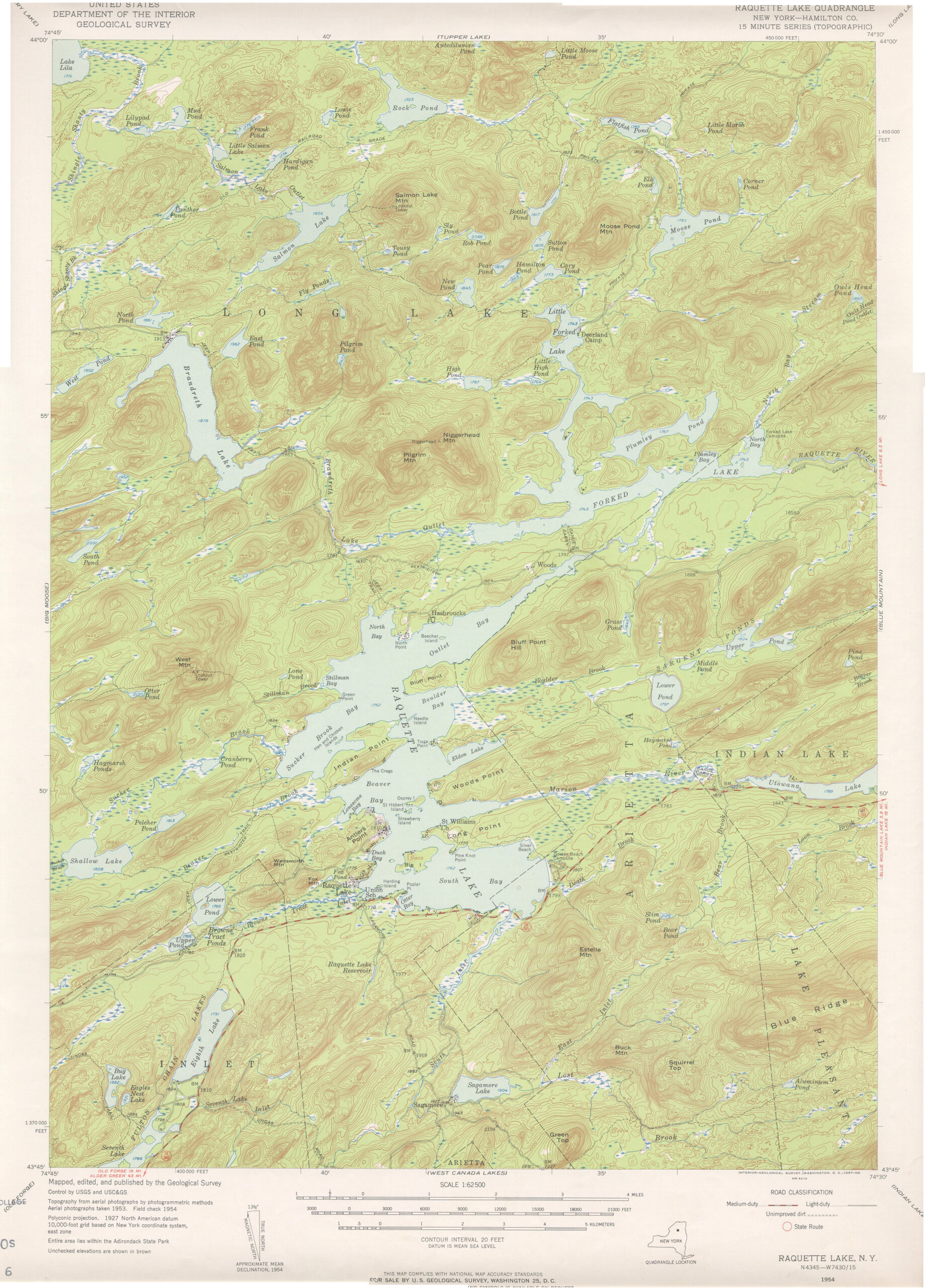
The map at left is the current DEC map of the William C. Whitney Wilderness and its environs. The two maps at right are details of historic map showing the region that now includes the Whitney region. Note how the 1903 forest fires followed the railroads and radiated outward into the adjacent forests.
The following links leave the AWA website and take you to various pages on the Department of Environmental Conservation (DEC) website with more information on the William C. Whitney Wilderness.
William C. Whitney Wilderness Information Page. Learn important contact information and peruse a list of facilities.
Backcountry Information for the Western Adirondacks. Trail conditions updated weekly for the William C. Whitney Wilderness and neighboring areas.
William C. Whitney Stewardship Plan (1998). Download DEC’s stewardship plan for the 1998 William C. Whitney Tract purchase.
(a) Description.
For the purposes of this section, William C. Whitney Area means those forest preserve lands situated in the Town of Long Lake, Hamilton County, New York and being portions of Townships 23 and 36 of Totten and Crossfield’s Purchase as acquired from Whitney Industries, LLC by deeds dated June 1, 1998. Included within this area is the 80± acre Headquarters Lot, being that triangular shaped parcel of land bounded on the north by County Route 10, on the east by the County Route 10A bridge over the watercourse known as the Bog Stream, and on the south by the shoreline of Little Tupper Lake. The Headquarters Lot includes the former Whitney Headquarters complex and the buildings associated therewith.
(b) Within the William C. Whitney Area, it is unlawful for any person to:
(1) Enter into or upon any road, trail, land, lake, pond, river, or stream with a mechanically propelled vessel, motor vehicle, snowmobile, chainsaw, or generator, except that:
(i) motor vehicles are permitted within the 80± acre Headquarters parcel; and
(ii) parties holding reserved contractual rights are not subject to this regulation with respect to certain limited uses of mechanically propelled vessels on Little Tupper Lake and certain limited motor vehicle access over Burn Road. This exception applies only to the extent that such activities are in strict conformance with the terms of said contract provisions and the companion deed restrictions.
(2) Alight on any road, trail, land, lake, pond, river or stream in an aircraft.
(3) Park a motor vehicle anywhere except in designated parking areas.
(4) Park a motor vehicle with a horse trailer anywhere except in parking areas designated for their use.
(5) Camp anywhere except at an officially designated campsite marked by an official sign.
(6) Camp in a group larger than eight people.
(7) Build a fire anywhere except at a designated campsite in a fire ring provided by the department.
(8) Launch a boat anywhere except at an officially designated location marked by an official sign.
(9) Trap within the Headquarters Lot.
(10) Have an unleashed dog within the Headquarters Lot.
(11) Fail to obey the special fishing regulations for the area contained in section 10.3 of this Title.
All photos © Bill Ingersoll. Site visitors are permitted to download an unlimited number of images from our website for personal, educational, scientific, or professional use only, with attribution. Commercial use and further distribution of images is prohibited without express written permission.


