
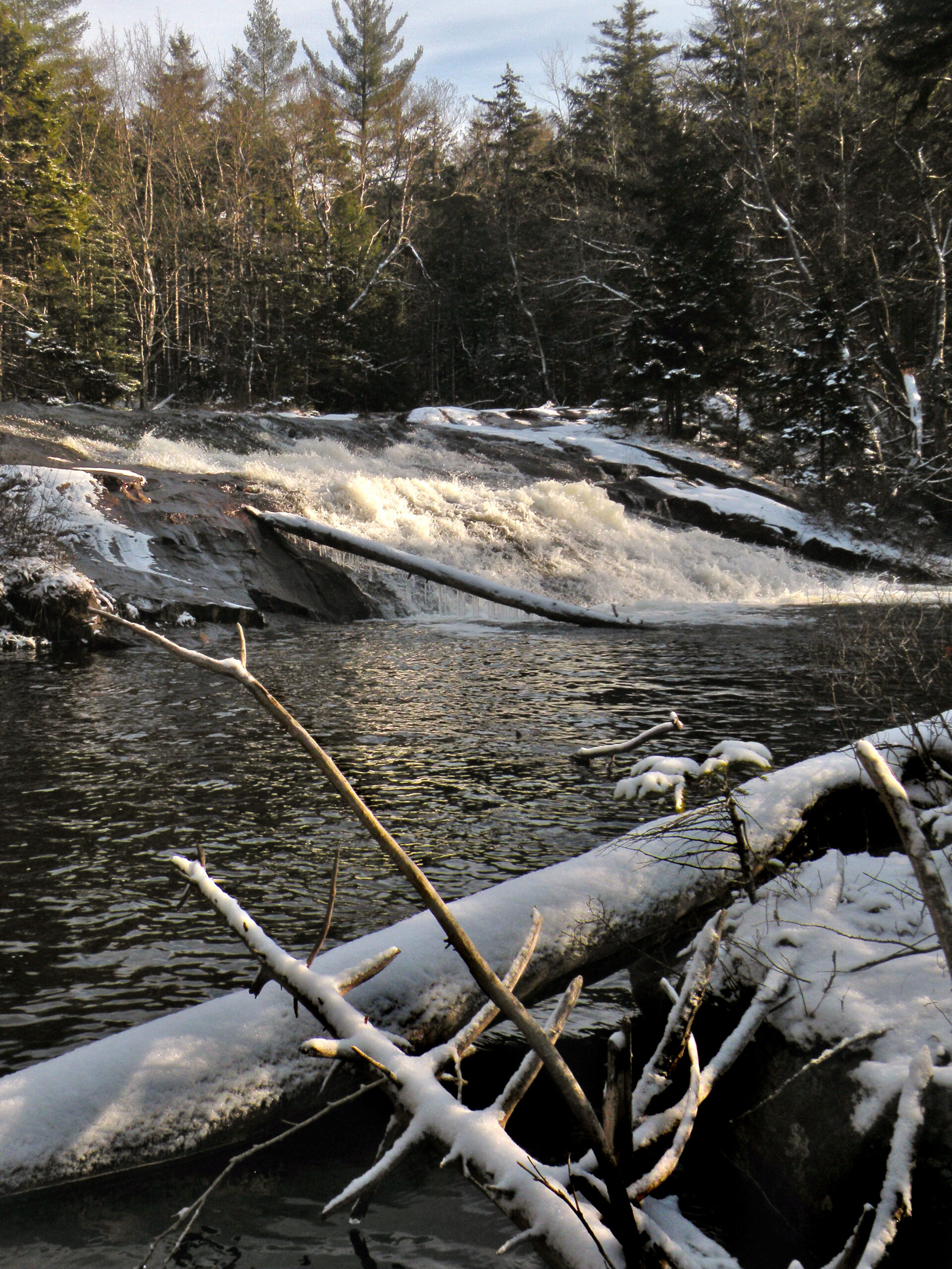
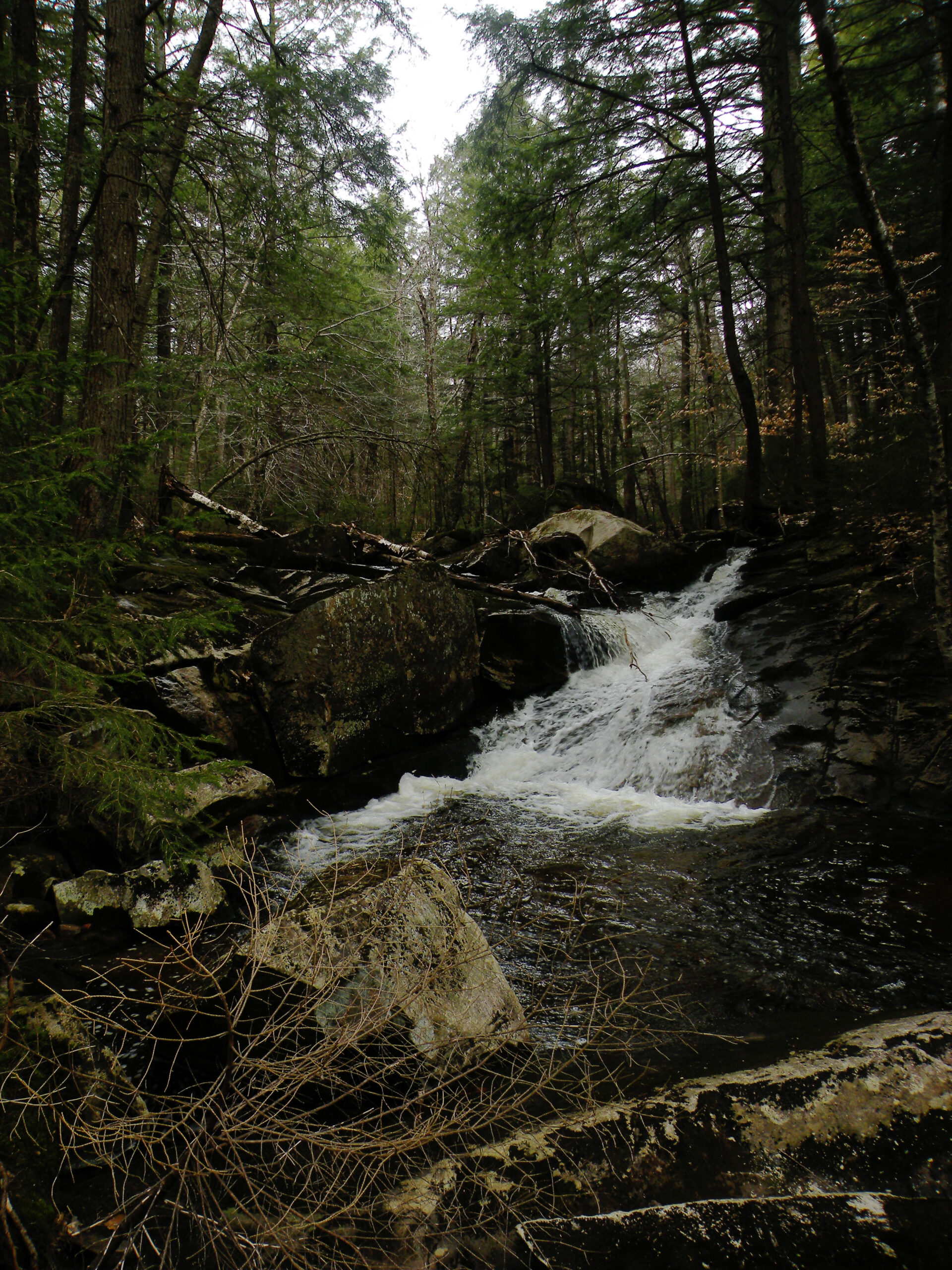
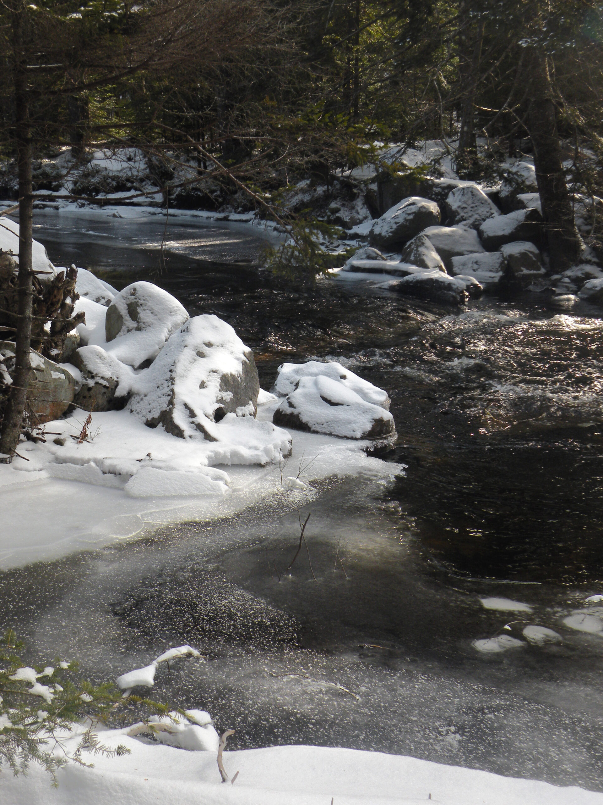
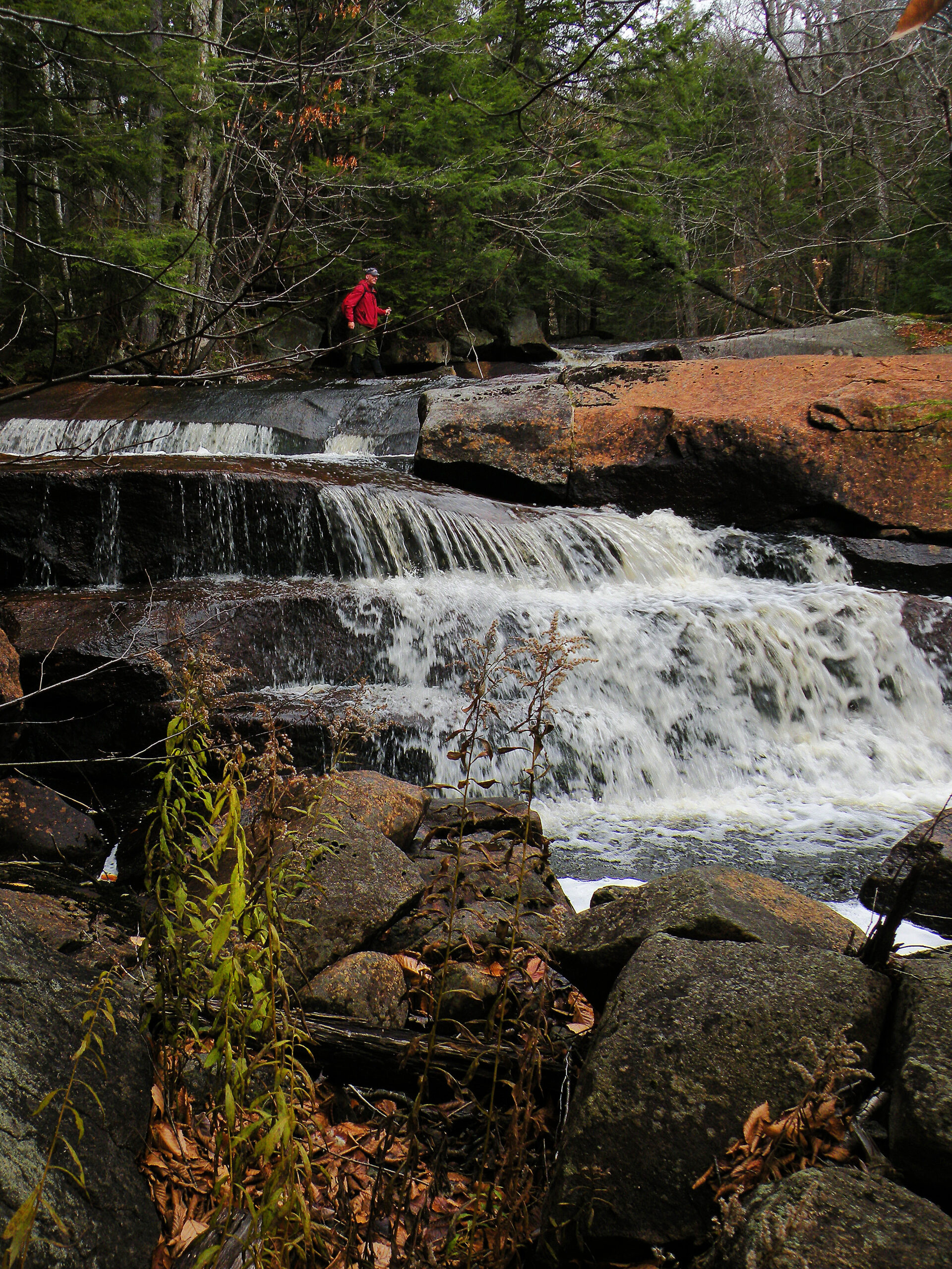
Sand Lake Falls

The Black River Wild Forest is in many ways a gateway area, occupying a prominent point of entry for the Adirondack Park where many people acquire their first tastes of backcountry adventure. It was also the site of some of New York State’s first attempts at resource management, several decades before the creation of the Adirondack Park and the Forest Preserve. And it just so happens to be one of several wild forests in the southern Adirondacks that contain pockets of outstanding wilderness.
In some respects, none of this area is remote, and it has been traveled by wheeled vehicles since at least the 1790s. These traits lend weight to the area’s wild forest designation. The original settlers of John Brown’s Tract – at the site of what would later become Old Forge – followed a primitive “road” from the Remsenburgh Patent to the Middle Branch Moose River, much of it through the Black River Wild Forest.
And when managers of the state’s canal system sought sources of water for the Erie and Black River canals, this was the first place they looked.
Compared to other regions of the Adirondack Park, this area at first glance seems to offer nothing particularly outstanding or unique. The mountains are little more than hills, and the ponds are not unlike others you will find elsewhere. The landscape is pleasing, to be sure, as well as vast and wild, but there is nothing going on here that isn’t outdone elsewhere.
Or is there?
Appearances can be deceiving, and even though much of the area is apparently shackled to a history of reservoirs and logging railroads, its southern reaches constitute a de facto wilderness – protected not by law and policy, but by an absence of public attention.
Please click through the tabs below to learn more about the Black River Wild Forest.
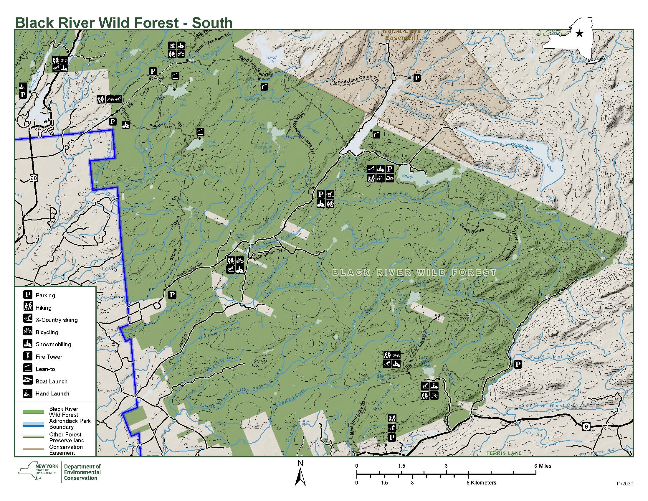
Size: 127,135 acres
First Designated: 1972
Unit Management Plan Status: Completed in 1996
Special Regulations: None; standard Forest Preserve regulations are in effect


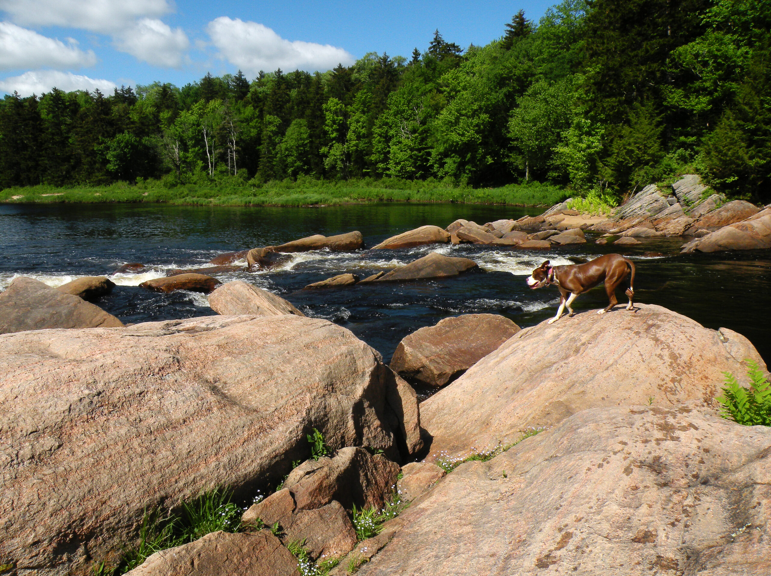
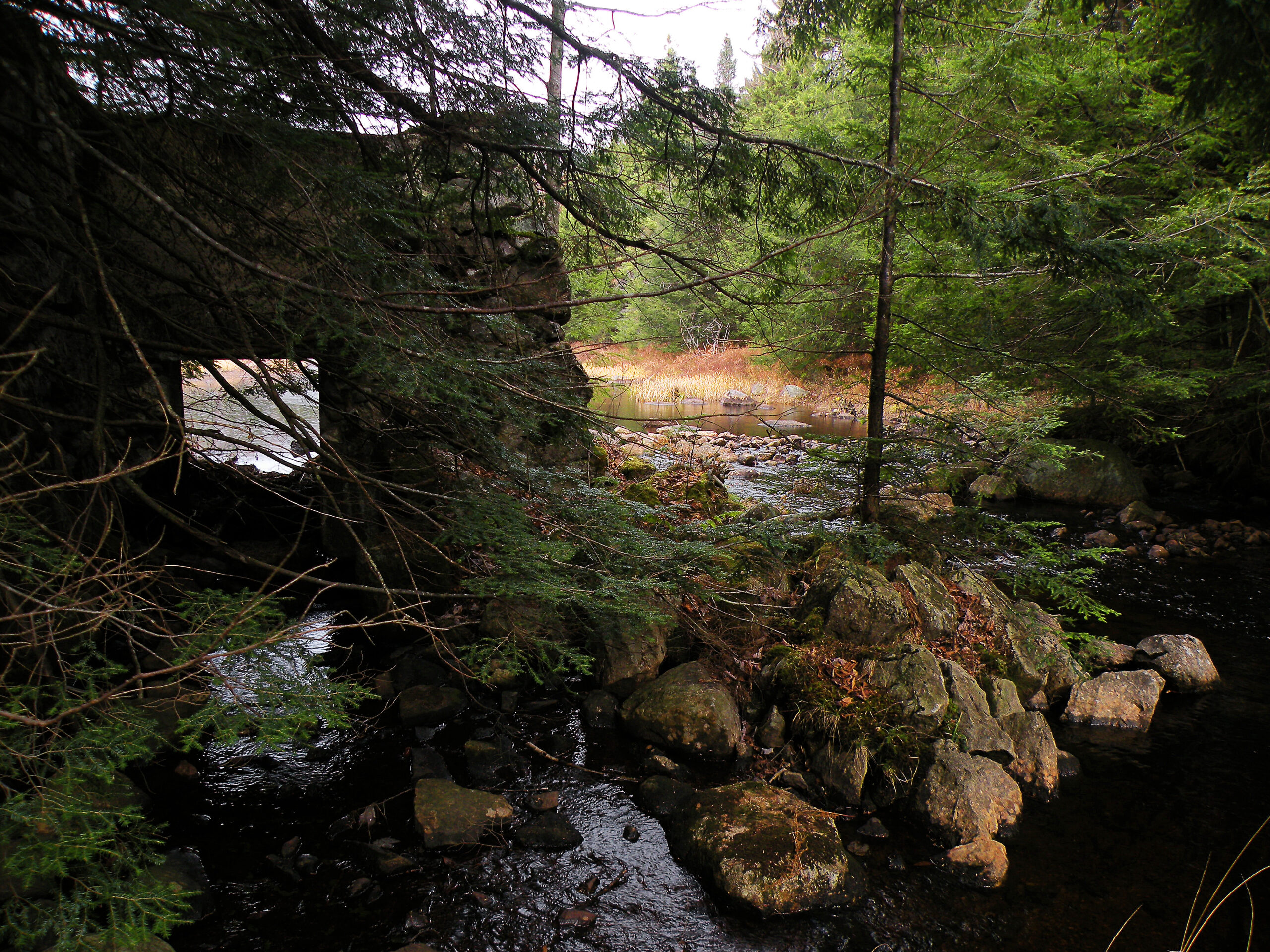
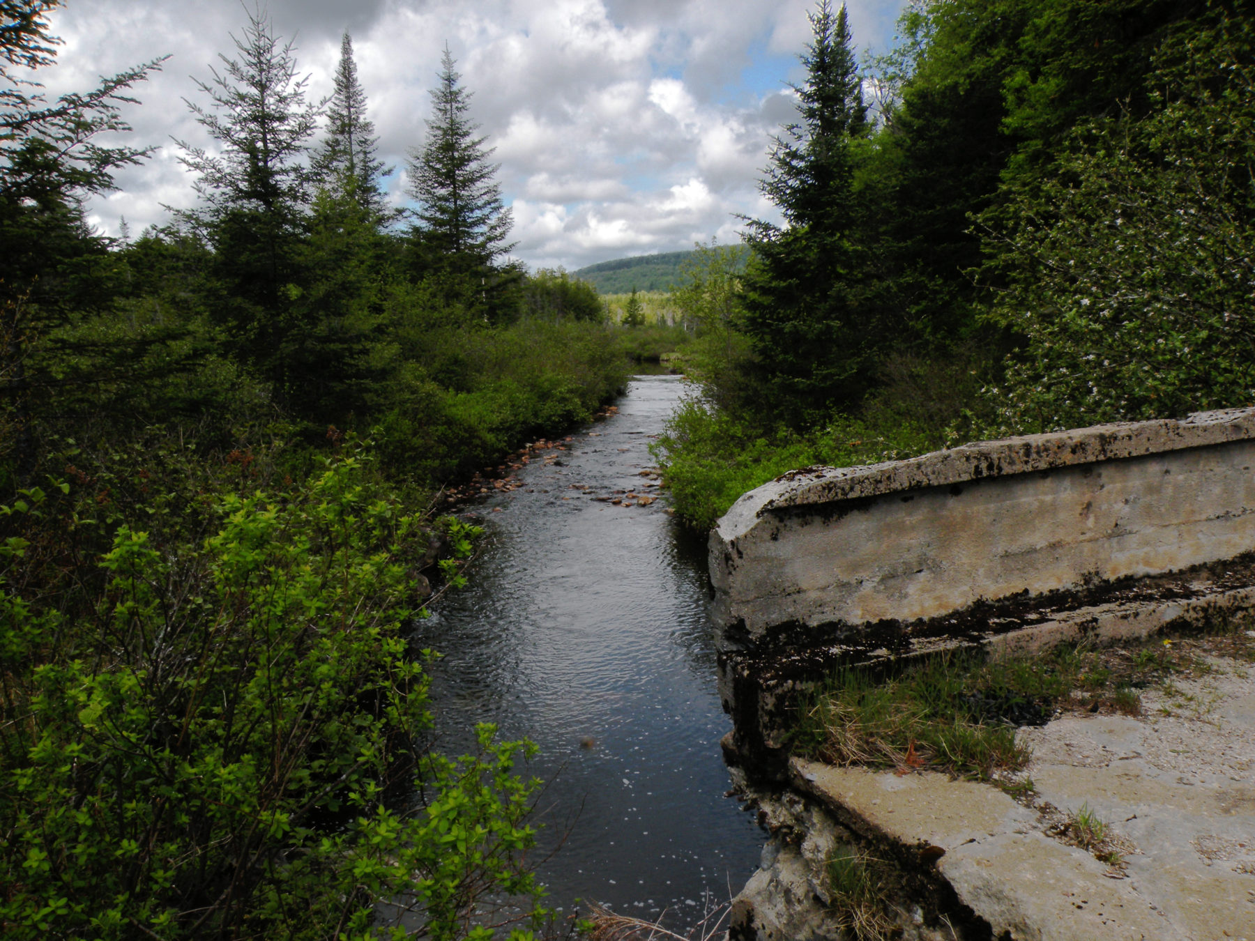
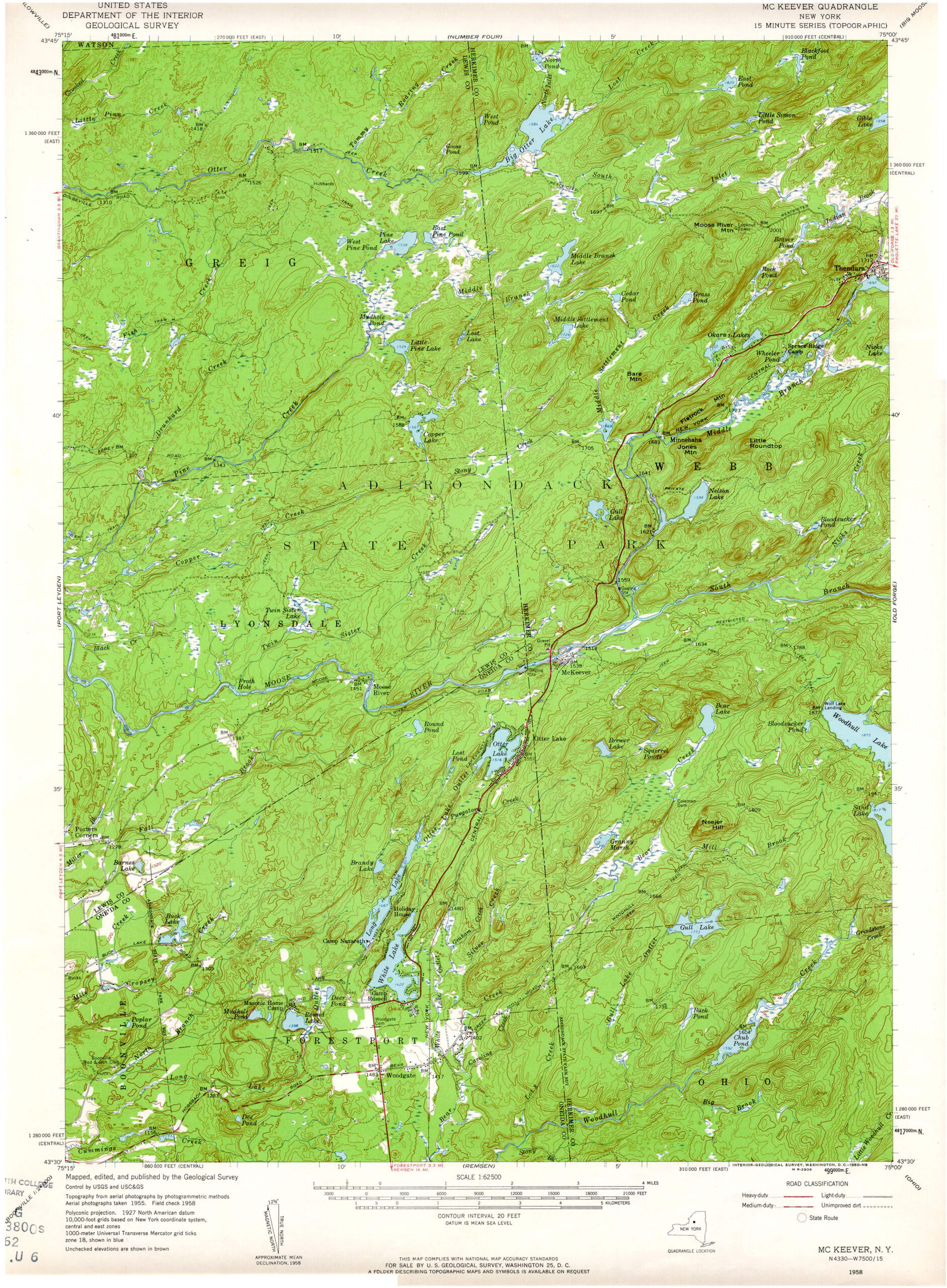
The Black River may be its namesake, but this chunky block of state land is arrayed across a variety of prominent features, including two branches of the Moose River and several noteworthy lakes.
But, yes, the major watershed here is the Black River, of which even the mighty Moose is a tributary. The river itself flows for only a few miles through the Forest Preserve, but its reach is extensive nonetheless – with all but the southeastern area (located in the West Canada Creek watershed) contributing its water to the Black and ultimately the Gulf of St. Lawrence.
Otherwise, the wild forest is trisected by three west-flowing streams: the Black River, Woodhull Creek, and the South Branch Moose River, with the Middle Branch Moose and West Canada Creek forming distant bookends. Between each of these major waterways is a distinctive section of forest: the subtleties surrounding Nelson Lake, the recreational hub between McKeever and Woodgate, the near-wilderness along North Lake Road, and the pockets of true wilderness surrounding Cotton Lake.
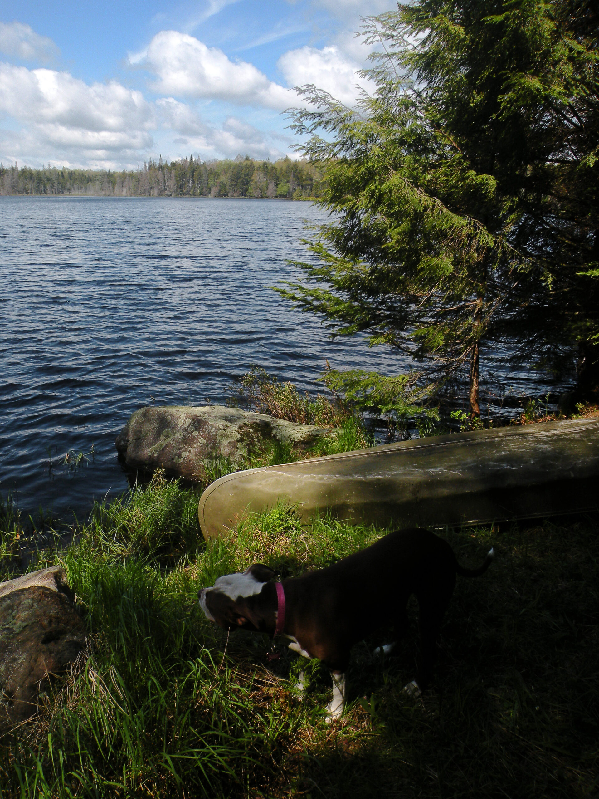
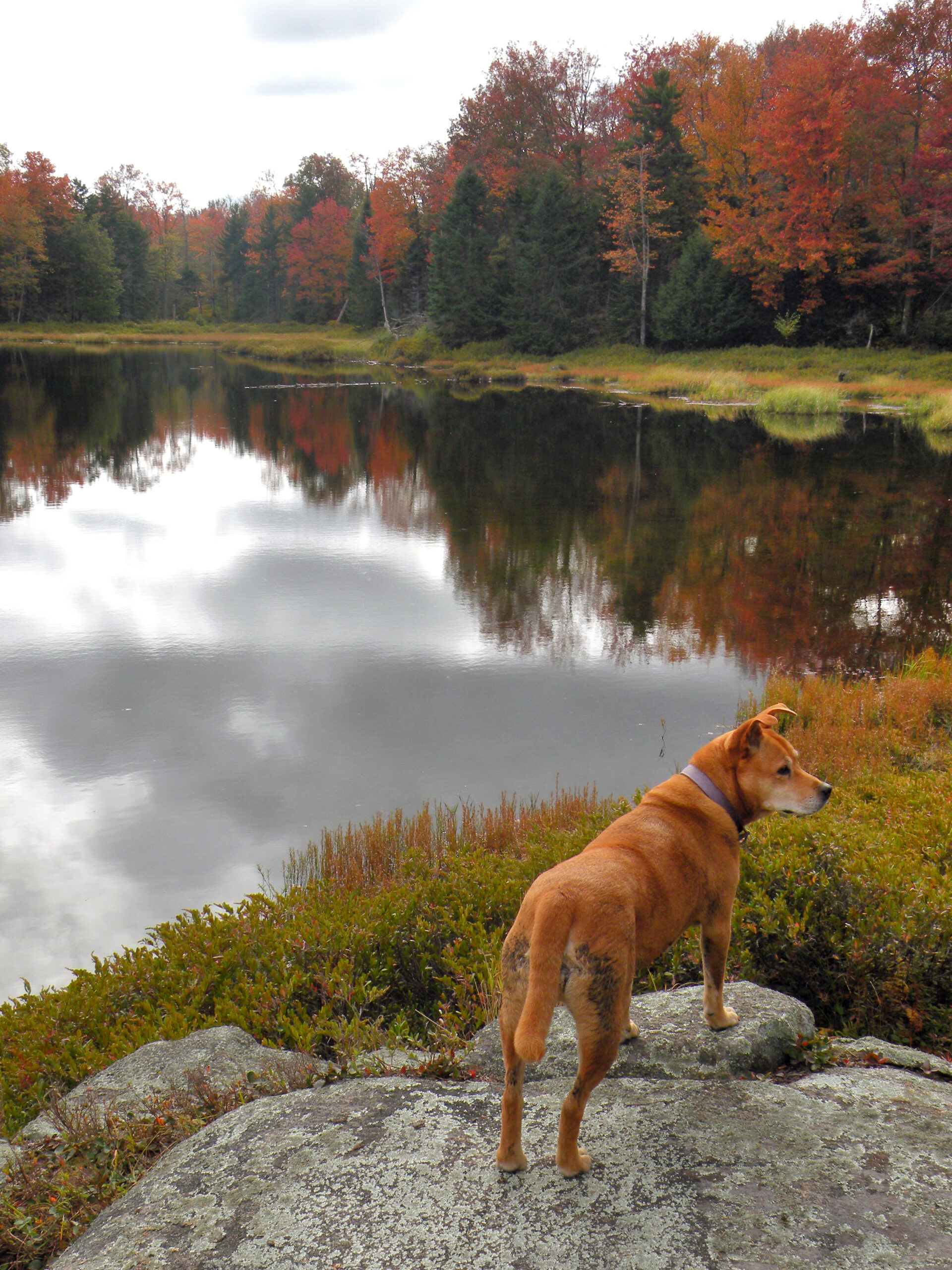
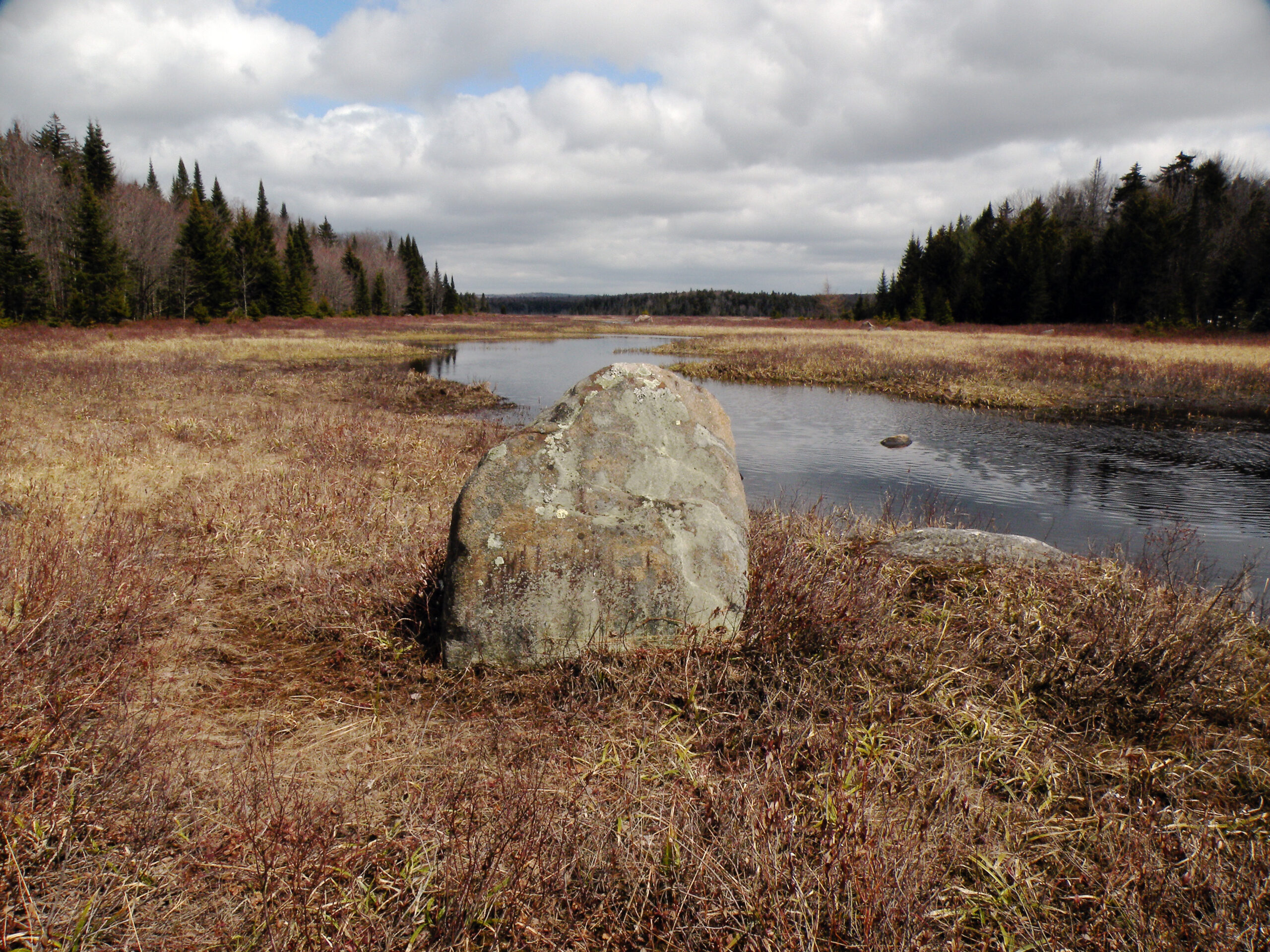
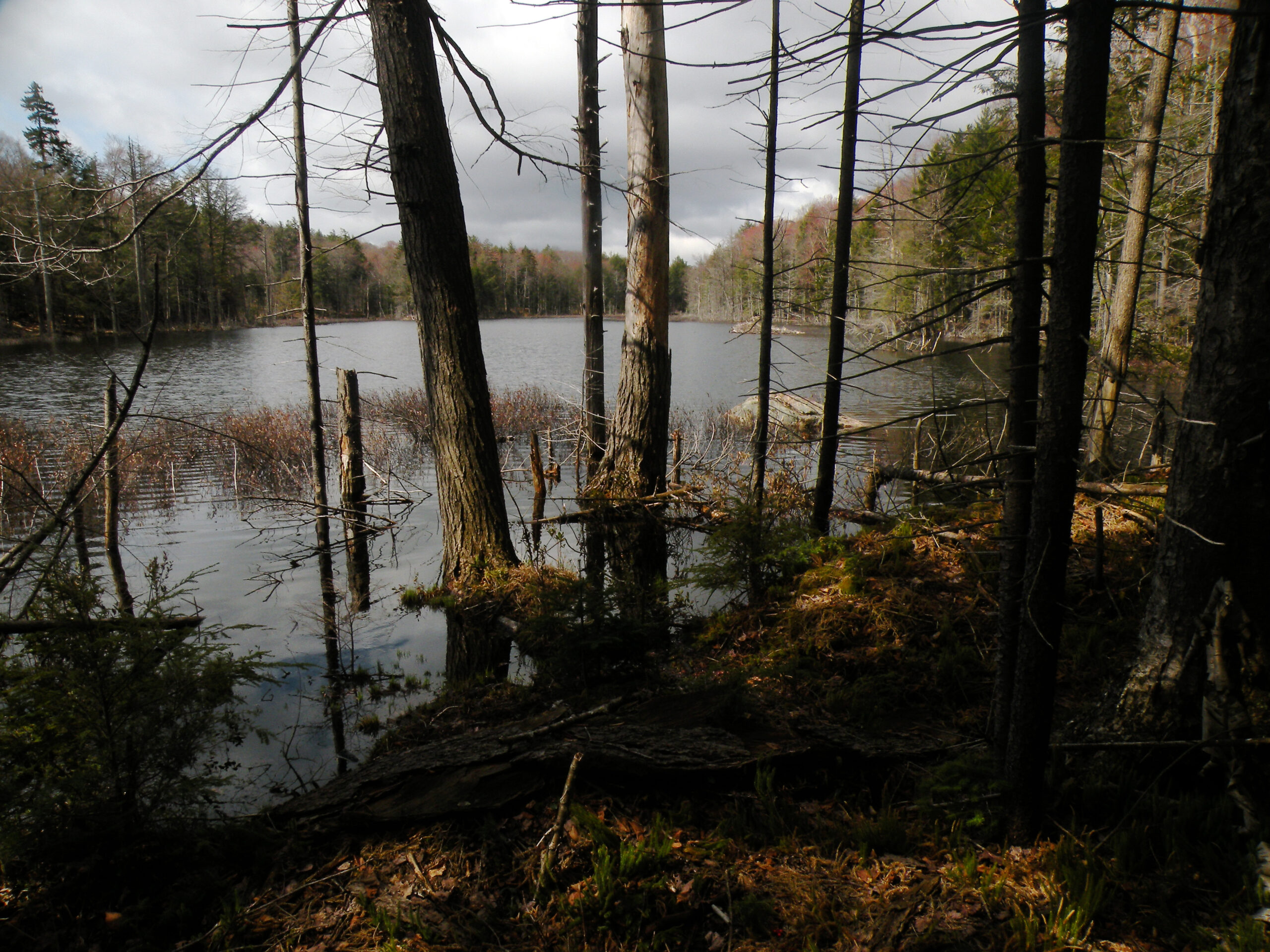
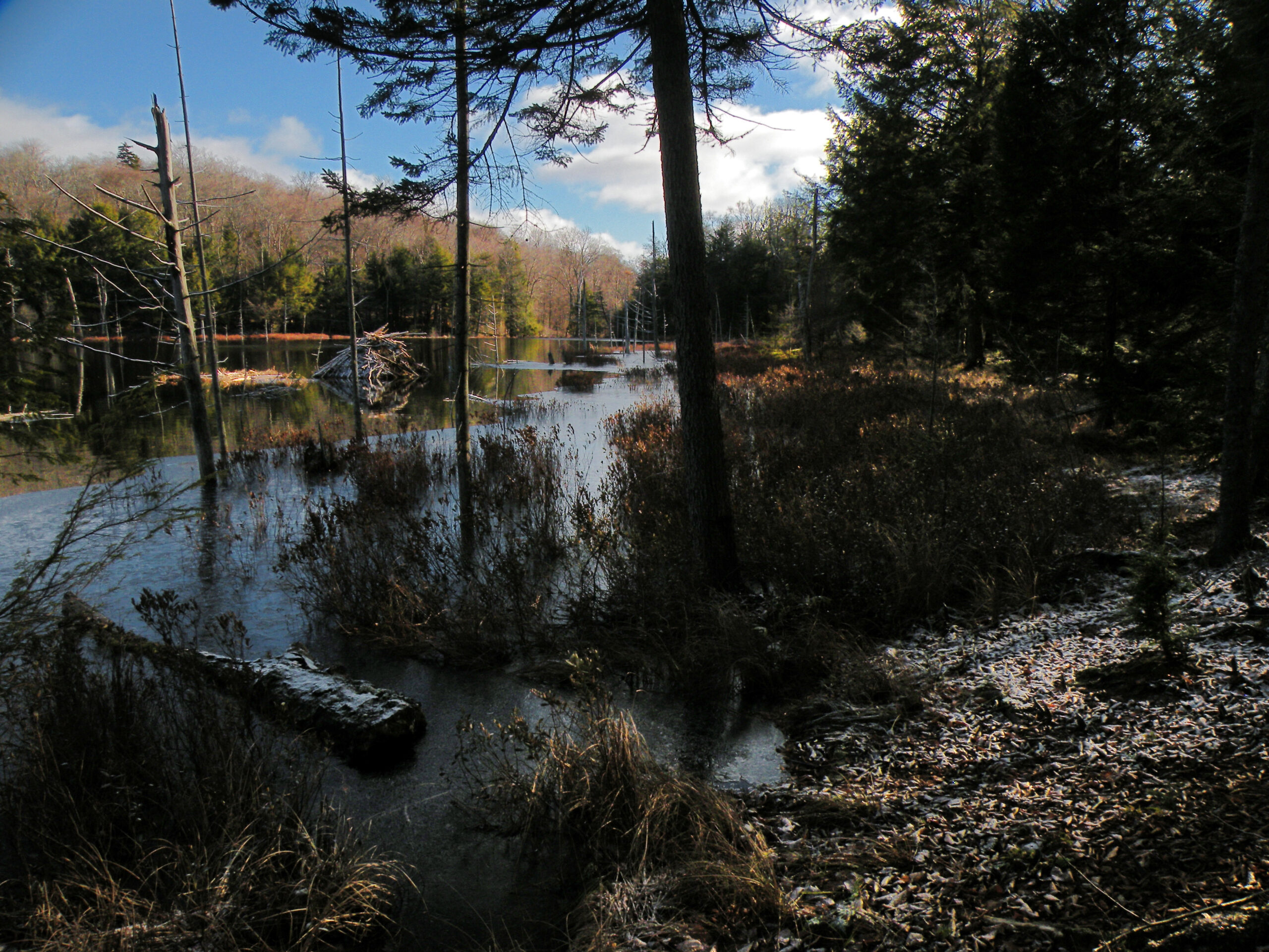
The entire area is richly populated with small lakes and ponds, including several with man-made origins. The most prominent may be the twin North and South lakes, each a reservoir which remains in nominal service to the state’s canal system even though the major use today is recreation. But away from the road lurks an entire constellation of tannic ponds, most accessed by a locally-popular trail.
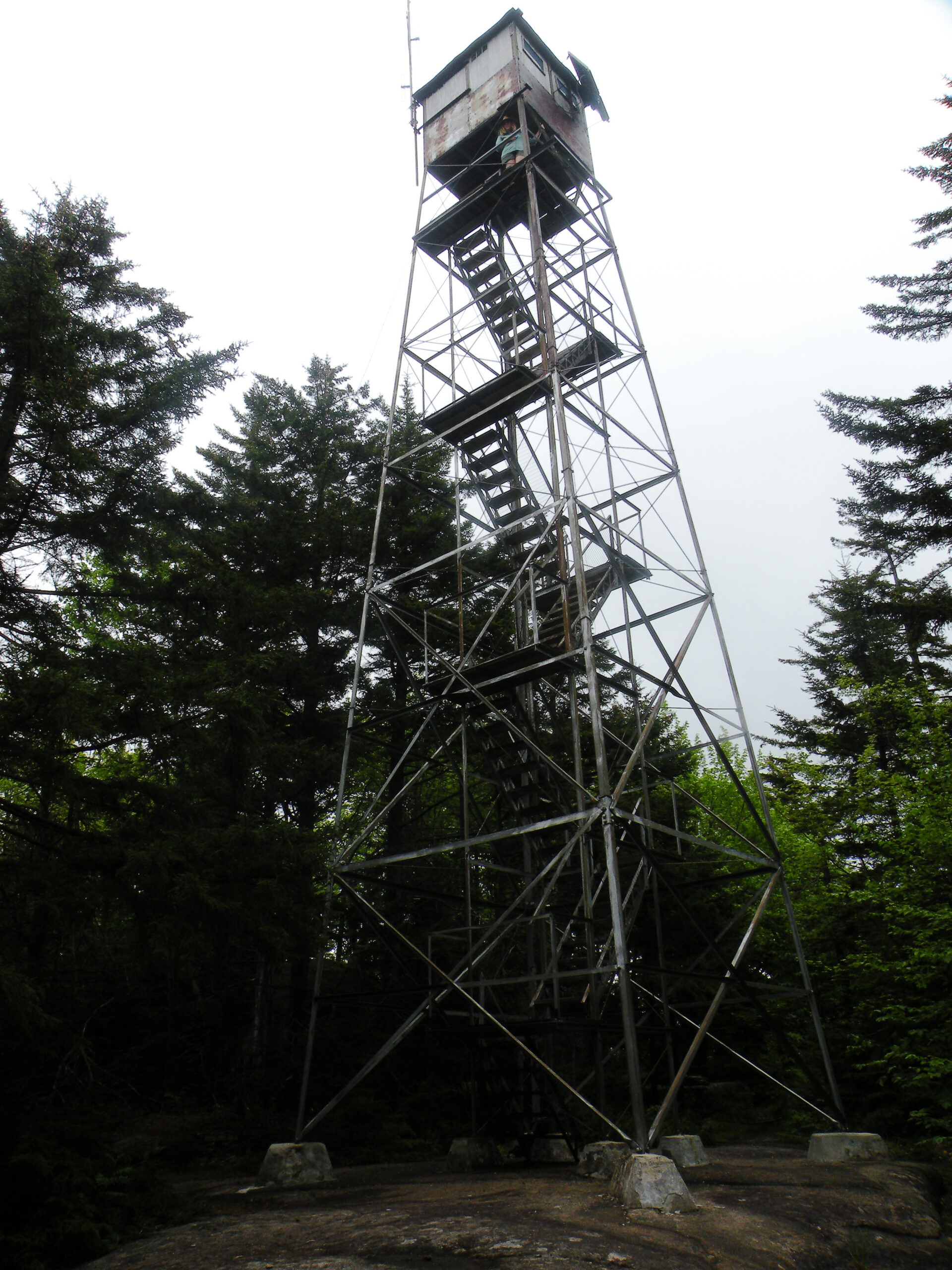
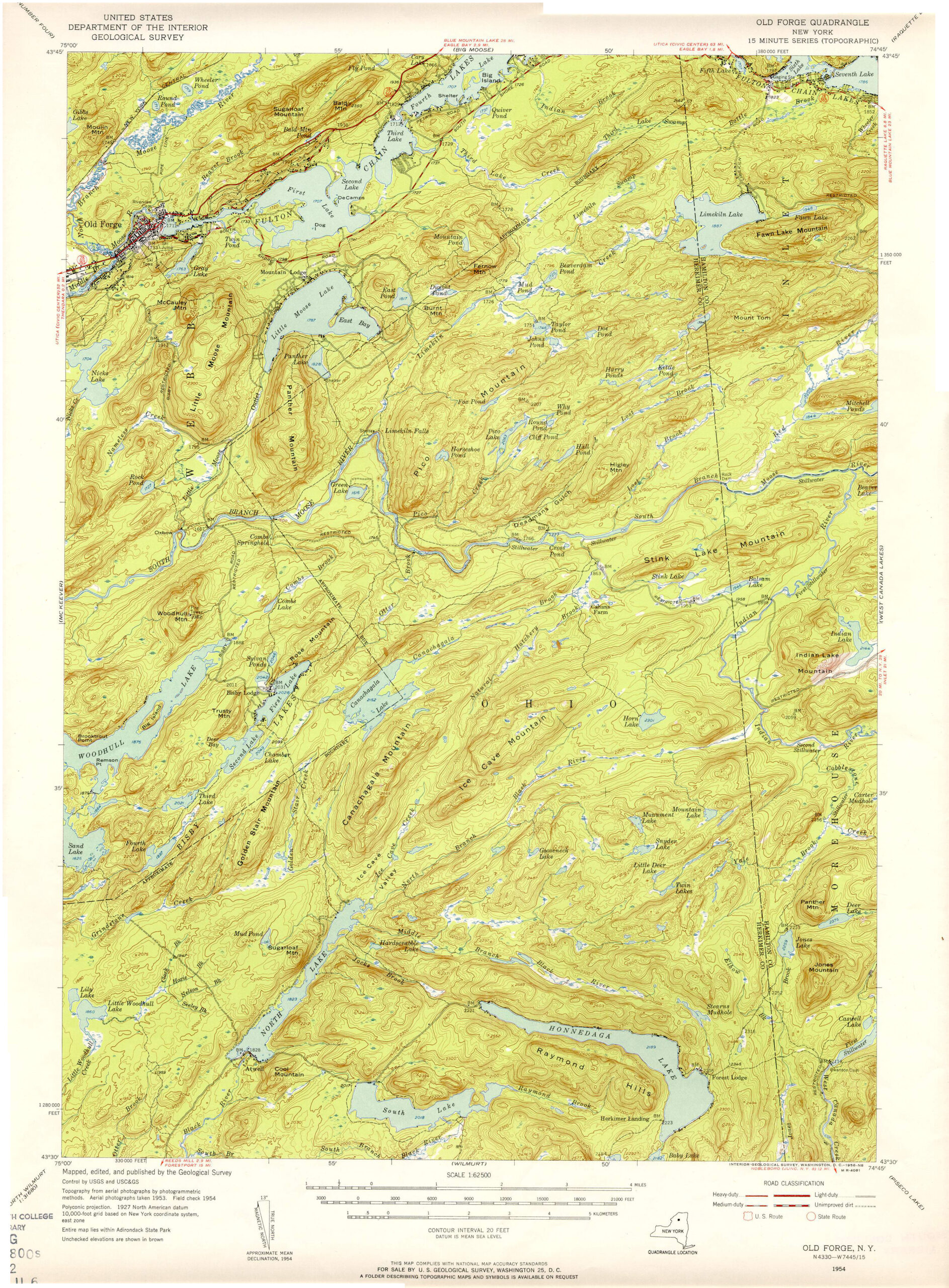
Such mountains as there are seem hardly worthy of the name, although elevations do swell to interesting heights in the hinterlands between the Black and West Canada watersheds. Woodhull Mountain may be the area’s sole summit of note, if only because of its fire tower, although Ice Cave Mountain (located on a conservation easement just outside the wild forest boundaries) should also be mentioned. The definitive feature of the latter mountain is a deep fissure in which ice really may linger well into the summer.
Forest quality forms an almost perfect gradient from north to south, following the pattern of land use and state acquisition. The wilderness-like southern region was acquired early, including a strip of virgin forest east of Twin Lakes, and therefore much of this region is typified by mature stands of grand proportions. North of Woodhull Creek, however, one encounters a forest that was logged more recently – as well as the bed of a logging railroad paralleling the Moose River. The northernmost region, between the two forks of the Moose River, was acquired the most recently and therefore exhibits the most signs of logging activity.
Otherwise even the best forests here are standard fare when considered in the context of the entire Adirondack Park, with stands that may be notable but are hardly unusual. Indeed, in the vast areas with no significant elevation change, one will observe consistent growths of northern hardwoods mixed with baseline amounts of hemlock and spruce. These “plain vanilla” forests obscure the truth of the area, though: the deep interior is truly wild and rugged, and the wild forest classification belies the wilderness potential of this resource.
The written history of the Black River Wild Forest begins in 1799, when the wealthy Rhode Island businessman (and reluctant Adirondack landowner) John Brown commissioned a road to the “Moose River Lakes” following what had once been an Indian trail.
This was part of a larger plan to open the area to settlement, although only twenty families could be enticed to make the move. John Brown’s new route was called the Remsen Road because it began in the Remsenburgh Patent, a tract that includes the modern village of Remsen but extends east to Nobleboro and North Wilmurt. His “road,” which was almost certainly a primitive track, crossed the Moose River at the site still known as Remsen Falls and extended north past Nicks Lake. In fact, the modern hiking trail between these two points likely follows the one surviving (and unmodified) section of the original Remsen Road.
South of the Moose River, the route of the Remsen Road is somewhat more conjectural. Received wisdom says it cut across the Black River at what is now Kayuta Lake and cut diagonally through the Black River Wild Forest to Remsen Falls. Perhaps that is indeed the case, but this doesn’t explain the presence of Grindstone Creek and Remsen Point – toponymic clues that suggest the settlers actually followed a route farther to the east.
In any event, the Remsen Road quickly fell out of favor – and was replaced altogether by Browns Tract Road in 1817, and the original version of NY 28 a century later.
State surveyors took an interest in this area in the 1850s, when nearly every pond feeding into Woodhull Creek and the Black River was desired as a source of water for the Erie Canal and the Black River Canal. In a building spree that peaked in the 1880s, the Canal Board commissioned several dams throughout the forest, including caretakers in the state’s employ, as well as a network of interconnecting roads. These “Canal Lakes” included Woodhull, Chub, Canachagala, Sand, Twin, North, South, and the Bisby chain.
However, the experience of maintaining so many relatively small reservoirs in such remote settings quickly proved impractical. The original North Lake dam failed catastrophically in the spring of 1869, and lumbermen reportedly sometimes opened the floodgates on other dams to help float their logs to mill. By the twentieth century, the focus shifted to building larger dams in more accessible locations, and thus the Canal Lakes were ultimately eclipsed by Hinckley and Kayuta.
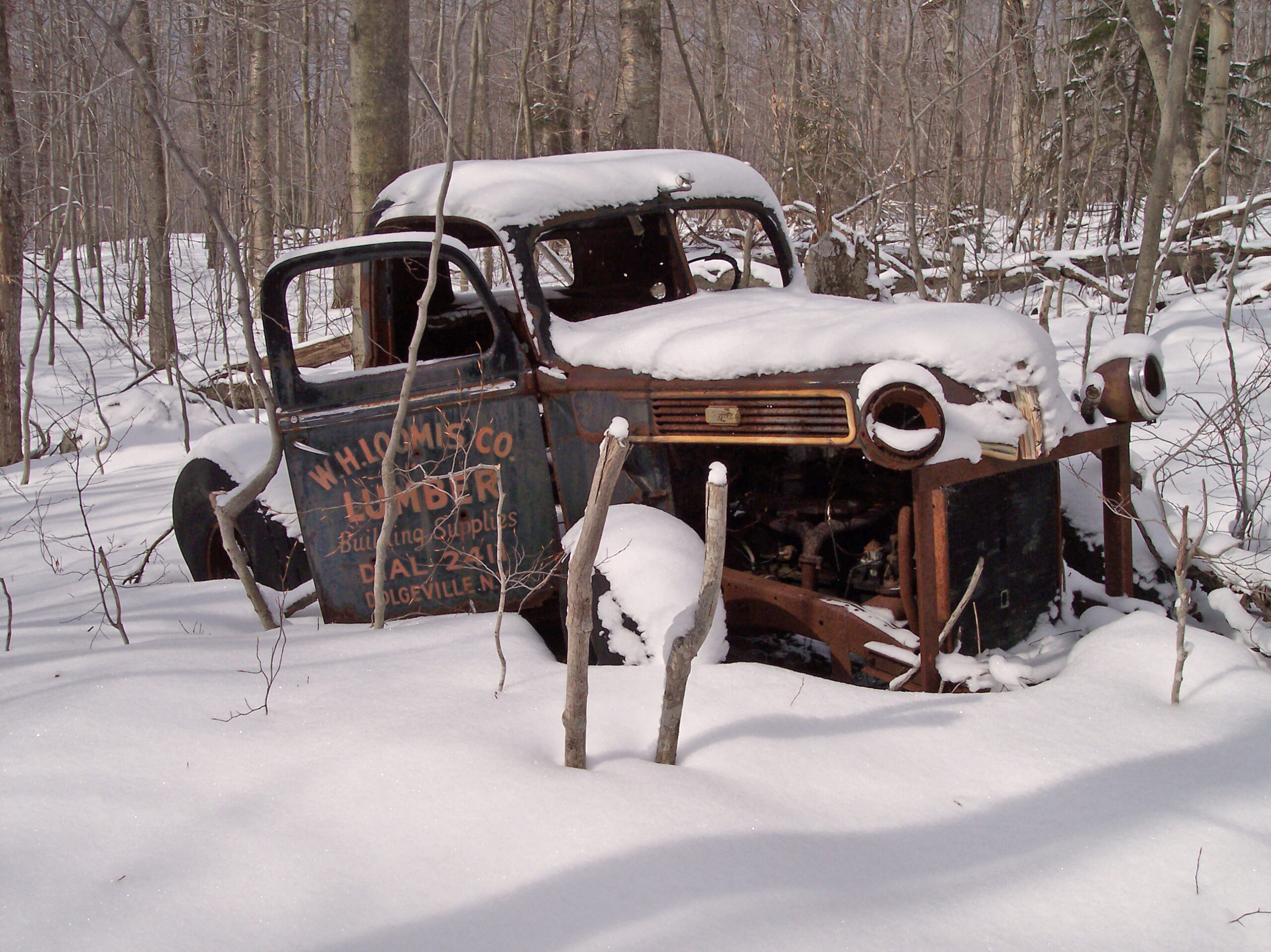
The third major historical development in the Black River Wild Forest occurred near McKeever, where old mill foundations still remain highly visible to travelers speeding by on NY 28. This was the seat of a bustling logging empire operated by John A. Dix, a successful businessman who also served briefly as New York State’s governor (one of two governors by that name, though not the one for whom Dix Mountain is named).
Dix, the lumberman, built a standard-gauge railroad from his McKeever mill to a logging camp near Remsen Falls in 1903. He was something of a pioneer in this respect, as transporting logs by rail for such short distances was still very much a new concept at that time. Dix, the governor, established the Conservation Commission, the entity that later grew into the Conservation Department and is now the Department of Environmental Conservation.
He was also rather conservation-minded by the standards of his day, ordering that trees be planted on his lands after logging occurred. His McKeever lands – which extended all the way to Woodhull Mountain – were acquired for the Forest Preserve in 1918, and indeed there are places where stands of Norway spruce can still be found. This European species was a favorite of early conservationists and do not occur naturally in North America. Therefore those now growing along the Moose River near McKeever must certainly be part of John A. Dix’s legacy in this area.
The Black River Wild Forest is one of the most accessible regions of the Adirondacks, with a robust trail network and much road frontage. The one irony is that little of this recreational development has anything to do with the Black River itself.
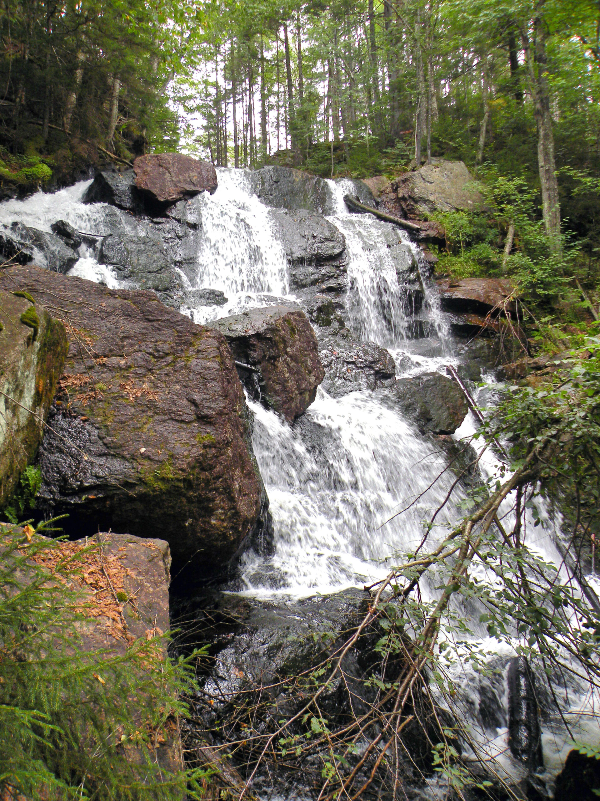
From the perspective of trails, the heart of this area is the block of land near Woodgate and McKeever, where a combination of trails and gravel roads provides deep access into the forest. In some respects, this area bears a modest resemblance to the Moose River Plains a few miles to the east, but without that area’s sense of deep remoteness. Here, the twin Wolf Lake Landing and Mill Creek roads provide summer springboard access to numerous scenic features: Remsen Falls, Bear Lake, Gull Lake, and Sand Lake Falls just for starters.
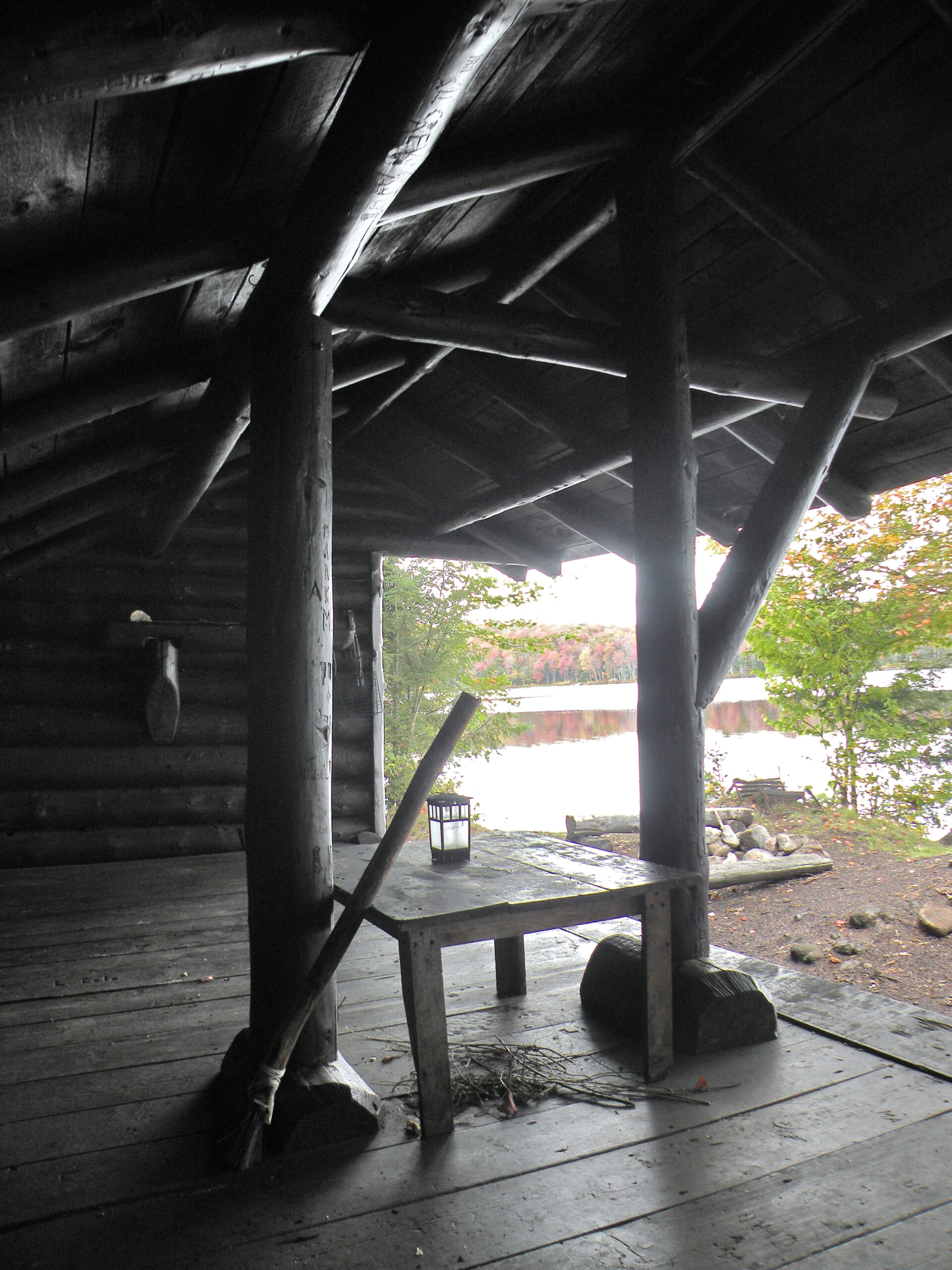
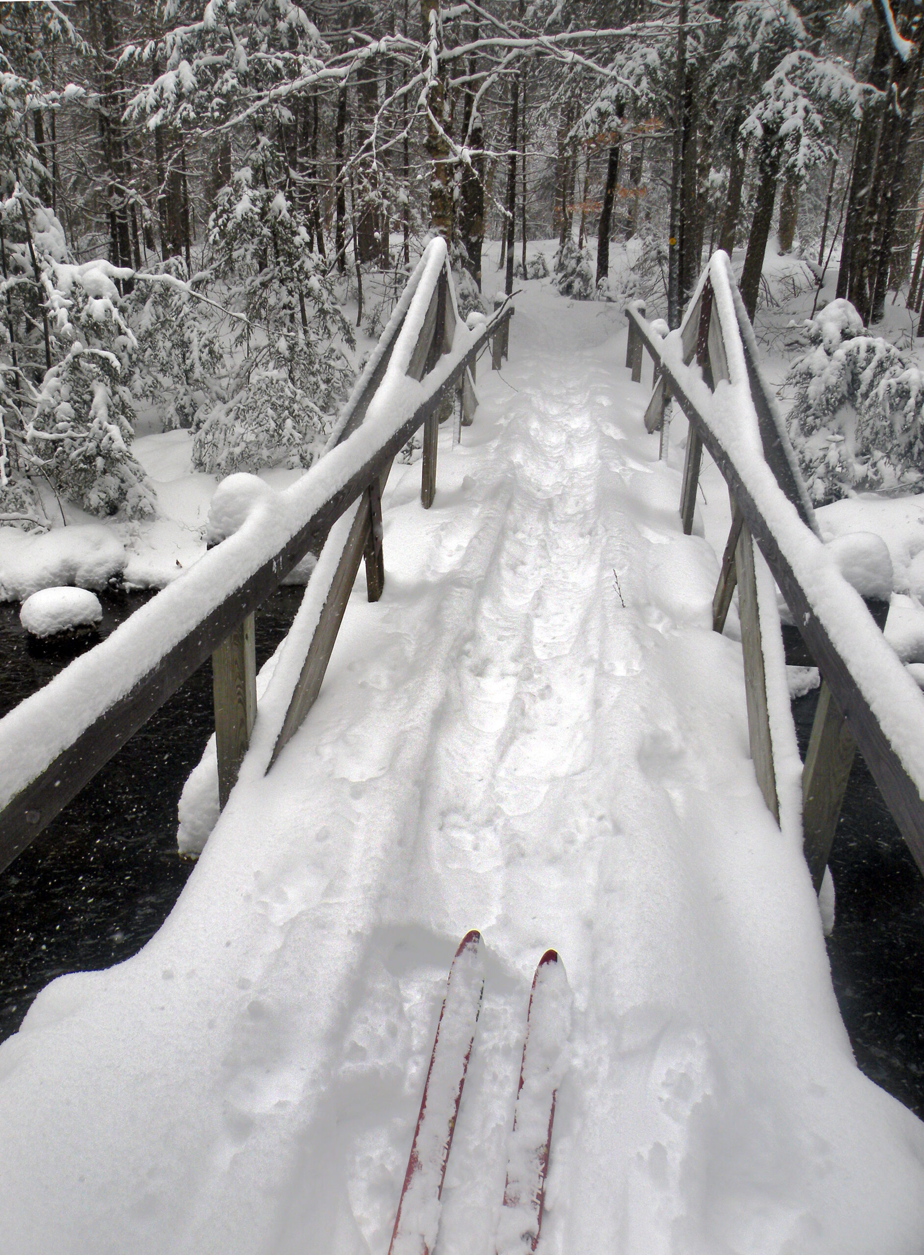
This is the setting for both day trips and easy overnight expeditions, with six lean-tos easily accessible from the trail network. Additionally, several drive-in campsites are available on a first-come basis along Wolf Lake Landing Road. This is a multi-use area, and in winter the roads are devoted to snowmobiling.
The area’s only fire tower is found atop Woodhull Mountain, an isolated summit with no natural views. Getting there entails hiking a portion of a former railroad grade, now a wide and level trail. The tower’s cab is closed to the public, although you may climb to the uppermost landing to obtain an over-the-treetop view of this subtle landscape.
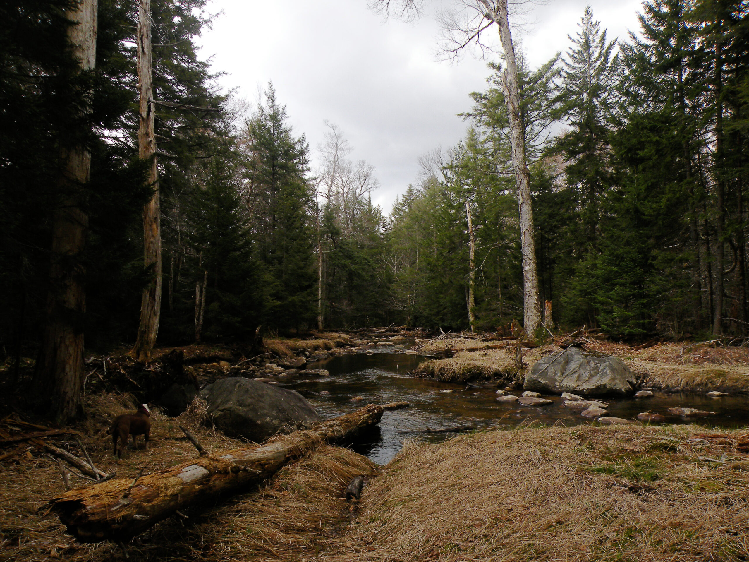
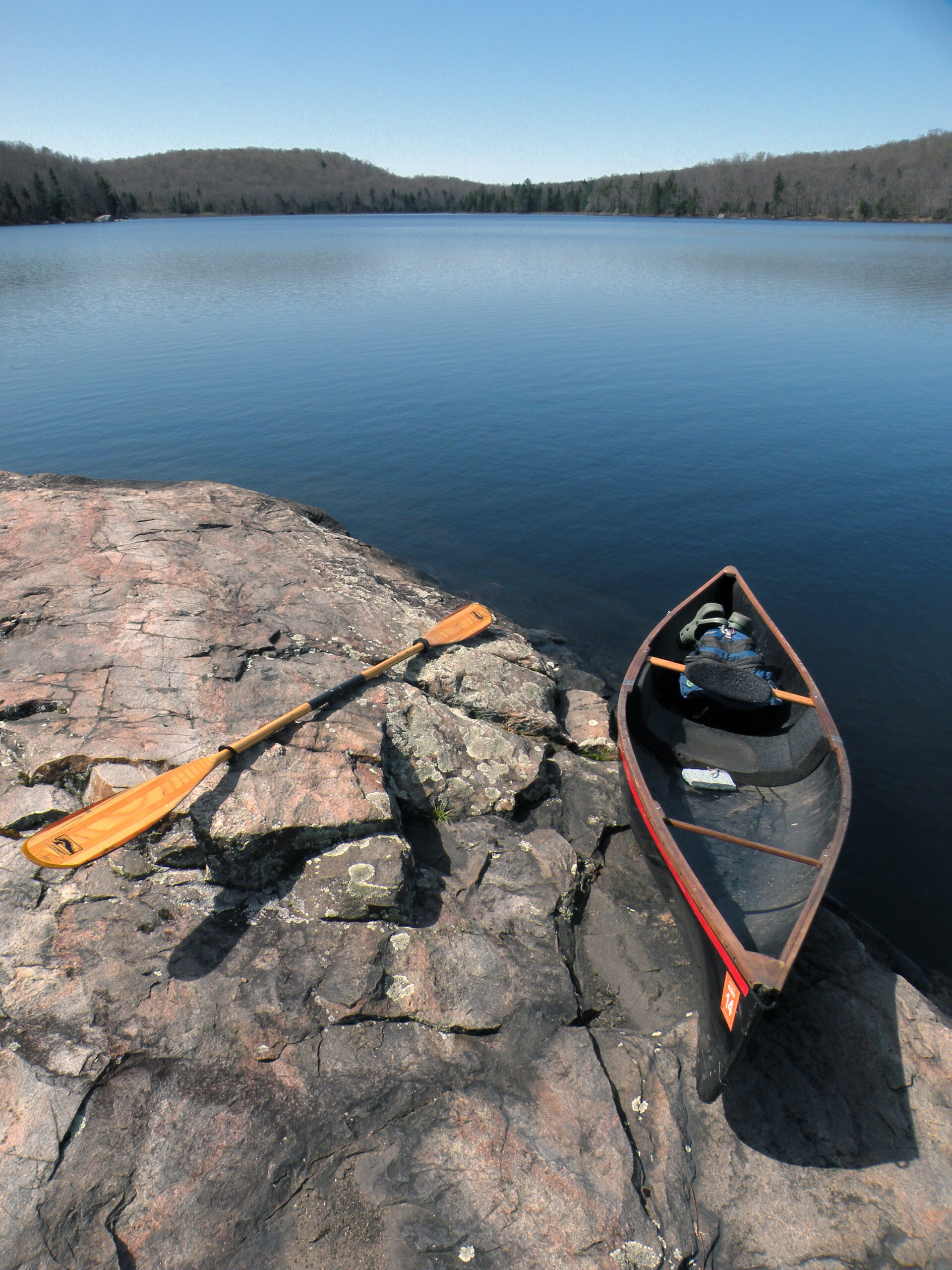
A robust trail network can also be found north of the Moose River, spiraling outward from Nicks Lake. Public use is very light, though, in the absence of scenic interest. Nearly all of the trails here are based on former logging roads, and thus the hiking (or biking) experience might be relatively unchanging from mile to mile. Nevertheless there are some interesting moments, such as the opportunities to hike alongside two branches of the Moose River, to paddle Nelson Lake, or to trace a surviving section of the Remsen Road – the historic eighteenth-century trail that served the original settlers of John Brown’s Tract.
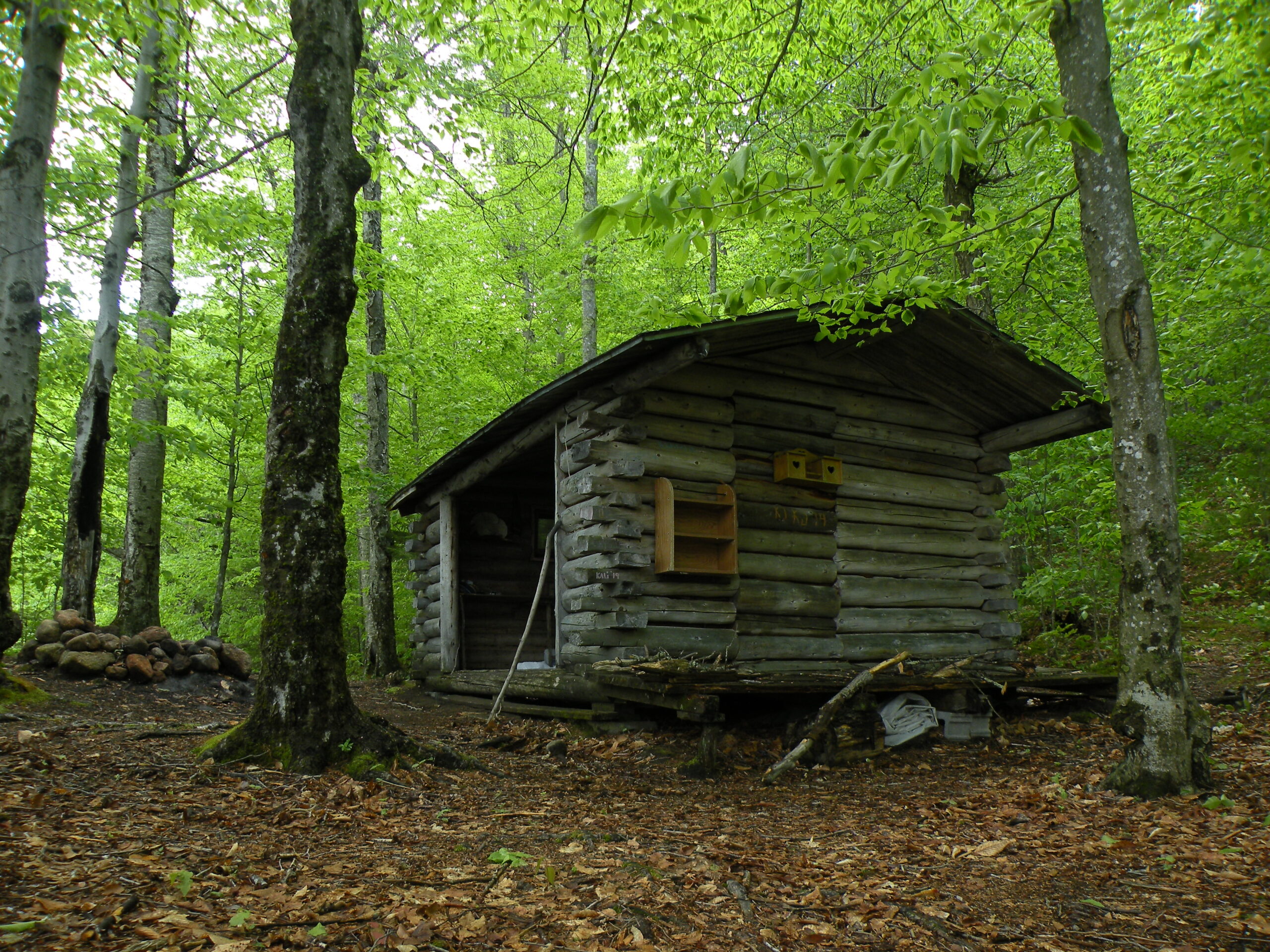
As an interesting aside, the lean-to at Nelson Lake is a transplant from the High Peaks, originally constructed as the Bear Brook Lean-to near Johns Brook. The structure was dismantled and rebuilt log-for-log in this non-mountainous area, its High Peaks graffiti still intact.
Woodhull Creek is like a dividing line across the wild forest, and to its south things become more wilderness-like – which is to say, a lower density of trails and larger open spaces. Although subdivided by North Lake Road and Farr Road, the spaces between these gravel lanes is satisfyingly wild and undeveloped, save for a few primitive trails.
The centerpieces of this region are the twin reservoirs North Lake and South Lake. Both are similar in size and exist in an out of public land, although they offer differing experiences. North Lake, with its deeply tannic waters, is paralleled by a popular access road for its entire length, with dozens of drive-in campsites that are sure to be occupied every summer weekend. South Lake leads away from all public roads, though, and its clear waters and rugged shoreline evoke something of a wilderness experience – if, of course, you ignore the large earthen dam.
The southernmost reaches of the Black River Wild Forest are something of a strange beast. This area might be an outstanding wilderness in an alternate universe, but in this reality it is peppered with small private inholdings, and the trail network (such as it is) seems more focused on landowner access than public recreation. Every route is open to motorized access, and several are regarded as “roads” even if ATVs are the only vehicles that can operate on them. Hiking in this area is not completely undesirable, but aside from the so-called Ledge Mountain near Wilmurt none of the trails are maintained a primitive foot trails.
A portion of the Black River Wild Forest south of North Lake Road and east of Farr Road exhibits many of the same qualities as the legally-protected wildernesses elsewhere in the Adirondack Park. However, without a formal wilderness classification the preservation of the so-called “Cotton Lake Wilderness” is not guaranteed.
Learn more about this potential wilderness area by following the link below.
The following links leave the AWA website and take you to various pages on the Department of Environmental Conservation (DEC) website with more information on the Black River Wild Forest.
Black River Wild Forest Information Page. Learn important contact information and peruse a list of facilities.
Backcountry Information for the Southwestern Adirondacks. Trail conditions updated weekly for the Black River Wild Forest and neighboring areas.
Black River Wild Forest Unit Management Plan (1996). Download DEC’s official management plan, approved in 1996. This plan was amended in 2004 and 2018.
State Land Regulations. Review the complete list of DEC regulations.
All photos © Bill Ingersoll. Site visitors are permitted to download an unlimited number of images from our website for personal, educational, scientific, or professional use only, with attribution. Commercial use and further distribution of images is prohibited without express written permission.


