
Cotton Lake: The Wilderness No One Knows
Seeing a potential wilderness designation in an area otherwise classified as wild forest often requires an active imagination and abundant optimism. However, neither trait is needed for one section of the Black River Wild Forest: the under-appreciated “Cotton Lake Wilderness.”
This term refers to a mostly undeveloped section of forest between the Black River and the main branch of Little Black Creek, which I first proposed for a wilderness reclassification in 2006. Some 25,000 acres in size (by rough estimate) this de facto wilderness is larger than several of the officially-recognized areas elsewhere in the Adirondack Park.
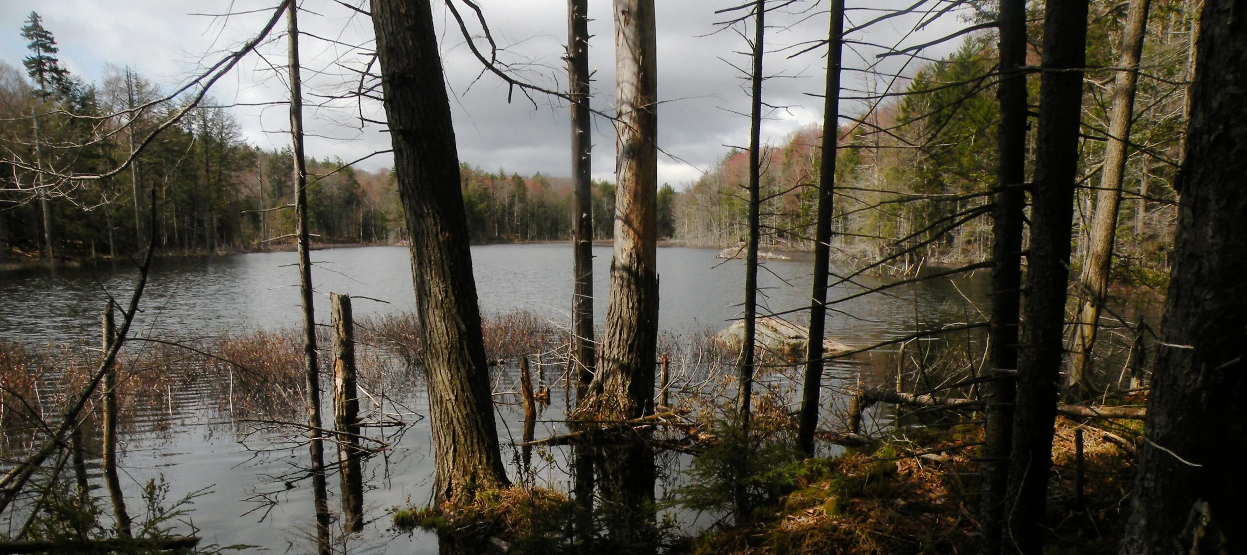
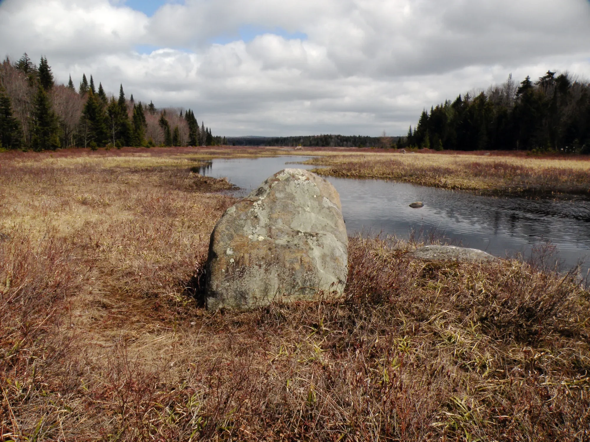
The central feature is Cotton Lake, a tiny teardrop of a pond with a surface that rises and falls at the whim of the beavers. The same can be said for nearby North Branch Lake and Forty Mountain Beaver Flow, all of which are natural pools and wetlands that can be quite handsome when dammed by these busy semiaquatic rodents, or somewhat underwhelming when the beavers move elsewhere. I have been exploring this area long enough to see Cotton and North Branch in both conditions, like the rise and ebb of a slow-motion tide.
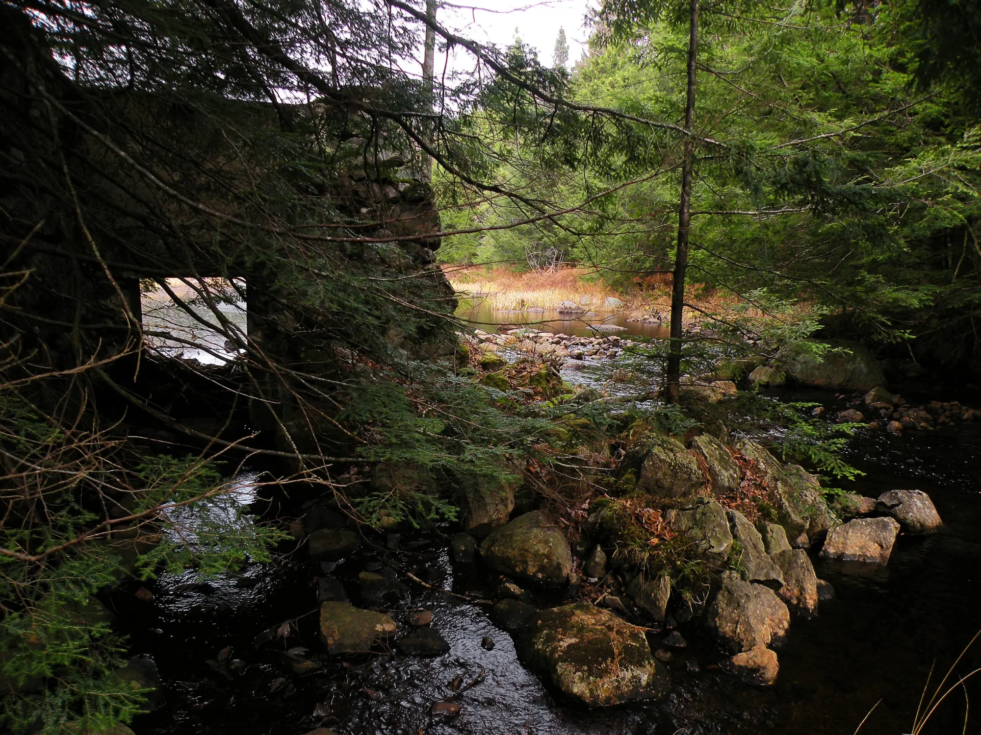
A dam of a different nature once enlarged the Twin Lakes to the north. For a brief time late in the nineteenth century, this sprawling wetland with its two namesake pools was a shallow reservoir in the service of the state’s canal system, at a time when engineers sought access to an entire network of such reservoirs in the Black River headwater region. They built a rather elaborate dam on the outlet, but abandoned it when the focus turned instead to larger reservoirs in more accessible locations. A portion of the stone masonry structure still stands, but the historic Twin Lakes Reservoir has long since faded from memory.
Otherwise, the “Cotton Lake Wilderness” shows little evidence of prior human occupation. The most striking feature might be a network of old tote roads, likely created in the aftermath of a 1950 hurricane during operations to remove fallen timber from the Forest Preserve. Some still serve as unofficial trails, though maintenance has been light and nature has been slowly grabbing the upper hand.


Why was this area not identified for a wilderness classification by state land planners, along with places like Silver Lake and the High Peaks? There were likely several factors, including a basic lack of knowledge about the area. The portions of the Adirondack Forest Preserve that did receive legal protection in 1972 (and later) all had strong advocates to speak about them and raise awareness. Until I began to speak up in 2006, little Cotton Lake had no such sponsor.
Aesthetics might also be a factor, somewhat ironically. People accessing the area are likely to be unimpressed with the “plain vanilla” hardwood forests that surround the main entry points, even if the interior is highly rugged and varied. First impressions are important, and one must spend some time in the Cotton Lake region before its higher qualities begin to grow on you.
Having a signature feature would also help. Despite the attractive small ponds, none are large enough (or maybe have enough fish) to attract the attention of people seeking an outdoor adventure. Sure, I have spent many a pleasant night next to a small campfire at several remote campsites throughout the area, but then I am something of a connoisseur of remoteness and hardly a measure of the popular taste. And “peak baggers” are likely to give this area a big yawn; the only named land feature – Forty Mountain – is little more than a bump on the landscape.
Perhaps more importantly, though, is the network of primitive roads and snowmobile trails that encircle the area to the east, near Black Creek Lake. This more than anything might have inspired the original Adirondack Park Agency (APA) planners to seek wilderness elsewhere. Indeed, these features fragment an otherwise spectacular stretch of wildland between Black Creek Lake and the West Canada Creek, but since they connect a variety of tiny private inholdings they cannot be administratively waved away. As long as there is a legitimate need to retain these roads and trails, the entire eastern portion is ineligible for a wilderness classification.

Black River Wild Forest Map South
Even so, the bulk of the state land west of this trail network fully meets State Land Master Plan (SLMP) criteria for wilderness management. This zone includes not only all of the small ponds named above, but several choice streams, wetlands, and waterfalls. The remote and seldom-seen territory east of Twin Lakes likely contains virgin timber that was never troubled by a woodsman’s ax. The only “non-conforming” feature that would require state action is the 3.1-mile Twin Lakes Trail, which is technically a snowmobile trail. Riders have not favored this trail in many years, and its closure to snowmobiles would almost certainly not be missed.
Of all the wild forest areas in the Adirondacks with pockets of wilderness-grade terrain, the “Cotton Lake Wilderness” is easily one of the largest. Without an official designation, it exists purely by administrative choice (or oversight, if one prefers a more cynical world view). State land managers have no policy directives to preserve its wilderness qualities, and the wild forest guidelines permit them to implement a wider array of recreational activities that could potentially erase its wilderness attributes.
No immediate “threats” have been proposed for Cotton Lake, other than perennial plans by DEC to “rehabilitate” some of those rough trails along the eastern edges and open them to ordinary automobiles. None of these proposals intrude directly on the “Cotton Lake Wilderness,” but they would nevertheless nibble away at its remote qualities.
Thus the need for constant vigilance.
There are two ways this area could be protected. The easiest – and therefore most likely to occur – would be if DEC administratively chose to leave this area alone in a future update to the Black River Wild Forest management plan. This would be a satisfactory solution for the short term, as it would at least be an official recognition by the state that this is an area worthy of protection.
But its long-term protection would depend on DEC’s institutional memory, or whether future foresters will choose to continue this course of action. Nothing would compel them to do so. Such was the problem encountered with national forests prior to passage of the 1964 Wilderness Act, when areas were protected and then un-protected as administrators (often with differing opinions about wilderness) came and went.
The lived experience with wilderness preservation is clear: to permanently protect it, only an affirmative designation does the trick. And on federal land this now means a literal act of Congress.
Likewise, the preferred method for preserving the “Cotton Lake Wilderness” as a state-recognized wilderness is to remove the quotation marks – for the APA board to take definitive action and reclassify the land per the procedures set in place by the SLMP. Doing so would elevate Cotton Lake to equal status with the nearby West Canada Lake and Ha-de-ron-dah areas.
Only this action would preserve the area’s wilderness qualities for the long term, thus assuring those few of us who know this area that its future will never again be in doubt – as it is today, so shall it be a century from now.