Second Pond is a little-known body of water tucked away behind Gore Mountain, well out of view of most people. Although the pond is nestled right at the foot of the mountain, there is not a ski slope or a garnet mine to be seen from this angle; only the array of communication towers on the summit mars the view. Given its proximity to the most popular tourist destination in North Creek, it is surprising that relatively few people know of Second Pond’s existence.
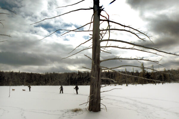
In recent months, I took the time to visit the pond twice, once in the fall and once in winter. In fact, the fall trip inspired the return visit a few months later, once I realized how much potential the 2.8-mile trail had for skiing. Therefore I waited for a nice snow shower in mid-February, and came back to enjoy a day of ski touring in deep powder.
Of course, regardless of the time of year this is a perfectly enjoyable walk in the woods, culminating with a handsome destination.
Getting There
The trail to Second Pond begins at a small trailhead on Chatiemac Road. To find it, follow NY 8 south for 4.3 miles from the traffic light at the intersection with NY 28 in Wevertown. Follow this gravel road for 2.3 miles up a long hill to a small turnoff on the right, where the trail begins. This spot is plowed in the winter. The road ends at Chatiemac Lake, a private lake with cottages and a clubhouse.

The Trail
The yellow-marked trail to Second Pond begins as a good, clear trail on the edge of private land. In just 0.1 mile you reach the outlet of Chatiemac Lake, which you cross on the only bridge you will find. Upstream there is a large beaver pond straddling the state land boundary. Downstream is a sprawling cluster of yews, a low-growing coniferous shrub with boughs that resemble hemlocks and small cones that look like red berries. When I skied here in February, wind blowing off the beaver pond had created long snowdrifts stretching across the trail.
The trail passes a corner of the wetlands on Black Mountain Brook, which you see below you to your right. It then dips to cross a small stream and traverses the eastern foot of Height-of-Land Mountain, where there is minimal elevation change. Although the trail is relatively level, winter visitors should know that this is a ski trail by designation, not by design. The trail was originally just an old tote road, and it has many unresolved drainage issues. Here, at the foot of the mountain, there are several long sections where it never completely freezes, and therefore you will have to ski through the open hardwoods off to the side.
Should you happen to notice a side trail to the right with two or three red markers at the intersection, this is the start of a rock climber’s access trail to a ledge on the back side of Gore Mountain.
For skiers, one of the highlights of the trail comes when it makes a gradual climb along the spine of a ridge with deep draws on either side. This is the biggest slope on the entire trail, and while hikers will not find it noteworthy, skiers will be delighted by the prospect of sliding down it. There are several turns on this hillside, but the trail is wide and blissfully free of erosion. With good snow, it is a joy to ski.
You reach a height-of-land at 1.3 miles, after climbing 250 feet from the outlet of Chatiemac Lake. After dipping through a narrow draw and climbing back up the other side, the path continues west, contouring along the lower slopes of Height of Land Mountain. This part of the trail is the most problematic on skis, as it is plagued with numerous little stream crossings. None have bridges, nor do they freeze reliably—but you do encounter them with a dispiriting frequency, about once every hundred yards or so. In each case I was forced to ski off trail in search of an adequate ice bridge. Snowshoers and summer hikers, on the other hand, shouldn’t have much of a problem.
As the trail begins to descend from the northern slopes of Height of Land Mountain, conditions do improve. The final section of the trail is a fun slope through a tall forest, with a total descent of about 210 vertical feet. For skiers, it is worth persevering with the trail’s imperfections to reach this point.
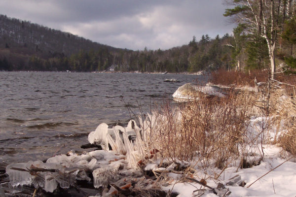
The trail comes to an end about midway along the pond’s south shore. If you are so inclined, look for a small designated campsite to the right; it is a cozy nook in the forest, and a suitable place for one or two people to hide from society for the weekend. On the shoreline, a pair of fallen trees has revealed a small rock ledge that is about the right size for a lunch stop. From here, only a corner of Gore Mountain is visible; everything else is delightfully wild.
In the winter, you can ski out past the end of the trail to a small islet in the middle of the pond. The extreme eastern and western ends of Second Pond are marshy, but the rest of the shoreline is ringed with a mix of spruce, fir, and birch. Most of this basin has been part of the Forest Preserve for a long time. Despite its name, the only thing to which this place has ever been second now goes by a different name; what was once called First Pond is now known as Chatiemac Lake
Second Pond is stocked with trout, but it is difficult to fish it without a boat as there are many snags near the shore, which is heavily wooded.


