
EXPLORE! Moxham Mountain
Moxham is a multi-peaked mountain that straddles the Essex-Warren county line. At about 2441 feet in elevation, it is well off the list of the highest summits in the park—actually, its highest point is just about even with quite a few ponds in the central highlands.
But driving past Moxham Mountain on NY 28N between North Creek and Minerva, its profile is nothing short of monumental. That’s because it is the epitome of a homocline, a mountain type that is common throughout the Adirondacks but reaches its most impressive form here. Homoclines have gentle northern slopes and precipitous, often rocky southern faces. But to say that Moxham’s southern slope is merely rocky would be an understatement—parts of the mountain are sheer cliffs!
Therefore Moxham is a sight to behold as much as it is a mountain to climb. The easternmost extent of the mountain, called Moxham Point, is an imposing landmark as viewed from NY 28N, like a scale model of one of Yosemite’s signature cliffs. The portion of the mountain that the trail visits is the central and highest summit, which is less cliff-like. Nevertheless, it offers unobstructed views of the chain of ponds at its foot. The state’s ownership of the mountain is incomplete—the foot of the mountain, for instance, is privately owned—but what the public does have access to is pretty outstanding. This is a favorite hike, worth visiting time and again.
The relatively modest hiking distance, moderate grades, and multiple vistas makes this a tempting family hike—an exciting adventure for all ages. The one caveat is the sheer drop-off at the top of the mountain, which is sure to make parents and pet owners nervous.
Getting There
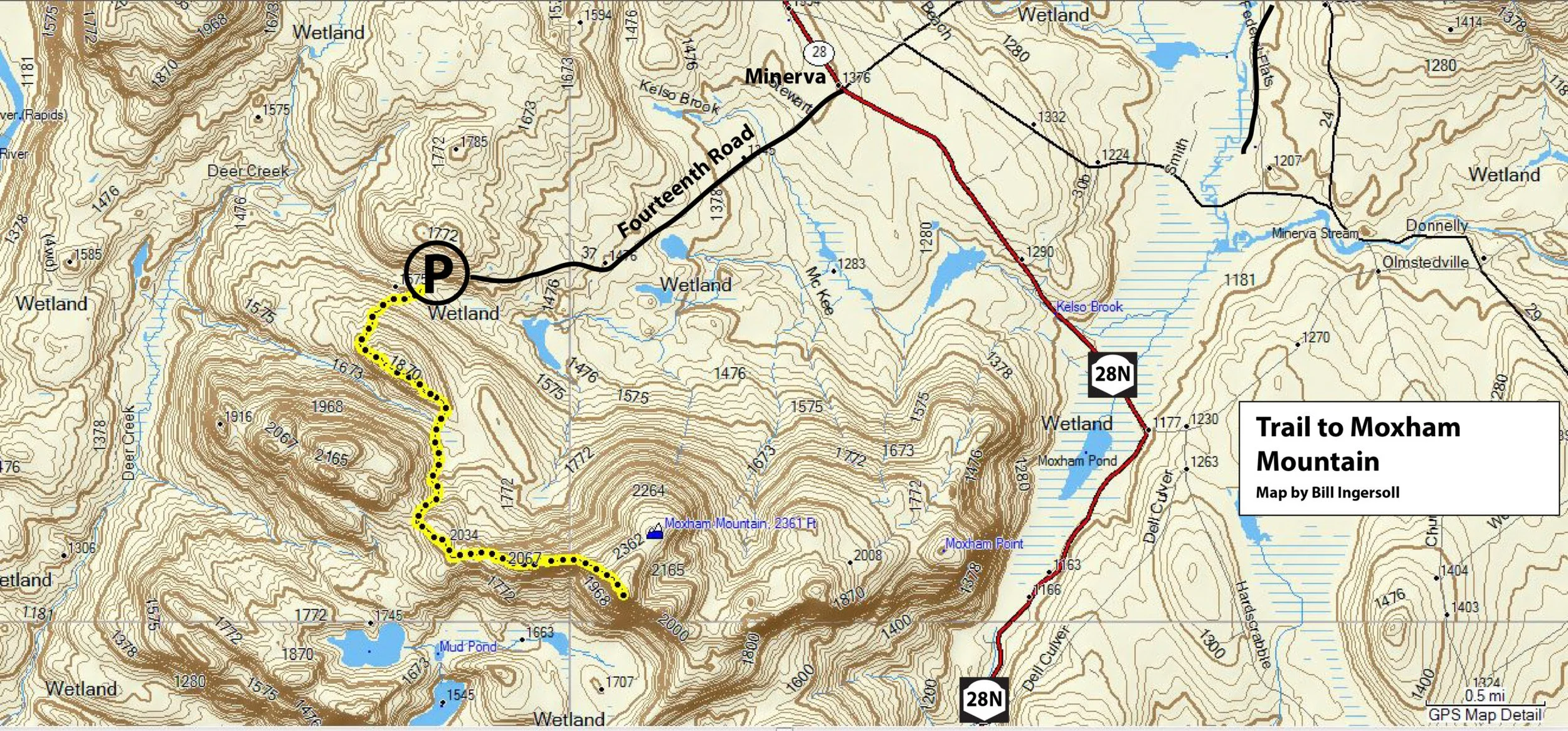
Follow NY 28N to the hamlet of Minerva, located in southern Essex County. From the four corners in the middle of town, turn southwest onto Fourteenth Road, so named because it leads into Township 14 of the old Totten and Crossfield Purchase. This dead-end road starts off as a paved county byway but eventually turns to gravel, dropping into the valley at the northern foot of the mountain. The trailhead for Moxham is 2.1 miles from Minerva, and it is plowed in the winter. Moxham Mountain is in the Vanderwhacker Mountain Wild Forest.
The Trail
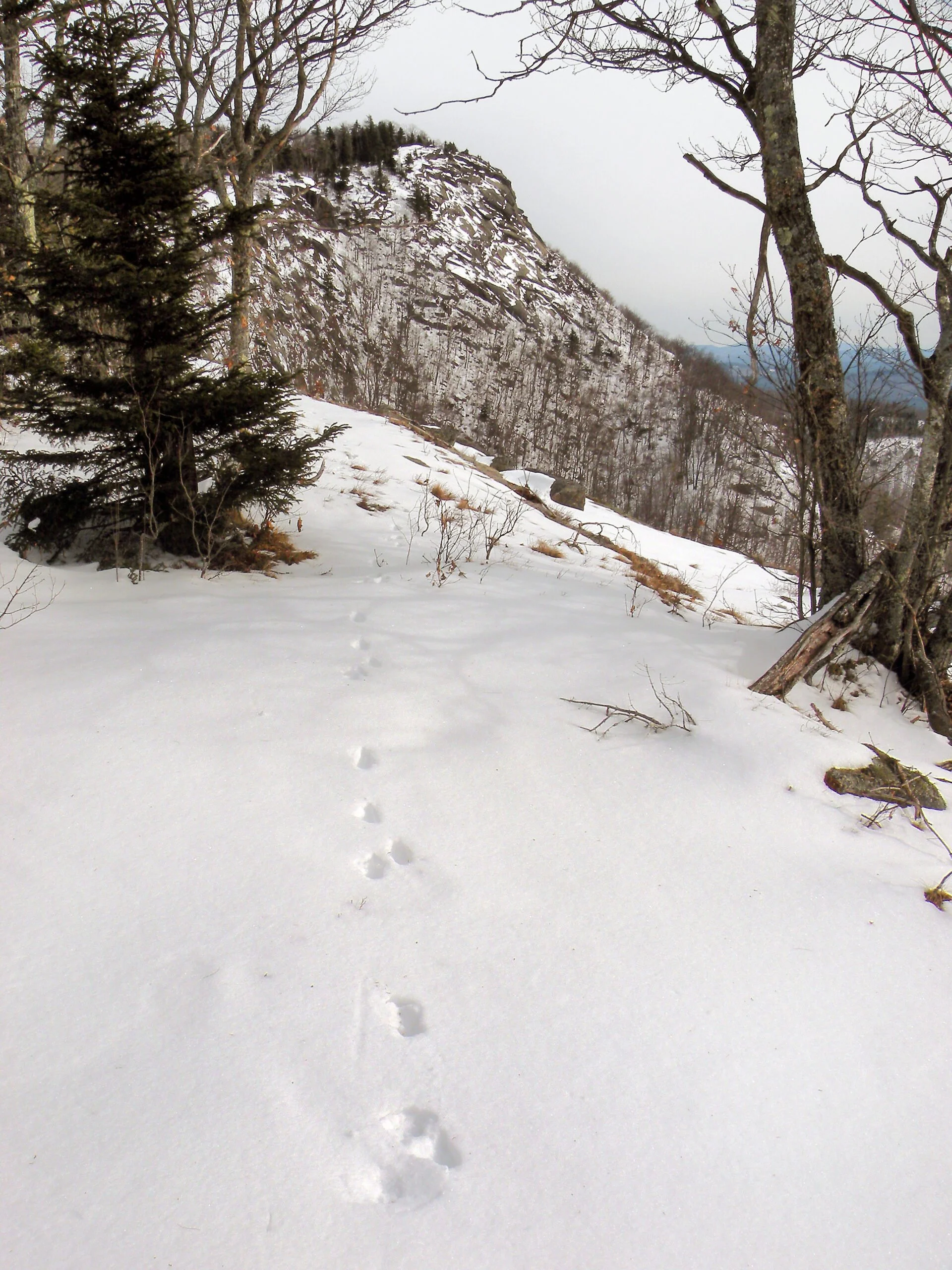
The foot trail leads southwest from the parking area, climbing away from Fourteenth Road at an angle. There are three noteworthy views along this trail, and the first comes from a foothill that you summit just 0.6 mile from the start, as little as twenty minutes into the hike. The trail circles around to the western flank of this small rock knob and ascends to a viewpoint 375 feet above where you parked. This view is not all-encompassing, but it is a good preview of what is ahead, including your first glimpse of the main summit, which is still 1.4 miles away as the crow flies.
You lose about 175 feet as you descend off this knob to the outlet of a small beaver meadow at 1 mile. At this point the trail is angling south toward a draw that ultimately divides two of the mountain’s summit clusters, turning southeast to climb over a 2034-foot knob on the main ridgeline. This begins the most exciting part of the hike, for the climb to Moxham is not just about the final scenic payoff, but the build-up of excitement as you follow the ridgeline to its highest point. The penultimate view of the summit is just as photogenic as the view from the summit.
Approaching Moxham Mountain’s Summit
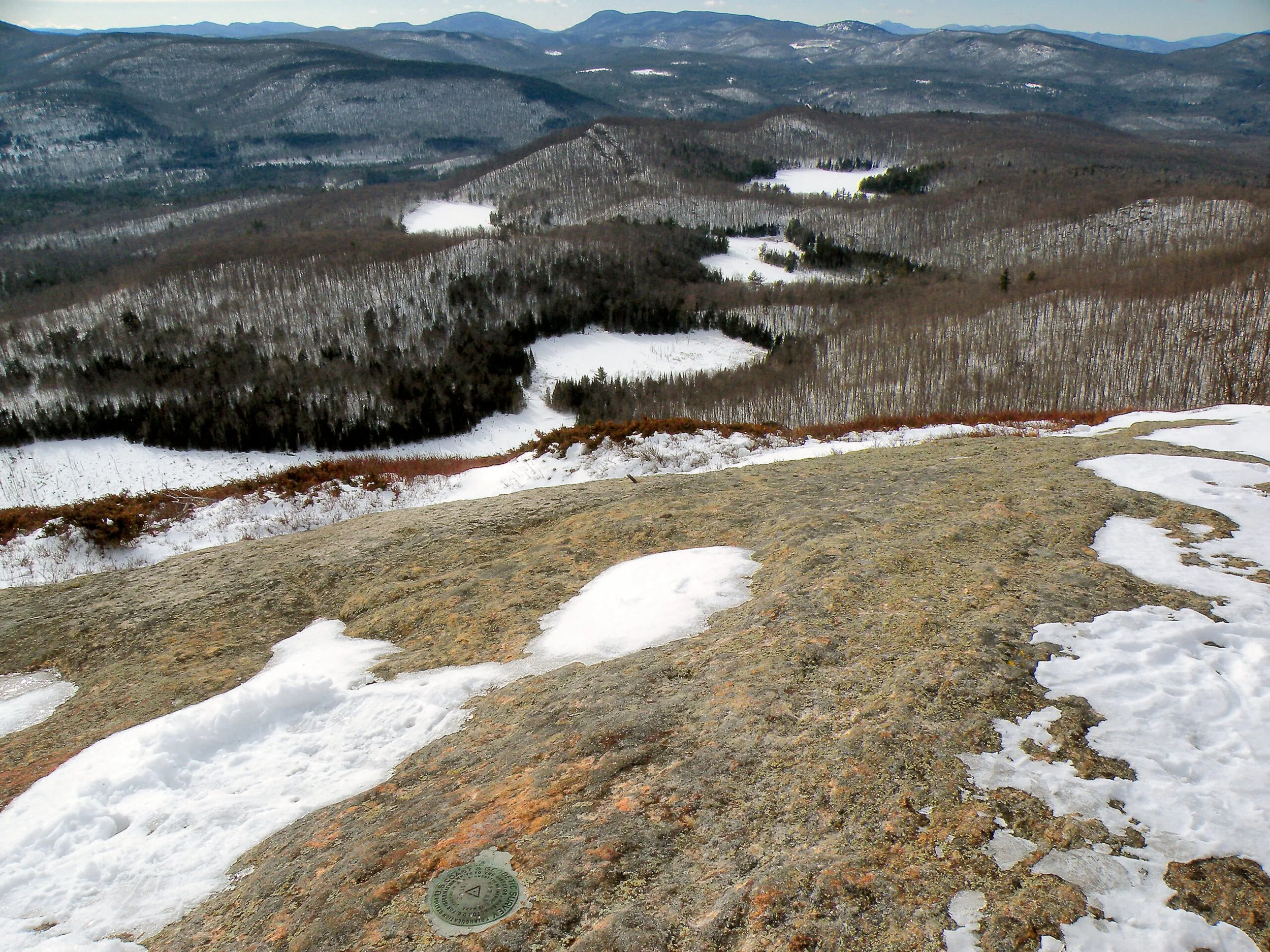
The hiking time to the summit—not counting all the stops along the way to take pictures—is just little more than an hour. The trail approaches it from behind, and you can enjoy the sweeping vista from the treeline without the need to proceed any closer to the edge. The open rock is capped by a benchmark affixed to the mountain by a 1942 federal survey, with bolts nearby that once anchored the surveying equipment.
The thrust of the view is southwest, meaning that the best time to experience the mountain is in the morning, especially if you want to come away with good pictures. The chain of beaver meadows and ponds at the foot of the mountain point the way like landing lights on a runway toward the mountains west of the Hudson River. Of these, the remote peaks of the Siamese Ponds Wilderness are the most prominent, especially Bullhead and Puffer. The knobby summit of Snowy Mountain can be easily picked out from the lineup of peaks on the western horizon.
One of the best things about this hike is that when you turn around to head back to your car, you get to experience all of these scenic views a second time.
Moxham Mountain Trail Map
Moxham Mountain View