
This Land is Your Land
AUGUST 2018 – It was the first day of a four-day hike, the introductory miles to a 38.7-mile loop I had been planning for a while. It would take my dog and me around the foot of the Santanoni Mountains, from Upper Works to Newcomb Lake, then from the Cold River to Duck Hole. This was a bit of an ambitious itinerary for me – not that I hadn’t done hikes of this distance before, but because a few years (and more than a few beers) had passed since my last “big trek.”

The weather was fine, perfect for late summer. My pack was heavy, but my legs were still fresh. Everything felt good. Bella, who was then just a two-year-old pit bull, labored happily under her own orange backpack, filled with enough kibble to keep her going all four days.
As far as I knew, or cared to know, I would be the first person to complete this loop. The entire distance was on established trails, but the majority of this first day would be on land that had been off-limits to the public until just a few years prior. My previous explorations of the MacIntyre West Tract had confirmed the information I had gleaned through online contacts: that the long-standing tenants of this land had been maintaining their own trail system on what was previously a private forest. This included an access road beginning near Upper Works as well as a dwindling footpath ending at Newcomb Lake, both of which directly connected the state trails at both ends.

The author’s backpacking loop in August 2018. Red lines represent marked DEC trails, green lines are DEC trails in poor maintenance, and black lines are the unmarked routes in MacIntyre West.
This was one of the many parcels of land New York State had acquired from Finch Pruyn, the logging company that had famously sold all of its land to The Nature Conservancy in 2007. MacIntyre West, so-named because of its location relative to the old MacIntyre iron mine, was less well-known compared to its controversial kin, such as the Essex Chain of Lakes and Boreas Ponds. But the terms of its purchase were essentially the same: over the course of a decade state ownership would be phased in, and the last remaining private uses would be phased out.
The end of that decade was September 30, 2018 – only five weeks after I began my loop hike. Most of my previous visits to “Mac West” had been spread out over the winters of 2015, 2016, and 2017, after the state acquired title to the 7,368 acres but while there was still plenty of time left on the clock for the hunting leases. It was something of an odd experience to explore a portion of the Forest Preserve that was dotted with small camps, and to have such intimate views of Santanoni’s southern slopes from active snowmobile trails. Each of the camps – and there were dozens of them strung along two primary access roads – had been permitted a one-acre “exclusive use envelope,” allowing full public access to most of the land but granting the lessees the dignity of solitude where their camps stood.
Now, though, it was August 2018, just a month ahead of the hard deadline by which all of these camps were required to be gone.
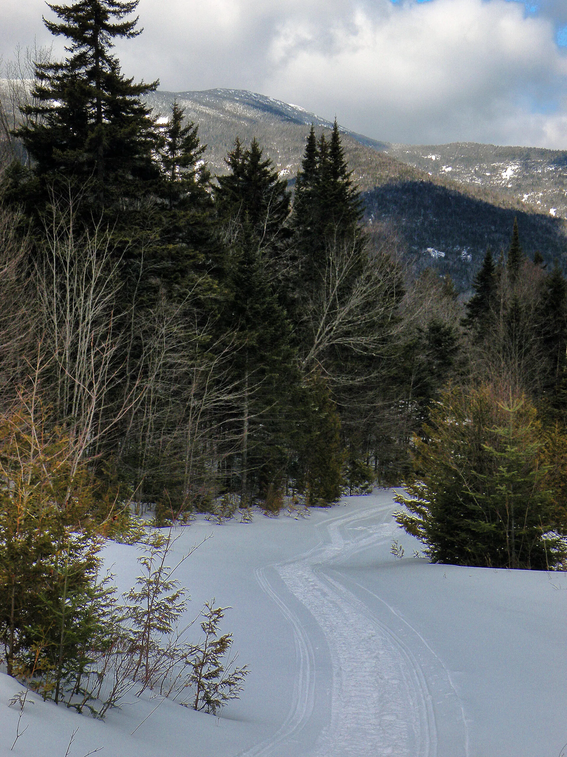
Snowmobile Tracks in the Shadow of Santanoni
Don’t Tread on Me
If you’ve hiked Santanoni, Panther, and Couchsachraga on a peak-bagging quest, you are already familiar with the start of my hike. That 14-hour slog begins on a gravel road that leads from the Bradley Pond Trailhead, but after the first 1.7 miles you are granted the minor mercy of turning right onto a wilderness foot trail.
The standard route into Mac West keeps you on that same road for several more miles. The surrounding forest is fine, though the soles of your feet might be less impressed, perhaps. Moments after passing the trail turn-off you come to a bridge with a sign that tries its best to be intimidating:
GO BACK
NO TRAIL ACCESS BEYOND HERE
After the state’s purchase in late 2014 this sign had no legal bite. It was intended, I’m sure, to keep all the Forty-Sixer aspirants on track, but this wasn’t me. Still, it wasn’t exactly a warm welcome, and unlike those ski and snowshoe visits, today I was much more likely to encounter the people who had posted it.

Bridge on the Road to MacIntyre West
I squeezed past the locked gate, cautiously allowing Bella to continue exploring off-leash for the moment. The clubs maintained a register just beyond, with the pages accruing more and more names of people like me who were here to explore this new Forest Preserve gem. Indeed, the land had already been added to the High Peaks Wilderness earlier in the year, well ahead of the lease expiration in September.
This was not the first new state acquisition I had explored; I had been to Madawaska Flow (2004) and Round Lake (2006) during similar interim phases, when public access and private leases briefly overlapped. In both of those cases, though, the remaining camps had already been near abandonment by the time I came along.
The Finch Pruyn lands were different, in part because of the sheer acreage involved, the overwhelming public interest, and the ten-year timeline between the logging company’s sale and the accrual of full public rights. It was a period that began before Obama’s first election and ended after Trump’s, and all the water that flowed under those two bridges had eddied once or twice here. What Elliot Spitzer’s administration agreed to purchase in the winter of 2008, Andrew Cuomo was taking credit for completing in 2018.
As Bella and I followed the gravel tote road deeper into Mac West, we came to the first of the cabin sites. This structure, which had stood mere feet from the side of the road, was already gone, its footprint covered with scattered hay.
The road began to climb. Other camps still stood, currently empty and seemingly untouched.
At the top of the hill, I already knew, was the beginning of a cluster of hunting camps so thick they almost formed a village of sorts, a lost Wanakena here in the High Peaks. Smoke wafted from the site of the first, where I remembered a Gadsden flag had once proudly been displayed. The structure was gone, but I could tell as we approached that someone was still on site.
Bella has a known tendency to approach all strangers without reservation and insist on their friendship, but the backpack slowed her down enough for me to grab her collar and hook the leash on her. I was just in time; the man who had been tending the fire in the vacant cabin site approached the road as we neared.
“The hiking trail ended back there at the bridge,” he said firmly. The Gadsden flag was still on display behind him, I noticed, as though in defiance of the events that had forced the demolition of the camp it once adorned.
He was trying to make me feel like I was trespassing. Not a threat, exactly, but I knew I was intruding on a personal moment. I imagined it was some sentimental part of his cabin that I now saw smoldering in the smoky fire.
Best to not respond emotionally, just stick to the facts. “This is all state land now,” I said, looking him in the eye from the middle of the road, matching firmness for firmness.
“Not until the end of September!”
I shook my head, realizing the importance of standing firm. “The state bought this in 2014, and the public already has access.”
Bella was struggling at her leash, oblivious to all the primate-style tension on either side of her. She saw only a potential new friend waiting to be persuaded by the power of her kisses. I saw a thin man with dark, scraggly hair who was not in the cheeriest of moods. He was mourning the loss of something that had been deeply important to him; what I was gaining in the form of more wilderness acreage was this man’s loss, and sometimes a loss is more sharply felt than something gained. This, I assumed, informed his desire to confront me.
“No, not yet,” the man said, still trying to convince me I was wrong.
I realized there was no good reason to linger and prolong this conversation, so I took a step up the road, signaling my intention to continue my hike. “You have your one-acre lease, which we’re respecting,” I said, “and I’m sorry that you lost your hunting camp. But this is state land now. Good day.”
So far as I know he was still glaring at us as we left. Thankfully Bella was cooperating, allowing me to make a polite and graceful exit.
We saw no one else as we passed through the “village” of camps, but I knew people were present because I saw ATVs parked outside a few of the structures. I wanted to photograph some of these sites, to have a record of Mac West during this final moment of transition, but I didn’t want to do it in full view and appear like a vulture. One vacant lot was surrounded by singed trees, brown witnesses to a cabin that had been burned to the ground ahead of the deadline.

MacIntyre West Hunting Camp
Our route took us up the mountain to Lake Andrew, perhaps the scenic highlight of the entire tract. We took our lunch at the site of a collapsed cabin on the south shore, one which had been made with unpeeled spruce logs in an earlier era B.P. (before plywood). It had then collapsed under the weight of a heavy winter snow, a rustic ruin many miles from the nearest gravel road.
At least two trails led down from Lake Andrew to the south, connecting with the next access road that would in turn deliver me to Newcomb Lake. I chose the one that wouldn’t lead directly to another lease camp. Even so, I put Bella back on the leash since it meant we would be passing the final cluster of Mac West’s hunting outposts, all of them facing the same hard deadline.
However, the only other people we saw were busily dismantling one of the cabins in a careful operation – apparently taking the walls apart board by board and burning the unsalvageable pieces in a nearby fire, perhaps with reconstruction elsewhere in mind. I counted two men, but they never looked up from their work, never acknowledged our passage; they contained any and all emotional reactions our presence might’ve provoked, if indeed we provoked one. The license plate on the truck identified its owner as a Vietnam veteran, and a radio was playing a song about smooth Tennessee whiskey.
Re-Wilding [Depopulating] the Adirondacks
The blunt reality is that any future land acquisition the state is ever likely to make will play out something like Mac West, as there are no eligible properties anywhere in the Adirondacks that are completely virginal.
Once there was acreage to spare in these mountains, and over the course of the nineteenth and twentieth centuries New York acquired as much of it as it could, thousands upon thousands of acres at a time, most of it briefly logged and then quickly sold as if land were abundant and disposable. These tracts became the nuclei of our modern wilderness areas, large and impressive but with significant missing pieces.
Then the pace of land acquisition slowed and became more deliberate. But the difference is that now any large tract worth pursuing for the Forest Preserve will have been in private ownership for more than a century; during that time roads have been built and people have built attachments. Acquisition will come at a cost, by which I do not mean the monetary price. It is an inevitability that must be acknowledged.
The way one perceives how this process plays out is not unlike a Rorschach test, in which different people may view the same scene through their individual filters and arrive at unique conclusions. Either the land is being re-wilded to make room for nature, or it is being de-populated and closed off to the people who worked and played there; either the wilderness is being reclaimed from a past human presence, or it is being manufactured out of well-managed timberlands.
It is important to note that New York’s long-standing policy on land acquisition is to deal only with willing sellers; eminent domain is technically a possibility, but rarely if ever invoked. Many of the National Parks in the eastern U.S. were purchased through the latter method, including Great Smoky Mountains, and not without engendering some amount of resentment that is still felt generations later. In the Adirondacks, the assumption is that both parties are entering the process with sober minds; market conditions might be a motivating factor for the sale, or perhaps the death of a family scion, but no landowner is being forced into a deal they wouldn’t otherwise make.
Over the last thirty years or so, the process has been splitting people’s sympathies. The sellers in most cases aren’t families with deep personal ties to what had once been a mammoth private park – they are corporations, making their decisions remotely by board approval. The Forest Preserve benefits when an alternate source of, say, cheap matchwood can be found somewhere in Asia, and no other market exists for a ten-thousand-acre tract of undeveloped woodland in a region where the state is offering top dollar.
Caught off guard, though, are the working-class sportsmen whose leases are about to be abruptly terminated. The corporate landowner, usually headquartered nowhere near the land it owns, is merely divesting itself of an unprofitable asset, but it’s the hunters who are forced to make the most personal sacrifices.
Of course, they were merely tenants on the land, perfectly aware of the temporary nature of any lease. Sooner or later they were going to have to leave anyway. Any improvement made to their camps might have been costly, but it could not be considered an investment because there could never be a financial return; the lease that allowed the sportsmen onto the land was a contract, one that would always require payment to the landowner as long as it was in force.
(Don’t criticize me for my use of such “archaic” gender-specific terms; as one hunting club officer once informed me, “We don’t have a written rule of no women during hunting season, but it’s not recommended to keep the peace.”)
Going to Rot
This dynamic has exposed some interesting biases over the years. For instance, take the strange case of Carol LaGrasse, the long-standing president of the Property Rights Foundation of America, Inc. This organization, based in Stony Creek in the southeastern Adirondacks, describes itself as “a grassroots, non-profit organization dedicated to protecting the constitutional right to own and use private property and to preserving the American tradition of private landownership.” Her biography states she has “testified six times on property rights, and in opposition to National Heritage Areas, American Heritage Areas, and UNESCO Biosphere Reserves before committees of the U.S. House of Representatives and the U.S. Senate.”
One would assume LaGrasse’s support for a private landowner – up to and including a timber company – to sell its lands as it see fits. This is, after all, part of the “American tradition of private landownership.” But twenty years ago she coordinated a lawsuit against the state’s purchase of 139,000 acres of land in fee and easement, siding with the hunting clubs who leased the land from the former owner, Champion International. “Three hundred camps will be burned down or bulldozed [because of this deal],” she wrote at the time, “but the State never looked at the social and cultural impact on the families who have used the camps for up to 100 years.”[1]
The image being invoked here is that of hearty American stock being run off their long-held homesteads by a heartless bureaucracy, but that has most certainly not been the case in these corporate land acquisitions. The leases, at most, dated to the 1930s, although this was probably not the point. Rather than private property rights, the real concern here was opposing public ownership at all cost.
And by any argument. It may not come as any surprise that LaGrasse also wrote in opposition to the just-announced Finch Pruyn acquisition in 2008. In comments made on behalf of the Property Rights Foundation at a hearing in Glens Falls that year, she listed a number of ways the state’s land acquisition program had forced people out of the region, eliminated jobs, and reducing biodiversity by allowing the land’s “productive capacity … to rot.” Reasonable people might disagree on certain points, but importantly none of her claims were supported with data.
But at the heart of her argument was the perception that the state’s acquisition of the land would harm more people than it would benefit. Forget Finch Pruyn, the landowner who rightfully sold its lands; at stake were the twenty hunting clubs with their 439 total members who faced a forced removal. In her words, these were “people with families and friends who share a multi-generational tradition together, as well as contribute importantly to the local economy.”
If 439 people seems like a rather small number to inspire such animosity to the deal, it is important to contrast this with her view of how the Forest Preserve is used:
The lie that is promulgated by the [land] conservancies and the Department of Environmental Conservation … is that land is going to be opened up for access by the people. But noone [sic] can reach the back country once DEC owns the land, because the DEC always closes the roads. Jack Leadley of Speculator, who is a highly esteemed woodsman, wrote to me that in all the 30-plus years and thousands of miles that he has hiked the back country, working his trap lines he has met less than five people. Nathaniel Dickinson, former DEC Big Game Unit Manager has told me several times over the years that he has met perhaps two or three people at the most in years of bushwhacking (off-trail hiking) through the Adirondacks.[2]
It seems almost staggering to believe that any rational person might think only five people have explored the Forest Preserve in over thirty years, and one would have to drive past many busy trailheads to track down the two guys happy to tell you the cherry-picked anecdotes you want to hear. Nevertheless, if this really was your vision of how state land is used in the Adirondacks, then I suppose the math otherwise makes sense; indeed, it would seem preposterous to spend so many millions of taxpayer dollars on something no one wants.
Or maybe the people who do use public lands were invisible to LaGrasse, who described her target audience as “ordinary people who would like to use the lands,” such as “hunters, … ordinary people who are not athletic, the elderly, the disabled, snowmobilers, four-wheelers, ATV users, motorized boaters, and float plane users. These people are part of the culture and economy of the Adirondacks, to be assaulted by the acquisition and flip of the land to ‘forever wild’ status.”[3]
With such blinders firmly in place, the rest of us who support state land acquisition and visit the Forest Preserve frequently don’t matter, have no status, do not participate in the region’s culture or economy, and simply pass unseen into the trees. If we aren’t the people Carol LaGrasse wants us to be, then to hell with us.
Access for Me, Access for You
To be sure, Carol LaGrasse represents an extreme point of view, but many of her speaking points have been echoed elsewhere, by other people. Indeed, at the public hearings held late in 2016 about the future of the Boreas Ponds, more than one speaker gave voice to the notion that closing now-obsolete logging roads on new state land acquisitions was effectively barring all but an elite group of people from ever going there again. Several people were even astounded at the notion the state might acquire these roads and not use them as intended.
These Finch Pruyn hearings, including those for the Essex Chain, were among the most widely attended Adirondack Park Agency events in recent memory, and the concept of “access” was foremost in the mind of every attendee. Except, of course, “access” meant something different to each person. Speaking for myself, “access” means simply being able to reach the point where state land begins; so long as I have a place to park my car at the trailhead, I look forward to the adventure of reaching those scenic destinations hidden deep in the interior by foot. But for others, “access” was impossible unless the parking areas were placed within strolling distance of those same destinations.
What made these new lands different from most others, though, was undoubtedly the fact they were already occupied by hundreds of hunting camps. This was not simply opening up vast acreages of forest that had been previously denied to the public-at-large, but driving out the leaseholders who were already there. One can rightly argue that as public lands they will serve more people and provide all sorts of wilderness-based benefits, but I’m sure it still stings for the minority who find themselves at the losing end of the equation.
To be sure, not all of the affected sportsmen were as resentful as the one unidentified man I met in August 2018 at Mac West; in fact I suspect most entered into their lease agreements knowing full well that someday those leases would be terminated. Still, it must’ve been a bitter process – and if left to their preference, these men would have chosen to stay in their camps.
For her final book in 2004, the late historian Barbara McMartin interviewed dozens of club representatives across the park, including those on the former Champion International lands that Carol LaGrasse was attempting to save. One such individual, speaking on behalf of a club whose land was now part of the Forest Preserve, seemed to confirm LaGrasse’s worst fears. After ruing how the sale seemed politically rushed, as well as the way the company kept the clubs “in the dark” during the negotiations, McMartin quoted him as saying this: “It is sad the Champion land that is now open to the public has received little use.”[4] It is important to note that the club lands in question included new public access to a canoe route on the St. Regis River, and was therefore not just some random spot in the woods.
This comment suggests the pain of leaving a tract of land that one has been hunting and fishing for years might be mitigated by the knowledge that others will soon come to appreciate the place just as much, albeit in different ways. From this perspective, the sale represents not a termination but merely a transition from one form of recreation to another.
But do the newcomers arriving to try out the “new” trails and waterways hold a reciprocal appreciation – respectfully acknowledging the sportsmen who once held exclusive domain here? Unless those people come during the interim period when both forms of access overlap, it is difficult to think that they do.
A Land of Solitude
The Forest Preserve, like so many other nature reserves, is presented as an anonymous tract of uninhabited land, pure nature set aside for its own intrinsic value. Sometimes there is also an obvious historic feature that is impossible to miss, such as the restored structures at Camp Santanoni, and its story is well communicated. But those random cellar holes one finds strewn throughout the eastern Adirondacks? Often those are little more than a curiosity, if they are noticed at all; these features merely add intrigue to the wild setting without dominating it.
Crews did such a good job eliminating the camps at MacIntyre West and other Finch Pruyn lands that these sites, too, will be difficult to discern after a few more years of new growth and stream erosion. It is not difficult to imagine a day in the near future when a young hiker arrives for the first time ever, assured by a smartphone app she will find a land of solitude here. Maybe the app will mention some sparse, anecdotal information that once this area was somewhat different, but that was long ago and altogether irrelevant now. What matters is the quality of the scenery and the challenge of the trail – and more specifically the location of the most scenic campsite and whether or not campfires are allowed. The fact that other hikers following the same app in search of the same solitude is a non sequitur not one of these newcomers will be self-aware enough to question.
I made my own return to Mac West just a few weeks ago as I write this, in August 2021. Once again my only hiking companion was Bella, now five years old but free to wander since no one else was present. That “lost Wanakena” I once hiked and skied through struck me as being eerily vacant, because I still remember the camps quite well and so I am aware of what is missing. It was easy to find the one site where the Gadsden flag once hung, although this time there was nothing to see. The exclusive use zone now expired, I wandered in but could find nothing more telling than a patch of broken glass, oddly reflective, like the remains of a shattered mirror.
The most unusual feature was the way the former access roads were so deliberately dug open and scarified by the last crew to leave the area. I admire the fact that practically all of the culverts were removed from the property, but the rest of the digging struck me as being a spiteful action against the very concept of roads, making them unusable for any purpose – including skiing.


But I was surprised that the remotest of the camps – the collapsed structure made in a bygone era with unpeeled spruce logs – was so thoroughly cleaned up, save for a few stray shards of window glass. This spot on the south shore of Lake Andrew was more than a mile in any direction from the nearest gravel road, and due to the difficulties of reaching the site I had expected the state to give this one camp a pass. Instead there is a spacious clearing that might someday become a good candidate for a lean-to.


The Lake Andrew Cabin Site in 2016 (left) and 2021 (right).
It was not far from here, at another spot near Lake Andrew’s outlet, where I found a spot to make my own camp for the night, one that consisted of little more than a nylon tent and a stone fireplace. For the first time ever Bella and I had the entirety of MacIntyre West to ourselves. Tiny frogs hopped for cover as I loaded the fireplace with wood, and the night fell dark without the sounds of ATVs or Ford F150s or distant voices of any kind. Great cedar trees rose around me, thick at the trunks but tapering quickly to their pointed tops; the largest of these trees all had a distinctive lean, as if in protestation against some long-forgotten wind.
I was aware that the site where I was camping was previously a spot where fishing boats had been stored; the boats too were gone, with only a stray package of Lake Clear Wabblers left under a stump as testament to the past uses of the site. I was also aware that all of the trails I had used to reach this spot were originally cut as ATV trails, but already the thick hobblebush was threatening to pounce on these from the sides.
The wilderness had been reclaimed here, and tonight I was the sole beneficiary of the state’s purchase. Given the visibility that deal had at the time it was made, I might’ve expected to see more curious visitors exploring the place in addition to myself; but given the absence of signs and trail markers pointing the way, then a population of one does make sense – even here on the fringes of the most popular wilderness in the park.