One of my favorite hikes in the southern Adirondacks has become the trail to County Line Lake in Bleecker. This outstanding hiking trail leads through the valley of Pinnacle Creek and climbs onto the high plateau west of Pigeon Mountain. The destination is a shallow pond that falls along the boundary of Fulton and Hamilton counties, hence its name.
This is a varied hike that seems to change its character every mile or so. The first section is a beautiful walk along an abandoned road through a magnificent hemlock forest. Then comes a section along a pair of large wetlands, with a dash of history thrown in. Finally comes the long climb into the high country, ending at the delicate shoreline of the pond.
County Line is one of the highest-elevation lakes in the southern Adirondacks, and a treat for those who like to enjoy rugged, out-of-the-way places. There are no established campsites, and there has been no fish for many years. Therefore this hike is all about the history contained within the lower valley, and the solitude found at its destination.
Getting There
This hike can be easily accessed from either Caroga Lake or Northville.
From NY Routes 10/29A in Caroga Lake, turn east onto County Road 112 and follow it for 6.5 miles to a four-way intersection. Pinnacle Road is to the left (north), marked by the Adirondack Beagle and Hare Club sign.
From NY 30 north of Northville, turn west onto Benson Road. Follow this road through Benson for 11.5 miles to the Pinnacle Road intersection.
From either direction, once you have found Pinnacle Road all you need to do is follow it for 2.6 miles to the trailhead at its end. This site is maintained for year-round exploration.

The Trail
From the end of Pinnacle Road, you’ll notice there are two diverging trails: the red-marked trail to Chase Lake, and the blue-marked trail to Pinnacle Creek and County Line. Both are highly worthy hikes, but for now let’s focus on the latter route.
The blue trail follows an old wagon road that is essentially a rugged extension of the town highway. Passing the rock barrier, it immediately turns left (west) and swings toward Pinnacle Creek. Hemlocks shade the trail, which climbs in stages along the foot of the Pinnacle. It is a highly enjoyable walk along the well-built roadway, with the creek as your companion to your left.
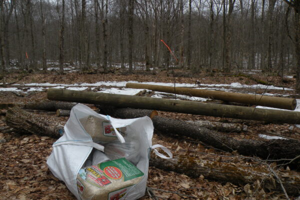
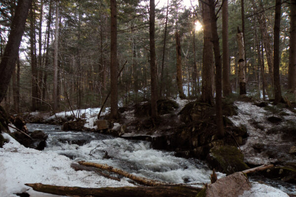
At 1.2 miles you cross a tributary of Pinnacle Creek; there are marshes off to the left. Beyond, the roadway climbs again. Watch closely now, for there two cellar holes to the right of the trail. The second one, located on the edge of a small clearing at 1.4 miles, is the more prominent of the two. These mark the site of the Pinnacle sawmill, one of many old industrial sites that are common in this region. The mill itself was located on the creek a short distance to the west; a short off-trail excursion will reveal some foundations and a few odd pieces of hardware.
After cutting through the mill site, the trail narrows slightly and continues beside a second wetland, one that may seem very wet and mucky at times. Tall maples and yellow birch mix with evergreens. There are glimpses of Pigeon Mountain and the high plateau to the west.
After skirting around the vlies, you reach a potentially wet area where Pinnacle Creek forks into two main branches. There are no bridges across either fork, which could be problematic in late fall and early spring (not to mention winter thaws). The route narrows into a proper foot trail as it continues northwest, now beginning to climb the lower slopes of Pigeon Mountain to a saddle that divides the Pinnacle watershed from the West Branch Sacandaga drainage. But rather than passing through the saddle, the trail turns west to begin climbing more aggressively. The hardwoods grow shorter with the increased elevation, until you top out at just bit under 2540 feet at another saddle northwest of Pigeon Mountain. This spot is 1000 feet higher than the trailhead and 3.2 miles from it.
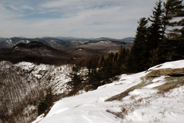
At this point the trail has crossed a short distance into Hamilton County and the Silver Lake Wilderness, but it now angles southwest as it begins a 100-foot descent toward the east end of County Line Lake. The marked trail ends near the Fulton County side of the lake, 3.7 miles from the trailhead (and at a rather disappointing part of the shoreline). A short, unmarked herd path veers left and hooks around the shoreline for a few hundred feet to a much better spot, one with a rock ledge and superior views of this wild place.
County Line Lake is devoid of fish, although DEC has identified it as a candidate for liming and trout stocking.
