In 1897 the state acquired a 24,000-acre tract southeast of Indian Lake for the Forest Preserve. Known as Township 15, it had been owned by the Glens Falls logging company Finch Pruyn. However, it soon became obvious there was a problem: over the years the company had already sold off numerous farm lots to local residents, and these previous sales had not been deducted from the state’s purchase.
This created an awkward situation in which the state and the occupants held conflicting titles to the land. Surveys to determine the correct property lines only made the situation more complicated. Therefore the state set up a special court in 1914 to resolve the conflict. Any resident who could produce evidence that he or she had purchased their lot before the state’s acquisition was granted clear title; those parts of Township 15 were no longer claimed by the state.
Those who were not able to satisfy the court’s criteria, however, were ruled to be squatters on public land, and so these portions of Township 15 were added to the Forest Preserve. All of the buildings were demolished, and the clearings were reforested with plantations of pine and spruce.
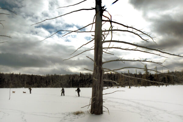
Of all these sites, Little Canada is the most notable. A modern foot trail passes through the former settlement, where several cellar holes and one small cemetery still remain. Little Canada occupied a scenic valley on John Pond Brook, located at the foot of Bullhead Mountain. Its boundaries can still be identified by the hard edges of the planted forest, especially when seen from one of the nearby summits.
Today, John Pond and its valley are the setting of a relatively short and easy hike. The lean-to near the pond’s outlet provides views of the rocky ridge that snuggles against the western shore, and the trail follows the course of the road that once led through the Little Canada settlement. And in 2017 the state completed a new link trail connecting John Pond with nearby Clear Pond; what had previously been two dead-end trails are now part of a scenic 5.2-mile loop.
Getting There
The loop trail begins from a pair of trailheads located on Wilderness Lane, southeast of Indian Lake. From NY 30 about 0.5 mile south of the intersection with NY 28, turn southeast onto Big Brook Road, also marked as County Route 4. At 3.4 miles turn left onto Starbuck Road, which leads to Wilderness Lane 1 mile later. The eastern trailhead for Clear Pond is located at this intersection. Turn right to find the John Pond trailhead at the end of the road; signs point left to a driveway leading to the parking area on state land, a total of 4.6 miles from NY 30.


The Trail
The yellow-marked loop trail is equally enjoyable regardless of whether you hike it in a clockwise or counterclockwise direction. Because the John Pond end has a dedicated parking area, let’s begin here. The trail leads south from the trailhead, level and nearly straight as an arrow. It is not the most exciting route, but it has the advantage of being easy. One moment of excitement comes at 0.4 mile, where you dip through an open wetland; a short side trail leads right at 0.5 mile to a view of John Pond Brook. At 0.7 mile the loop trail makes a sharp turn left. Continuing straight toward the brook on a faint herd path brings you to the first of the Little Canada foundations.
Turning eastward on the loop trail, you’ll enjoy the scenic view of Bullhead Mountain across the valley at 1.4 miles, where the trail bumps up against the edge of a large wetland on the brook. Then you encounter yet another side trail at 1.7 miles; this one leads north for 120 feet to a small cemetery—Little Canada’s most poignant site. Here you will find the graves of Elizabeth Amelia King and Peter Savarie, two half-siblings who died in 1897 from diphtheria. Today their resting place is located deep within a forest of white pine.

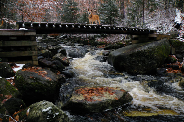
Continuing northeast on the loop trail, you reach the crossing of John Pond Brook at 1.9 miles, where only visitors during a winter thaw or the early spring runoff will be stymied in their efforts to reach John Pond. Everyone else should be able to step across this small stream without much concern.
At 2 miles you reach a junction with a blue-marked trail leading south along the foot of Bullhead to Puffer Pond. Just before this intersection, and within sight of it, look for a cellar hole off to the right.
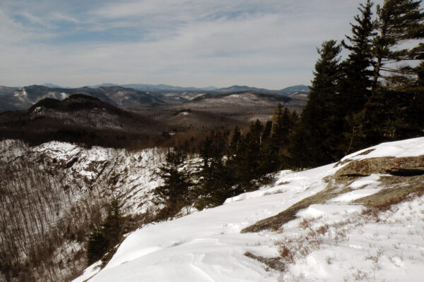
A subtle ascent leads up to the south end of John Pond at 2.4 miles. A moment before you reach the pond the yellow-marked loop trail bears right, but for now you should stay on the old road as it leads the final 0.1 mile to the John Pond Lean-to. A plantation of red pine surrounds this site, which offers views of the rocky ridgeline to the west. That small mountain has no official name, nor does it have a trail—but its bald ledges and knobs offers some outstanding vistas of the pond and the surrounding wilderness landscape. Experienced hikers may be tempted to leave the loop trail and seek out its secrets. Most people refer to the mountain as John Pond Ridge.
To continue the loop hike, you will need to backtrack south from the lean-to to the point where the new loop trail turns northeast. This connector trail is well constructed, although it passes so far east of John Pond that you will have no further views of it. Instead of the shoreline, it favors the high ground, slowly working its way up the flanks of John Pond Ridge.
Clear Pond lacks the close-up mountain views that John is known for, and when you first see the pond at 3.6 miles you may find the view somewhat underwhelming. The trail passes very close to the southwestern shoreline, leading inland to a trail junction at 3.8 miles. Left leads back to Wilderness Lane, but first you really should explore the red-marked spur to the right. This trail leads across the rocky outlet stream with its nearby cattail marsh, then hooks through the woods to a scenic shoreline ledge with a fine view down the length of the pond to Bullhead Mountain. A herd path continues around the shoreline to Clear’s best campsites.
Returning back across the outlet, the yellow-marked loop trail climbs briefly away from the pond before making a slow descent southwest back to the junction of Wilderness Lane and Starbuck Road. You reach this trailhead 4.9 miles into your adventure. If you have a car spotted here, then your hike is over. However, if you parked at the John Pond trailhead then you will need to turn left onto Wilderness Lane and keep walking for a few minutes more; the distance between the two endpoints is a mere 0.3 mile by road.
