
EXPLORE! Ausable Marsh
A hidden gem in the Town of Peru is the Ausable Marsh encompassing 660 acres of the Ausable River delta on the shore of Lake Champlain. Ausable Marsh is a birding heaven - migratory species use the peninsula as a resting place before they continue their journey north and local species find the dense vegetation and waterways irresistible.
We’re no birders but in 2 hours we saw Pied-billed Grebe (with their crazy calls), Common Loon, Osprey, ducks, Canada Goose, woodpeckers, Swamp Sparrow, Baltimore Oriole, Marsh Wren, vireos, Double-crested Cormorant, Eastern Kingbird, Least Bittern, a variety of warblers including Common Yellowthroat, Great Blue Heron, and many, many Red-Winged Blackbirds. But birds weren't the only critters we spied. Beaver and plentiful frogs also call this place home.
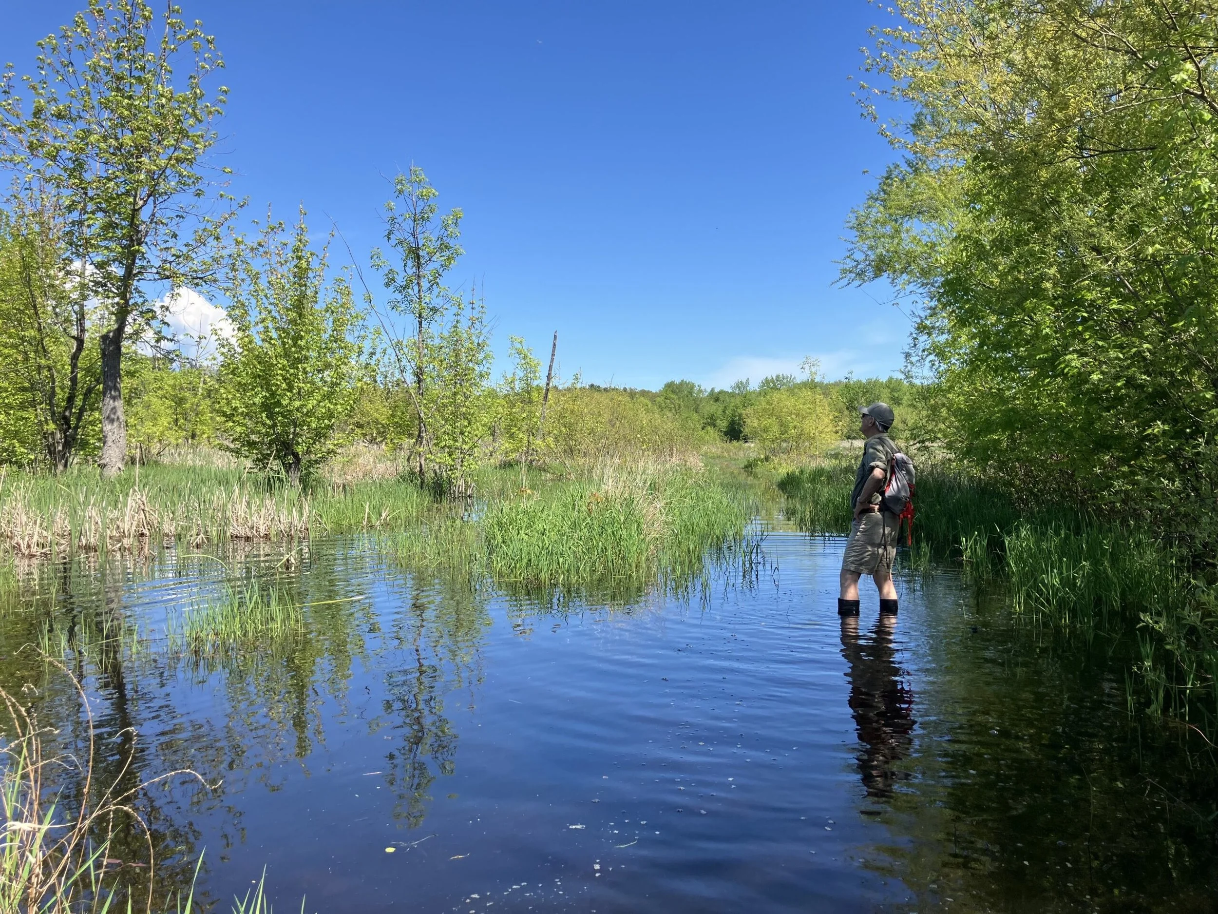
In spring or times of high water, the trail may be flooded.
Ausable Marsh is far from a Wilderness Area. It's technically a wildlife management area, meaning that the DEC's Division of Fish and Wildlife for wildlife conservation and wildlife-associated recreation (hunting, trapping, wildlife viewing, and photography). Wood Duck nest boxes can be seen along the trail and certain management techniques that alter the landscape provide critical habitat for ducks and other bird species. Even though this special place is not a designated Wilderness, it has a direct link to one of the Adirondacks' most prized destinations: the High Peaks Wilderness. The Ausable River begins its journey in two separate branches before joining together in the Main Branch. The headwaters of the East and West Branches are situated some 4,000 feet above sea level in the High Peaks, on the southeast and northwest shoulders, respectively, of Mount Marcy. Many towns and hamlets are located within the River's watershed. What starts high in a mountain wilderness ends 100 feet above sea level in Lake Champlain. Protecting the wilderness headwaters of the Ausable River is critical because they play a vital role in maintaining water quality, regulating floodwaters, and providing habitat for diverse species, as well as filter out pollutants. So, when the High Peaks were protected as Wilderness, Ausable Marsh benefited, despite being 40 miles away as the crow flies.
Getting There
Take Exit 35 of the Adirondack Northway (I-87). Turn east onto Bear Swamp Road (Route 442) - turn right if coming from the south or turn left if coming from the north. Take Bear Swamp Road approximately 3 miles to State Route 9. The main trail can be accessed from a short dirt road off Route 9 across from Bear Swamp Road.
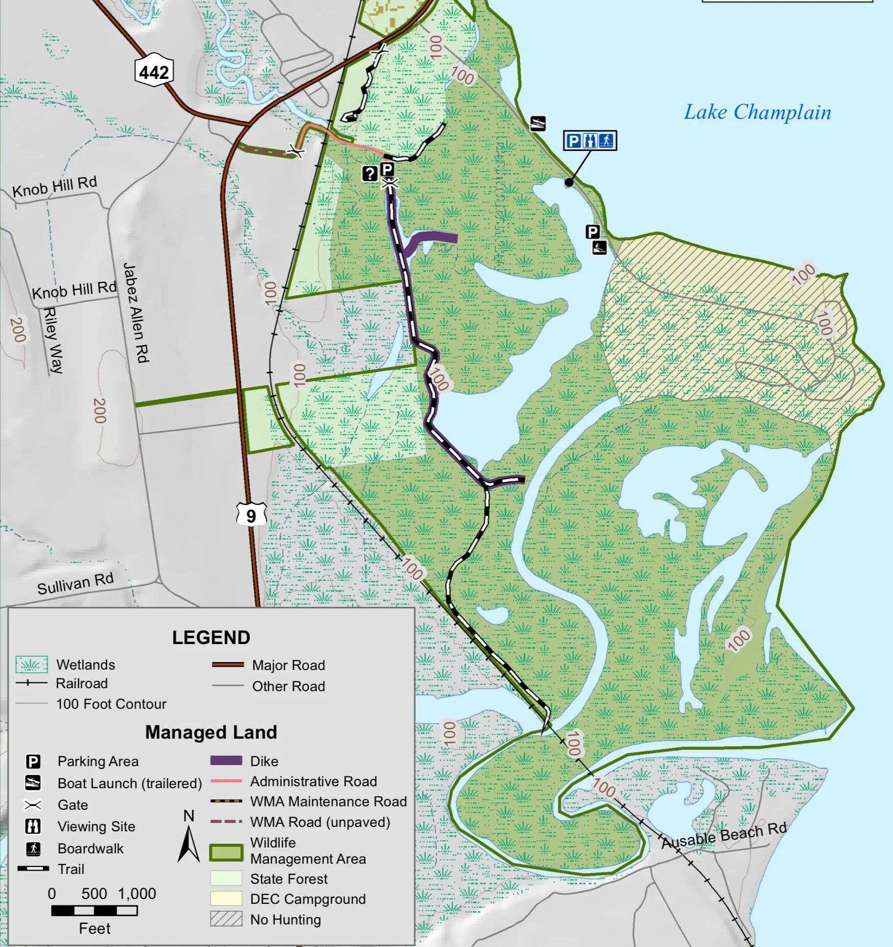
Ausable Marsh Wildlife Management Area map
The Trail
A 2-mile trail with firm footing along an old railroad bed takes you deep into the marsh. On Memorial Day 2025, we saw no one. Make sure to bring your boots! At high-water in the spring, my 16-inch Tasmanian Blundies barely kept my feet dry in some spots if I went on tiptoe. In drier weather, the trail is more accessible, offering a relatively level pathway into this water world. For a designated accessible access point, a 100-foot viewing platform can be reached from Ausable Point Road near the entrance to the Ausable Point Campground. This platform has extensive views across the marsh.