
Counting Hikers at the Garden
An RIT-built trail counter is now reporting daily from one of the High Peaks' most popular trailheads.
How many people hike in the Adirondacks, and where do they go? For a park this size and this heavily visited, the honest answer is that nobody really knows. Trail registers have most of the data, but in a form that is hard to work with. Parking lot counts show cars, not people. Most decisions about how to manage crowded trails are made with very little data.
So we built a trail counter. But not like the others. This one uses cellular technology to upload data every night and a modern website to view the data in near-real time.
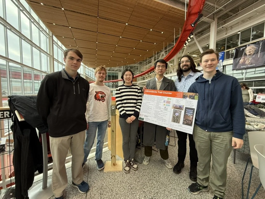
Kate Gleason College of Engineering student design team
The counter was designed and built by a Multidisciplinary Senior Design team at Rochester Institute of Technology's Kate Gleason College of Engineering. AWA sponsored the project, which ran through 2025. The goal was a device that could sit inconspicuously beside a trail, count people as they pass, and report the counts over the cellular network, with nobody needing to visit it to download data.
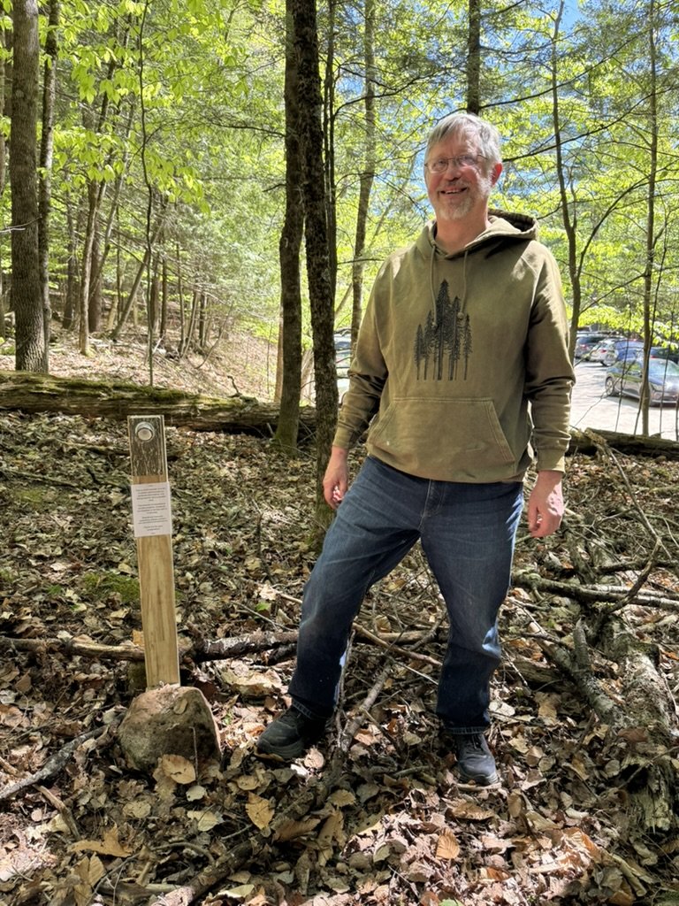
Pete Nelson with the newly installed counter at the Garden trailhead in Keene Valley.
In late May 2026, Craig McGowan, AWA board member and RIT adjunct professor, and Pete Nelson installed the counter at the Garden, the trailhead in Keene Valley for the Johns Brook Valley and the heart of the High Peaks. Mounted on a plain wooden post a short way up the Brothers trail, it is plainly visible to hikers, but hopefully close enough to civilization that most won’t mind its presence.
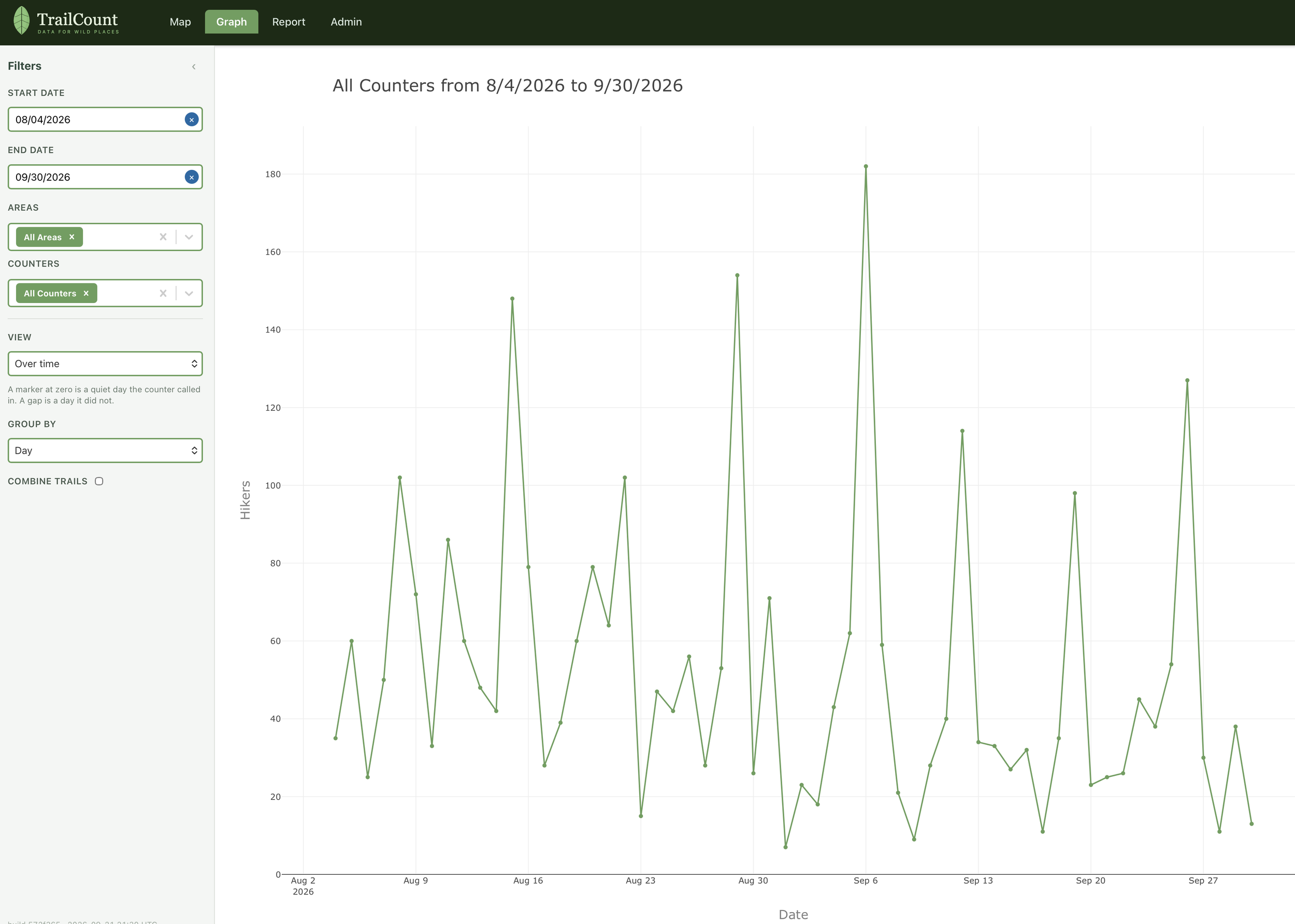
Daily counts at the Brothers Trail, August and September 2026.
The counts appear on a website built for the purpose: adk.trailcount.io (password required). RIT Software Engineering students at the Golisano College of Computing and Information Sciences built the first version, and AWA has developed it further since. Users can pick a date range and see daily counts as a graph or a report, or find the counter's location on a map.
The pattern is roughly what you would expect, but seeing the actual size of the peaks quantified, and seeing the data update every morning is why we did this. Weekends bring the crowds. Every peak in August and September fell on a Saturday, except the busiest day of all: about 180 hikers counted on the Sunday of Labor Day weekend. Weekdays were much quieter, mostly under 60 and often under 30 by late September.
Why does a wilderness advocacy group care about counting hikers? Because protecting wild places depends on understanding how people use them. AWA is using the Garden data in a pilot visitor use management project. We are working toward more counters at more trailheads, with a new RIT team already developing the next version.
