
Musings on a future remote Whitney
Here at AWA we value remoteness. Going back to our founding, we have focused on keeping roads out of newly purchased State land. We even published a map showing the areas within the Adirondack Park that are more than 3 miles from a road.
So when it began to seem like the 32,000 acres of the 36,000 acre Whitney Park was on it’s way to becoming State land sometime in the future, I started to think: “what parts would I want the state to buy, and how would the State land map change?
Whitney Park Today
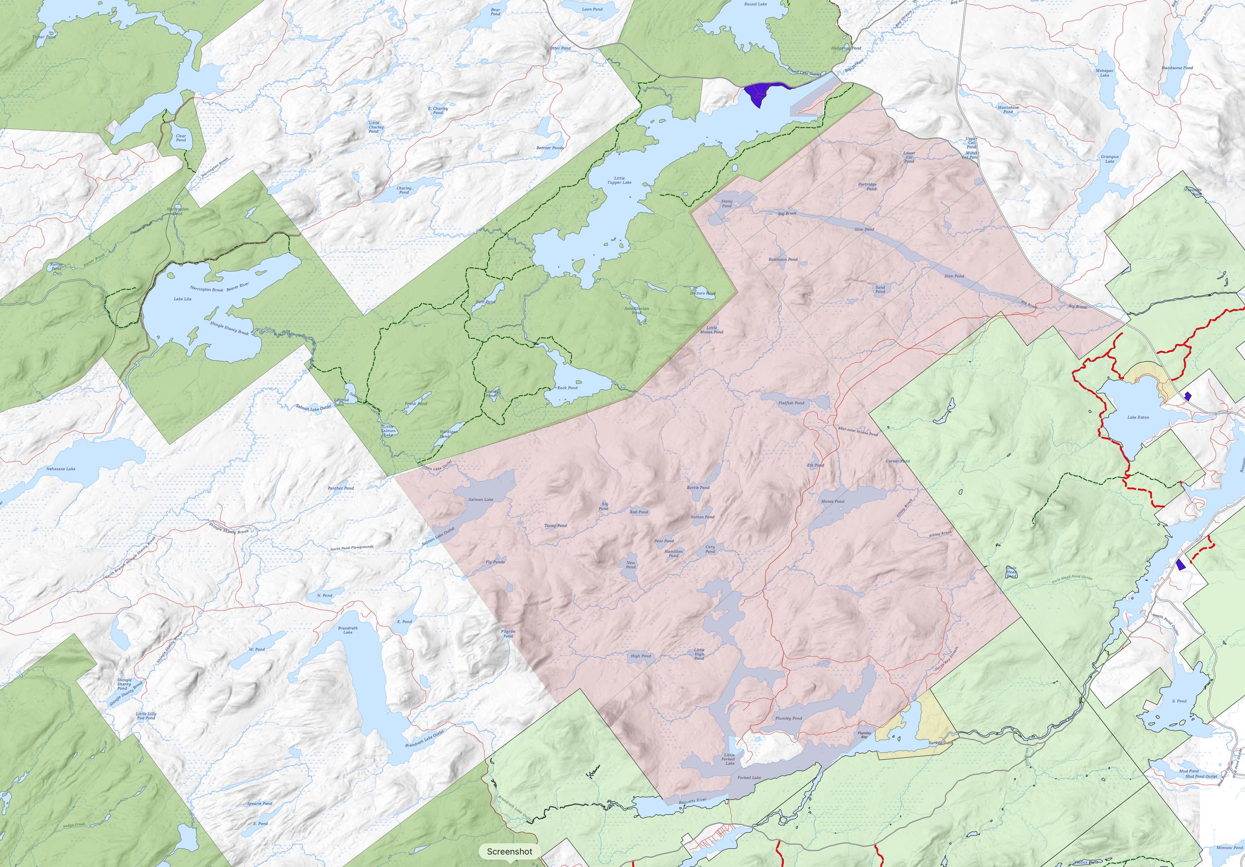
Large Scale Map Showing Whitney Park (pink) with surrounding State Wilderness (darker green), Wild Forest (lighter green), and Intensive Use (yellow). Click to enlarge.
Whitney Park is bracketed by State Land on the northwest and southeast, roads on the northeast and, private land on the southwest. In addition to the Whitney compounds on Salmon Lake and Little Forked Lake, there is a private inholding on Forked Lake. A network of roads starting on NYS Route 30 penetrate the property.
Whitney Roads vs Remoteness
As I was reading the reports of the potential deal between NYS, Todd Interests, and Whitney Industries, it became obvious that roads would become a problem if we are to expand remoteness. One road nearly bisects the property. I don’t have information on the road to Salmon Lake, but that, assuming it exists would also penetrate deep into the property.

Road Network in southwest Whitney Park (data from NYS GIS Clearinghouse).
However, as I looked at the map more closely, I noticed that there is a fairly large intensive-use zoned parcel of State land on the eastern side of Forked Lake: the Forked Lake State Campground. This area includes the Forked Lake dam, and bridge over the Raquette River.
I also noticed roads leading from Whitney Park directly towards the Intensive Use Area. Could there be an old road on State land that connected to it?
A Potential New Gateway into Whitney?
I quickly sketched up a map (shown below) that envisioned how Whitney could look after a State + Todd acquisition could look.

Sketch map showing new gateway into “Private Whitney” via State Intensive Use area.
This sketch is intended to be a rough idea, but it should be immediately apparent that it would greatly increase the amount of Whitney Park that would be left remote when it is combined with the existing William C. Whitney wilderness area and portions of the state wild forests around Owl’s Head Mountain.
I’ll leave you to think about this idea and its potential to make an expanded Whitney Wilderness more remote. Take a look at a couple photos I took on a recent visit to the area.
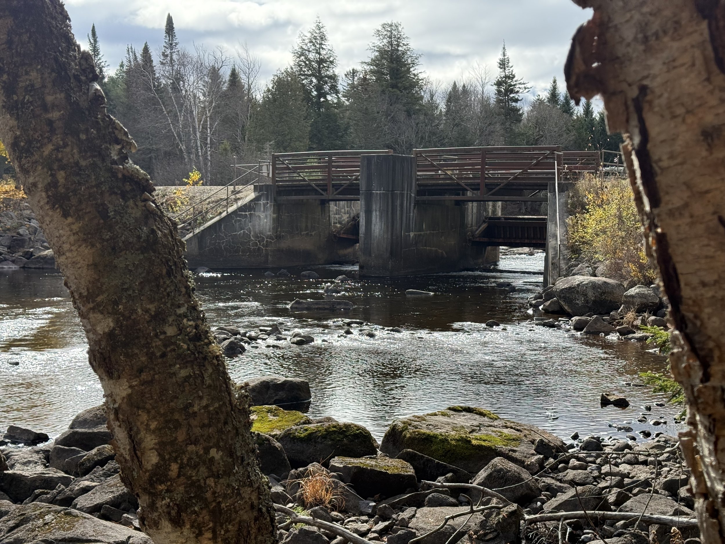
Combined Bridge / Dam at Forked Lake outlet
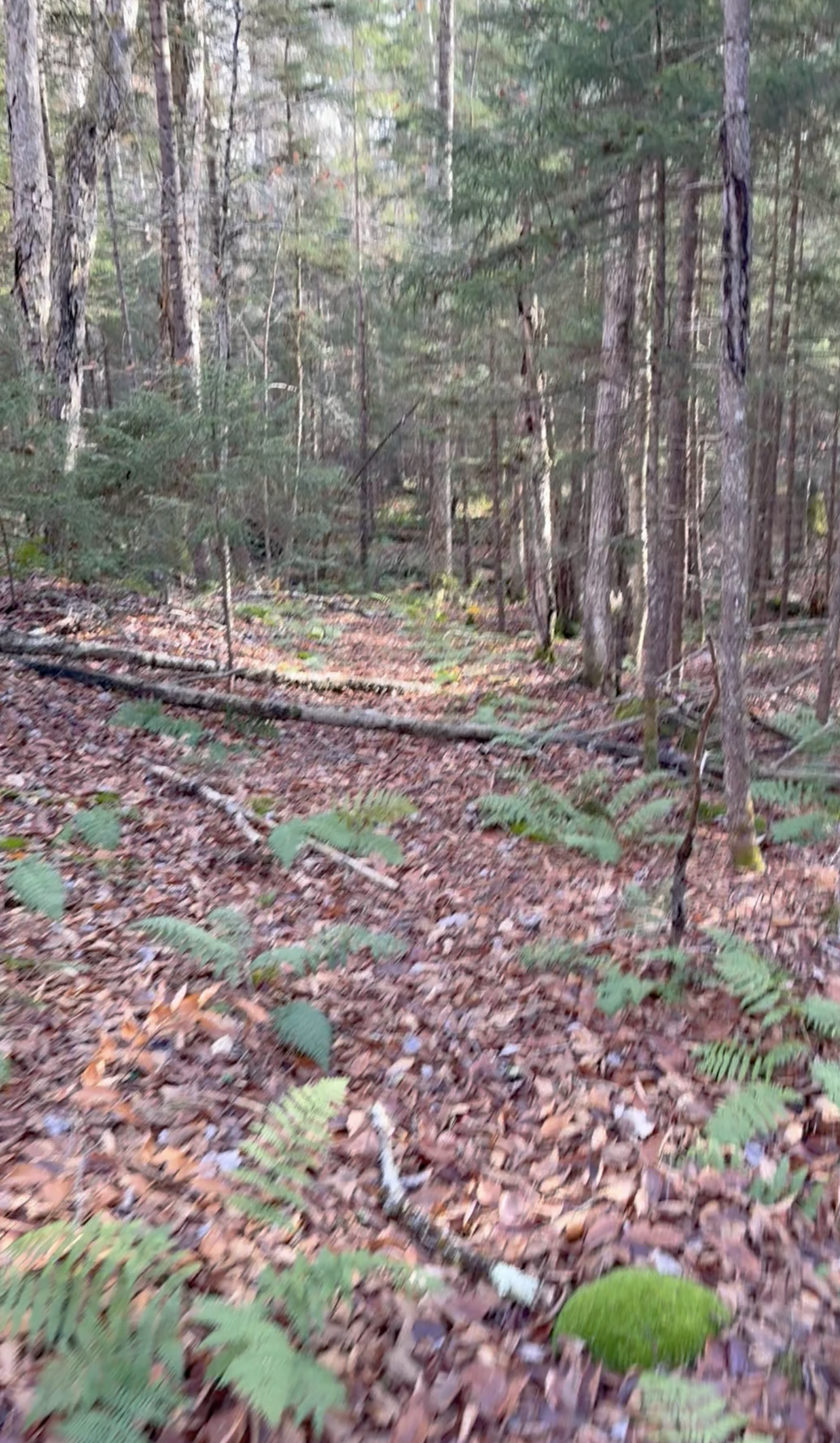
Slightly blurry photo of old woods road in Forked Lake Intensive Use area leading in the direction of Whitney Park